close
-
Layers w
- Weather Layers
- Pro
- Pro
- Pro
- Pro
- Pro
- Pro
- More Layers
- Pro
- Pro
- Pro
- Pro
-
Upgrade to

3D
Trail Conditions
- Unknown
- Snow Groomed
- Snow Packed
- Snow Covered
- Snow Cover Partial
- Freeze/thaw Cycle
- Icy
- Prevalent Mud
- Wet
- Variable
- Ideal
- Dry
- Very Dry
Trail Flow (Ridden Direction)
Trailforks scans users ridelogs to determine the most popular direction each trail is ridden. A good flowing trail network will have most trails flowing in a single direction according to their intension.
The colour categories are based on what percentage of riders are riding a trail in its intended direction.
The colour categories are based on what percentage of riders are riding a trail in its intended direction.
- > 96%
- > 90%
- > 80%
- > 70%
- > 50%
- < 50%
- bi-directional trail
- no data
Trail Last Ridden
Trailforks scans ridelogs to determine the last time a trail was ridden.
- < 2 days
- < 1 week
- < 2 weeks
- < 1 month
- < 6 months
- > 6 months
Trail Ridden Direction
The intended direction a trail should be ridden.
- Downhill Only
- Downhill Primary
- Both Directions
- Uphill Primary
- Uphill Only
- One Direction
Contribute Details
Colors indicate trail is missing specified detail.
- Description
- Photos
- Description & Photos
- Videos
Trail Popularity ?
Trailforks scans ridelogs to determine which trails are ridden the most in the last 9 months.
Trails are compared with nearby trails in the same city region with a possible 25 colour shades.
Think of this as a heatmap, more rides = more kinetic energy = warmer colors.
- most popular
- popular
- less popular
- not popular
ATV/ORV/OHV Filter
Max Vehicle Width
inches
US Cell Coverage
Legend

Radar Time
Activity Recordings
Trailforks uses anonymized public activity data.
?
Activity Recordings
Trailforks uses anonymized public activity data.
?
Personal Heatmap
▶
Activity Types
all
/
none
▶
Options
2
Date range
month
–
Winter Trails
Warning
A routing network for winter maps does not exist. Selecting trails using the winter trails layer has been disabled.
Missing Trails
Most Popular
Least Popular
Trails are colored based on popularity. The more popular a trail is, the more red. Less popular trails trend towards green.
Jump Magnitude Heatmap
Heatmap of where riders jump on trails. Zoom in to see individual jumps, click circles to view jump details.
BC Backroad Status
![map legend]()
Service Road Atlas is a free to use, community-driven service for viewing and creating reports on the numerous back-country service roads around B.C. and Alberta.

Slope Aspect
Direction the slope faces
Trails Deemphasized
Trails are shown in grey.
Only show trails with no bike usage.
Suggested Layers
Based on selected activity type
Save the current map location and zoom level as your default home location whenever this page is loaded.
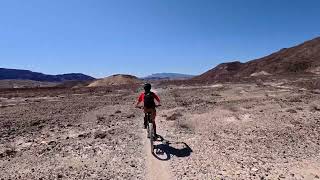
SaveTerlingua's name origin has been lost to time, but is thought to be a corruption of "tres linguas" or "three tongues", or as I believe, comes from "latis linguas" meaning "crossing tongues", which describes the shifting sandbars where Terlingua Creek and Santa Elena Canyon meet. This is a prehistoric crossing for both man and beast. The area is pure Chihuahuan Desert - cactus and thorn scrub with Lechuguilla being the indicator plant known for eating shins and bike tires. Riding is varied, with limestone, volcanics, and sand being the main surfaces. Nothing is soft here; everything either sticks, stings, or stinks. Summers are brutal, but the barren rock illuminates under moonlight for a desert adventure few know. Winters are mild, but the weather can change on you without warning. Doubletrack roads created by mule-drawn wagons go for miles, and beckon with unexplored hills and canyons. Singletrack trails can be found near Lajitas and on the State Park, crumbling doubletracks criss-cross the Terlingua Ranch (roads are open, the land is private), and National Park unmaintained roads round out whatever riding challenges you are up for. Don't forget to pack plenty of water and spare tubes with patches. Tubeless tire setups are highly recommended.
Activities Click to view
- Mountain Bike
99 trails
- E-Bike
23 trails
- Gravel Bike
2 trails
- Adaptive Bike
2 trails
- Horse
58 trails
- Hike
164 trails
- Trail Running
164 trails
- Dirtbike/Moto
38 trails
- ATV/ORV/OHV
38 trails
Region Details
- 60
- 5
- 21
- 13
Region Status
Open as of Apr 29, 2026Stats
- Avg Trail Rating
- Trails (view details)
- 162
- Trails Mountain Bike
- 99
- Trails E-Bike
- 23
- Trails Gravel Bike
- 2
- Trails Adaptive Bike
- 2
- Trails Horse
- 58
- Trails Hike
- 164
- Trails Trail Running
- 164
- Trails Dirtbike/Moto
- 38
- Trails Observed Trials
- 1
- Trails ATV/ORV/OHV
- 38
- Total Distance
- 562 miles
- Total Descent
- 50,108 ft
- Total Vertical
- 6,118 ft
- Highest Trailhead
- 7,773 ft
- Reports
- 105
- Photos
- 128
- Ridden Counter
- 5,852
Articles
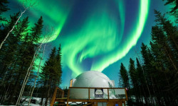
Where to Find the Darkest Skies in North America for Aurora Hunting and Stargazing
Aug 1, 2024 from outsideonline.com
You’ll be counting stars and catching the Northern Lights at these one-of-a-kind dark-sky retreats
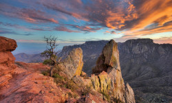
Hike of the Week: Lost Mine Trail, Big Bend National Park, TX
Oct 10, 2018 from backpacker.com
This shoulder-season cruiser delivers you to some of the best views in West Texas.
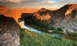
Hike the Grander Canyon
Feb 10, 2020 from backpacker.com
What's deeper than the Grand Canyon and has one-tenth as many visitors? Head to Boquillas Canyon in Big Bend National Park, Texas, to find out.
Sub Regions
-
Big Bend National Park
- 1
-
Big Bend Ranch State Park
- 5
- 20
- 12
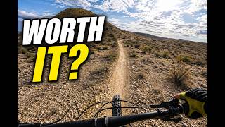
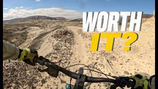
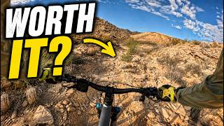
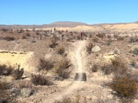
Popular Terlingua Mountain Biking Trails
• 100 ★ 4.5 • 1 mile • 155 ft • 270 •
This is a desert trail with many lose stones, crossing several arroyos and arriving at an amazing quartz crystal hillside towards the north end of the trail.
• 100 ★ 4.4 • 1 mile • 91 ft • 261 •
Popular blue difficulty singletrack. This multi-use trail can be used both directions. On average it takes 7 minutes to complete this trail.
• 100 ★ 4.0 • 2 miles • 266 ft • 194 •
Highly rated popular blue difficulty singletrack. This multi-use trail can be used both directions. On average it takes 22 minutes to complete this trail.
• 100 ★ 4.5 • 4,441 ft • 60 ft • 187 •
Popular blue difficulty singletrack. This multi-use trail can be used both directions. On average it takes 11 minutes to complete this trail.
• 95 ★ 4.5 • 1 mile • 40 ft • 168 •
Popular blue difficulty singletrack. This multi-use trail can be used both directions. On average it takes 8 minutes to complete this trail.
• 95 ★ 4.6 • 3 miles • 57 ft • 162 •
Popular blue difficulty singletrack. This multi-use trail can be used both directions. On average it takes 27 minutes to complete this trail.
• 95 ★ 3.7 • 1 mile • 54 ft • 153 •
Popular blue difficulty singletrack. This multi-use trail. On average it takes 5 minutes to complete this trail.
Terlingua Mountain Bike Routes
★ 5.0 • 57 miles • 3,446 ft • 6 •
★ 5.0 • 51 miles • 1,709 ft • 3 • Point to Point •
This is the full 52.1 mile River Road route. The midpoint of this trail connects to the Black Gap Road at...
30 miles • 2,444 ft • 5 • Point to Point •
Suggested draft route for the Cross Texas Trail - xTx
47 miles • 2,640 ft • 5 • Point to Point •
Suggested draft route for the Cross Texas Trail - xTx
4 miles • 39 ft • 0 • Point to Point •
To get off the road for the last 5 miles to Lajitas, stop at the "Airport Road" trailhead and take the...
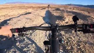
Photos of Terlingua Mountain Bike
Videos of Terlingua Mountain Bike

21:16 |
4 |
Jun 18, 2026
trail: East Dome Trail
10:30 |
4 |
Jun 18, 2026 , Terlingua
trail: West Dome Trail
14:57 |
5 |
Jun 18, 2026 , Terlingua
trail: Dog Cholla
6:34 |
6 |
Jun 18, 2026 , Terlingua
trail: Waterhole Trail
6:46 |
2 |
Jun 18, 2026 , Terlingua
trail: Dog Cholla
4:34 |
90 |
Feb 28, 2025 , Terlingua
trail: Sport Course
7:05 |
81 |
Feb 27, 2025 , Terlingua
trail: Dog Cholla
137 |
Dec 25, 2024 , Terlingua
Recent Trail Reports
| status | trail | date | condition | info | user |
|---|---|---|---|---|---|
| Dog Cholla | May 2, 2026 @ 4:58am (Pacific/Midway) May 2, 2026 | Dry | steuer | ||
| Crystal Trail | May 2, 2026 @ 4:58am (Pacific/Midway) May 2, 2026 | Dry | steuer | ||
| East Dome Trail | May 2, 2026 @ 4:58am (Pacific/Midway) May 2, 2026 | Dry | steuer | ||
| Loop 4 | Feb 20, 2026 @ 9:08am (America/Ojinaga) Feb 20, 2026 | Dry | re-tire | ||
| Rock Quarry Trail | Feb 1, 2026 @ 1:39pm (America/Ojinaga) Feb 1, 2026 | Dry | mjholloway67 | ||
| Sport Course | Oct 12, 2025 @ 7:51pm (America/Chicago) Oct 12, 2025 | Ideal | Nickr25Oab | ||
| Loop 2 | Oct 12, 2025 @ 10:15am (America/Chicago) Oct 12, 2025 | Prevalent Mud | Nickr25Oab | ||
| Singlespeed trail | Oct 12, 2025 @ 10:14am (America/Chicago) Oct 12, 2025 | Dry | Nickr25Oab | ||
| Buena Suerte Road | Feb 7, 2025 @ 9:51am Feb 7, 2025 | Very Dry | ronfleisher | ||
| Fresno Divide Trail | Feb 9, 2025 @ 9:15am Feb 9, 2025 | Very Dry | yacapo91 |
Activity Feed
| username | action | type | title | date |
|---|---|---|---|---|
| steuer | add | video | activity #97269333 and 1 more | Jun 18, 2026 @ 12:23pm 2 days |
| steuer | add | video | activity #97251292 and 2 more | Jun 18, 2026 @ 7:39am 3 days |
| schillingsworth | ridden | trail | activity #96134466 | Jun 2, 2026 @ 9:12pm Jun 2, 2026 |
| schillingsworth | vote | trail | activity #96134443 and 3 more | Jun 2, 2026 @ 9:11pm Jun 2, 2026 |
| steuer | add | report | activity #94831251 and 1 more | May 16, 2026 @ 10:25am May 16, 2026 |
Recent Comments
| username | type | title | comment | date |
|---|---|---|---|---|
| trail | Short and super fun trail. Definitely worth... | Mar 27, 2025 @ 9:01pm Mar 27, 2025 | ||
| trail | Most of the trail is creek bed, so either wide... | Mar 27, 2025 @ 9:00pm Mar 27, 2025 | ||
| trail | This is the easiest black trail you will ever... | Mar 27, 2025 @ 8:57pm Mar 27, 2025 | ||
| trail | Super fun trail. The climb from West Dome is a... | Mar 27, 2025 @ 8:54pm Mar 27, 2025 | ||
| trail | In | Mar 10, 2025 @ 1:20pm Mar 10, 2025 |
Local Badges
-

10 Blue Trails47 awarded -

10 Black Trails4 awarded -

Epic Ride Climb 2k5 awarded -

Climbing 10k Badge4 awarded -

Climbing 100k Badge0 awarded -

Epic Ride Descent 2k3 awarded
Activity Type Stats
| activitytype | trails | distance | descent | descent distance | total vertical | rating | global rank | state rank | photos | reports | routes | ridelogs |
|---|---|---|---|---|---|---|---|---|---|---|---|---|
| Mountain Bike | 99 | 462 miles | 30,725 ft | 222 miles | 3,858 ft | #526 | #192 | 116 | 94 | 7 | 2,284 | |
| E-Bike | 23 | 228 miles | 14,803 ft | 128 miles | 3,858 ft | #712 | #752 | 76 | 86 | |||
| Gravel Bike | 2 | #655 | #1,176 | 1 | 6 | |||||||
| Adaptive Bike | 2 | #541 | #1,842 | 2 | ||||||||
| Horse | 58 | 123 miles | 8,514 ft | 58 miles | 3,068 ft | #382 | #475 | 6 | 3 | 3 | ||
| Hike | 164 | 562 miles | 50,108 ft | 271 miles | 6,119 ft | #94 | #56 | 12 | 105 | 3 | 2,303 | |
| Trail Running | 164 | 562 miles | 50,108 ft | 271 miles | 6,119 ft | #163 | #70 | 105 | 2 | 101 | ||
| Dirtbike/Moto | 38 | 93 miles | 6,240 ft | 46 miles | 3,068 ft | #529 | #176 | 6 | ||||
| Observed Trials | 1 | 4 miles | 108 ft | 5,020 ft | 131 ft | 1 | ||||||
| ATV/ORV/OHV | 38 | 93 miles | 6,240 ft | 46 miles | 3,068 ft | #359 | #103 | 6 | 1 |
Frequently Asked Questions About Terlingua
▼
What are the best places to ride in Terlingua?
Terlingua has 2 areas to explore for mountain biking. The top rated areas are:
▼
What are the highest rated mountain biking trails in Terlingua?
The highest rated mountain biking trails in Terlingua are:
- Loop 4 (4.3/5)
- West Main Trail (4.3/5)
- Fresno Divide Trail (4.3/5)
- Crystal Trail (4.2/5)
- West Dome Trail (4.1/5)
▼
What is the best time of the year to ride in Terlingua?
Based on ride log data, the most popular months to ride in Terlingua are:
- February (57 activities)
- January (28 activities)
- November (22 activities)
▼
Where can I park to ride in Terlingua?
There are 29 parking locations listed in Terlingua. The most popular parking spots are: View all parking and trailhead locations on the map to plan your visit.
Activities
Trails
- By brenthillier
 NSMBA TRAILFORKS & contributors
 - Admins: apply
- #3709 - 8,196 views
- terlingua activity log | embed map of Terlingua mountain bike trails | terlingua mountain biking points of interest
Downloading of trail gps tracks in kml & gpx formats is enabled for Terlingua.
You must login to download files.