close
-
Layers w
- Weather Layers
- Pro
- Pro
- Pro
- Pro
- Pro
- Pro
- More Layers
- Pro
- Pro
- Pro
- Pro
-
Upgrade to

3D
Trail Conditions
- Unknown
- Snow Groomed
- Snow Packed
- Snow Covered
- Snow Cover Partial
- Freeze/thaw Cycle
- Icy
- Prevalent Mud
- Wet
- Variable
- Ideal
- Dry
- Very Dry
Trail Flow (Ridden Direction)
Trailforks scans users ridelogs to determine the most popular direction each trail is ridden. A good flowing trail network will have most trails flowing in a single direction according to their intension.
The colour categories are based on what percentage of riders are riding a trail in its intended direction.
The colour categories are based on what percentage of riders are riding a trail in its intended direction.
- > 96%
- > 90%
- > 80%
- > 70%
- > 50%
- < 50%
- bi-directional trail
- no data
Trail Last Ridden
Trailforks scans ridelogs to determine the last time a trail was ridden.
- < 2 days
- < 1 week
- < 2 weeks
- < 1 month
- < 6 months
- > 6 months
Trail Ridden Direction
The intended direction a trail should be ridden.
- Downhill Only
- Downhill Primary
- Both Directions
- Uphill Primary
- Uphill Only
- One Direction
Contribute Details
Colors indicate trail is missing specified detail.
- Description
- Photos
- Description & Photos
- Videos
Trail Popularity ?
Trailforks scans ridelogs to determine which trails are ridden the most in the last 9 months.
Trails are compared with nearby trails in the same city region with a possible 25 colour shades.
Think of this as a heatmap, more rides = more kinetic energy = warmer colors.
- most popular
- popular
- less popular
- not popular
ATV/ORV/OHV Filter
Max Vehicle Width
inches
US Cell Coverage
Legend

Radar Time
Activity Recordings
Trailforks uses anonymized public activity data.
?
Activity Recordings
Trailforks uses anonymized public activity data.
?
Personal Heatmap
▶
Activity Types
all
/
none
▶
Options
2
Date range
month
–
Winter Trails
Warning
A routing network for winter maps does not exist. Selecting trails using the winter trails layer has been disabled.
Missing Trails
Most Popular
Least Popular
Trails are colored based on popularity. The more popular a trail is, the more red. Less popular trails trend towards green.
Jump Magnitude Heatmap
Heatmap of where riders jump on trails. Zoom in to see individual jumps, click circles to view jump details.
BC Backroad Status
![map legend]()
Service Road Atlas is a free to use, community-driven service for viewing and creating reports on the numerous back-country service roads around B.C. and Alberta.

Slope Aspect
Direction the slope faces
Trails Deemphasized
Trails are shown in grey.
Only show trails with no bike usage.
Suggested Layers
Based on selected activity type
Save the current map location and zoom level as your default home location whenever this page is loaded.
SaveThailand is where landscape meets culture, making it the perfect location for biking enthusiasts and those who wants to discover old Thailand. With mountains, rivers and forests, Thailand provides some great biking, and scenic routes. The north of Thailand also boasts a distinct culture, as can be seen by visiting local hill tribes, tasting Khao Soi or getting off your bike to see the province's glorious ancient temples. The mountain biking community is growing fast here and more trails and route are opened and developed everyday.
Stats
- Avg Trail Rating
- Trails (view details)
- 183
- Trails Mountain Bike
- 182
- Trails E-Bike
- 35
- Trails Horse
- 8
- Trails Hike
- 161
- Trails Trail Running
- 168
- Trails Dirtbike/Moto
- 20
- Trails ATV/ORV/OHV
- 2
- Total Distance
- 249 miles
- Total Descent
- 80,827 ft
- Total Vertical
- 5,523 ft
- Highest Trailhead
- 5,548 ft
- Reports
- 353
- Photos
- 353
- Ridden Counter
- 2,379
Articles

Race Report: Cody Kelley & Ingrid Larouche Win 3rd Round of Asia-Pacific Continental Series in Chiang Mai
Dec 13, 2019 from pinkbike.com
The Thailand International Chiang Mai Enduro was the country's first foray into the world of Enduro World Series racing as Rowena Fry and Cody...

Wild Winter Jungle Shredding & Good Times in Thailand - Video
Mar 21, 2018 from pinkbike.com
Six months in Thailand building trails at Bike Park Chiang Mai, shredding bikes in the jungle, and nothing but good times.
Popular Trail Networks
view all areas »Sub Regions
- Chiang Dao (12)
- Chonburi (18)
- Ko Tao Island (0)
- Patong (0)
- Petchaburi (0)
- Phetchaburi (1)
- Phetchaburi (1)
- Phetchaburi (1)
- Prachin Buri (15)
- Wang Nam Keow (1)
- Wang Nam Keow (1)
- Prachuap Kiri Khan (11)
- Rayong (0)
- Ban Chang (0)
- Ban Chang (0)
- Saraburi (1)
- Bangkok (1)
- Chai Nat (2)
- Chiang Mai (92)
- Khon Kaen (7)
- Nakhon Ratchasima (14)
- Saraburi (2)
- Ubon Ratchathani (1)
- Udon Thani (1)
Popular Thailand Mountain Biking Trails
• 100 ★ 4.2 • 4 miles • 178 ft • 155 •
Fun downhill trail with difficult steep beginning section. There is a Buddhist monastery at the end of the trail. Ride slow, keep the noise down, or dogs will come out to chase you.
• 95 ★ 4.4 • 3 miles • 51 ft • 122 •
Probably the most popular downhill trail on Doi Suthep and it's easy to see why. The trail is fast and flowy, it has quite a few jumps plus a few technical challenges, all of which increases the fun factor. It starts on Sriwichai Rd. a...
• 100 ★ 4.0 • 2 miles • 17 ft • 111 •
An aggressive Single Track that flows nice with some off camber sections, steep shoots, a rock garden and overall just fun. The trail comes out just below the Center which is a little closer to the Zoo if you want to head up Doi Suthep...
• 70 ★ 4.6 • 4 miles • 2 ft • 86 •
This trail is really nice and technical with some super steep parts and rock gardens/loose stones, bloody amazing backdrop though and really long. Make sure your fitness is up as this one is tough on the hands! (gets super slippery in...
• 100 ★ 5.0 • 2 miles • 76 ft • 84 •
3 kilometers of leg burning fun. This trail has it all: punchy climbs, flowy downhill, hairpin corners, small jumps, steep lines, and a nasty rock-garden. The trail starts on nice loam and ends on loose rocky terrain. Average grade is...
• 100 ★ 5.0 • 4,505 ft • 0 ft • 82 •
One of the most popular trails on Doi Suthep and for good reason! The trail starts with an S curve into a big jump and stays rowdy the rest of the way down. Flowy with tight turns, root sections, some log drops and ends with a nice...
• 85 ★ 5.0 • 2 miles • 123 ft • 57 •
Nearly 3 kms of fast track that starts with a wide track, open and off-camber turns, and then drops into the woods for some tricky single track with tight switchbacks, soft dirt, and plenty of roots to keep things interesting. It ends...
• 100 ★ 5.0 • 1 mile • 0 ft • 52 •
A Steep crasher from the Chom Viewpoint down to the Royal Project Reservoir. The trail starts with three short stair cases into golden single track that is characterized by repeated short drops in rapid concession, lots of roots and...
Thailand Mountain Bike Routes
6 miles • 198 ft • 0 •
A fun and approachable red clay farm road on the outer side of Doi Suthep, entering from the dirt road...
5 miles • 364 ft • 1 •
"The Chicken" is a brand new track at Maejo Farm, 7 km of mixed terrain with some challenging singletrack...
★ 3.0 • 1 mile • 302 ft • 0 •
Not for beginners. Moderately steep up and down, you'll have to walk your bike in the odd place unless you...
35 miles • 1,630 ft • 0 • Loop •
Loop route around the Pranburi Dam in Prachuap Khiri Khan province. Pranburi, and Pak Nam Pran, are...
4 miles • 445 ft • 0 • Loop •
Small loop close to Mueang Ngai village. South part is concrete/asphalt (20%), rest is dirt road. There is...
Photos of Thailand Mountain Bike
Videos of Thailand Mountain Bike
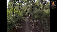
trail: Red Clay Resonance
0:41 |
4 |
May 28, 2026
4:03 |
82 |
Sep 6, 2021

trail: Gee's House Trail
0:41 |
62 |
Sep 26, 2019
trail: Bamboo Trail
0:04 |
131 |
Mar 9, 2019
trail: Crazy Dust
5:05 |
106 |
Dec 9, 2018
trail: Gee's House Trail
4:35 |
72 |
Dec 9, 2018
trail: Bamboo Trail
4:00 |
78 |
May 26, 2018

trail: CDC
0:51 |
87 |
May 26, 2018
Recent Comments
| username | type | title | comment | date |
|---|---|---|---|---|
| trail | Riding the existing trail mapped here. It's a... | Mar 1, 2026 @ 8:38pm Mar 1, 2026 | ||
| trail | It is a fun flowy trail despite too many... | Feb 17, 2026 @ 11:31pm Feb 17, 2026 | ||
| trail | I’m not sure what this trail is about it’s... | Jan 4, 2026 @ 12:47am Jan 4, 2026 | ||
| trail | This trail is really honestly not that much... | Oct 30, 2025 @ 1:53am Oct 30, 2025 | ||
| report | Needs more roots | Oct 28, 2025 @ 9:53pm Oct 28, 2025 |
Bike & Skill Parks
| name | type | city | rating |
|---|---|---|---|
| Peppermint Bike Park | skill park | Bangkok | |
| Hua Mak Skatepark | skill park | Bangkok | |
| Kite Cable Pump Track & Dirt Jumps | skill park | Pranburi |
Activity Type Stats
| activitytype | trails | distance | descent | descent distance | total vertical | rating | global rank | state rank | photos | reports | routes | ridelogs |
|---|---|---|---|---|---|---|---|---|---|---|---|---|
| Mountain Bike | 181 | 245 miles | 79,711 ft | 154 miles | 5,459 ft | #65 | 329 | 352 | 16 | 29,282 | ||
| E-Bike | 35 | 30 miles | 7,415 ft | 20 miles | 3,914 ft | #81 | 6 | 237 | 3 | 673 | ||
| Horse | 8 | 13 miles | 2,188 ft | 7 miles | 991 ft | #66 | 81 | 1 | ||||
| Hike | 161 | 226 miles | 73,045 ft | 141 miles | 5,505 ft | #68 | 17 | 343 | 4 | 3,197 | ||
| Trail Running | 168 | 235 miles | 73,950 ft | 146 miles | 5,505 ft | #67 | 1 | 343 | 4 | 234 | ||
| Dirtbike/Moto | 20 | 20 miles | 3,980 ft | 11 miles | 4,344 ft | #41 | 89 | 1 | 163 | |||
| ATV/ORV/OHV | 2 | 6 miles | 1,263 ft | 3 miles | 3,330 ft | #54 | 86 | 12 |
Activities
Trails
- By klapai & contributors
- Admins: apply
- #3271 - 30,893 views
- thailand activity log | embed map of Thailand mountain bike trails | thailand mountain biking points of interest
Downloading of trail gps tracks in kml & gpx formats is enabled for Thailand.
You must login to download files.