
close
-
Layers w
- Weather Layers
- Pro
- Pro
- Pro
- Pro
- Pro
- Pro
- More Layers
- Pro
- Pro
- Pro
- Pro
-
Upgrade to

3D
Trail Conditions
- Unknown
- Snow Groomed
- Snow Packed
- Snow Covered
- Snow Cover Partial
- Freeze/thaw Cycle
- Icy
- Prevalent Mud
- Wet
- Variable
- Ideal
- Dry
- Very Dry
Trail Flow (Ridden Direction)
Trailforks scans users ridelogs to determine the most popular direction each trail is ridden. A good flowing trail network will have most trails flowing in a single direction according to their intension.
The colour categories are based on what percentage of riders are riding a trail in its intended direction.
The colour categories are based on what percentage of riders are riding a trail in its intended direction.
- > 96%
- > 90%
- > 80%
- > 70%
- > 50%
- < 50%
- bi-directional trail
- no data
Trail Last Ridden
Trailforks scans ridelogs to determine the last time a trail was ridden.
- < 2 days
- < 1 week
- < 2 weeks
- < 1 month
- < 6 months
- > 6 months
Trail Ridden Direction
The intended direction a trail should be ridden.
- Downhill Only
- Downhill Primary
- Both Directions
- Uphill Primary
- Uphill Only
- One Direction
Contribute Details
Colors indicate trail is missing specified detail.
- Description
- Photos
- Description & Photos
- Videos
Trail Popularity ?
Trailforks scans ridelogs to determine which trails are ridden the most in the last 9 months.
Trails are compared with nearby trails in the same city region with a possible 25 colour shades.
Think of this as a heatmap, more rides = more kinetic energy = warmer colors.
- most popular
- popular
- less popular
- not popular
ATV/ORV/OHV Filter
Max Vehicle Width
inches
US Cell Coverage
Legend

Radar Time
Activity Recordings
Trailforks uses anonymized public activity data.
?
Activity Recordings
Trailforks uses anonymized public activity data.
?
Personal Heatmap
▶
Activity Types
all
/
none
▶
Options
2
Date range
month
–
Winter Trails
Warning
A routing network for winter maps does not exist. Selecting trails using the winter trails layer has been disabled.
Missing Trails
Most Popular
Least Popular
Trails are colored based on popularity. The more popular a trail is, the more red. Less popular trails trend towards green.
Jump Magnitude Heatmap
Heatmap of where riders jump on trails. Zoom in to see individual jumps, click circles to view jump details.
BC Backroad Status
![map legend]()
Service Road Atlas is a free to use, community-driven service for viewing and creating reports on the numerous back-country service roads around B.C. and Alberta.

Slope Aspect
Direction the slope faces
Trails Deemphasized
Trails are shown in grey.
Only show trails with no bike usage.
Suggested Layers
Based on selected activity type
Save the current map location and zoom level as your default home location whenever this page is loaded.
SaveThe Driving Range is an Adaptive Mountain Bike (aMTB) network, designed in partnership with the Kelly Brush Foundation for all users to enjoy The trails have aMTB ratings and are all rideable on adaptive bikes. There are also progressive features for both aMTBs and traditional bikes, including gap jumps, ladder bridges, drops, and rollers.
This network was designed and built by Richmond Mountain Trails (RMT) and their amazing volunteers, along with professional builders, Tom Lepesquer of L&D Trailworks, Phil Kmetz and Hailey Sarausky, Dana Cabrera of Mountain Trailworkx. Zac Freeman of Apex Trailworks.
RMT received incredible local support from Vermont Huts, Bolton Valley, Catamount Trail, Velomont and CRAG Vermont, as well as two other chapters of VMBA.
We have also had an unbelievable help from project sponsors: Shimano, OnX, Yeti Cycles, Fox, Lawsons Finest Liquids, Bivo, The Vermont Community Foundation, SunCommon, Birdseye, Healthy Living, the Lintilhac Foundation, Velocio, Burlington Beer Co., Outdoor Gear Exchange, Northfield Community Savings, Union Bank, Kingsbury Construction, Masocma Bank, Ben and Jerry's, NEMBA, Zero Gravity, the Big Spruce, Price Chopper, the Waterwheel Foundation, and more!
This network was designed and built by Richmond Mountain Trails (RMT) and their amazing volunteers, along with professional builders, Tom Lepesquer of L&D Trailworks, Phil Kmetz and Hailey Sarausky, Dana Cabrera of Mountain Trailworkx. Zac Freeman of Apex Trailworks.
RMT received incredible local support from Vermont Huts, Bolton Valley, Catamount Trail, Velomont and CRAG Vermont, as well as two other chapters of VMBA.
We have also had an unbelievable help from project sponsors: Shimano, OnX, Yeti Cycles, Fox, Lawsons Finest Liquids, Bivo, The Vermont Community Foundation, SunCommon, Birdseye, Healthy Living, the Lintilhac Foundation, Velocio, Burlington Beer Co., Outdoor Gear Exchange, Northfield Community Savings, Union Bank, Kingsbury Construction, Masocma Bank, Ben and Jerry's, NEMBA, Zero Gravity, the Big Spruce, Price Chopper, the Waterwheel Foundation, and more!
Primary Trail Type: All-Mountain & Downhill
Land Status: Private Managed Forest
Land Manager: Richmond Mountain Trails
 google parking directions
Links
Activities Click to view
- Mountain Bike
3 trails
- Hike
7 trails
- Trail Running
7 trails
Region Details
- 2
- 1
- 2
Region Status
Caution as of Jun 25, 2026

Stats
- Avg Trail Rating
- Trails (view details)
- 2
- Trails Mountain Bike
- 18
- Trails E-Bike
- 4
- Trails Hike
- 7
- Trails Trail Running
- 7
- Total Distance
- 3 miles
- Total Descent Distance
- 2 miles
- Total Descent
- 846 ft
- Total Vertical
- 709 ft
- Highest Trailhead
- 1,073 ft
- Reports
- 946
- Photos
- 81
- Ridden Counter
- 12,668
Articles
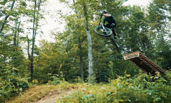
Video: Riding Bolton, Vermont in 'The Range'
Aug 29, 2025 from pinkbike.com
An afternoon well spent chasing Evan through the Driving Range trail network.
Popular The Driving Range Mountain Biking Trails
• 90 ★ 4.0 • 3,045 ft • 305 ft • 941 •
aMTB Accessible multi directional trail, climbing to the height of land. Two-way multi-use trail. Please review the Richmond Trail Conditions Page for current status: https://shorturl.at/gwCGZ
• 85 ★ 4.7 • 1,654 ft • 3 ft • 940 •
Upper : aMTB accessible Blue Jump trail with optional Pro-Line Features. Stay right at the splits to stay on the main trail. Bike Traffic Only. Look before you leap! This trail has jumps and optional features for advanced riders.
• 40 ★ 5.0 • 2,457 ft • 5 ft • 863 •
aMTB accessible downhill jump trail. No mandatory gaps or features. Bikes Only! Yield at trail crossings!
• 100 ★ 5.0 • 420 ft • 0 ft • 852 •
The first section of leading into was built by hand by Richmond Mountain Trails Volunteers. The trail splits off right into the machin-built portion built by Lepesqueur and Daughters, LLC. The trail splits right into the .
The Driving Range Mountain Bike Routes
★ 5.0 • 2 miles • 414 ft • 7 • Loop •
Testing out mapping on Trailforks
4 miles • 820 ft • 14 • Loop •
Lower network: , Hot Dogged and open to ride, and will be groomed once more snow accumulates. Skid Marks...
Videos of The Driving Range Mountain Bike
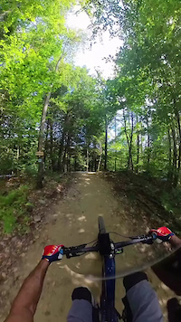
trail: Hot Dogger (lower)
0:14 |
21 |
Oct 28, 2025
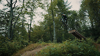
trail: Brushfire
0:12 |
315 |
Aug 28, 2025
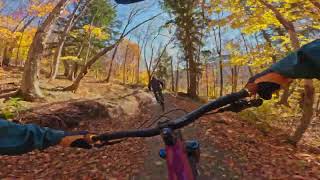
trail: Heavy Duty (Lower)
2:47 |
70 |
Sep 25, 2025 , Bolton
youtuber
![ROWDY LAP n the Driving Range’s GAP TRAIL]()
trail: Don't Panic - Roller
3:07 |
147 |
Dec 7, 2024 , Bolton
youtuber
![ROWDY LAP n the Driving Range’s GAP TRAIL]()
trail: Don't Panic
3:07 |
116 |
Dec 7, 2024 , Bolton
youtuber
![ROWDY LAP n the Driving Range’s GAP TRAIL]()
trail: Hot Dogger (lower)
3:07 |
220 |
Dec 7, 2024 , Bolton
youtuber
![ROWDY LAP n the Driving Range’s GAP TRAIL]()
trail: Hot Dogger
3:07 |
149 |
Dec 7, 2024 , Bolton
youtuber
![Attempting MASSIVE PROLINE GAPS at The Driving...]()
trail: Hot Dogger
2:13 |
118 |
Dec 7, 2024 , Bolton
Current Trail Warnings
| status | trail | date | condition | user | info |
|---|---|---|---|---|---|
| Heavy Duty (Lower) | Jun 24, 2026 @ 5:21am (America/New_York) Jun 24, 2026 | Unknown | Ownesmatt | Large tree down |
Recent Trail Reports
Activity Feed
| username | action | type | title | date |
|---|---|---|---|---|
| Tylerig00tQ | wishlist | trail | activity #99013723 and 1 more | Jul 12, 2026 @ 6:32am 1 day |
| pepsiqueen | wishlist | region | activity #98810294 | Jul 9, 2026 @ 1:52pm Jul 9, 2026 |
| l9ywza | wishlist | region | activity #98775703 | Jul 9, 2026 @ 4:38am Jul 9, 2026 |
| born-a-fred | ridden | trail | activity #98671751 | Jul 7, 2026 @ 3:54pm Jul 7, 2026 |
| Sabon | difficultyvote | trail | activity #98463067 | Jul 4, 2026 @ 5:24pm Jul 4, 2026 |
Recent Comments
| username | type | title | comment | date |
|---|---|---|---|---|
| trail | This is absolutely not a pro level jump line,... | Jul 3, 2026 @ 4:44pm Jul 3, 2026 | ||
| report | Thanks for the report. The trail was closed... | Jun 19, 2026 @ 10:35am Jun 19, 2026 | ||
| trail | Signage calls this Iteration. There’s a side... | Aug 21, 2025 @ 8:54pm Aug 21, 2025 | ||
| report | Awesome job by L&D trail works | Aug 6, 2025 @ 3:27am Aug 6, 2025 | ||
| trail | Super well constructed, so it's easy to go... | Sep 20, 2024 @ 8:27am Sep 20, 2024 |
Nearby Areas
| name | distance | ||||
|---|---|---|---|---|---|
| Bolton Valley Resort | 5 | 11 | 23 | 8 | 3.8 km |
| Little River State Park | 1 | 4 | 4.1 km | ||
| Little River to Perry | 4.5 km | ||||
| Perry Hill | 4 | 5 | 3 | 3 | 5.9 km |
| Cottonbrook Nebraska Network | 1 | 6.3 km |
Activity Type Stats
| activitytype | trails | distance | descent | descent distance | total vertical | rating | global rank | state rank | photos | reports | routes | ridelogs |
|---|---|---|---|---|---|---|---|---|---|---|---|---|
| Mountain Bike | 3 | 3 miles | 846 ft | 2 miles | 709 ft | #2,406 | #830 | 77 | 963 | 2 | 1,889 | |
| E-Bike | 4 | 2,457 ft | 240 ft | 1,896 ft | 240 ft | 1 | 43 | 1 | 112 | |||
| Hike | 7 | 2 miles | 49 ft | 2,300 ft | 709 ft | #17,016 | #7,919 | 940 | 86 | |||
| Trail Running | 7 | 2 miles | 49 ft | 2,300 ft | 709 ft | #16,079 | #7,153 | 4 | 940 | 6 |
- By WillieJacobsz
 Trailforks SBP SWW & contributors
 - Admins: RMT
- #51149 - 16,522 views
- the driving range activity log | embed map of The Driving Range mountain bike trails | the driving range mountain biking points of interest
Downloading of trail gps tracks in kml & gpx formats is enabled for The Driving Range.
You must login to download files.