close
-
Layers w
- Weather Layers
- Pro
- Pro
- Pro
- Pro
- Pro
- Pro
- More Layers
- Pro
- Pro
- Pro
- Pro
-
Upgrade to

3D
Trail Conditions
- Unknown
- Snow Groomed
- Snow Packed
- Snow Covered
- Snow Cover Partial
- Freeze/thaw Cycle
- Icy
- Prevalent Mud
- Wet
- Variable
- Ideal
- Dry
- Very Dry
Trail Flow (Ridden Direction)
Trailforks scans users ridelogs to determine the most popular direction each trail is ridden. A good flowing trail network will have most trails flowing in a single direction according to their intension.
The colour categories are based on what percentage of riders are riding a trail in its intended direction.
The colour categories are based on what percentage of riders are riding a trail in its intended direction.
- > 96%
- > 90%
- > 80%
- > 70%
- > 50%
- < 50%
- bi-directional trail
- no data
Trail Last Ridden
Trailforks scans ridelogs to determine the last time a trail was ridden.
- < 2 days
- < 1 week
- < 2 weeks
- < 1 month
- < 6 months
- > 6 months
Trail Ridden Direction
The intended direction a trail should be ridden.
- Downhill Only
- Downhill Primary
- Both Directions
- Uphill Primary
- Uphill Only
- One Direction
Contribute Details
Colors indicate trail is missing specified detail.
- Description
- Photos
- Description & Photos
- Videos
Trail Popularity ?
Trailforks scans ridelogs to determine which trails are ridden the most in the last 9 months.
Trails are compared with nearby trails in the same city region with a possible 25 colour shades.
Think of this as a heatmap, more rides = more kinetic energy = warmer colors.
- most popular
- popular
- less popular
- not popular
ATV/ORV/OHV Filter
Max Vehicle Width
inches
US Cell Coverage
Legend

Radar Time
Activity Recordings
Trailforks uses anonymized public activity data.
?
Activity Recordings
Trailforks uses anonymized public activity data.
?
Personal Heatmap
▶
Activity Types
all
/
none
▶
Options
2
Date range
month
–
Winter Trails
Warning
A routing network for winter maps does not exist. Selecting trails using the winter trails layer has been disabled.
Missing Trails
Most Popular
Least Popular
Trails are colored based on popularity. The more popular a trail is, the more red. Less popular trails trend towards green.
Jump Magnitude Heatmap
Heatmap of where riders jump on trails. Zoom in to see individual jumps, click circles to view jump details.
BC Backroad Status
![map legend]()
Service Road Atlas is a free to use, community-driven service for viewing and creating reports on the numerous back-country service roads around B.C. and Alberta.

Slope Aspect
Direction the slope faces
Trails Deemphasized
Trails are shown in grey.
Only show trails with no bike usage.
Suggested Layers
Based on selected activity type
Save the current map location and zoom level as your default home location whenever this page is loaded.
SavePrivate cycling club, membership or day pass required.
Well draining sand based soil. Rideable typically 4 hours after it rains.
A good mix of trails, XC and All Mountain.
Well draining sand based soil. Rideable typically 4 hours after it rains.
A good mix of trails, XC and All Mountain.
Primary Trail Type: Cross-Country
eBikes Allowed:
Yes
Land Status: Conservation Reserve
Land Manager: woodstock cycling club
 google parking directions
 Activities Click to view
- Mountain Bike
56 trails
- E-Bike
20 trails
Stats
- Avg Trail Rating
- Trails (view details)
- 55
- Trails Mountain Bike
- 56
- Trails E-Bike
- 20
- Trails Hike
- 3
- Trails Trail Running
- 3
- Total Distance
- 12 miles
- Total Descent Distance
- 4 miles
- Total Descent
- 1,068 ft
- Total Vertical
- 433 ft
- Highest Trailhead
- 1,030 ft
- Reports
- 1,539
- Photos
- 101
- Ridden Counter
- 39,060
Popular The Pines Mountain Biking Trails
• 90 ★ 3.4 • 459 ft • 0 ft • 887 •
DUAL SLALOM COURSE.PLEASE RESPECT THE GATES, AND RIDE ALL OF THE FLAT CORNERS, AFTER ALL IT IS A SLALOM COURSE! STARTS WITH A RIGHT HAND BERM INTO SOME PUMPABLE ROLLERS. 5 FLAT TURNS NEXT, THE LAST ONE IS A LITTLE OFF CAMBER! NEXT IS...
• 95 ★ 4.0 • 571 ft • 0 ft • 887 •
STARTS AT THE DOUG'S HUB. HEADS EAST, LEFT HANDER ITO A JUMP OVER THE RIDGE TO THE , JUMPING TO THE LEFT ALLOWS FOR A LONGER LANDING TO AVOID GOING TO FLAT, CONTINUES TO A STEP UP. RIGHT TURN AFTER TO A DROP THAT PRECEEDS A . SWOOPING...
• 90 ★ 4.0 • 528 ft • 9 ft • 880 •
Small optional , climb past trees and through long grass, larger optional , ends into . *** mod is to twist trail through long grass to allow space for DS course on right/ make climb more interesting. Would return to original trail just...
• 100 ★ 5.0 • 712 ft • 3 ft • 852 •
STARTS WITH THE , SPLITS LEFT, A COUPLE OF FAST TURNS, HOP OVER A FALLEN TREE,. SHARP TURN LEFT OFF THE RIDGE FOLLOWED BY SOME JANKY TURNS BACK TO THE .
• 85 ★ 4.7 • 653 ft • 0 ft • 811 •
Tight through trees. Small whoops. Joins back on to . Replaces fun alt. black line that was converted into a climb.
• 85 ★ 3.4 • 495 ft • 0 ft • 793 •
Popular green difficulty singletrack. This mountain bike primary trail can be used one direction and has a easy overall physical rating with a 0 ft green climb. Trail visibility is always easy to follow. On average it takes minutes to complete this trail.
• 85 ★ 4.6 • 646 ft • 3 ft • 793 •
MEANDER TO A BLIND DROP/GAP, HARD LEFT INTO TABLETOP FOLLOWED IMMEDIATELY BY A GAP JUMP, THEN A SECOND GAP ON THE LEFT LEADING TO AN OFF CAMBER LEFT HANDER. FOLLOW BACK TO 354 HUB CLIMB.
The Pines Mountain Bike Routes
★ 5.0 • 5 miles • 274 ft • 17 • Loop •
For anyone looking for a loop of the new pines! You can always mix and match at any of the hubs.
• 15 miles • 729 ft • 213 •
• 14 miles • 747 ft • 114 •
• 13 miles • 813 ft • 158 •
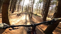
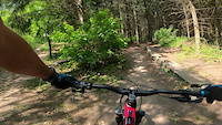
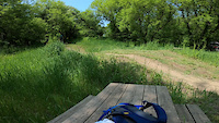
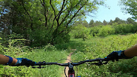
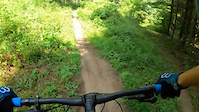
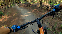
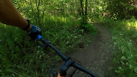
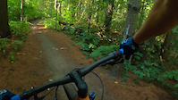
Photos of The Pines Mountain Bike
Videos of The Pines Mountain Bike
trail: APTOS
2:09 |
104 |
Nov 12, 2023
trail: FORMAL COMPLAINT
0:54 |
54 |
May 29, 2023
trail: Dual Slalom
0:05 |
58 |
May 29, 2023
trail: DAVE'S NOT HERE! MAN!
0:22 |
103 |
May 29, 2023
trail: Jumping Jack Flash
0:35 |
42 |
Mar 21, 2023
trail: Your Mum
0:35 |
24 |
Mar 21, 2023
trail: Your Mum
0:35 |
9 |
Mar 21, 2023
trail: Cardiac Hill
0:12 |
17 |
Mar 21, 2023
Recent Trail Reports
| status | trail | date | condition | info | user |
|---|---|---|---|---|---|
| Dual Slalom | Jun 7, 2026 @ 10:16am (America/Toronto) Jun 7, 2026 | Very Dry | jfishie | ||
| Three Bridges | Apr 23, 2026 @ 4:58pm (America/Toronto) Apr 23, 2026 | Variable | LangtonIP4k6J | ||
| Foundations | Apr 23, 2026 @ 4:58pm (America/Toronto) Apr 23, 2026 | Variable | LangtonIP4k6J | ||
| Dropped Nuts | Apr 23, 2026 @ 4:58pm (America/Toronto) Apr 23, 2026 | Variable | LangtonIP4k6J | ||
| Driveway | Apr 23, 2026 @ 4:58pm (America/Toronto) Apr 23, 2026 | Icy | LangtonIP4k6J | ||
| The Dentist | Apr 23, 2026 @ 4:58pm (America/Toronto) Apr 23, 2026 | Ideal | LangtonIP4k6J | ||
| 454 | Apr 23, 2026 @ 4:58pm (America/Toronto) Apr 23, 2026 | Ideal | LangtonIP4k6J | ||
| Access Road | Apr 23, 2026 @ 4:58pm (America/Toronto) Apr 23, 2026 | Ideal | LangtonIP4k6J | ||
| Twisty's | Apr 23, 2026 @ 4:58pm (America/Toronto) Apr 23, 2026 | Ideal | LangtonIP4k6J | ||
| ROCK GARDEN | Apr 23, 2026 @ 4:58pm (America/Toronto) Apr 23, 2026 | Ideal | LangtonIP4k6J |
Activity Feed
| username | action | type | title | date |
|---|---|---|---|---|
| naadiia | ridden | trail | activity #96905172 and 11 more | Jun 13, 2026 @ 12:22pm Jun 13, 2026 |
| jfishie | add | report | activity #96476710 | Jun 7, 2026 @ 10:32am Jun 7, 2026 |
| lpl5iA | wishlist | region | activity #96422545 | Jun 6, 2026 @ 6:41pm Jun 6, 2026 |
| steve-007 | wishlist | region | activity #96401041 | Jun 6, 2026 @ 1:13pm Jun 6, 2026 |
| 1BallMan | wishlist | region | activity #94630693 | May 13, 2026 @ 8:56am May 13, 2026 |
Recent Comments
| username | type | title | comment | date |
|---|---|---|---|---|
| trail | Super fun downhill trail. One of the longer... | Aug 10, 2025 @ 7:56am Aug 10, 2025 | ||
| trail | A very fast, flowy trail. Some jumps too | Mar 21, 2023 @ 10:09am Mar 21, 2023 | ||
| trail | Easy, twisty trail. Nice way to leave the trails. | Apr 24, 2022 @ 9:41am Apr 24, 2022 | ||
| trail | Great workout, not too difficult | Apr 24, 2022 @ 9:39am Apr 24, 2022 | ||
| trail | Ya good one to the whoops, but I held on! | Sep 18, 2021 @ 11:45am Sep 18, 2021 |
Nearby Areas
| name | distance | ||||
|---|---|---|---|---|---|
| Walker Woods | 4 | 12.6 km | |||
| New Hamburg Town Trails | 13.8 km | ||||
| Schmidt Woods | 2 | 14.6 km | |||
| Nith River Open Space | 1 | 15.2 km | |||
| Lions Park | 1 | 15.7 km |
Local Badges
-

Completionist10 awarded
Bike & Skill Parks
| name | type | city | rating |
|---|---|---|---|
| Pumptrack | skill park | Woodstock |
Activity Type Stats
| activitytype | trails | distance | descent | descent distance | total vertical | rating | global rank | state rank | photos | reports | routes | ridelogs |
|---|---|---|---|---|---|---|---|---|---|---|---|---|
| Mountain Bike | 56 | 12 miles | 1,066 ft | 4 miles | 433 ft | #34 | #4 | 101 | 1,538 | 3 | 12,348 | |
| E-Bike | 20 | 3 miles | 328 ft | 1 mile | 49 ft | #3,432 | #85 | 1,131 | 254 | |||
| Hike | 3 | 3,960 ft | 20 ft | 741 ft | 26 ft | #419 | #17 | 1,498 | 56 | |||
| Trail Running | 3 | 3,960 ft | 20 ft | 741 ft | 26 ft | #421 | #17 | 1,496 | 17 |
Frequently Asked Questions About The Pines
▼
What are the highest rated mountain biking trails in The Pines?
The highest rated mountain biking trails in The Pines are:
- HOPBOT! (4.5/5)
- Deer Run (4.4/5)
- DAVE'S NOT HERE! MAN! (4.4/5)
- 454 (4.4/5)
- Your Mum (4.4/5)
▼
What is the best time of the year to ride in The Pines?
Based on ride log data, the most popular months to ride in The Pines are:
- June (148 activities)
- July (142 activities)
- May (132 activities)
▼
Where can I park to ride in The Pines?
There are 1 parking locations listed in The Pines. The most popular parking spots are:
▼
What is the longest trail in The Pines?
The longest trail in The Pines is DEER RUN EXTENTION at 1.5 km. View all trails sorted by distance.
Trails
Points of Interest
- By brenthillier
 NSMBA TRAILFORKS & contributors
 - Admins: WCC
- #4655 - 44,539 views
- the pines activity log | embed map of The Pines mountain bike trails | the pines mountain biking points of interest polygons
Downloading of trail gps tracks in kml & gpx formats is enabled for The Pines.
You must login to download files.