close
-
Layers w
- Weather Layers
- Pro
- Pro
- Pro
- Pro
- Pro
- Pro
- More Layers
- Pro
- Pro
- Pro
- Pro
-
Upgrade to

3D
Trail Conditions
- Unknown
- Snow Groomed
- Snow Packed
- Snow Covered
- Snow Cover Partial
- Freeze/thaw Cycle
- Icy
- Prevalent Mud
- Wet
- Variable
- Ideal
- Dry
- Very Dry
Trail Flow (Ridden Direction)
Trailforks scans users ridelogs to determine the most popular direction each trail is ridden. A good flowing trail network will have most trails flowing in a single direction according to their intension.
The colour categories are based on what percentage of riders are riding a trail in its intended direction.
The colour categories are based on what percentage of riders are riding a trail in its intended direction.
- > 96%
- > 90%
- > 80%
- > 70%
- > 50%
- < 50%
- bi-directional trail
- no data
Trail Last Ridden
Trailforks scans ridelogs to determine the last time a trail was ridden.
- < 2 days
- < 1 week
- < 2 weeks
- < 1 month
- < 6 months
- > 6 months
Trail Ridden Direction
The intended direction a trail should be ridden.
- Downhill Only
- Downhill Primary
- Both Directions
- Uphill Primary
- Uphill Only
- One Direction
Contribute Details
Colors indicate trail is missing specified detail.
- Description
- Photos
- Description & Photos
- Videos
Trail Popularity ?
Trailforks scans ridelogs to determine which trails are ridden the most in the last 9 months.
Trails are compared with nearby trails in the same city region with a possible 25 colour shades.
Think of this as a heatmap, more rides = more kinetic energy = warmer colors.
- most popular
- popular
- less popular
- not popular
ATV/ORV/OHV Filter
Max Vehicle Width
inches
US Cell Coverage
Legend

Radar Time
Activity Recordings
Trailforks uses anonymized public activity data.
?
Activity Recordings
Trailforks uses anonymized public activity data.
?
Personal Heatmap
▶
Activity Types
all
/
none
▶
Options
2
Date range
month
–
Winter Trails
Warning
A routing network for winter maps does not exist. Selecting trails using the winter trails layer has been disabled.
Missing Trails
Most Popular
Least Popular
Trails are colored based on popularity. The more popular a trail is, the more red. Less popular trails trend towards green.
Jump Magnitude Heatmap
Heatmap of where riders jump on trails. Zoom in to see individual jumps, click circles to view jump details.
BC Backroad Status
![map legend]()
Service Road Atlas is a free to use, community-driven service for viewing and creating reports on the numerous back-country service roads around B.C. and Alberta.

Slope Aspect
Direction the slope faces
Trails Deemphasized
Trails are shown in grey.
Only show trails with no bike usage.
Suggested Layers
Based on selected activity type
Save the current map location and zoom level as your default home location whenever this page is loaded.
SaveThe Thomson trails are located behind LH Thomson. They manufacture some of the finest bicycle components in the world under their own name as well as contract manufacturing for other companies in other industries, including a lot of aerospace work for Boeing and others.
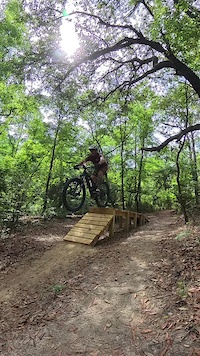
You’ll find the trailhead in the back right corner of the parking lot. The trail is directional based on what day of the week it is, so check the kiosk before heading into the woods. The trail itself is fast and flowy and a bit rooty in places. The soil is sandy and drains really well, making this trail rideable after a rain faster than all others in the area.
You’ll find the trailhead in the back right corner of the parking lot. The trail is directional based on what day of the week it is, so check the kiosk before heading into the woods. The trail itself is fast and flowy and a bit rooty in places. The soil is sandy and drains really well, making this trail rideable after a rain faster than all others in the area.
source: OMBA Website
Primary Trail Type: Cross-Country
eBikes Allowed:
Yes
Land Status: Private Managed Forest
 google parking directions
 Access Info:
7800 NE Industrial Blvd, Macon, GA 31216
Disclaimer:
IMPORTANT: Riders must sign a waiver in the mailbox at the trailhead before riding trail. Dogs must be leashed.
Links
Activities Click to view
- Mountain Bike
10 trails
- E-Bike
10 trails
- Hike
8 trails
- Trail Running
8 trails
Region Details
- 1
- 2
- 5
Region Status
Open as of Apr 9, 2026Stats
- Avg Trail Rating
- Trails (view details)
- 8
- Trails Mountain Bike
- 10
- Trails E-Bike
- 10
- Trails Hike
- 8
- Trails Trail Running
- 8
- Total Distance
- 5 miles
- Total Descent Distance
- 1 mile
- Total Descent
- 282 ft
- Total Vertical
- 53 ft
- Highest Trailhead
- 353 ft
- Reports
- 85
- Photos
- 49
- Ridden Counter
- 590
Popular Thomson Trails Mountain Biking Trails
• 100 ★ 4.5 • 4,829 ft • 74 ft • 105 •
Popular blue difficulty singletrack. This multi-use trail can be used both directions and has a moderate overall physical rating with a 74 ft blue climb. On average it takes 32 minutes to complete this trail.
• 95 ★ 3.0 • 1,811 ft • 0 ft • 88 •
Popular green difficulty singletrack. This multi-use trail can be used both directions. On average it takes 2 minutes to complete this trail.
• 100 ★ 0.0 • 512 ft • 0 ft • 40 •
• 100 ★ 4.0 • 4,488 ft • 59 ft • 31 •
The section of Thomson is one of the more physically demanding sections out here. This loop has plenty of short, punchy hills to test your out of shape levels! The trail passes the Radar Station for the airport
• 95 ★ 3.0 • 3,675 ft • 94 ft • 24 •
Newest addition to Thomson Trails. The more you ride it, the smoother it gets! Just opened Feb 24, 2024.
Thomson Trails Mountain Bike Routes
Thomson Full Black Loop Featured
★ 4.0 • 6 miles • 367 ft • 8 • Loop •
Thomson Black Loop. Follows the Black Arrows and its the entire trail system. Trail rating is actually...
Sandbox (Blue Loop) Featured
★ 5.0 • 4 miles • 248 ft • 5 • Loop •
Thomson Blue Loop. Follows the blue arrows
Thomson Black Loop Featured
5 miles • 306 ft • 9 • Loop •
The is the black loop minus Jake n Brake. This is kinda the OG black loop that most of the locals ride....
Green Loop Featured
★ 5.0 • 1 mile • 55 ft • 2 •
Green Loop @ Thomson. This is a 1 mile loop that is easy for beginners.
Green Extended Featured
2 miles • 81 ft • 2 • Loop •
This is another perfect beginner route. This uses the and part of Sandbox #3 to create a easy loop...
Photos of Thomson Trails Mountain Bike
Videos of Thomson Trails Mountain Bike
trail: Sandbox #1
0:08 |
73 |
Jun 7, 2024

trail: Sandbox #1
30:39 |
715 |
Sep 29, 2020 , Macon
Recent Trail Reports
| status | trail | date | condition | info | user |
|---|---|---|---|---|---|
| Sandbox #1 | Apr 9, 2026 @ 6:06pm (America/New_York) Apr 9, 2026 | Ideal | MikeyMcBikey OMBA SORBA | ||
| Jake-N-Brake | Mar 18, 2026 @ 9:14pm (America/New_York) Mar 18, 2026 | Ideal | MikeyMcBikey OMBA SORBA | ||
| Brass Monkey | Oct 8, 2025 @ 8:19am (America/New_York) Oct 8, 2025 | Dry | tacobravo OMBA SORBA | ||
| Brass Monkey | Oct 8, 2025 @ 8:19am (America/New_York) Oct 8, 2025 | Dry | tacobravo OMBA SORBA | ||
| Radar Loop | Oct 8, 2025 @ 8:18am (America/New_York) Oct 8, 2025 | Dry | tacobravo OMBA SORBA | ||
| Sandbox #2 | Oct 8, 2025 @ 8:17am (America/New_York) Oct 8, 2025 | Dry | tacobravo OMBA SORBA | ||
| Sandbox #3 | Oct 8, 2025 @ 8:17am (America/New_York) Oct 8, 2025 | Dry | tacobravo OMBA SORBA | ||
| The Spiral | Oct 8, 2025 @ 8:16am (America/New_York) Oct 8, 2025 | Dry | tacobravo OMBA SORBA | ||
| Express Lane | Oct 8, 2025 @ 8:16am (America/New_York) Oct 8, 2025 | Dry | tacobravo OMBA SORBA | ||
| Ronnie's Way | Oct 8, 2025 @ 8:16am (America/New_York) Oct 8, 2025 | Dry | tacobravo OMBA SORBA |
Activity Feed
| username | action | type | title | date |
|---|---|---|---|---|
| MikeyMcBikey | add | report | activity #92281289 | Apr 9, 2026 @ 3:06pm Apr 9, 2026 |
| MikeyMcBikey | comment | report | activity #92281237 | Apr 9, 2026 @ 3:06pm Apr 9, 2026 |
| MikeyMcBikey | add | report | activity #92089976 | Apr 6, 2026 @ 5:43pm Apr 6, 2026 |
| tacobravo | add | trail | activity #92068332 | Apr 6, 2026 @ 11:45am Apr 6, 2026 |
| tacobravo | add | route | activity #92068105 and 1 more | Apr 6, 2026 @ 11:41am Apr 6, 2026 |
Recent Comments
| username | type | title | comment | date |
|---|---|---|---|---|
| report | Tree cleared | Apr 9, 2026 @ 3:06pm Apr 9, 2026 | ||
| trail | This trail is well maintained and is... | Sep 7, 2025 @ 8:39am Sep 7, 2025 |
Nearby Areas
| name | distance | ||||
|---|---|---|---|---|---|
| MGSU - Macon Campus | 1 | 9 km | |||
| Ocmulgee Heritage Trail | 10 | 10.2 km | |||
| Macon Children's Home | 3 | 2 | 10.9 km | ||
| Arrowhead Park | 7 | 9 | 11.7 km | ||
| Mattie Wells Park | 15.6 km |
Bike & Skill Parks
| name | type | city | rating |
|---|---|---|---|
| Thomson Dirt Jump Skill Area | skill park | Macon |
Activity Type Stats
| activitytype | trails | distance | descent | descent distance | total vertical | rating | global rank | state rank | photos | reports | routes | ridelogs |
|---|---|---|---|---|---|---|---|---|---|---|---|---|
| Mountain Bike | 10 | 5 miles | 282 ft | 1 mile | 52 ft | #7,524 | #2,894 | 51 | 96 | 2 | 1,235 | |
| E-Bike | 10 | 5 miles | 282 ft | 1 mile | 52 ft | #6,835 | #1,961 | 100 | 5 | 103 | ||
| Hike | 8 | 5 miles | 282 ft | 1 mile | 52 ft | #13,532 | #5,769 | 111 | 11 | |||
| Trail Running | 8 | 5 miles | 282 ft | 1 mile | 52 ft | #12,367 | #4,953 | 111 | 37 |
Frequently Asked Questions About Thomson Trails
▼
What are the highest rated mountain biking trails in Thomson Trails?
The highest rated mountain biking trails in Thomson Trails are:
- Sandbox #1 (4.1/5)
- The Spiral (4/5)
- Radar Loop (4/5)
- Ronnie's Way (3.8/5)
- Jake-N-Brake (3.8/5)
▼
What is the best time of the year to ride in Thomson Trails?
Based on ride log data, the most popular months to ride in Thomson Trails are:
- October (10 activities)
- August (7 activities)
- November (7 activities)
▼
Where can I park to ride in Thomson Trails?
There are 1 parking locations listed in Thomson Trails. The most popular parking spots are:
▼
What is the longest trail in Thomson Trails?
The longest trail in Thomson Trails is Express Lane at 1.2 miles. View all trails sorted by distance.
Activities
Trails
- By WillieJacobsz
 Trailforks SBP SWW & contributors
 - Admins: OMBA SORBA
- #52449 - 5,278 views
- thomson trails activity log | embed map of Thomson Trails mountain bike trails | thomson trails mountain biking points of interest
Downloading of trail gps tracks in kml & gpx formats is enabled for Thomson Trails.
You must login to download files.