close
-
Layers w
- Weather Layers
- Pro
- Pro
- Pro
- Pro
- Pro
- Pro
- More Layers
- Pro
- Pro
- Pro
- Pro
-
Upgrade to

3D
Trail Conditions
- Unknown
- Snow Groomed
- Snow Packed
- Snow Covered
- Snow Cover Partial
- Freeze/thaw Cycle
- Icy
- Prevalent Mud
- Wet
- Variable
- Ideal
- Dry
- Very Dry
Trail Flow (Ridden Direction)
Trailforks scans users ridelogs to determine the most popular direction each trail is ridden. A good flowing trail network will have most trails flowing in a single direction according to their intension.
The colour categories are based on what percentage of riders are riding a trail in its intended direction.
The colour categories are based on what percentage of riders are riding a trail in its intended direction.
- > 96%
- > 90%
- > 80%
- > 70%
- > 50%
- < 50%
- bi-directional trail
- no data
Trail Last Ridden
Trailforks scans ridelogs to determine the last time a trail was ridden.
- < 2 days
- < 1 week
- < 2 weeks
- < 1 month
- < 6 months
- > 6 months
Trail Ridden Direction
The intended direction a trail should be ridden.
- Downhill Only
- Downhill Primary
- Both Directions
- Uphill Primary
- Uphill Only
- One Direction
Contribute Details
Colors indicate trail is missing specified detail.
- Description
- Photos
- Description & Photos
- Videos
Trail Popularity ?
Trailforks scans ridelogs to determine which trails are ridden the most in the last 9 months.
Trails are compared with nearby trails in the same city region with a possible 25 colour shades.
Think of this as a heatmap, more rides = more kinetic energy = warmer colors.
- most popular
- popular
- less popular
- not popular
ATV/ORV/OHV Filter
Max Vehicle Width
inches
US Cell Coverage
Legend

Radar Time
Activity Recordings
Trailforks uses anonymized public activity data.
?
Activity Recordings
Trailforks uses anonymized public activity data.
?
Personal Heatmap
▶
Activity Types
all
/
none
▶
Options
2
Date range
month
–
Winter Trails
Warning
A routing network for winter maps does not exist. Selecting trails using the winter trails layer has been disabled.
Missing Trails
Most Popular
Least Popular
Trails are colored based on popularity. The more popular a trail is, the more red. Less popular trails trend towards green.
Jump Magnitude Heatmap
Heatmap of where riders jump on trails. Zoom in to see individual jumps, click circles to view jump details.
BC Backroad Status
![map legend]()
Service Road Atlas is a free to use, community-driven service for viewing and creating reports on the numerous back-country service roads around B.C. and Alberta.

Slope Aspect
Direction the slope faces
Trails Deemphasized
Trails are shown in grey.
Only show trails with no bike usage.
Suggested Layers
Based on selected activity type
Save the current map location and zoom level as your default home location whenever this page is loaded.
SaveThis region is Unsanctioned, Ride at your own Risk!
Unofficial riding spot. Not for beginners, no facilities, no markers, take your rubbish home and respect the other forest users, riders and trail builders. These trails aren't built for the high numbers of users, and they're built by people on their own free time. Big groups riding them ruins these trails.
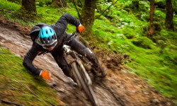
Primary Trail Type: All-Mountain & Downhill
AKA: Thorny
Land Status: National Forest
Land Manager: Forest and Land Scotland
 google parking directions
 Access Info:
Car Park - sign posted from the road as Thornielee viewpoint- a quiet, historical part of Scottish history.So park your VW T4 sensibly and turn the stereo off before you open the doors. ;-P
This region uses the Uk/Euro style trail grading system.
Activities Click to view
- Mountain Bike
27 trails
- E-Bike
26 trails
- Horse
6 trails
- Hike
12 trails
- Trail Running
12 trails
Region Details
- 3
- 9
- 4
- 11
Region Status
Caution as of Jun 16, 2026Stats
- Avg Trail Rating
- Trails (view details)
- 27
- Trails Mountain Bike
- 27
- Trails E-Bike
- 26
- Trails Horse
- 6
- Trails Hike
- 12
- Trails Trail Running
- 12
- Total Distance
- 9 miles
- Total Descent Distance
- 6 miles
- Total Descent
- 4,803 ft
- Total Vertical
- 792 ft
- Highest Trailhead
- 1,260 ft
- Reports
- 4,337
- Photos
- 69
- Ridden Counter
- 12,500
Articles
Video: Scottish Roadtripping & Trail Riding in 'Search for the Slop'
Dec 29, 2020 from pinkbike.com
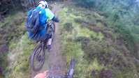
Popular Thornielee Mountain Biking Trails
• 75 ★ 1.0 • 456 ft • 0 ft • 724 • • hike
Popular green difficulty other. This hike primary trail can be used both directions. On average it takes minutes to complete this trail.
• 80 ★ 5.0 • 1,381 ft • 0 ft • 349 •
Popular red difficulty singletrack. This mountain bike primary trail and has a moderate overall physical rating with a 0 ft blue climb. Trail visibility is always easy to follow. On average it takes 1 minutes to complete this trail.
• 70 ★ 1.0 • 669 ft • 0 ft • 238 • • hike
Popular green difficulty singletrack. This hike primary trail can be used both directions and has a easy overall physical rating with a 0 ft green climb. Trail visibility is always easy to follow. On average it takes 1 minutes to complete this trail.
• 35 ★ 0.0 • 2,028 ft • 0 ft • 38 • • hike
Less popular green difficulty singletrack. This hike primary trail can be used both directions and has a moderate overall physical rating with a 0 ft blue climb. Trail visibility is always easy to follow. On average it takes 11 minutes to complete this trail.
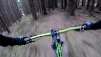
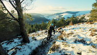
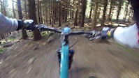
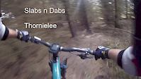
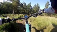
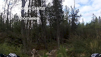
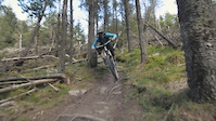
Videos of Thornielee Mountain Bike
2:23 |
294 |
Oct 11, 2018
trail: High Definition
2:09 |
261 |
Jan 25, 2017
0:50 |
474 |
Oct 17, 2016
4:00 |
885 |
Oct 9, 2016
trail: High Definition
0:12 |
162 |
Oct 9, 2016
2:26 |
238 |
Oct 9, 2016
0:54 |
316 |
May 19, 2016
3:46 |
1529 |
Dec 20, 2015
Recent Trail Reports
| status | trail | date | condition | info | user |
|---|---|---|---|---|---|
| Forest Path | Oct 23, 2025 @ 3:39pm (Europe/London) Oct 23, 2025 | Ideal | marccr0wley FLS | ||
| Turbo Ferret | Oct 23, 2025 @ 3:37pm (Europe/London) Oct 23, 2025 | Ideal | marccr0wley FLS | ||
| Top Dog | Oct 23, 2025 @ 3:37pm (Europe/London) Oct 23, 2025 | Ideal | marccr0wley FLS | ||
| Top Dog 2 Helter | Oct 23, 2025 @ 3:36pm (Europe/London) Oct 23, 2025 | Unknown | marccr0wley FLS | ||
| Gumdrops | Oct 23, 2025 @ 3:36pm (Europe/London) Oct 23, 2025 | Unknown | marccr0wley FLS | ||
| Techno Troot | Oct 23, 2025 @ 3:36pm (Europe/London) Oct 23, 2025 | Unknown | marccr0wley FLS | ||
| Forest Path | Oct 23, 2025 @ 3:36pm (Europe/London) Oct 23, 2025 | Ideal | marccr0wley FLS | ||
| Slabs and Tarts | Jul 1, 2025 @ 12:27am Jul 1, 2025 | Very Dry | marccr0wley FLS | ||
| Stones and Bones | Jul 1, 2025 @ 12:23am Jul 1, 2025 | Very Dry | marccr0wley FLS | ||
| The Glory Hole | Jul 1, 2025 @ 12:23am Jul 1, 2025 | Very Dry | marccr0wley FLS |
Activity Feed
| username | action | type | title | date |
|---|---|---|---|---|
| Brettstabler | add | report | activity #96803575 | Jun 12, 2026 @ 7:45am Jun 12, 2026 |
| KathrynWest | add | report | activity #92673258 | Apr 15, 2026 @ 11:14am Apr 15, 2026 |
| LKEO | wishlist | trail | activity #89978567 | Mar 4, 2026 @ 3:38pm Mar 4, 2026 |
| Vezo69 | wishlist | region | activity #87047316 | Jan 11, 2026 @ 2:06pm Jan 11, 2026 |
| trailforks | add | video | activity #86804665 | Jan 7, 2026 @ 10:25am Jan 7, 2026 |
Recent Comments
| username | type | title | comment | date |
|---|---|---|---|---|
| trail | RIP Turbo Ferret. Too many trees down. | May 9, 2025 @ 2:30am May 9, 2025 | ||
| trail | Loads of trees down | Apr 3, 2025 @ 11:24pm Apr 3, 2025 | ||
| trail | Tree down lower section. | May 31, 2024 @ 4:17am May 31, 2024 | ||
| trail | Trees down just below entrance | Jan 23, 2024 @ 2:13am Jan 23, 2024 | ||
| trail | Rocky and slippy in the wet I thought, but... | Aug 13, 2023 @ 9:23am Aug 13, 2023 |
Nearby Areas
| name | distance | ||||
|---|---|---|---|---|---|
| Elibank | 2 | 1.1 km | |||
| Caberston | 3 | 3 | 3.5 km | ||
| Traquair Trails | 1 | 4 | 3.8 km | ||
| Yair | 10 | 9 | 3.9 km | ||
| Gala Hill | 2 | 5.7 km |
Local Badges
-

Completionist50 awarded
Activity Type Stats
| activitytype | trails | distance | descent | descent distance | total vertical | rating | global rank | state rank | photos | reports | routes | ridelogs |
|---|---|---|---|---|---|---|---|---|---|---|---|---|
| Mountain Bike | 27 | 9 miles | 4,803 ft | 6 miles | 791 ft | #2,986 | #95 | 69 | 4,300 | 2,385 | ||
| E-Bike | 26 | 9 miles | 4,419 ft | 5 miles | 791 ft | #3,499 | #136 | 1,583 | 392 | |||
| Horse | 6 | 4 miles | 43 ft | 2,306 ft | 791 ft | #1,202 | #62 | 1,195 | ||||
| Hike | 12 | 5 miles | 679 ft | 2 miles | 791 ft | #8,164 | #199 | 4,171 | 22 | |||
| Trail Running | 12 | 5 miles | 679 ft | 2 miles | 791 ft | #8,334 | #226 | 4,112 | 13 |
Frequently Asked Questions About Thornielee
▼
What are the highest rated mountain biking trails in Thornielee?
The highest rated mountain biking trails in Thornielee are:
- Gumdrops (4.4/5)
- Top Dog (4.3/5)
- Top Dog 2 Helter (4.3/5)
- High Definition (4.2/5)
- Bench Press (4.1/5)
▼
What is the best time of the year to ride in Thornielee?
Based on ride log data, the most popular months to ride in Thornielee are:
- April (10 activities)
- November (9 activities)
- May (8 activities)
▼
Where can I park to ride in Thornielee?
There are 1 parking locations listed in Thornielee. The most popular parking spots are:
▼
What is the longest trail in Thornielee?
The longest trail in Thornielee is Walkers Path at 1.2 km. View all trails sorted by distance.
Activities
- By 20twenty-p
 TVTA & contributors
 - Admins: TVTA
- #5908 - 18,314 views
- thornielee activity log | embed map of Thornielee mountain bike trails | thornielee mountain biking points of interest polygons
Downloading of trail gps tracks in kml & gpx formats is enabled for Thornielee.
You must login to download files.