close
-
Layers w
- Weather Layers
- Pro
- Pro
- Pro
- Pro
- Pro
- Pro
- More Layers
- Pro
- Pro
- Pro
- Pro
-
Upgrade to

3D
Trail Conditions
- Unknown
- Snow Groomed
- Snow Packed
- Snow Covered
- Snow Cover Partial
- Freeze/thaw Cycle
- Icy
- Prevalent Mud
- Wet
- Variable
- Ideal
- Dry
- Very Dry
Trail Flow (Ridden Direction)
Trailforks scans users ridelogs to determine the most popular direction each trail is ridden. A good flowing trail network will have most trails flowing in a single direction according to their intension.
The colour categories are based on what percentage of riders are riding a trail in its intended direction.
The colour categories are based on what percentage of riders are riding a trail in its intended direction.
- > 96%
- > 90%
- > 80%
- > 70%
- > 50%
- < 50%
- bi-directional trail
- no data
Trail Last Ridden
Trailforks scans ridelogs to determine the last time a trail was ridden.
- < 2 days
- < 1 week
- < 2 weeks
- < 1 month
- < 6 months
- > 6 months
Trail Ridden Direction
The intended direction a trail should be ridden.
- Downhill Only
- Downhill Primary
- Both Directions
- Uphill Primary
- Uphill Only
- One Direction
Contribute Details
Colors indicate trail is missing specified detail.
- Description
- Photos
- Description & Photos
- Videos
Trail Popularity ?
Trailforks scans ridelogs to determine which trails are ridden the most in the last 9 months.
Trails are compared with nearby trails in the same city region with a possible 25 colour shades.
Think of this as a heatmap, more rides = more kinetic energy = warmer colors.
- most popular
- popular
- less popular
- not popular
ATV/ORV/OHV Filter
Max Vehicle Width
inches
US Cell Coverage
Legend

Radar Time
Activity Recordings
Trailforks uses anonymized public activity data.
?
Activity Recordings
Trailforks uses anonymized public activity data.
?
Personal Heatmap
▶
Activity Types
all
/
none
▶
Options
2
Date range
month
–
Winter Trails
Warning
A routing network for winter maps does not exist. Selecting trails using the winter trails layer has been disabled.
Missing Trails
Most Popular
Least Popular
Trails are colored based on popularity. The more popular a trail is, the more red. Less popular trails trend towards green.
Jump Magnitude Heatmap
Heatmap of where riders jump on trails. Zoom in to see individual jumps, click circles to view jump details.
BC Backroad Status
![map legend]()
Service Road Atlas is a free to use, community-driven service for viewing and creating reports on the numerous back-country service roads around B.C. and Alberta.

Slope Aspect
Direction the slope faces
Trails Deemphasized
Trails are shown in grey.
Only show trails with no bike usage.
Suggested Layers
Based on selected activity type
Save the current map location and zoom level as your default home location whenever this page is loaded.
SaveIts many astonishing routes through lakes, valleys and mountain peaks, plus an ideal climate, make Ticino the perfect canton for MTB enthusiasts. Discover our mountain bike destinations.
AKA: Tessin
Links
This region uses the Uk/Euro style trail grading system.
Region Details
- 148
- 134
- 362
- 269
- 106
- 6
Stats
- Avg Trail Rating
- Trails (view details)
- 1,036
- Trails Mountain Bike
- 1,025
- Trails E-Bike
- 938
- Trails Gravel Bike
- 172
- Trails Adaptive Bike
- 30
- Trails Winter Fat Bike
- 2
- Trails Horse
- 2
- Trails Hike
- 994
- Trails Trail Running
- 994
- Total Distance
- 944 miles
- Total Descent
- 483,888 ft
- Total Vertical
- 7,738 ft
- Highest Trailhead
- 8,408 ft
- Reports
- 7,256
- Photos
- 1,465
- Ridden Counter
- 49,257
Articles
Video: Nino Schurter VS Mike Levy - Humbled
Nov 25, 2019 from pinkbike.com
Cross-country racing's GOAT shows Levy what it's like to ride and train in Lugano. It does not go well for Levy...
Popular Trail Networks
view all areas »Sub Regions
- Distretto di Bellinzona (69)
- Bellinzona (56)
- Cadenazzo (3)
- Isone (1)
- Lumino (3)
- Sant'Antonio (5)
- Bellinzona (56)
- Distretto di Blenio (102)
- Acquarossa (27)
- Nara Bike Park (35)
- Blenio (61)
- Valle di Blenio (61)
- Serravalle (14)
- Acquarossa (27)
- Distretto di Leventina (115)
- Airolo (49)
- Airolo Bike Park (6)
- Bedretto (31)
- Val Bedretto (29)
- Faido (17)
- Pollegio (3)
- Quinto (18)
- Airolo (49)
- Distretto di Locarno (182)
- Ascona (19)
- Centovalli (7)
- Cugnasco-Gerra (27)
- Gambarogno (32)
- Locarno (61)
- Cardada Cimetta (61)
- Losone (28)
- Mergoscia (8)
- Verzasca (2)
- Ascona (19)
- Distretto di Lugano (371)
- Alto Malcantone (25)
- Aranno (2)
- Arogno (5)
- Astano (8)
- Bioggio (13)
- Cademario (13)
- Capriasca (23)
- Caslano (6)
- Collina D'Oro (19)
- Lugano (138)
- Arbostora Trail Alliance (34)
- Monte Bar (56)
- Monte Boglia (28)
- Pairolo (18)
- Miglieglia (24)
- Monte Lema (19)
- Monteceneri (66)
- Monte Tamaro (24)
- Novaggio (5)
- origlio (11)
- Pura (21)
- Monte Mondini (19)
- Tresa (20)
- Vernate (5)
- Alto Malcantone (25)
- Distretto di Mendrisio (173)
- Chiasso (4)
- Mendrisio (156)
- Monte Generoso (39)
- Monte San Giorgio (56)
- Valle di Muggio (56)
- Stabio (18)
- Chiasso (4)
- Distretto Di Riviera (2)
- Biasca (2)
- Biasca (2)
- Distretto di Vallemaggia (27)
- Avegno Gordevio (2)
- Cevio (1)
- Lavizzara (10)
- Maggia (14)
- Avegno Gordevio (2)
Popular Ticino Mountain Biking Trails
• 100 ★ 3.8 • 3 miles • 47 ft • 418 •
The trail into the Resa Valley first takes you over a grassy ridge before dropping into a dense deciduous forest with plenty of flowing berms. With alternating easy and moderate technical sections.
• 95 ★ 4.6 • 4,400 ft • 17 ft • 339 •
Highly rated popular black difficulty alpine singletrack. This multi-use trail can be used one direction. It features rock face and rock garden. On average it takes 23 minutes to complete this trail.
• 100 ★ 4.3 • 5 miles • 327 ft • 335 •
Unfortunetly the trail is no longer maintained. However it is still ridable with very few exeptions. For the most part it is a rough nature-trail but is hasse some built turns in it. There is considerable climb after roughtly the first...
• 95 ★ 4.0 • 5 miles • 815 ft • 306 •
Really nice single track through open alpine meadows. Technical section going down and uphill. Need some power to be fully appreciate. Some stream crossing need hike and bike. Can be ride also from Monte Bar hut towards San Lucio but it...
• 80 ★ 4.7 • 2 miles • 50 ft • 276 • • hike
Highly rated popular black difficulty singletrack. This hike primary trail can be used downhill primary and has a hard overall physical rating. It features drop, rock face and rock garden. On average it takes 26 minutes to complete this trail.
• 95 ★ 4.3 • 4,347 ft • 29 ft • 270 •
Highly rated popular red difficulty singletrack. This multi-use trail can be used downhill primary. It features rock garden. Exposure: High Risk of Serious Injury. On average it takes 9 minutes to complete this trail.
• 100 ★ 4.7 • 3,100 ft • 0 ft • 252 •
Highly rated popular red difficulty singletrack. This mountain bike primary trail. It features rock garden. Trail visibility is always easy to follow. On average it takes 13 minutes to complete this trail.
• 80 ★ 4.0 • 2 miles • 0 ft • 243 •
Popular red difficulty singletrack. This multi-use trail can be used downhill primary. On average it takes 1 hour10 minutes to complete this trail.
Ticino Mountain Bike Routes
Monte Tamaro Bike #362 Featured
20 miles • 2,659 ft • 6 • Loop •
This loop trail is quite an experience: the ascent from to Capanna is rough, but the fantastic views of...
Airolo Bike #391 Featured
13 miles • 4,159 ft • 2 • Shuttled •
An itinerary rich in unique and unforgettable alpine walks and vistas, ideally suited to those who prefer...
Castagno Bike #355 Featured
24 miles • 5,171 ft • 15 • Loop •
The Castagno Bike route leads to the northern part of Malcantone, known as Alto Malcantone. It passes...
★ 3.7 • 15 miles • 1,793 ft • 12 • Point to Point •
The "Man and Sun" XXL format is a variant of the "Man and Sun" route, with start and finish in Olivone. A...
★ 5.0 • 12 miles • 3,654 ft • 5 • Loop •
Circular route starting from Gordola with an asphalt climb up to . From here begins a technical...
★ 3.5 • 19 miles • 4,722 ft • 4 • Loop •
and Val Resa that starts and finishes in Locarno and presents for most parts a breath-taking view over the...
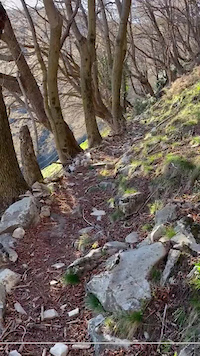
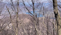
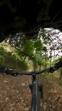
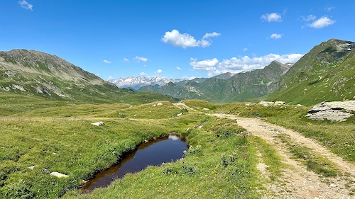
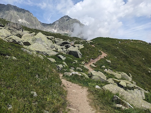
Photos of Ticino Mountain Bike
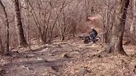
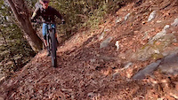
Videos of Ticino Mountain Bike
0:00 |
3 |
Sep 18, 2025
trail: Gana Negra
0:25 |
|
Sep 29, 2024
trail: Cascata del Botto
0:08 |
16 |
Mar 19, 2024
trail: Sassi var
0:11 |
44 |
Dec 5, 2023
trail: Poncione Superiore
0:11 |
81 |
Dec 4, 2023
trail: Confinale
0:18 |
44 |
Dec 4, 2023
trail: Tornante
0:06 |
19 |
Dec 4, 2023
3:09 |
43 |
Nov 28, 2023
Current Trail Warnings
| status | trail | date | condition | user | info |
|---|---|---|---|---|---|
| Torre di Redde origlio | Jun 16, 2026 @ 5:35pm (Europe/Vaduz) 2 days | Ideal | francesco-mgn | Ci sono piante cadute sul sentiero in... | |
| Cardada Connector Lower Cardada Cimetta | Jun 16, 2026 @ 8:20am (Europe/Vaduz) 3 days | Ideal | eile | ||
| Snek Cardada Cimetta | Jun 16, 2026 @ 8:20am (Europe/Vaduz) 3 days | Ideal | eile | Will open July 1st. |
Recent Trail Reports
National Scenic Trails & Official Routes
-
Lugano Bike #66
- Mountain Bike
- E-Bike
-
St.-Gotthard Fünf-Pässe Bike #85
- Mountain Bike
- E-Bike
-
St.-Gotthard Vier-Pässe Bike #84
- Mountain Bike
- E-Bike

Activity Feed
| username | action | type | title | date |
|---|---|---|---|---|
| Claudiob5RWAg | wishlist | trail | activity #97207148 | Jun 17, 2026 @ 1:38pm 22 hours |
| montfort | add | report | activity #97180522 | Jun 17, 2026 @ 7:02am 1 day |
| trailpapst | difficultyvote | trail | activity #97177543 and 7 more | Jun 17, 2026 @ 6:02am 1 day |
| trailpapst | update | trail | activity #97177180 and 4 more | Jun 17, 2026 @ 5:54am 1 day |
| Leatt1977 | wishlist | route | activity #97164869 | Jun 16, 2026 @ 11:23pm 1 day |
Recent Comments
| username | type | title | comment | date |
|---|---|---|---|---|
| report | Yes :) | Jun 15, 2026 @ 10:40pm 3 days | ||
| report | Was the trail still full of leaves? | Jun 15, 2026 @ 7:39am Jun 15, 2026 | ||
| report | Is the trail now officially open? | Jun 15, 2026 @ 2:38am Jun 15, 2026 | ||
| report | Der Trail ist freigeräumt | Jun 14, 2026 @ 8:50am Jun 14, 2026 | ||
| report | Der weg ist freigeräumt | Jun 14, 2026 @ 8:49am Jun 14, 2026 |
Local Badges
-
10 Red Trails15 awarded -

Epic Ride Descent 2k5 awarded -
Epic Ride Descent 2k0 awarded -
Epic Ride Descent 2k1 awarded -
Epic Ride Descent 2k2 awarded -
Epic Ride Descent 2k0 awarded
Bike & Skill Parks
| name | type | city | rating |
|---|---|---|---|
| Airolo Bike Park | bike park | Airolo | |
| Nara Bike Park | bike park | Acquarossa | |
| Pump Track Mendrisio | skill park | Mendrisio | |
| Pump track Cevio | skill park | Cevio | |
| Bike Park | skill park | Mendrisio |
Activity Type Stats
| activitytype | trails | distance | descent | descent distance | total vertical | rating | global rank | state rank | photos | reports | routes | ridelogs |
|---|---|---|---|---|---|---|---|---|---|---|---|---|
| Mountain Bike | 1,025 | 929 miles | 473,018 ft | 605 miles | 7,740 ft | 1,425 | 7,246 | 75 | 41,735 | |||
| E-Bike | 938 | 867 miles | 429,534 ft | 556 miles | 7,740 ft | 15 | 6,836 | 64 | 7,911 | |||
| Gravel Bike | 172 | 267 miles | 31,355 ft | 79 miles | 7,028 ft | 302 | 1 | 273 | ||||
| Adaptive Bike | 30 | 39 miles | 4,154 ft | 12 miles | 6,555 ft | 359 | 1 | |||||
| Winter Fat Bike | 2 | 1 mile | 571 ft | 4,186 ft | 1,768 ft | 10 | ||||||
| Horse | 2 | 1 mile | 217 ft | 3,504 ft | 640 ft | 297 | ||||||
| Hike | 994 | 921 miles | 465,463 ft | 593 miles | 7,740 ft | 7,047 | 8 | 4,819 | ||||
| Trail Running | 994 | 921 miles | 465,463 ft | 593 miles | 7,740 ft | 5 | 7,039 | 8 | 1,709 |
Activities
Trails
Points of Interest
- Panorama Viewpoint
- Capanna Scaletta SAT Lodge
- Capanna Pian d'Alpe Lodge
- Pizzo del Sole 2773m Summit
- Capanna Cadagno Lodge
- Capanna Cadlimo CAS Lodge
- Rock Face TTF
- Oratorio di San Martino 860 m Viewpoint
- [Bike Wash] Acquarossa-Comprovasco Other
- Camping Bellinzona
- Adula - Rheinwaldhorn (10,997 ft)
- Güferhorn (10,827 ft)
- Läntahorn (10,459 ft)
- By brenthillier
 NSMBA TRAILFORKS & contributors
 - Admins: swiss, trailpapst, TIS
- #8968 - 20,671 views
- ticino activity log | embed map of Ticino mountain bike trails | ticino mountain biking points of interest
Downloading of trail gps tracks in kml & gpx formats is enabled for Ticino.
You must login to download files.