close
-
Layers w
- Weather Layers
- Pro
- Pro
- Pro
- Pro
- Pro
- Pro
- More Layers
- Pro
- Pro
- Pro
- Pro
-
Upgrade to

3D
Trail Conditions
- Unknown
- Snow Groomed
- Snow Packed
- Snow Covered
- Snow Cover Partial
- Freeze/thaw Cycle
- Icy
- Prevalent Mud
- Wet
- Variable
- Ideal
- Dry
- Very Dry
Trail Flow (Ridden Direction)
Trailforks scans users ridelogs to determine the most popular direction each trail is ridden. A good flowing trail network will have most trails flowing in a single direction according to their intension.
The colour categories are based on what percentage of riders are riding a trail in its intended direction.
The colour categories are based on what percentage of riders are riding a trail in its intended direction.
- > 96%
- > 90%
- > 80%
- > 70%
- > 50%
- < 50%
- bi-directional trail
- no data
Trail Last Ridden
Trailforks scans ridelogs to determine the last time a trail was ridden.
- < 2 days
- < 1 week
- < 2 weeks
- < 1 month
- < 6 months
- > 6 months
Trail Ridden Direction
The intended direction a trail should be ridden.
- Downhill Only
- Downhill Primary
- Both Directions
- Uphill Primary
- Uphill Only
- One Direction
Contribute Details
Colors indicate trail is missing specified detail.
- Description
- Photos
- Description & Photos
- Videos
Trail Popularity ?
Trailforks scans ridelogs to determine which trails are ridden the most in the last 9 months.
Trails are compared with nearby trails in the same city region with a possible 25 colour shades.
Think of this as a heatmap, more rides = more kinetic energy = warmer colors.
- most popular
- popular
- less popular
- not popular
ATV/ORV/OHV Filter
Max Vehicle Width
inches
US Cell Coverage
Legend

Radar Time
Activity Recordings
Trailforks uses anonymized public activity data.
?
Activity Recordings
Trailforks uses anonymized public activity data.
?
Personal Heatmap
▶
Activity Types
all
/
none
▶
Options
2
Date range
month
–
Winter Trails
Warning
A routing network for winter maps does not exist. Selecting trails using the winter trails layer has been disabled.
Missing Trails
Most Popular
Least Popular
Trails are colored based on popularity. The more popular a trail is, the more red. Less popular trails trend towards green.
Jump Magnitude Heatmap
Heatmap of where riders jump on trails. Zoom in to see individual jumps, click circles to view jump details.
BC Backroad Status
![map legend]()
Service Road Atlas is a free to use, community-driven service for viewing and creating reports on the numerous back-country service roads around B.C. and Alberta.

Slope Aspect
Direction the slope faces
Trails Deemphasized
Trails are shown in grey.
Only show trails with no bike usage.
Suggested Layers
Based on selected activity type
Save the current map location and zoom level as your default home location whenever this page is loaded.
SaveTignes is a group of villages that form a high-altitude ski resort in the French Alps, near the Italian border. With nearby Val d’Isère, it’s part of the Espace Killy ski area, linked by a network of lifts. Val Claret and Tignes Le Lac villages are lively hubs, with restaurants and shops. In summer, the area offers trails, golf and a bike park, plus ski runs on the Grande Motte glacier.
https://www.tignes.net
https://www.tignes.net
This region uses the Uk/Euro style trail grading system.
Activities Click to view
- Mountain Bike
99 trails
- E-Bike
57 trails
- Adaptive Bike
0 trails
- Winter Fat Bike
0 trails
- Horse
2 trails
- Hike
105 trails
- Trail Running
104 trails
- Downhill Ski
4 trails
- Backcountry Ski
4 trails
- Nordic Ski
4 trails
Region Details
- 12
- 7
- 13
- 45
- 15
- 3
Region Status
Open as of Apr 1, 2026Stats
- Avg Trail Rating
- Trails (view details)
- 100
- Trails Mountain Bike
- 100
- Trails E-Bike
- 57
- Trails Horse
- 2
- Trails Hike
- 105
- Trails Trail Running
- 104
- Trails Snowshoe
- 1
- Trails Downhill Ski
- 4
- Trails Backcountry Ski
- 4
- Trails Nordic Ski
- 4
- Total Distance
- 80 miles
- Total Descent
- 41,229 ft
- Total Vertical
- 7,677 ft
- Highest Trailhead
- 12,117 ft
- Reports
- 138
- Photos
- 101
- Ridden Counter
- 19,857
Sub Regions
-
Tignes/Val d'Isère
- 1
- 2
- 3
- 1
Popular Tignes Mountain Biking Trails
• 100 ★ 3.3 • 4,829 ft • 0 ft • 304 •
A Tignes classic; as hard as you want it to be. A near-beginner? Smoothly ride down enjoying the swoops and whoops of deep berms. Advanced rider? Smash the berms at high speed and fly over all the tabletop jumps. The trail splits a few...
• 100 ★ 4.2 • 1 mile • 15 ft • 293 •
Principale piste de descente du secteur de en direction de Tignes Val Claret, cette piste très joueuse, sans pente très raide, comporte de nombreux jumps et sections flowy. Permet l'accès à d'autres pistes comme , Funky , , , , ......
• 95 ★ 3.5 • 3,975 ft • 3 ft • 225 •
Short Steep and Fast. 2013 sees the arrival of ! With lots of big jumps, gaps and even wooden berms. You start at 2580m and finish at around 2000m (altitude). At quite a high pace (this is slightly more difficult but makes the trail...
• 100 ★ 3.0 • 2,264 ft • 10 ft • 210 •
Popular blue difficulty family friendly alpine machine groomed. This mountain bike primary trail can be used downhill only. On average it takes 3 minutes to complete this trail.
• 95 ★ 0.0 • 1 mile • 106 ft • 200 •
Popular green difficulty family friendly paved path. This multi-use trail can be used both directions and has a easy overall physical rating with a 106 ft green climb. On average it takes 6 minutes to complete this trail.
• 100 ★ 5.0 • 817 ft • 0 ft • 200 •
Popular blue difficulty machine groomed. This mountain bike primary trail can be used downhill only. It features berm and jump. On average it takes minutes to complete this trail.
• 100 ★ 0.0 • 3,665 ft • 9 ft • 190 •
Popular blue difficulty machine groomed. This mountain bike primary trail can be used downhill only. It features berm. Trail visibility is always easy to follow. On average it takes 3 minutes to complete this trail.
• 95 ★ 4.3 • 1 mile • 12 ft • 173 •
A fun trail that takes you back from the trails above , to Tignes Val Claret. Access involves a flat ride past a lake at the top; see the "Access Info" section. It's all downhill, starting with some deep bermed switchbacks before...
Tignes Mountain Bike Routes
★ 5.0 • 25 miles • 11,571 ft • 4 •
only for the hard core, requires high level of fitness and technical ability.
★ 5.0 • 15 miles • 4,412 ft • 2 • Loop •
Out of Tignes le Lavachet, Down Gr5 to val disere, up the road to sassiere lake then straight back down...
★ 5.0 • 18 miles • 5,151 ft • 6 • Loop •
epic single track route. 2 x big climbs on road.
23 miles • 6,592 ft • 13 • Shuttled •
37km Tour of the Tignes area. Amazing views of its 7 mountain Lakes, Villages and Hamlets 2,300M of decent...
★ 5.0 • 7 miles • 2,245 ft • 13 • Loop •
Part of the GR5 so be careful when you ride to avoid hikers! best in Autumn. Requires a very high level of...
25 miles • 5,351 ft • 16 • Point to Point •
Une Gros journée Tignes - Sassier - St Foy - Viclaire Big day out Tignes - Sassier - St Foy - Viclaire
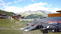
Photos of Tignes Mountain Bike
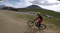
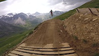
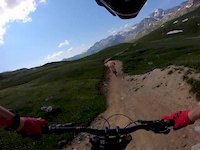
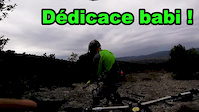
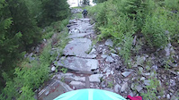
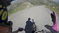
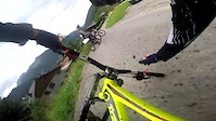
Videos of Tignes Mountain Bike
trail: Tignes Le Lac
0:14 |
46 |
Jul 5, 2024
trail: Tignes Le Lac
3:51 |
44 |
Sep 6, 2020
trail: Kangooride pt 1
5:24 |
94 |
Aug 20, 2020
trail: Tignes Le Lac
0:17 |
242 |
Jul 24, 2019
trail: Cote Chaudanne
0:23 |
42 |
Nov 17, 2018
trail: Tignes Le Lac
4:00 |
65 |
Nov 19, 2017
trail: Kangooride pt 1
2:36 |
92 |
Aug 19, 2016
trail: Best kept secret
0:00 |
482 |
Aug 10, 2016
Recent Trail Reports
| status | trail | date | condition | info | user |
|---|---|---|---|---|---|
| TS Tufs | Aug 21, 2025 @ 10:43am Aug 21, 2025 | Ideal | kardi13 TFSPAIN | ||
| Kangooride pt 1 | Aug 21, 2025 @ 10:43am Aug 21, 2025 | Ideal | kardi13 TFSPAIN | ||
| Toviere | Aug 21, 2025 @ 10:43am Aug 21, 2025 | Ideal | kardi13 TFSPAIN | ||
| Red Hot part 3 | Aug 21, 2025 @ 10:43am Aug 21, 2025 | Ideal | kardi13 TFSPAIN | ||
| Jump Around | Aug 21, 2025 @ 10:43am Aug 21, 2025 | Ideal | kardi13 TFSPAIN | ||
| Jump Around part 4 | Aug 21, 2025 @ 10:43am Aug 21, 2025 | Ideal | kardi13 TFSPAIN | ||
| Palafour | Aug 21, 2025 @ 10:43am Aug 21, 2025 | Ideal | kardi13 TFSPAIN | ||
| Tignes Le Lac | Aug 21, 2025 @ 10:43am Aug 21, 2025 | Ideal | kardi13 TFSPAIN | ||
| Kangooride pt 2 | Aug 21, 2025 @ 10:43am Aug 21, 2025 | Ideal | kardi13 TFSPAIN | ||
| Borsat | Aug 21, 2025 @ 10:43am Aug 21, 2025 | Ideal | kardi13 TFSPAIN |
Activity Feed
| username | action | type | title | date |
|---|---|---|---|---|
| freerider48 | update | trail | activity #96525109 | Jun 8, 2026 @ 12:43am Jun 8, 2026 |
| mingliu99 | wishlist | route | activity #96280818 and 4 more | Jun 5, 2026 @ 12:55am Jun 5, 2026 |
| mtbitzel | wishlist | trail | activity #95039409 | May 19, 2026 @ 7:25am May 19, 2026 |
| toast2266 | vote | trail | activity #91400969 | Mar 27, 2026 @ 3:42pm Mar 27, 2026 |
| Edwardzci3PF | wishlist | route | activity #91336767 | Mar 26, 2026 @ 12:41pm Mar 26, 2026 |
Recent Comments
| username | type | title | comment | date |
|---|---|---|---|---|
| trail | Great go to natural trail for Tignes... Fun to... | Sep 27, 2025 @ 2:05am Sep 27, 2025 | ||
| trail | Good little climb on the e-bike... Takes your... | Sep 27, 2025 @ 1:57am Sep 27, 2025 | ||
| trail | Fun trail that flows back to the club med.... | Sep 21, 2025 @ 1:06am Sep 21, 2025 | ||
| trail | Great connection trail.. be aware of hikers.. | Sep 21, 2025 @ 1:02am Sep 21, 2025 | ||
| trail | The top two thirds are great until you get to... | Sep 20, 2025 @ 11:45pm Sep 20, 2025 |
Local Badges
-

Epic Ride Climb 2k152 awarded -

Climbing 10k Badge14 awarded -

Climbing 100k Badge1 awarded -

Epic Ride Descent 2k270 awarded -

Descent 10k Badge23 awarded -

Descent 100k Badge2 awarded
Local Trail Supporters
- BikeSolutions
![]()
Activity Type Stats
| activitytype | trails | distance | descent | descent distance | total vertical | rating | global rank | state rank | photos | reports | routes | ridelogs |
|---|---|---|---|---|---|---|---|---|---|---|---|---|
| Mountain Bike | 99 | 76 miles | 39,347 ft | 43 miles | 7,677 ft | #1,641 | #34 | 102 | 139 | 14 | 2,647 | |
| E-Bike | 57 | 39 miles | 15,581 ft | 18 miles | 3,727 ft | #2,214 | #122 | 125 | 13 | 235 | ||
| Horse | 2 | 1 mile | 59 ft | 1,194 ft | 981 ft | #644 | #29 | 24 | ||||
| Hike | 105 | 70 miles | 34,993 ft | 38 miles | 7,677 ft | #1,644 | #42 | 132 | 10 | 240 | ||
| Trail Running | 104 | 70 miles | 34,970 ft | 38 miles | 7,677 ft | #1,500 | #42 | 132 | 9 | 186 | ||
| Snowshoe | 1 | 3 miles | 1,253 ft | 2 miles | 1,207 ft | 3 | 4 | |||||
| Downhill Ski | 4 | 3 miles | 1,253 ft | 2 miles | 1,207 ft | #55 | #11 | 1,724 | ||||
| Backcountry Ski | 4 | 3 miles | 1,253 ft | 2 miles | 1,207 ft | #99 | #9 | 3 | 148 | |||
| Nordic Ski | 4 | 3 miles | 1,253 ft | 2 miles | 1,207 ft | #104 | #10 | 55 |
Frequently Asked Questions About Tignes
▼
What are the highest rated mountain biking trails in Tignes?
The highest rated mountain biking trails in Tignes are:
- Condutie Forcée (4.3/5)
- Rocky Trail (4.2/5)
- La Clittaz (4.2/5)
- Narnia (4.2/5)
- Foret de Millo (4.2/5)
▼
What is the best time of the year to ride in Tignes?
Based on ride log data, the most popular months to ride in Tignes are:
- July (26 activities)
- August (22 activities)
- September (9 activities)
▼
Where can I park to ride in Tignes?
There are 3 parking locations listed in Tignes. The most popular parking spots are: View all parking and trailhead locations on the map to plan your visit.
▼
What is the longest trail in Tignes?
The longest trail in Tignes is Too Much Sass at 5.8 km. View all trails sorted by distance.
Activities
Trails
Points of Interest
- By RCarter15 & contributors
- Admins: LSBP, freerider48, provencemb, fredhornybsm, Whipperman
- #7264 - 9,879 views
- tignes activity log | embed map of Tignes mountain bike trails | tignes mountain biking points of interest
Downloading of trail gps tracks in kml & gpx formats is enabled for Tignes.
You must login to download files.