close
-
Layers w
- Weather Layers
- Pro
- Pro
- Pro
- Pro
- Pro
- Pro
- More Layers
- Pro
- Pro
- Pro
- Pro
-
Upgrade to

3D
Trail Conditions
- Unknown
- Snow Groomed
- Snow Packed
- Snow Covered
- Snow Cover Partial
- Freeze/thaw Cycle
- Icy
- Prevalent Mud
- Wet
- Variable
- Ideal
- Dry
- Very Dry
Trail Flow (Ridden Direction)
Trailforks scans users ridelogs to determine the most popular direction each trail is ridden. A good flowing trail network will have most trails flowing in a single direction according to their intension.
The colour categories are based on what percentage of riders are riding a trail in its intended direction.
The colour categories are based on what percentage of riders are riding a trail in its intended direction.
- > 96%
- > 90%
- > 80%
- > 70%
- > 50%
- < 50%
- bi-directional trail
- no data
Trail Last Ridden
Trailforks scans ridelogs to determine the last time a trail was ridden.
- < 2 days
- < 1 week
- < 2 weeks
- < 1 month
- < 6 months
- > 6 months
Trail Ridden Direction
The intended direction a trail should be ridden.
- Downhill Only
- Downhill Primary
- Both Directions
- Uphill Primary
- Uphill Only
- One Direction
Contribute Details
Colors indicate trail is missing specified detail.
- Description
- Photos
- Description & Photos
- Videos
Trail Popularity ?
Trailforks scans ridelogs to determine which trails are ridden the most in the last 9 months.
Trails are compared with nearby trails in the same city region with a possible 25 colour shades.
Think of this as a heatmap, more rides = more kinetic energy = warmer colors.
- most popular
- popular
- less popular
- not popular
ATV/ORV/OHV Filter
Max Vehicle Width
inches
US Cell Coverage
Legend

Radar Time
Activity Recordings
Trailforks uses anonymized public activity data.
?
Activity Recordings
Trailforks uses anonymized public activity data.
?
Personal Heatmap
▶
Activity Types
all
/
none
▶
Options
2
Date range
month
–
Winter Trails
Warning
A routing network for winter maps does not exist. Selecting trails using the winter trails layer has been disabled.
Missing Trails
Most Popular
Least Popular
Trails are colored based on popularity. The more popular a trail is, the more red. Less popular trails trend towards green.
Jump Magnitude Heatmap
Heatmap of where riders jump on trails. Zoom in to see individual jumps, click circles to view jump details.
BC Backroad Status
![map legend]()
Service Road Atlas is a free to use, community-driven service for viewing and creating reports on the numerous back-country service roads around B.C. and Alberta.

Slope Aspect
Direction the slope faces
Trails Deemphasized
Trails are shown in grey.
Only show trails with no bike usage.
Suggested Layers
Based on selected activity type
Save the current map location and zoom level as your default home location whenever this page is loaded.
SaveTijeras is just South of the I40. It is the closest town to the Cedro & Otero/Tunnel Canyon riding areas. The Ranger Station is right off the 337 and is a good source for trail information, maps, etc...
Activities Click to view
- Mountain Bike
10 trails
- E-Bike
0 trails
- Horse
13 trails
- Hike
13 trails
- Trail Running
13 trails
- Dirtbike/Moto
0 trails
Region Details
- 1
- 4
- 5
Region Status
Open as of Nov 17, 2022Stats
- Avg Trail Rating
- Trails (view details)
- 13
- Trails Mountain Bike
- 10
- Trails Horse
- 13
- Trails Hike
- 13
- Trails Trail Running
- 13
- Total Distance
- 5 miles
- Total Descent Distance
- 3 miles
- Total Descent
- 803 ft
- Total Vertical
- 633 ft
- Highest Trailhead
- 7,053 ft
- Photos
- 2
- Ridden Counter
- 110
Sub Regions
-
Ojito de San Antonio Open Space
- 1
- 2
-
San Antonito Open Space
- 3
- 3
Popular Tijeras Mountain Biking Trails
• 100 ★ 0.0 • 3,504 ft • 75 ft • 12 •
Popular blue difficulty singletrack. This multi-use trail can be used both directions. On average it takes 9 minutes to complete this trail.
• 80 ★ 0.0 • 3,619 ft • 73 ft • 5 •
Popular blue difficulty singletrack. This multi-use trail can be used both directions. On average it takes 6 minutes to complete this trail.
• 90 ★ 0.0 • 3,550 ft • 111 ft • 5 •
Popular blue difficulty singletrack. This multi-use trail can be used both directions.
• 70 ★ 0.0 • 259 ft • 0 ft • 4 •
Popular green difficulty singletrack. This multi-use trail can be used both directions. On average it takes minutes to complete this trail.
• 60 ★ 0.0 • 4,826 ft • 114 ft • 2 •
Moderately popular blue difficulty singletrack. This multi-use trail can be used both directions. On average it takes 7 minutes to complete this trail.
• 30 ★ 0.0 • 968 ft • 4 ft • 2 •
Less popular blue difficulty singletrack. This multi-use trail can be used both directions.
• 20 ★ 0.0 • 246 ft • 0 ft • 1 •
Less popular green difficulty singletrack. This multi-use trail can be used both directions.
• 40 ★ 0.0 • 305 ft • 0 ft • 1 •
Moderately popular green difficulty singletrack. This multi-use trail can be used both directions.
Tijeras Mountain Bike Routes
★ 3.0 • 32 miles • 3,350 ft • 45 •
Real fun route that traverses around all of the Cedro and Otero Canyon trail systems. There are many...
★ 3.0 • 21 miles • 3,201 ft • 9 •
Percorso molto bello su e giù dai Colli di Bergamo. Partenza da Ponteranica (BG).
13 miles • 1,134 ft • 0 • Loop •
Beautiful XC-like ride with small downhill sections. Nothing major. Blue square at most. No risky stuff,...
8 miles • 777 ft • 0 • Loop •
Beautiful XC-like ride with small downhill sections. Nothing major. Blue square at most. No risky stuff,...
Videos of Tijeras Mountain Bike
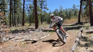
0:14 |
78 |
Jun 28, 2024
Activity Feed
| username | action | type | title | date |
|---|---|---|---|---|
| mattiar3alskiaccy | wishlist | route | activity #95501703 | May 25, 2026 @ 10:26am May 25, 2026 |
| Liuk66 | vote | route | activity #93760921 | May 1, 2026 @ 12:56am May 1, 2026 |
| mrprevost | wishlist | route | activity #91857333 | Apr 3, 2026 @ 4:20pm Apr 3, 2026 |
| jaslowuphillabq | wishlist | route | activity #91830197 | Apr 3, 2026 @ 9:27am Apr 3, 2026 |
| LomiMonk | wishlist | route | activity #82759842 | Oct 21, 2025 @ 7:29am Oct 21, 2025 |
Local Badges
-

Epic Ride Descent 2k0 awarded -

Descent 10k Badge0 awarded -

Descent 100k Badge0 awarded
Activity Type Stats
| activitytype | trails | distance | descent | descent distance | total vertical | rating | global rank | state rank | photos | reports | routes | ridelogs |
|---|---|---|---|---|---|---|---|---|---|---|---|---|
| Mountain Bike | 10 | 4 miles | 371 ft | 2 miles | 433 ft | #9,983 | #3,120 | 2 | 5 | 1,364 | ||
| Horse | 13 | 5 miles | 804 ft | 3 miles | 633 ft | #2,882 | #1,612 | 1 | 4 | |||
| Hike | 13 | 5 miles | 804 ft | 3 miles | 633 ft | #2,653 | #1,022 | 2 | 290 | |||
| Trail Running | 13 | 5 miles | 804 ft | 3 miles | 633 ft | #11,735 | #4,084 | 1 | 43 |
Frequently Asked Questions About Tijeras
▼
What are the best places to ride in Tijeras?
Tijeras has 3 areas to explore for mountain biking. The top rated areas are:
▼
What are the highest rated mountain biking trails in Tijeras?
The highest rated mountain biking trails in Tijeras are:
- San Antonito Trail (0/5)
- San Antonito Loop Trail (0/5)
- San Antonito Outer Loop Trail (0/5)
- Parking Lot Connector (0/5)
- Loop Trail (0/5)
▼
What is the best time of the year to ride in Tijeras?
Based on ride log data, the most popular months to ride in Tijeras are:
- August (37 activities)
- July (27 activities)
- September (26 activities)
▼
Where can I park to ride in Tijeras?
Activities
- By canadaka
 Trailforks & contributors
 - Admins: AMBA
- #27723 - 3,536 views
- tijeras activity log | embed map of Tijeras mountain bike trails | tijeras mountain biking points of interest
Downloading of trail gps tracks in kml & gpx formats is enabled for Tijeras.
You must login to download files.