close
-
Layers w
- Weather Layers
- Pro
- Pro
- Pro
- Pro
- Pro
- Pro
- More Layers
- Pro
- Pro
- Pro
- Pro
-
Upgrade to

3D
Trail Conditions
- Unknown
- Snow Groomed
- Snow Packed
- Snow Covered
- Snow Cover Partial
- Freeze/thaw Cycle
- Icy
- Prevalent Mud
- Wet
- Variable
- Ideal
- Dry
- Very Dry
Trail Flow (Ridden Direction)
Trailforks scans users ridelogs to determine the most popular direction each trail is ridden. A good flowing trail network will have most trails flowing in a single direction according to their intension.
The colour categories are based on what percentage of riders are riding a trail in its intended direction.
The colour categories are based on what percentage of riders are riding a trail in its intended direction.
- > 96%
- > 90%
- > 80%
- > 70%
- > 50%
- < 50%
- bi-directional trail
- no data
Trail Last Ridden
Trailforks scans ridelogs to determine the last time a trail was ridden.
- < 2 days
- < 1 week
- < 2 weeks
- < 1 month
- < 6 months
- > 6 months
Trail Ridden Direction
The intended direction a trail should be ridden.
- Downhill Only
- Downhill Primary
- Both Directions
- Uphill Primary
- Uphill Only
- One Direction
Contribute Details
Colors indicate trail is missing specified detail.
- Description
- Photos
- Description & Photos
- Videos
Trail Popularity ?
Trailforks scans ridelogs to determine which trails are ridden the most in the last 9 months.
Trails are compared with nearby trails in the same city region with a possible 25 colour shades.
Think of this as a heatmap, more rides = more kinetic energy = warmer colors.
- most popular
- popular
- less popular
- not popular
ATV/ORV/OHV Filter
Max Vehicle Width
inches
US Cell Coverage
Legend

Radar Time
Activity Recordings
Trailforks uses anonymized public activity data.
?
Activity Recordings
Trailforks uses anonymized public activity data.
?
Personal Heatmap
▶
Activity Types
all
/
none
▶
Options
2
Date range
month
–
Winter Trails
Warning
A routing network for winter maps does not exist. Selecting trails using the winter trails layer has been disabled.
Missing Trails
Most Popular
Least Popular
Trails are colored based on popularity. The more popular a trail is, the more red. Less popular trails trend towards green.
Jump Magnitude Heatmap
Heatmap of where riders jump on trails. Zoom in to see individual jumps, click circles to view jump details.
BC Backroad Status
![map legend]()
Service Road Atlas is a free to use, community-driven service for viewing and creating reports on the numerous back-country service roads around B.C. and Alberta.

Slope Aspect
Direction the slope faces
Trails Deemphasized
Trails are shown in grey.
Only show trails with no bike usage.
Suggested Layers
Based on selected activity type
Save the current map location and zoom level as your default home location whenever this page is loaded.
SaveTilgate Forest near Crawley in Sussex is part of the UK cycle network so it is suitable to ride mountain bikes there.
The majority of the downhill/freeride stuff is fairly large and not for the inexperienced but there are select parts that would probably be manageable by novices.
Tilgate Forest also has plenty of XC and Singletrack trails for you to explore and there's no restriction on when you can ride. People have clearly put a ot of work into the riding facilities so be respectful and don't wreck anything or leave litter.
Primary Trail Type: All-Mountain & Downhill
Land Status: Managed by Local Riding Association
This region uses the Uk/Euro style trail grading system.
Activities Click to view
- Mountain Bike
13 trails
- E-Bike
13 trails
- Hike
10 trails
- Trail Running
12 trails
Region Details
- 2
- 1
- 10
Region Status
Caution as of May 17, 2026Stats
- Avg Trail Rating
- Trails (view details)
- 13
- Trails Mountain Bike
- 13
- Trails E-Bike
- 13
- Trails Horse
- 2
- Trails Hike
- 10
- Trails Trail Running
- 12
- Total Distance
- 5 miles
- Total Descent Distance
- 2 miles
- Total Descent
- 526 ft
- Total Vertical
- 185 ft
- Highest Trailhead
- 498 ft
- Reports
- 49
- Photos
- 17
- Ridden Counter
- 1,105
Popular Tilgate Forest Mountain Biking Trails
• 100 ★ 0.0 • 915 ft • 0 ft • 75 •
Popular blue difficulty singletrack. This mountain bike primary trail can be used downhill primary and has a moderate overall physical rating. It features berm and jump. On average it takes 7 minutes to complete this trail.
• 45 ★ 5.0 • 1 mile • 44 ft • 60 •
Moderately popular blue difficulty singletrack. This mountain bike primary trail can be used both directions. On average it takes 7 minutes to complete this trail.
• 60 ★ 4.0 • 2,421 ft • 65 ft • 57 •
Moderately popular blue difficulty singletrack. This mountain bike primary trail can be used both directions. On average it takes 3 minutes to complete this trail.
• 55 ★ 4.0 • 1,768 ft • 45 ft • 53 •
Moderately popular blue difficulty singletrack. This mountain bike primary trail can be used both directions. On average it takes 3 minutes to complete this trail.
• 60 ★ 0.0 • 1,680 ft • 0 ft • 51 •
Moderately popular green difficulty singletrack. This mountain bike primary trail can be used both directions and has a easy overall physical rating. On average it takes 2 minutes to complete this trail.
• 50 ★ 0.0 • 722 ft • 48 ft • 49 •
Moderately popular blue difficulty singletrack. This mountain bike primary trail can be used both directions. On average it takes 1 minutes to complete this trail.
• 70 ★ 4.0 • 1,745 ft • 19 ft • 48 •
Popular blue difficulty singletrack. This multi-use trail can be used both directions and has a moderate overall physical rating. On average it takes 3 minutes to complete this trail.
• 85 ★ 0.0 • 719 ft • 0 ft • 43 •
Popular blue difficulty singletrack. This mountain bike primary trail can be used downhill primary and has a easy overall physical rating. On average it takes 5 minutes to complete this trail.
Tilgate Forest Mountain Bike Routes
25 miles • 2,003 ft • 1 • Loop •
Route leaves Crawley on the Worth Way (NCN21) cycle route, which is a gravel route, then road to Werewood...
20 miles • 1,309 ft • 0 • Loop •
Ride leaves Crawley on urban cycle routes and bridleway to Kilnwood estate were it crosses the A264. The...
25 miles • 1,242 ft • 0 • Loop •
This route starts at the Cafe at Tilgate golf course, then the heads out across the Golf course to the...
630 ft • 0 • Point to Point •
Short DH section with a few berms and a small rock garden. better ridden in the summer
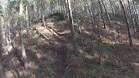
Photos of Tilgate Forest Mountain Bike
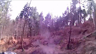
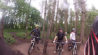
Videos of Tilgate Forest Mountain Bike

trail: Short But Sweet
0:19 |
137 |
Apr 5, 2018
trail: Old School
0:00 |
225 |
Mar 28, 2015
trail: Short But Sweet
0:39 |
139 |
Mar 1, 2015

trail: Old School
2:56 |
260 |
Jun 11, 2014
trail: Old School
0:57 |
228 |
May 26, 2014

trail: Old School
2:21 |
2476 |
Oct 12, 2013

trail: Old School
0:40 |
368 |
Jun 19, 2013

trail: Short But Sweet
0:00 |
266 |
Mar 21, 2010
Recent Trail Reports
| status | trail | date | condition | info | user |
|---|---|---|---|---|---|
| Chewbacca’s Belt | May 17, 2026 @ 12:29pm (Europe/London) May 17, 2026 | Unknown | pedallingplumber | ||
| Mr Bradley Top | Sep 17, 2025 @ 6:01pm (Europe/London) Sep 17, 2025 | Wet | ThexMiniman | ||
| Stumps Bumps and Berms | Sep 17, 2025 @ 6:01pm (Europe/London) Sep 17, 2025 | Wet | ThexMiniman | ||
| Naughty Boy | Sep 17, 2025 @ 6:01pm (Europe/London) Sep 17, 2025 | Wet | ThexMiniman | ||
| Tilgate Climb | Sep 17, 2025 @ 6:01pm (Europe/London) Sep 17, 2025 | Wet | ThexMiniman | ||
| Muddy Arse | Sep 17, 2025 @ 6:01pm (Europe/London) Sep 17, 2025 | Wet | ThexMiniman | ||
| Buck Wild | Sep 17, 2025 @ 6:01pm (Europe/London) Sep 17, 2025 | Prevalent Mud | ThexMiniman | ||
| Toasty | May 1, 2025 @ 6:37am May 1, 2025 | Ideal | Olimobile | ||
| Fiddle Through The Trees | Nov 2, 2024 @ 7:51am Nov 2, 2024 | Prevalent Mud | Jon-Davis |
Activity Feed
| username | action | type | title | date |
|---|---|---|---|---|
| rikk0 | wishlist | trail | activity #95939308 | May 31, 2026 @ 7:45am May 31, 2026 |
| pedallingplumber | add | report | activity #94888183 | May 17, 2026 @ 4:29am May 17, 2026 |
| pedallingplumber | wishlist | route | activity #94859623 | May 16, 2026 @ 4:13pm May 16, 2026 |
| EbonyFox | ridden | trail | activity #92992411 | Apr 19, 2026 @ 5:04pm Apr 19, 2026 |
| Ovf8sj | wishlist | route | activity #92854923 | Apr 18, 2026 @ 6:35am Apr 18, 2026 |
Recent Comments
| username | type | title | comment | date |
|---|---|---|---|---|
| trail | Gentle beginners run | Apr 15, 2024 @ 9:55am Apr 15, 2024 | ||
| trail | Twisty fun. No issue for beginners | Nov 4, 2023 @ 1:05pm Nov 4, 2023 | ||
| trail | Fun twisty singletrack. Best for summer as... | Nov 4, 2023 @ 1:04pm Nov 4, 2023 | ||
| trail | This trail not both directions. All the jumps... | Oct 16, 2023 @ 12:07pm Oct 16, 2023 |
Nearby Areas
| name | distance | ||||
|---|---|---|---|---|---|
| Buchan Country Park | 1 | 3 | 2.2 km | ||
| St Leonards Forest | 9 | 10 | 4.3 km | ||
| Deers Leap Bike Park (Closed) | 1 | 9 | 6.6 km | ||
| Redlands Woods | 10.1 km | ||||
| North Downs | 4 | 4 | 1 | 12.1 km |
Activity Type Stats
| activitytype | trails | distance | descent | descent distance | total vertical | rating | global rank | state rank | photos | reports | routes | ridelogs |
|---|---|---|---|---|---|---|---|---|---|---|---|---|
| Mountain Bike | 13 | 5 miles | 525 ft | 2 miles | 187 ft | #5,588 | #166 | 17 | 49 | 5 | 4,939 | |
| E-Bike | 13 | 5 miles | 525 ft | 2 miles | 187 ft | #4,801 | #203 | 46 | 2 | 238 | ||
| Horse | 2 | 1 mile | 10 ft | 663 ft | 187 ft | 5 | ||||||
| Hike | 10 | 4 miles | 394 ft | 2 miles | 187 ft | #9,275 | #251 | 45 | 2 | 66 | ||
| Trail Running | 12 | 5 miles | 466 ft | 2 miles | 187 ft | #8,363 | #227 | 45 | 1 | 99 |
Frequently Asked Questions About Tilgate Forest
▼
What are the highest rated mountain biking trails in Tilgate Forest?
The highest rated mountain biking trails in Tilgate Forest are:
- Toasty (4.1/5)
- Old School (4.1/5)
- Muddy Arse (4/5)
- Tilgate Slalom (4/5)
- Chewbacca’s Belt (4/5)
▼
What is the best time of the year to ride in Tilgate Forest?
Based on ride log data, the most popular months to ride in Tilgate Forest are:
- July (31 activities)
- September (22 activities)
- June (20 activities)
▼
Where can I park to ride in Tilgate Forest?
Check the Tilgate Forest trail map for trailhead and parking information. Community members regularly update access and parking details for trails in the area.
▼
What is the longest trail in Tilgate Forest?
The longest trail in Tilgate Forest is Toasty at 1.7 km. View all trails sorted by distance.
Activities
- By pukkasilvia & contributors
- Admins: FE
- #7295 - 19,665 views
- tilgate forest activity log | embed map of Tilgate Forest mountain bike trails |
Downloading of trail gps tracks in kml & gpx formats is enabled for Tilgate Forest.
You must login to download files.