close
-
Layers w
- Weather Layers
- Pro
- Pro
- Pro
- Pro
- Pro
- Pro
- More Layers
- Pro
- Pro
- Pro
- Pro
-
Upgrade to

3D
Trail Conditions
- Unknown
- Snow Groomed
- Snow Packed
- Snow Covered
- Snow Cover Partial
- Freeze/thaw Cycle
- Icy
- Prevalent Mud
- Wet
- Variable
- Ideal
- Dry
- Very Dry
Trail Flow (Ridden Direction)
Trailforks scans users ridelogs to determine the most popular direction each trail is ridden. A good flowing trail network will have most trails flowing in a single direction according to their intension.
The colour categories are based on what percentage of riders are riding a trail in its intended direction.
The colour categories are based on what percentage of riders are riding a trail in its intended direction.
- > 96%
- > 90%
- > 80%
- > 70%
- > 50%
- < 50%
- bi-directional trail
- no data
Trail Last Ridden
Trailforks scans ridelogs to determine the last time a trail was ridden.
- < 2 days
- < 1 week
- < 2 weeks
- < 1 month
- < 6 months
- > 6 months
Trail Ridden Direction
The intended direction a trail should be ridden.
- Downhill Only
- Downhill Primary
- Both Directions
- Uphill Primary
- Uphill Only
- One Direction
Contribute Details
Colors indicate trail is missing specified detail.
- Description
- Photos
- Description & Photos
- Videos
Trail Popularity ?
Trailforks scans ridelogs to determine which trails are ridden the most in the last 9 months.
Trails are compared with nearby trails in the same city region with a possible 25 colour shades.
Think of this as a heatmap, more rides = more kinetic energy = warmer colors.
- most popular
- popular
- less popular
- not popular
ATV/ORV/OHV Filter
Max Vehicle Width
inches
US Cell Coverage
Legend

Radar Time
Activity Recordings
Trailforks uses anonymized public activity data.
?
Activity Recordings
Trailforks uses anonymized public activity data.
?
Personal Heatmap
▶
Activity Types
all
/
none
▶
Options
2
Date range
month
–
Winter Trails
Warning
A routing network for winter maps does not exist. Selecting trails using the winter trails layer has been disabled.
Missing Trails
Most Popular
Least Popular
Trails are colored based on popularity. The more popular a trail is, the more red. Less popular trails trend towards green.
Jump Magnitude Heatmap
Heatmap of where riders jump on trails. Zoom in to see individual jumps, click circles to view jump details.
BC Backroad Status
![map legend]()
Service Road Atlas is a free to use, community-driven service for viewing and creating reports on the numerous back-country service roads around B.C. and Alberta.

Slope Aspect
Direction the slope faces
Trails Deemphasized
Trails are shown in grey.
Only show trails with no bike usage.
Suggested Layers
Based on selected activity type
Save the current map location and zoom level as your default home location whenever this page is loaded.
Save
No description for Tillamook has been added yet!
Login or register to submit one.
Activities Click to view
- Hike
123 trails
- Mountain Bike
90 trails
- E-Bike
61 trails
- Gravel Bike
0 trails
- Adaptive Bike
- Horse
7 trails
- Trail Running
124 trails
- Dirtbike/Moto
593 trails
- ATV/ORV/OHV
173 trails
Region Details
- 58
- 4
- 18
- 3
- 1
Region Status
Open as of Jun 16, 2026Stats
- Avg Trail Rating
- Trails (view details)
- 628
- Trails Mountain Bike
- 92
- Trails E-Bike
- 61
- Trails Horse
- 7
- Trails Hike
- 123
- Trails Trail Running
- 124
- Trails Dirtbike/Moto
- 597
- Trails Observed Trials
- 1
- Trails ATV/ORV/OHV
- 173
- Total Distance
- 1,143 miles
- Total Descent Distance
- 335 miles
- Total Descent
- 144,344 ft
- Total Vertical
- 3,530 ft
- Highest Trailhead
- 3,535 ft
- Reports
- 1,089
- Photos
- 597
- Ridden Counter
- 8,912
Sub Regions
-
Tillamook State Forest
- 2
- 18
- 3
- 1
Popular Tillamook Mountain Biking Trails
• 100 ★ 4.8 • 4 miles • 87 ft • 598 •
This hand-built descent features natural flow mixed with gnar. Designed/built to push you outside of your comfort zone: Roots, Rocks, Loam, Steeps, Off-cambers, jumps(gaps), drops, option lines- you won't find any needless berms here....
• 95 ★ 4.0 • 8 miles • 1,453 ft • 532 •
This is an awesome cross country trail, with lots of roots and rocks and some faster downhill sections, along with a few steeper climbs. Punchy climbs await the most skilled. It can be ridden in both directions, but most riders prefer a...
• 90 ★ 3.9 • 2 miles • 13 ft • 342 •
Rooty, Rocks, Epic views. Historic Forest. Loam. Sharp Switchbacks.
• 90 ★ 3.0 • 2 miles • 625 ft • 286 •
Loamy. Rooty. Rocks here and there. Historic forest views and wildlife will be seen of all types. Connects to the Gales Greek Trail and can access the Campground area.
• 100 ★ 4.4 • 2 miles • 0 ft • 181 •
This is a DH shuttle built by Brad Watt and Phillip Weiring. One-way DH only. There are options to shuttle all the way to top or half way (at road/trail crossing). The lower parking area has room for 10 vehicles. Same with upper drop...
• 95 ★ 4.0 • 1 mile • 454 ft • 167 •
A beautiful trail, follows the Nehalem River. Gorgeous forest. Not for kids- punchy climbs. Nothing technical or scary. Steep climbs, sharp turns, huge roots and precarious rocks await. Keep you dog close as I have personally seen...
• 100 ★ 4.9 • 2 miles • 15 ft • 157 •
Cant stop here, this is . Though seriously, you'll want to scope out the lines before hitting them at speed. Nestled between and Fear & Loaming (both in location and in difficulty) checks most the boxes; gnar, steeps, option lines,...
Tillamook Mountain Bike Routes
★ 4.0 • 34 miles • 6,584 ft • 6 • Loop •
Connect the best descents in Tillamook via Gales Creek and the forest roads. Like Gales Creek Epic, but...
★ 4.0 • 28 miles • 5,623 ft • 12 •
Linking all of the Gales Creek area trails together provides a legendary experience. Leave from Reeher's Camp.
• 18 miles • 3,663 ft • 6 •
• 20 miles • 3,852 ft • 2 •
• 20 miles • 4,805 ft • 4 •
• 10 miles • 3,797 ft • 3 •
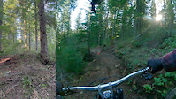
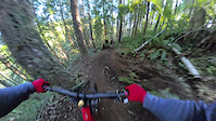
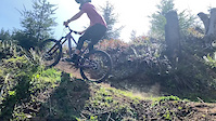
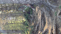
Photos of Tillamook Mountain Bike
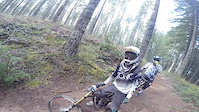
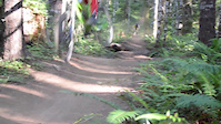
Videos of Tillamook Mountain Bike
trail: North Fork Wilson River Road
0:04 |
11 |
Apr 18, 2026
trail: Bat Country
0:18 |
29 |
Jan 18, 2026
trail: Gnarstow
0:20 |
|
Sep 30, 2024
trail: Ravens Ridge Shuttle
0:14 |
75 |
Jun 2, 2024
trail: Rogers Camp Loop
0:12 |
|
Apr 12, 2020
trail: Ravens Ridge
5:13 |
1027 |
Mar 31, 2015
trail: Ravens Ridge
0:54 |
632 |
Aug 11, 2014

trail: Ravens Ridge
0:46 |
373 |
Nov 25, 2013
Current Trail Warnings
| status | trail | date | condition | user | info |
|---|---|---|---|---|---|
| Fear and Loaming | Jun 16, 2026 @ 1:38pm (America/Los_Angeles) Jun 16, 2026 | Unknown | fatdonkey WTF | 6/20/26 Drift Creek Triple Crown Event... | |
| F&L Shuttle | Jun 16, 2026 @ 1:38pm (America/Los_Angeles) Jun 16, 2026 | Unknown | fatdonkey WTF | 6/20/26 Drift Creek Triple Crown Event... | |
| Northwest Drift Creek Road | Jun 16, 2026 @ 1:38pm (America/Los_Angeles) Jun 16, 2026 | Unknown | fatdonkey WTF | 6/20/26 Drift Creek Triple Crown Event... |
Recent Trail Reports
| status | trail | date | condition | info | user |
|---|---|---|---|---|---|
| Step Creek Trail | Jun 7, 2026 @ 7:08pm (America/Los_Angeles) Jun 7, 2026 | Ideal | brendabw1 | ||
| Ravens Ridge | Jun 7, 2026 @ 9:17am (America/Vancouver) Jun 7, 2026 | Ideal | brendabw1 | ||
| Gales Creek Trail - North | Jun 7, 2026 @ 9:17am (America/Vancouver) Jun 7, 2026 | Ideal | brendabw1 | ||
| Rogers Camp Loop | Jun 3, 2026 @ 1:09pm (America/Los_Angeles) Jun 3, 2026 | Unknown | mperham | ||
| Wilson River (East) | May 12, 2026 @ 11:08am (America/Los_Angeles) May 12, 2026 | Ideal | mechanicalexplorer | ||
| Sickter Lars Loop | Apr 26, 2026 @ 2:33pm (America/Los_Angeles) Apr 26, 2026 | Ideal | cdaringepb | ||
| Storeyburn Trail - South | Apr 26, 2026 @ 2:33pm (America/Los_Angeles) Apr 26, 2026 | Variable | cdaringepb | ||
| Storeyburn Trail - North | Apr 17, 2026 @ 2:09pm (America/Vancouver) Apr 17, 2026 | Variable | EliRing | ||
| Gales Creek Trail - South | Apr 10, 2026 @ 8:24pm (America/Los_Angeles) Apr 10, 2026 | Ideal | N432a1 | ||
| Triple C Loop | Aug 9, 2025 @ 3:44pm Aug 9, 2025 | Variable | Msteeno |
Activity Feed
| username | action | type | title | date |
|---|---|---|---|---|
| jlien | ridden | trail | activity #97369121 | Jun 19, 2026 @ 11:56pm 11 hours |
| fatdonkey | add | report | activity #97135564 and 4 more | Jun 16, 2026 @ 1:41pm Jun 16, 2026 |
| Thomas2012 | ridden | trail | activity #97059254 and 1 more | Jun 15, 2026 @ 12:28pm Jun 15, 2026 |
| BigFish6565 | wishlist | region | activity #96993809 | Jun 14, 2026 @ 12:10pm Jun 14, 2026 |
| drewdrewdrewliu | wishlist | trail | activity #96784117 | Jun 11, 2026 @ 9:36pm Jun 11, 2026 |
Recent Comments
| username | type | title | comment | date |
|---|---|---|---|---|
| trail | The King's mountain TH to Jones Creek section... | May 12, 2026 @ 11:18am May 12, 2026 | ||
| trail | Do not try to bike this road. The sections... | Apr 18, 2026 @ 9:55pm Apr 18, 2026 | ||
| trail | Trail is in great shape! A little muddy in the... | Jan 19, 2026 @ 12:33pm Jan 19, 2026 | ||
| trail | Analog rider in decent shape should be +/- 1.5... | Oct 30, 2025 @ 11:53am Oct 30, 2025 | ||
| trail | Anyone have any info if the times listed below... | Oct 29, 2025 @ 3:20pm Oct 29, 2025 |
Local Badges
-

Completionist0 awarded -

10 Blue Trails20 awarded -

Epic Mountain Bike Climb 2k71 awarded -

Climbing 10k Badge18 awarded -

Mountain Biking 100k Badge0 awarded -

Epic Ride Descent 2k71 awarded
Activity Type Stats
| activitytype | trails | distance | descent | descent distance | total vertical | rating | global rank | state rank | photos | reports | routes | ridelogs |
|---|---|---|---|---|---|---|---|---|---|---|---|---|
| Mountain Bike | 90 | 229 miles | 31,463 ft | 91 miles | 3,363 ft | #1,188 | #460 | 556 | 977 | 1 | 5,981 | |
| E-Bike | 61 | 147 miles | 18,363 ft | 59 miles | 3,212 ft | #1,117 | #815 | 448 | 481 | |||
| Horse | 7 | 13 miles | 2,438 ft | 6 miles | 1,594 ft | #2,368 | #1,310 | 205 | ||||
| Hike | 123 | 248 miles | 31,601 ft | 95 miles | 3,376 ft | #540 | #246 | 22 | 707 | 1,423 | ||
| Trail Running | 124 | 251 miles | 31,673 ft | 96 miles | 3,376 ft | #585 | #221 | 707 | 365 | |||
| Dirtbike/Moto | 593 | 981 miles | 124,042 ft | 258 miles | 3,363 ft | #5 | #2 | 10 | 281 | 1 | 331 | |
| Observed Trials | 1 | 1 | ||||||||||
| ATV/ORV/OHV | 173 | 314 miles | 33,340 ft | 133 miles | 3,468 ft | #14 | #10 | 12 | 165 | 20 |
Frequently Asked Questions About Tillamook
▼
What are the best places to ride in Tillamook?
Tillamook has 4 areas to explore for mountain biking. The top rated areas are:
▼
What are the highest rated mountain biking trails in Tillamook?
The highest rated mountain biking trails in Tillamook are:
- Fear and Loaming (4.7/5)
- Gnarstow (4.5/5)
- Bat Country (4.5/5)
- Ravens Ridge (4.3/5)
- Gales Creek Trail - South (4.1/5)
▼
What is the best time of the year to ride in Tillamook?
Based on ride log data, the most popular months to ride in Tillamook are:
- July (79 activities)
- August (58 activities)
- September (58 activities)
▼
Where can I park to ride in Tillamook?
There are 38 parking locations listed in Tillamook. The most popular parking spots are:
- Drift Creek Trailhead
- Rogers Camp Trailhead / Staging Area
- Parking
- Gravel Pile staging area
- Drop Off Point
Activities
Trails
Points of Interest
- Mount Hebo Summit
- East Dunes Campground Camping
- Sand Beach Campground Camping
- Angora Peak Summit
- Recreational Users Information
- Diamond Hill Camp Area Camping
- Arch Cape View Viewpoint
- Pheasant Falls Sight
- Niagara Falls Sight
- South Lake Dispersed Camping
- Rogers Peak (3,704 ft)
- Larch Mountain (3,461 ft)
- South Saddle Mountain (3,445 ft)
- By WESTdelEST
 & contributors
 - Admins: NWTA
- #43890 - 4,543 views
- tillamook activity log | embed map of Tillamook mountain bike trails | tillamook mountain biking points of interest polygons
Downloading of trail gps tracks in kml & gpx formats is enabled for Tillamook.
You must login to download files.