close
-
Layers w
- Weather Layers
- Pro
- Pro
- Pro
- Pro
- Pro
- Pro
- More Layers
- Pro
- Pro
- Pro
- Pro
-
Upgrade to

3D
Trail Conditions
- Unknown
- Snow Groomed
- Snow Packed
- Snow Covered
- Snow Cover Partial
- Freeze/thaw Cycle
- Icy
- Prevalent Mud
- Wet
- Variable
- Ideal
- Dry
- Very Dry
Trail Flow (Ridden Direction)
Trailforks scans users ridelogs to determine the most popular direction each trail is ridden. A good flowing trail network will have most trails flowing in a single direction according to their intension.
The colour categories are based on what percentage of riders are riding a trail in its intended direction.
The colour categories are based on what percentage of riders are riding a trail in its intended direction.
- > 96%
- > 90%
- > 80%
- > 70%
- > 50%
- < 50%
- bi-directional trail
- no data
Trail Last Ridden
Trailforks scans ridelogs to determine the last time a trail was ridden.
- < 2 days
- < 1 week
- < 2 weeks
- < 1 month
- < 6 months
- > 6 months
Trail Ridden Direction
The intended direction a trail should be ridden.
- Downhill Only
- Downhill Primary
- Both Directions
- Uphill Primary
- Uphill Only
- One Direction
Contribute Details
Colors indicate trail is missing specified detail.
- Description
- Photos
- Description & Photos
- Videos
Trail Popularity ?
Trailforks scans ridelogs to determine which trails are ridden the most in the last 9 months.
Trails are compared with nearby trails in the same city region with a possible 25 colour shades.
Think of this as a heatmap, more rides = more kinetic energy = warmer colors.
- most popular
- popular
- less popular
- not popular
ATV/ORV/OHV Filter
Max Vehicle Width
inches
US Cell Coverage
Legend

Radar Time
Activity Recordings
Trailforks uses anonymized public activity data.
?
Activity Recordings
Trailforks uses anonymized public activity data.
?
Personal Heatmap
▶
Activity Types
all
/
none
▶
Options
2
Date range
month
–
Winter Trails
Warning
A routing network for winter maps does not exist. Selecting trails using the winter trails layer has been disabled.
Missing Trails
Most Popular
Least Popular
Trails are colored based on popularity. The more popular a trail is, the more red. Less popular trails trend towards green.
Jump Magnitude Heatmap
Heatmap of where riders jump on trails. Zoom in to see individual jumps, click circles to view jump details.
BC Backroad Status
![map legend]()
Service Road Atlas is a free to use, community-driven service for viewing and creating reports on the numerous back-country service roads around B.C. and Alberta.

Slope Aspect
Direction the slope faces
Trails Deemphasized
Trails are shown in grey.
Only show trails with no bike usage.
Suggested Layers
Based on selected activity type
Save the current map location and zoom level as your default home location whenever this page is loaded.
Save
No description for Timaru has been added yet!
Login or register to submit one.
Activities Click to view
- Mountain Bike
53 trails
- E-Bike
18 trails
- Gravel Bike
0 trails
- Adaptive Bike
0 trails
- Winter Fat Bike
0 trails
- Hike
47 trails
- Trail Running
46 trails
Region Details
- 4
- 15
- 11
- 16
- 2
- 1
Region Status
Open as of May 24, 2026Stats
- Avg Trail Rating
- Trails (view details)
- 51
- Trails Mountain Bike
- 53
- Trails E-Bike
- 18
- Trails Hike
- 47
- Trails Trail Running
- 46
- Total Distance
- 21 miles
- Total Descent
- 1,212 ft
- Total Vertical
- 241 ft
- Highest Trailhead
- 244 ft
- Reports
- 62
- Photos
- 22
- Ridden Counter
- 3,155
Sub Regions
-
Centennial Park
- 5
- 6
- 15
- 1
- 1
Popular Timaru Mountain Biking Trails
• 100 ★ 3.5 • 3,143 ft • 34 ft • 139 •
Popular blue difficulty singletrack. This mountain bike primary trail can be used both directions and has a easy overall physical rating with a 34 ft green climb. It features rock face, rock garden and skinny. On average it takes 3 minutes to complete this trail.
• 85 ★ 4.7 • 1 mile • 5 ft • 135 •
Popular blue difficulty singletrack. This mountain bike primary trail can be used both directions and has a easy overall physical rating with a 5 ft green climb. It features berm, bridge, drop, jump, rock garden, roller coaster and skinny. On average it takes 7 minutes to complete this trail.
• 95 ★ 4.0 • 400 ft • 10 ft • 132 •
Popular blue difficulty singletrack. This mountain bike primary trail can be used both directions and has a easy overall physical rating with a 10 ft green climb. It features berm, roller coaster and wallride. On average it takes minutes to complete this trail.
• 100 ★ 4.0 • 515 ft • 0 ft • 127 •
Popular advanced difficulty singletrack. This mountain bike primary trail can be used downhill only and has a moderate overall physical rating. It features berm, drop, jump and wallride. On average it takes minutes to complete this trail.
• 70 ★ 2.0 • 1,453 ft • 2 ft • 125 •
Popular blue difficulty singletrack. This mountain bike primary trail can be used both directions and has a easy overall physical rating with a 2 ft double black diamond climb. It features bridge, rock face, rock garden and skinny. On average it takes 1 minutes to complete this trail.
• 80 ★ 4.0 • 1 mile • 60 ft • 123 •
Popular blue difficulty singletrack. This mountain bike primary trail can be used both directions and has a moderate overall physical rating with a 60 ft green climb. It features berm, drop, jump, rock face, rock garden, skinny and wallride. On average it takes 8 minutes to complete this trail.
• 90 ★ 3.0 • 1,680 ft • 12 ft • 110 •
Popular green difficulty singletrack. This mountain bike primary trail can be used both directions and has a easy overall physical rating with a 12 ft green climb. It features berm, bridge and skinny. On average it takes 1 minutes to complete this trail.
• 80 ★ 3.3 • 2,556 ft • 75 ft • 106 •
Popular blue difficulty singletrack. This mountain bike primary trail can be used both directions and has a easy overall physical rating with a 75 ft green climb. It features bridge, jump and skinny. On average it takes 2 minutes to complete this trail.
Timaru Mountain Bike Routes
2 miles • 64 ft • 5 • Loop • Race •
Aoraki Secondary Schools Cross Country Track 2016
• 10 miles • 1,231 ft • 27 •
• 10 miles • 1,227 ft • 22 •
• 9 miles • 1,094 ft • 26 •
Photos of Timaru Mountain Bike
Videos of Timaru Mountain Bike
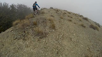
trail: Ridgeline
4:39 |
354 |
Oct 23, 2014
2:28 |
121 |
Apr 30, 2024
Recent Trail Reports
| status | trail | date | condition | info | user |
|---|---|---|---|---|---|
| Coastal Track: Marine Parade to Ellis Road | Aug 1, 2025 @ 2:08pm Aug 1, 2025 | Ideal | jhkoning | ||
| Caroline Bay Park Walkway | Aug 1, 2025 @ 2:08pm Aug 1, 2025 | Ideal | jhkoning | ||
| Wetlands Track | Mar 11, 2024 @ 8:54pm Mar 11, 2024 | Dry | Recreateme | ||
| Ridgeline | Sep 26, 2022 @ 1:28am Sep 26, 2022 | Dry | Gravelben | ||
| Black Hole | Jun 9, 2021 @ 12:46am Jun 9, 2021 | Dry | Jallington2020 | ||
| The Moguls | May 28, 2021 @ 2:13pm May 28, 2021 | Prevalent Mud | Jallington2020 | ||
| Bankers Track | Apr 20, 2021 @ 6:56pm Apr 20, 2021 | Very Dry | Steiniee | ||
| Flatliner | Apr 20, 2021 @ 6:56pm Apr 20, 2021 | Dry | Steiniee | ||
| Kevs Track | Nov 25, 2020 @ 5:51pm Nov 25, 2020 | Prevalent Mud | GSnailG | ||
| F1 | Feb 16, 2018 @ 2:59pm Feb 16, 2018 | Dry | PaddyGresham |
Activity Feed
| username | action | type | title | date |
|---|---|---|---|---|
| YogiNZ | ridden | trail | activity #95474318 | May 25, 2026 @ 3:10am May 25, 2026 |
| hayleyesler03 | ridden | trail | activity #89439318 | Feb 23, 2026 @ 4:46pm Feb 23, 2026 |
| MarkpF4mlV | wishlist | region | activity #89203266 | Feb 19, 2026 @ 5:32pm Feb 19, 2026 |
| jwindbla | add | photo | activity #87832581 and 2 more | Jan 25, 2026 @ 8:14pm Jan 25, 2026 |
| bigswanaka | wishlist | region | activity #87263849 | Jan 15, 2026 @ 6:52pm Jan 15, 2026 |
Recent Comments
| username | type | title | comment | date |
|---|---|---|---|---|
| report | Trees down before bridge | Jan 13, 2026 @ 6:53pm Jan 13, 2026 | ||
| trail | Rough overgrown trail with drops | Jan 11, 2025 @ 8:15pm Jan 11, 2025 | ||
| trail | Later section flowy. Lots of roots that are... | Jan 11, 2025 @ 8:14pm Jan 11, 2025 | ||
| trail | Tight exposed sections but many singletrack... | Jan 11, 2025 @ 8:14pm Jan 11, 2025 | ||
| trail | Later section flowy. Lots of roots that are... | Jan 11, 2025 @ 7:55pm Jan 11, 2025 |
Local Badges
-

Epic Ride Climb 2k9 awarded -

Climbing 10k Badge19 awarded -

Climbing 100k Badge2 awarded -

Epic Ride Descent 2k9 awarded -

Descent 10k Badge19 awarded -

Descent 100k Badge2 awarded
Bike & Skill Parks
| name | type | city | rating |
|---|---|---|---|
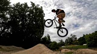
| Timaru Freestyle Jump Park | skill park | Timaru |
Activity Type Stats
| activitytype | trails | distance | descent | descent distance | total vertical | rating | global rank | state rank | photos | reports | routes | ridelogs |
|---|---|---|---|---|---|---|---|---|---|---|---|---|
| Mountain Bike | 53 | 21 miles | 1,211 ft | 7 miles | 243 ft | #2,267 | #39 | 21 | 62 | 1 | 5,908 | |
| E-Bike | 18 | 11 miles | 591 ft | 3 miles | 217 ft | #2,909 | #49 | 1 | 60 | 268 | ||
| Hike | 47 | 17 miles | 755 ft | 5 miles | 207 ft | #1,164 | #24 | 54 | 44 | |||
| Trail Running | 46 | 16 miles | 699 ft | 5 miles | 207 ft | #3,690 | #51 | 54 | 207 |
Frequently Asked Questions About Timaru
▼
What are the best places to ride in Timaru?
Timaru has 1 areas to explore for mountain biking. The top rated areas are:
▼
What are the highest rated mountain biking trails in Timaru?
The highest rated mountain biking trails in Timaru are:
- Bottom Track (4.2/5)
- Dashing Rocks Walk (4.1/5)
- Patiti Point Walkway (4.1/5)
- Sidewinder (4.1/5)
- The Summit (4.1/5)
▼
What is the best time of the year to ride in Timaru?
Based on ride log data, the most popular months to ride in Timaru are:
- February (33 activities)
- January (23 activities)
- December (20 activities)
▼
Where can I park to ride in Timaru?
Check the Timaru trail map for trailhead and parking information. Community members regularly update access and parking details for trails in the area.
- By YogiNZ & contributors
- Admins: Alps2Ocean-Cycle-Trail, MBA, rhino333
- #8492 - 14,375 views
- timaru activity log | embed map of Timaru mountain bike trails | timaru mountain biking points of interest
Downloading of trail gps tracks in kml & gpx formats is enabled for Timaru.
You must login to download files.