close
-
Layers w
- Weather Layers
- Pro
- Pro
- Pro
- Pro
- Pro
- Pro
- More Layers
- Pro
- Pro
- Pro
- Pro
-
Upgrade to

3D
Trail Conditions
- Unknown
- Snow Groomed
- Snow Packed
- Snow Covered
- Snow Cover Partial
- Freeze/thaw Cycle
- Icy
- Prevalent Mud
- Wet
- Variable
- Ideal
- Dry
- Very Dry
Trail Flow (Ridden Direction)
Trailforks scans users ridelogs to determine the most popular direction each trail is ridden. A good flowing trail network will have most trails flowing in a single direction according to their intension.
The colour categories are based on what percentage of riders are riding a trail in its intended direction.
The colour categories are based on what percentage of riders are riding a trail in its intended direction.
- > 96%
- > 90%
- > 80%
- > 70%
- > 50%
- < 50%
- bi-directional trail
- no data
Trail Last Ridden
Trailforks scans ridelogs to determine the last time a trail was ridden.
- < 2 days
- < 1 week
- < 2 weeks
- < 1 month
- < 6 months
- > 6 months
Trail Ridden Direction
The intended direction a trail should be ridden.
- Downhill Only
- Downhill Primary
- Both Directions
- Uphill Primary
- Uphill Only
- One Direction
Contribute Details
Colors indicate trail is missing specified detail.
- Description
- Photos
- Description & Photos
- Videos
Trail Popularity ?
Trailforks scans ridelogs to determine which trails are ridden the most in the last 9 months.
Trails are compared with nearby trails in the same city region with a possible 25 colour shades.
Think of this as a heatmap, more rides = more kinetic energy = warmer colors.
- most popular
- popular
- less popular
- not popular
ATV/ORV/OHV Filter
Max Vehicle Width
inches
US Cell Coverage
Legend

Radar Time
Activity Recordings
Trailforks uses anonymized public activity data.
?
Activity Recordings
Trailforks uses anonymized public activity data.
?
Personal Heatmap
▶
Activity Types
all
/
none
▶
Options
2
Date range
month
–
Winter Trails
Warning
A routing network for winter maps does not exist. Selecting trails using the winter trails layer has been disabled.
Missing Trails
Most Popular
Least Popular
Trails are colored based on popularity. The more popular a trail is, the more red. Less popular trails trend towards green.
Jump Magnitude Heatmap
Heatmap of where riders jump on trails. Zoom in to see individual jumps, click circles to view jump details.
BC Backroad Status
![map legend]()
Service Road Atlas is a free to use, community-driven service for viewing and creating reports on the numerous back-country service roads around B.C. and Alberta.

Slope Aspect
Direction the slope faces
Trails Deemphasized
Trails are shown in grey.
Only show trails with no bike usage.
Suggested Layers
Based on selected activity type
Save the current map location and zoom level as your default home location whenever this page is loaded.
Save
No description for Tofield has been added yet!
Login or register to submit one.
Activities Click to view
- Mountain Bike
42 trails
- E-Bike
29 trails
- Gravel Bike
0 trails
- Winter Fat Bike
0 trails
- Horse
13 trails
- Hike
42 trails
- Trail Running
42 trails
- Snowshoe
5 trails
- Nordic Ski
25 trails
Region Details
- 4
- 34
- 1
- 1
Region Status
Open as of Apr 3, 2026Stats
- Avg Trail Rating
- Trails (view details)
- 40
- Trails Mountain Bike
- 42
- Trails E-Bike
- 29
- Trails Horse
- 13
- Trails Hike
- 42
- Trails Trail Running
- 42
- Trails Snowshoe
- 5
- Trails Backcountry Ski
- 2
- Trails Nordic Ski
- 25
- Total Distance
- 52 miles
- Total Descent
- 2,695 ft
- Total Vertical
- 262 ft
- Highest Trailhead
- 2,571 ft
- Reports
- 166
- Photos
- 55
- Ridden Counter
- 2,267
Sub Regions
-
Cooking Lake / Blackfoot Recreation Area
- 31
- 1
- 1
Popular Tofield Mountain Biking Trails
• 100 ★ 5.0 • 4,997 ft • 92 ft • 99 • • skixc
Popular green difficulty doubletrack. This nordic ski primary trail can be used both directions and has a easy overall physical rating with a 92 ft green climb. Winter use: Classic snow grooming. On average it takes 6 minutes to complete this trail.
• 95 ★ 4.0 • 1 mile • 103 ft • 82 • • skixc
Popular green difficulty doubletrack. This nordic ski primary trail can be used both directions and has a moderate overall physical rating with a 103 ft green climb. Winter use: Classic snow grooming. Trail visibility is always easy to follow. On average it takes 9 minutes to complete this trail.
• 100 ★ 4.0 • 1 mile • 169 ft • 76 • • skixc
Popular green difficulty doubletrack. This nordic ski primary trail can be used both directions and has a moderate overall physical rating with a 169 ft green climb. Winter use: Classic snow grooming. Trail visibility is always easy to follow. On average it takes 10 minutes to complete this trail.
• 75 ★ 4.0 • 9 miles • 580 ft • 72 • • skixc
Popular green difficulty machine groomed. This nordic ski primary trail can be used both directions and has a moderate overall physical rating with a 580 ft green climb. Winter use: Classic snow grooming. Trail visibility is always easy to follow. On average it takes 58 minutes to complete this trail.
• 75 ★ 4.5 • 1 mile • 31 ft • 58 • • skixc
Popular green difficulty family friendly doubletrack. This nordic ski primary trail can be used both directions and has a moderate overall physical rating with a 31 ft green climb. Winter use: Classic snow grooming. Trail visibility is always easy to follow. On average it takes 8 minutes to complete this trail.
• 80 ★ 0.0 • 4,577 ft • 8 ft • 52 • • skixc
Popular green difficulty doubletrack. This nordic ski primary trail can be used both directions and has a easy overall physical rating with a 8 ft green climb. Winter use: Classic snow grooming. On average it takes 5 minutes to complete this trail.
• 55 ★ 3.5 • 4 miles • 275 ft • 50 • • skixc
Moderately popular blue difficulty family friendly doubletrack. This nordic ski primary trail can be used both directions and has a moderate overall physical rating with a 275 ft green climb. Winter use: Classic snow grooming. Trail visibility is always easy to follow. On average it takes 22 minutes to complete this trail.
• 50 ★ 0.0 • 407 ft • 2 ft • 41 •
Moderately popular green difficulty machine groomed. This mountain bike primary trail can be used downhill primary and has a easy overall physical rating with a 2 ft green climb. On average it takes minutes to complete this trail.
Tofield Mountain Bike Routes
21 miles • 429 ft • 7 • Loop •
The trail out here is mostly grassy with small ups and downs as you wind between marshy lakes. Bring bug...
• 7 miles • 98 ft • 2 •
• 8 miles • 149 ft • 4 •
• 18 miles • 512 ft • 3 •
• 16 miles • 363 ft • 5 •
• 7 miles • 150 ft • 2 •
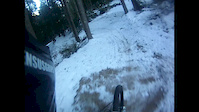
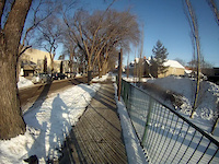
Photos of Tofield Mountain Bike
Videos of Tofield Mountain Bike


Recent Trail Reports
| status | trail | date | condition | info | user |
|---|---|---|---|---|---|
| Lost Lake | Mar 14, 2026 @ 2:30pm (America/Edmonton) Mar 14, 2026 | Snow Groomed | hartskinner | ||
| Neon Lake | Jan 10, 2026 @ 1:55pm (America/Edmonton) Jan 10, 2026 | Snow Groomed | Nutrifit | ||
| Waskehegan / Meadow | Oct 25, 2025 @ 10:52am (America/Edmonton) Oct 25, 2025 | Ideal | Bcharanduk | ||
| Flattail | Oct 25, 2025 @ 10:52am (America/Edmonton) Oct 25, 2025 | Ideal | Bcharanduk | ||
| Grouse | Oct 25, 2025 @ 10:52am (America/Edmonton) Oct 25, 2025 | Ideal | Bcharanduk | ||
| Spruce Hollow | Oct 25, 2025 @ 10:52am (America/Edmonton) Oct 25, 2025 | Ideal | Bcharanduk | ||
| Central Alleyway Trail | Sep 13, 2025 @ 12:25pm (America/Edmonton) Sep 13, 2025 | Very Dry | leonsmtb | ||
| Buck Run (North Part) | Aug 22, 2025 @ 10:26am Aug 22, 2025 | Ideal | TXYQDB | ||
| Norris Ridge | Aug 22, 2025 @ 10:26am Aug 22, 2025 | Ideal | TXYQDB | ||
| Don's Way | Jul 12, 2025 @ 10:04am Jul 12, 2025 | Dry | Bcharanduk |
Activity Feed
| username | action | type | title | date |
|---|---|---|---|---|
| jeffgull | ridden | trail | activity #95900254 and 5 more | May 30, 2026 @ 5:35pm May 30, 2026 |
| SophieOd1E9l | wishlist | region | activity #91391772 | Mar 27, 2026 @ 1:03pm Mar 27, 2026 |
| w1EExn | add | trail | activity #86464418 | Jan 1, 2026 @ 1:27pm Jan 1, 2026 |
| w1EExn | add | trail | activity #84629154 | Nov 23, 2025 @ 2:30pm Nov 23, 2025 |
| w1EExn | add | trail | activity #84444471 | Nov 20, 2025 @ 9:45am Nov 20, 2025 |
Recent Comments
| username | type | title | comment | date |
|---|---|---|---|---|
| trail | I rode this trail during the summer in wet... | Nov 19, 2024 @ 4:19pm Nov 19, 2024 | ||
| trail | All dry today, but there’s a little creek... | May 1, 2021 @ 7:21pm May 1, 2021 | ||
| trail | Good conditions, no issues at all, nice wide trail | Oct 7, 2020 @ 5:21pm Oct 7, 2020 | ||
| trail | Good conditions today, no mud. | Oct 7, 2020 @ 5:20pm Oct 7, 2020 | ||
| trail | Agreed | Sep 27, 2020 @ 11:19am Sep 27, 2020 |
Local Badges
-

10 Green Trails19 awarded -

Epic Ride Climb 2k0 awarded -

Climbing 10k Badge1 awarded -

Climbing 100k Badge0 awarded -

Epic Ride Descent 2k0 awarded -

Descent 10k Badge1 awarded
Bike & Skill Parks
| name | type | city | rating |
|---|---|---|---|
| Antler Lake MX | skill park | Tofield |
Activity Type Stats
| activitytype | trails | distance | descent | descent distance | total vertical | rating | global rank | state rank | photos | reports | routes | ridelogs |
|---|---|---|---|---|---|---|---|---|---|---|---|---|
| Mountain Bike | 42 | 52 miles | 2,694 ft | 20 miles | 262 ft | #4,158 | #32 | 53 | 144 | 1 | 1,863 | |
| E-Bike | 29 | 35 miles | 1,637 ft | 13 miles | 262 ft | #3,840 | #31 | 135 | 1 | 116 | ||
| Horse | 13 | 11 miles | 148 ft | 2 miles | 108 ft | #2,281 | #24 | 43 | ||||
| Hike | 42 | 52 miles | 2,694 ft | 20 miles | 262 ft | #4,841 | #29 | 142 | 1 | 259 | ||
| Trail Running | 42 | 52 miles | 2,694 ft | 20 miles | 262 ft | #4,250 | #31 | 142 | 1 | 100 | ||
| Snowshoe | 5 | 3 miles | 20 ft | 1,778 ft | 79 ft | #1,243 | #31 | 21 | 26 | |||
| Backcountry Ski | 2 | 21 | 4 | |||||||||
| Nordic Ski | 25 | 34 miles | 1,647 ft | 12 miles | 256 ft | #129 | #7 | 2 | 27 | 648 |
Frequently Asked Questions About Tofield
▼
What are the best places to ride in Tofield?
Tofield has 1 areas to explore for mountain biking. The top rated areas are:
▼
What are the highest rated mountain biking trails in Tofield?
The highest rated mountain biking trails in Tofield are:
- Push Lake (4.2/5)
- Winter (4.1/5)
- Neon Lake (4.1/5)
- Spruce Hollow (4/5)
- Waskehegan / Meadow (4/5)
▼
What is the best time of the year to ride in Tofield?
Based on ride log data, the most popular months to ride in Tofield are:
- October (43 activities)
- May (26 activities)
- August (25 activities)
▼
Where can I park to ride in Tofield?
There are 4 parking locations listed in Tofield. The most popular parking spots are: View all parking and trailhead locations on the map to plan your visit.
Activities
Trails
Points of Interest
- By brenthillier
 NSMBA TRAILFORKS & contributors
 - Admins: CAAG
- #19965 - 2,336 views
- tofield activity log | embed map of Tofield mountain bike trails | tofield mountain biking points of interest
Downloading of trail gps tracks in kml & gpx formats is enabled for Tofield.
You must login to download files.