close
-
Layers w
- Weather Layers
- Pro
- Pro
- Pro
- Pro
- Pro
- Pro
- More Layers
- Pro
- Pro
- Pro
- Pro
-
Upgrade to

3D
Trail Conditions
- Unknown
- Snow Groomed
- Snow Packed
- Snow Covered
- Snow Cover Partial
- Freeze/thaw Cycle
- Icy
- Prevalent Mud
- Wet
- Variable
- Ideal
- Dry
- Very Dry
Trail Flow (Ridden Direction)
Trailforks scans users ridelogs to determine the most popular direction each trail is ridden. A good flowing trail network will have most trails flowing in a single direction according to their intension.
The colour categories are based on what percentage of riders are riding a trail in its intended direction.
The colour categories are based on what percentage of riders are riding a trail in its intended direction.
- > 96%
- > 90%
- > 80%
- > 70%
- > 50%
- < 50%
- bi-directional trail
- no data
Trail Last Ridden
Trailforks scans ridelogs to determine the last time a trail was ridden.
- < 2 days
- < 1 week
- < 2 weeks
- < 1 month
- < 6 months
- > 6 months
Trail Ridden Direction
The intended direction a trail should be ridden.
- Downhill Only
- Downhill Primary
- Both Directions
- Uphill Primary
- Uphill Only
- One Direction
Contribute Details
Colors indicate trail is missing specified detail.
- Description
- Photos
- Description & Photos
- Videos
Trail Popularity ?
Trailforks scans ridelogs to determine which trails are ridden the most in the last 9 months.
Trails are compared with nearby trails in the same city region with a possible 25 colour shades.
Think of this as a heatmap, more rides = more kinetic energy = warmer colors.
- most popular
- popular
- less popular
- not popular
ATV/ORV/OHV Filter
Max Vehicle Width
inches
US Cell Coverage
Legend

Radar Time
Activity Recordings
Trailforks uses anonymized public activity data.
?
Activity Recordings
Trailforks uses anonymized public activity data.
?
Personal Heatmap
▶
Activity Types
all
/
none
▶
Options
2
Date range
month
–
Winter Trails
Warning
A routing network for winter maps does not exist. Selecting trails using the winter trails layer has been disabled.
Missing Trails
Most Popular
Least Popular
Trails are colored based on popularity. The more popular a trail is, the more red. Less popular trails trend towards green.
Jump Magnitude Heatmap
Heatmap of where riders jump on trails. Zoom in to see individual jumps, click circles to view jump details.
BC Backroad Status
![map legend]()
Service Road Atlas is a free to use, community-driven service for viewing and creating reports on the numerous back-country service roads around B.C. and Alberta.

Slope Aspect
Direction the slope faces
Trails Deemphasized
Trails are shown in grey.
Only show trails with no bike usage.
Suggested Layers
Based on selected activity type
Save the current map location and zoom level as your default home location whenever this page is loaded.
Save
No description for Tola has been added yet!
Login or register to submit one.
Activities Click to view
- Mountain Bike
63 trails
- E-Bike
73 trails
- Adaptive Bike
0 trails
- Winter Fat Bike
0 trails
- Horse
14 trails
- Hike
69 trails
- Trail Running
65 trails
Region Details
- 20
- 12
- 12
- 4
- 1
- 3
Region Status
Caution as of Sep 11, 2025Local Trail Association
Stats
- Avg Trail Rating
- Trails (view details)
- 52
- Trails Mountain Bike
- 77
- Trails E-Bike
- 73
- Trails Horse
- 14
- Trails Hike
- 70
- Trails Trail Running
- 65
- Trails Dirtbike/Moto
- 1
- Total Distance
- 84 miles
- Total Descent Distance
- 38 miles
- Total Descent
- 10,652 ft
- Total Vertical
- 926 ft
- Highest Trailhead
- 947 ft
- Reports
- 527
- Photos
- 112
- Ridden Counter
- 1,141
Sub Regions
-
Hacienda Iguana
- 1
-
Rancho Santana
- 11
- 11
Popular Tola Mountain Biking Trails
• 85 ★ 0.0 • 2,792 ft • 16 ft • 27 •
Popular green difficulty family friendly singletrack. This mountain bike primary trail can be used both directions and has a moderate overall physical rating with a 16 ft blue climb. It features berm and bridge. Trail visibility is always easy to follow. On average it takes 8 minutes to complete this trail.
• 90 ★ 5.0 • 1,204 ft • 0 ft • 27 •
A modern flow / jump trail and the Nicaragua's first! Built by Ride BC and crew to be a progressive trail with features to encourage safe progression and develop the fundamental skills for jump, drops, rollers and corners. Enjoy!
• 95 ★ 4.0 • 2 miles • 87 ft • 26 •
Popular blue difficulty singletrack. This mountain bike primary trail can be used both directions and has a hard overall physical rating with a 87 ft black diamond climb. It features berm, bridge, drop, rock face, rock garden, skinny and other. Trail visibility is always easy to follow. On average it takes 5 minutes to complete this trail.
• 80 ★ 5.0 • 2 miles • 444 ft • 20 •
Popular black diamond difficulty singletrack. This mountain bike primary trail can be used both directions and has a hard overall physical rating with a 444 ft black diamond climb. It features berm, drop, rock garden and skinny. Adaptive MTB rating: amtb black. Trail visibility is always easy to follow. On average it takes 4 minutes to complete this trail.
• 100 ★ 0.0 • 2 miles • 99 ft • 17 •
Popular green difficulty singletrack. This mountain bike primary trail can be used both directions and has a easy overall physical rating with a 99 ft green climb. It features berm, bridge and drop. Adaptive MTB rating: amtb green. Trail visibility is always easy to follow.
• 90 ★ 0.0 • 1 mile • 44 ft • 16 •
Popular blue difficulty singletrack. This mountain bike primary trail can be used both directions and has a moderate overall physical rating with a 44 ft blue climb. It features bridge and rock garden. Trail visibility is always easy to follow. On average it takes minutes to complete this trail.
Tola Mountain Bike Routes
★ 5.0 • 4 miles • 707 ft • 3 • Loop •
This is currently the best short loop on the Ranch. Park at the top of to start your descent right away,...
Rancho Quick Blue Route Via Trails Featured
★ 5.0 • 4 miles • 707 ft • 10 • Loop •
This is currently the best short loop on the Ranch. Park at the top of to start your descent right away,...
★ 5.0 • 4 miles • 628 ft • 5 • Out & Back •
A quick fun route that starts at La Tienda and ends at La Tienda.
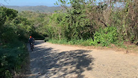
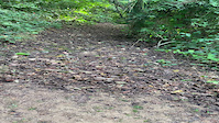
Photos of Tola Mountain Bike
Videos of Tola Mountain Bike
trail: Bella Vista Road
0:18 |
57 |
Feb 5, 2021
trail: Machete
0:29 |
|
Jan 13, 2021
Recent Trail Reports
| status | trail | date | condition | info | user |
|---|---|---|---|---|---|
| Seabreeze | Sep 11, 2025 @ 7:01am Sep 11, 2025 | Ideal | 0xjackson ECMBA | ||
| Acces To Duna | Sep 11, 2025 @ 7:01am Sep 11, 2025 | Ideal | 0xjackson ECMBA | ||
| Dune | Sep 11, 2025 @ 7:01am Sep 11, 2025 | Ideal | 0xjackson ECMBA | ||
| Sanctuary Trail | Sep 11, 2025 @ 7:00am Sep 11, 2025 | Ideal | 0xjackson ECMBA | ||
| Machete | Sep 11, 2025 @ 7:00am Sep 11, 2025 | Ideal | 0xjackson ECMBA | ||
| Wave Watcher | Sep 11, 2025 @ 7:00am Sep 11, 2025 | Ideal | 0xjackson ECMBA | ||
| Volcano | Sep 11, 2025 @ 7:00am Sep 11, 2025 | Ideal | 0xjackson ECMBA | ||
| Moon Crab | Sep 11, 2025 @ 6:59am Sep 11, 2025 | Ideal | 0xjackson ECMBA | ||
| Senior CC | Sep 11, 2025 @ 6:59am Sep 11, 2025 | Ideal | 0xjackson ECMBA | ||
| Tropical Wanderer | Sep 11, 2025 @ 6:59am Sep 11, 2025 | Ideal | 0xjackson ECMBA |
Activity Feed
| username | action | type | title | date |
|---|---|---|---|---|
| KeeslerArielQrzToe | wishlist | trail | activity #95800528 | May 29, 2026 @ 1:55pm May 29, 2026 |
| William6US9pC | ridden | trail | activity #95793881 | May 29, 2026 @ 12:04pm May 29, 2026 |
| Mackybowlin | ridden | trail | activity #93287339 and 1 more | Apr 24, 2026 @ 9:30am Apr 24, 2026 |
| CaraHkJt65 | wishlist | region | activity #91079142 | Mar 22, 2026 @ 8:49am Mar 22, 2026 |
| cmorell | vote | route | activity #89521671 | Feb 25, 2026 @ 8:35am Feb 25, 2026 |
Recent Comments
| username | type | title | comment | date |
|---|---|---|---|---|
| report | I’m I’m l | Mar 20, 2025 @ 10:23am Mar 20, 2025 | ||
| report | Hash kis is 9. Uinp o7997 | Mar 20, 2025 @ 10:22am Mar 20, 2025 | ||
| trail | Uh | Dec 28, 2024 @ 5:50am Dec 28, 2024 | ||
| trail | I would rate this as a straight black with no... | Apr 14, 2024 @ 10:13pm Apr 14, 2024 | ||
| trail | Good steady climb or fun and fast intermediate... | Apr 13, 2024 @ 5:43am Apr 13, 2024 |
Local Badges
-

Completionist0 awarded -

10 Blue Trails10 awarded -

Epic Mountain Bike Climb 2k0 awarded -

Climbing 10k Badge4 awarded -

Mountain Biking 100k Badge0 awarded -

Epic Ride Descent 2k0 awarded
Local Trail Supporters
- Rancho Santana
Activity Type Stats
| activitytype | trails | distance | descent | descent distance | total vertical | rating | global rank | state rank | photos | reports | routes | ridelogs |
|---|---|---|---|---|---|---|---|---|---|---|---|---|
| Mountain Bike | 63 | 84 miles | 10,653 ft | 38 miles | 925 ft | #1,329 | #1 | 100 | 548 | 16 | 538 | |
| E-Bike | 73 | 83 miles | 10,653 ft | 38 miles | 925 ft | #775 | #1 | 9 | 526 | 13 | 81 | |
| Horse | 14 | 20 miles | 1,919 ft | 7 miles | 919 ft | #391 | #1 | 260 | ||||
| Hike | 69 | 69 miles | 8,789 ft | 31 miles | 925 ft | #1,395 | #1 | 1 | 527 | 6 | 99 | |
| Trail Running | 65 | 67 miles | 8,274 ft | 30 miles | 925 ft | #1,054 | #1 | 2 | 507 | 7 | 72 | |
| Dirtbike/Moto | 1 | 7 miles | 965 ft | 3 miles | 794 ft | 241 |
Frequently Asked Questions About Tola
▼
What are the best places to ride in Tola?
Tola has 2 areas to explore for mountain biking. The top rated areas are:
▼
What are the highest rated mountain biking trails in Tola?
The highest rated mountain biking trails in Tola are:
- Flow Trail & Skill Course (4.2/5)
- Howler Loop (4.1/5)
- Seabreeze (4.1/5)
- Wave Watcher (4/5)
- Sanctuary Trail (4/5)
▼
What is the best time of the year to ride in Tola?
Based on ride log data, the most popular months to ride in Tola are:
- March (9 activities)
- November (8 activities)
- August (5 activities)
▼
Where can I park to ride in Tola?
Check the Tola trail map for trailhead and parking information. Community members regularly update access and parking details for trails in the area.
Activities
Trails
- By 0xjackson
 ECMBA & contributors
 - Admins: ECMBA
- #43662 - 1,454 views
- tola activity log | embed map of Tola mountain bike trails |
Downloading of trail gps tracks in kml & gpx formats is enabled for Tola.
You must login to download files.