close
-
Layers w
- Weather Layers
- Pro
- Pro
- Pro
- Pro
- Pro
- Pro
- More Layers
- Pro
- Pro
- Pro
- Pro
-
Upgrade to

3D
Trail Conditions
- Unknown
- Snow Groomed
- Snow Packed
- Snow Covered
- Snow Cover Partial
- Freeze/thaw Cycle
- Icy
- Prevalent Mud
- Wet
- Variable
- Ideal
- Dry
- Very Dry
Trail Flow (Ridden Direction)
Trailforks scans users ridelogs to determine the most popular direction each trail is ridden. A good flowing trail network will have most trails flowing in a single direction according to their intension.
The colour categories are based on what percentage of riders are riding a trail in its intended direction.
The colour categories are based on what percentage of riders are riding a trail in its intended direction.
- > 96%
- > 90%
- > 80%
- > 70%
- > 50%
- < 50%
- bi-directional trail
- no data
Trail Last Ridden
Trailforks scans ridelogs to determine the last time a trail was ridden.
- < 2 days
- < 1 week
- < 2 weeks
- < 1 month
- < 6 months
- > 6 months
Trail Ridden Direction
The intended direction a trail should be ridden.
- Downhill Only
- Downhill Primary
- Both Directions
- Uphill Primary
- Uphill Only
- One Direction
Contribute Details
Colors indicate trail is missing specified detail.
- Description
- Photos
- Description & Photos
- Videos
Trail Popularity ?
Trailforks scans ridelogs to determine which trails are ridden the most in the last 9 months.
Trails are compared with nearby trails in the same city region with a possible 25 colour shades.
Think of this as a heatmap, more rides = more kinetic energy = warmer colors.
- most popular
- popular
- less popular
- not popular
ATV/ORV/OHV Filter
Max Vehicle Width
inches
US Cell Coverage
Legend

Radar Time
Activity Recordings
Trailforks uses anonymized public activity data.
?
Activity Recordings
Trailforks uses anonymized public activity data.
?
Personal Heatmap
▶
Activity Types
all
/
none
▶
Options
2
Date range
month
–
Winter Trails
Warning
A routing network for winter maps does not exist. Selecting trails using the winter trails layer has been disabled.
Missing Trails
Most Popular
Least Popular
Trails are colored based on popularity. The more popular a trail is, the more red. Less popular trails trend towards green.
Jump Magnitude Heatmap
Heatmap of where riders jump on trails. Zoom in to see individual jumps, click circles to view jump details.
BC Backroad Status
![map legend]()
Service Road Atlas is a free to use, community-driven service for viewing and creating reports on the numerous back-country service roads around B.C. and Alberta.

Slope Aspect
Direction the slope faces
Trails Deemphasized
Trails are shown in grey.
Only show trails with no bike usage.
Suggested Layers
Based on selected activity type
Save the current map location and zoom level as your default home location whenever this page is loaded.
Save
No description for Tooele has been added yet!
Login or register to submit one.
Activities Click to view
- Mountain Bike
62 trails
- E-Bike
31 trails
- Gravel Bike
0 trails
- Adaptive Bike
0 trails
- Horse
22 trails
- Hike
68 trails
- Trail Running
68 trails
- Dirtbike/Moto
32 trails
- ATV/ORV/OHV
10 trails
Region Details
- 12
- 6
- 15
- 22
- 6
Region Status
Open as of 2 daysStats
- Avg Trail Rating
- Trails (view details)
- 81
- Trails Mountain Bike
- 63
- Trails E-Bike
- 31
- Trails Horse
- 22
- Trails Hike
- 68
- Trails Trail Running
- 68
- Trails Dirtbike/Moto
- 32
- Trails ATV/ORV/OHV
- 10
- Trails Snowshoe
- 1
- Trails Backcountry Ski
- 1
- Total Distance
- 205 miles
- Total Descent
- 31,250 ft
- Total Vertical
- 6,780 ft
- Highest Trailhead
- 10,974 ft
- Reports
- 240
- Photos
- 289
- Ridden Counter
- 1,960
Sub Regions
-
Bates Canyon
-
Settlement Canyon
- 2
- 11
- 2
-
Stansbury Island
- 2
-
Stansbury Mountains
- 4
- 12
- 9
- 2
-
Utah Motorsports Campus
Popular Tooele Mountain Biking Trails
• 100 ★ 4.4 • 2 miles • 0 ft • 80 •
follows Settlement Canyon Creek. From the parking lot there is a brief section of pavement just after the toll gate. Turn right onto the first dirt road. It quickly turns into single track. Just stay on the single track. There trail...
• 65 ★ 3.5 • 6 miles • 1,144 ft • 70 •
The initial climb from is pretty brutal, but once up to the top the trail is very flat and very easy. It's a great early spring ride when Fat Bike season is ending and before other trails dry out. But the guns. So many guns. Be very...
• 100 ★ 0.0 • 1 mile • 4 ft • 70 •
This is the upper section of the full . Mimics the lower half, with a steady climb, and a fun decent. This is on land that cattle is fed on, so one should be weary when using it. You also have to go around the "NO Trespassing" gate, so...
• 90 ★ 3.5 • 2 miles • 922 ft • 38 •
This trail starts at Settlement Canyon Road near the Left Hand Fork Road turnoff, and traverses up the south side of the canyon south of camp Wapiti and meets up with the Bottom trail. The climb is still very strenuous, but one could...
• 55 ★ 4.0 • 2 miles • 574 ft • 37 •
The trail connects White Pine to Butterfield Pass along the south end of . The trails wanders through lots of dense forest on single track. The top is thick pines and aspens. On west facing slopes the will much more sun exposure. There...
• 80 ★ 0.0 • 2 miles • 715 ft • 31 •
Popular blue difficulty singletrack. This multi-use trail can be used both directions. On average it takes 41 minutes to complete this trail.
• 45 ★ 3.0 • 1 mile • 847 ft • 26 •
The trail climbs up through aspen up to Bear Trap Pass. At Bear Trap Pass you could turn around or you could switch to , Bench trail or make the descent down the backside into the main part of settlement canyon. The trail is popular...
• 5 ★ 4.8 • 21 miles • 5,573 ft • 25 • • moto
Point-to-point trail mostly ridden North to South. Primarily a Rough dirt bike singletrack. Moto's (and ebikes) can ride here and it can get rutted out and washed out in places. Some steep climbs and some loose rock sections.
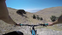
Photos of Tooele Mountain Bike
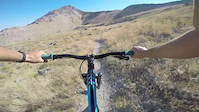
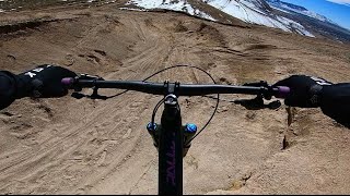
Videos of Tooele Mountain Bike
trail: Stansbury Mtb
0:00 |
408 |
Jan 28, 2017
trail: Stansbury Mtb
0:57 |
262 |
Jan 28, 2017
trail: Sand Trap
0:12 |
210 |
Mar 22, 2022 , Tooele

trail: Middle Canyon Trail
16:24 |
295 |
Mar 4, 2021 , Tooele
trail: Dark Trail
11:25 |
243 |
Oct 7, 2020 , Tooele

trail: Upper Dark
11:25 |
343 |
Oct 7, 2020 , Tooele
trail: Upper Dark
15:43 |
210 |
Oct 7, 2020 , Tooele

trail: Dark Trail
15:43 |
1844 |
Oct 7, 2020 , Tooele
Recent Trail Reports
| status | trail | date | condition | info | user |
|---|---|---|---|---|---|
| Dark Trail | Jun 20, 2026 @ 6:20pm (America/Denver) 2 days | Dry | StudChild | ||
| Upper Dark | Jun 20, 2026 @ 6:20pm (America/Denver) 2 days | Dry | StudChild | ||
| Stansbury East MTB | Mar 1, 2026 @ 1:21pm (America/Denver) Mar 1, 2026 | Dry | Jodiraerod | ||
| Stansbury Mtb | Mar 1, 2026 @ 1:21pm (America/Denver) Mar 1, 2026 | Dry | Jodiraerod | ||
| Pole Line to Lower Oquirrh Bluffs Connector | Feb 7, 2026 @ 1:20pm (America/Boise) Feb 7, 2026 | Dry | Jodiraerod | ||
| Jazzy's Ravine/BBC | Feb 7, 2026 @ 1:20pm (America/Boise) Feb 7, 2026 | Prevalent Mud | Jodiraerod | ||
| Magpie's Glide | Nov 22, 2025 @ 9:29pm (America/Denver) Nov 22, 2025 | Dry | aobbard | ||
| Muddy trail | Aug 17, 2025 @ 7:17am Aug 17, 2025 | Dry | DmmrrMcm | ||
| Maggie's Trail | Aug 6, 2025 @ 12:43pm Aug 6, 2025 | Very Dry | soonercougarjr | ||
| Stansbury Front Trail | Jul 13, 2025 @ 7:08pm Jul 13, 2025 | Dry | h-d |
Activity Feed
| username | action | type | title | date |
|---|---|---|---|---|
| CharlotteqeFsVN | wishlist | trail | activity #97583934 | Jun 22, 2026 @ 2:00pm 1 hours |
| StudChild | add | report | activity #97478030 and 1 more | Jun 21, 2026 @ 6:25am 1 day |
| Spencerv5ZnEB | ridden | trail | activity #95374754 | May 23, 2026 @ 7:38pm May 23, 2026 |
| Spencerv5ZnEB | ridden | trail | activity #94859265 | May 16, 2026 @ 4:08pm May 16, 2026 |
| matgover | ridden | trail | activity #93673020 | Apr 29, 2026 @ 2:46pm Apr 29, 2026 |
Recent Comments
| username | type | title | comment | date |
|---|---|---|---|---|
| trail | test | Jul 2, 2025 @ 5:15pm Jul 2, 2025 | ||
| trail | Great idea, done to about the quality of work... | Jul 2, 2025 @ 4:52pm Jul 2, 2025 | ||
| report | Fun trail, use a front fender horse and cow... | Jun 10, 2025 @ 9:32am Jun 10, 2025 | ||
| trail | Made it to trailhead and didn't get to ride.... | May 29, 2024 @ 7:48am May 29, 2024 | ||
| trail | Made it to trailhead and didn't get to ride.... | May 29, 2024 @ 7:46am May 29, 2024 |
Local Badges
-

Epic Ride Climb 2k26 awarded -

Climbing 10k Badge22 awarded -

Climbing 100k Badge2 awarded -

Epic Ride Descent 2k28 awarded -

Descent 10k Badge22 awarded -

Descent 100k Badge2 awarded
Bike & Skill Parks
| name | type | city | rating |
|---|---|---|---|
| Miller Motorsports Park | skill park | Tooele |
Activity Type Stats
| activitytype | trails | distance | descent | descent distance | total vertical | rating | global rank | state rank | photos | reports | routes | ridelogs |
|---|---|---|---|---|---|---|---|---|---|---|---|---|
| Mountain Bike | 62 | 139 miles | 22,707 ft | 54 miles | 5,125 ft | #2,161 | #773 | 262 | 238 | 5,056 | ||
| E-Bike | 31 | 94 miles | 12,808 ft | 33 miles | 4,199 ft | #1,993 | #918 | 215 | 399 | |||
| Horse | 22 | 38 miles | 6,594 ft | 14 miles | 4,029 ft | #1,234 | #766 | 57 | ||||
| Hike | 68 | 153 miles | 26,686 ft | 58 miles | 6,778 ft | #1,483 | #672 | 10 | 240 | 1 | 661 | |
| Trail Running | 68 | 153 miles | 26,686 ft | 58 miles | 6,778 ft | #1,150 | #417 | 240 | 3 | 235 | ||
| Dirtbike/Moto | 32 | 92 miles | 11,762 ft | 29 miles | 4,140 ft | #55 | #32 | 18 | 62 | 326 | ||
| ATV/ORV/OHV | 10 | 16 miles | 1,063 ft | 4 miles | 2,989 ft | #704 | #291 | 55 | 10 | |||
| Snowshoe | 1 | 3,468 ft | 62 ft | 1,578 ft | 62 ft | 2 | ||||||
| Backcountry Ski | 1 | 3,468 ft | 62 ft | 1,578 ft | 62 ft | 108 |
Frequently Asked Questions About Tooele
▼
What are the best places to ride in Tooele?
Tooele has 6 areas to explore for mountain biking. The top rated areas are:
▼
What are the highest rated mountain biking trails in Tooele?
The highest rated mountain biking trails in Tooele are:
- Jazzy's Ravine/BBC (4.3/5)
- Stansbury Front Trail (4.3/5)
- Molly's Trail (4.2/5)
- Snake Chute (4.1/5)
- Dark Trail (4.1/5)
▼
What is the best time of the year to ride in Tooele?
Based on ride log data, the most popular months to ride in Tooele are:
- July (38 activities)
- August (31 activities)
- June (30 activities)
▼
Where can I park to ride in Tooele?
There are 14 parking locations listed in Tooele. The most popular parking spots are: View all parking and trailhead locations on the map to plan your visit.
Activities
Trails
- By canadaka
 Trailforks & contributors
 - Admins: jkwilliamz, UtahJohn, jpmcghee, jasonmalczyk
- #4872 - 9,583 views
- tooele activity log | embed map of Tooele mountain bike trails | tooele mountain biking points of interest
Downloading of trail gps tracks in kml & gpx formats is enabled for Tooele.
You must login to download files.