close
-
Layers w
- Weather Layers
- Pro
- Pro
- Pro
- Pro
- Pro
- Pro
- More Layers
- Pro
- Pro
- Pro
- Pro
-
Upgrade to

3D
Trail Conditions
- Unknown
- Snow Groomed
- Snow Packed
- Snow Covered
- Snow Cover Partial
- Freeze/thaw Cycle
- Icy
- Prevalent Mud
- Wet
- Variable
- Ideal
- Dry
- Very Dry
Trail Flow (Ridden Direction)
Trailforks scans users ridelogs to determine the most popular direction each trail is ridden. A good flowing trail network will have most trails flowing in a single direction according to their intension.
The colour categories are based on what percentage of riders are riding a trail in its intended direction.
The colour categories are based on what percentage of riders are riding a trail in its intended direction.
- > 96%
- > 90%
- > 80%
- > 70%
- > 50%
- < 50%
- bi-directional trail
- no data
Trail Last Ridden
Trailforks scans ridelogs to determine the last time a trail was ridden.
- < 2 days
- < 1 week
- < 2 weeks
- < 1 month
- < 6 months
- > 6 months
Trail Ridden Direction
The intended direction a trail should be ridden.
- Downhill Only
- Downhill Primary
- Both Directions
- Uphill Primary
- Uphill Only
- One Direction
Contribute Details
Colors indicate trail is missing specified detail.
- Description
- Photos
- Description & Photos
- Videos
Trail Popularity ?
Trailforks scans ridelogs to determine which trails are ridden the most in the last 9 months.
Trails are compared with nearby trails in the same city region with a possible 25 colour shades.
Think of this as a heatmap, more rides = more kinetic energy = warmer colors.
- most popular
- popular
- less popular
- not popular
ATV/ORV/OHV Filter
Max Vehicle Width
inches
US Cell Coverage
Legend

Radar Time
Activity Recordings
Trailforks uses anonymized public activity data.
?
Activity Recordings
Trailforks uses anonymized public activity data.
?
Personal Heatmap
▶
Activity Types
all
/
none
▶
Options
2
Date range
month
–
Winter Trails
Warning
A routing network for winter maps does not exist. Selecting trails using the winter trails layer has been disabled.
Missing Trails
Most Popular
Least Popular
Trails are colored based on popularity. The more popular a trail is, the more red. Less popular trails trend towards green.
Jump Magnitude Heatmap
Heatmap of where riders jump on trails. Zoom in to see individual jumps, click circles to view jump details.
BC Backroad Status
![map legend]()
Service Road Atlas is a free to use, community-driven service for viewing and creating reports on the numerous back-country service roads around B.C. and Alberta.

Slope Aspect
Direction the slope faces
Trails Deemphasized
Trails are shown in grey.
Only show trails with no bike usage.
Suggested Layers
Based on selected activity type
Save the current map location and zoom level as your default home location whenever this page is loaded.
Save
No description for Toowoomba has been added yet!
Login or register to submit one.
Activities Click to view
- Mountain Bike
148 trails
- E-Bike
62 trails
- Gravel Bike
0 trails
- Adaptive Bike
0 trails
- Winter Fat Bike
0 trails
- Horse
6 trails
- Hike
91 trails
- Trail Running
91 trails
Region Details
- 56
- 14
- 46
- 15
- 13
- 4
Region Status
Caution as of May 17, 2026Stats
- Avg Trail Rating
- Trails (view details)
- 156
- Trails Mountain Bike
- 148
- Trails E-Bike
- 62
- Trails Horse
- 6
- Trails Hike
- 91
- Trails Trail Running
- 91
- Total Distance
- 131 miles
- Total Descent
- 22,790 ft
- Total Vertical
- 1,530 ft
- Highest Trailhead
- 2,550 ft
- Reports
- 414
- Photos
- 239
- Ridden Counter
- 27,570
Sub Regions
-
Jubilee Park
- 15
- 8
- 10
- 2
-
Mount Peel
- 1
- 18
- 3
- 1
-
Mountain Bike Mecca
-
Neilson Park
-
Picnic Point Parklands
- 5
-
Redwood Park
Popular Toowoomba Mountain Biking Trails
• 100 ★ 3.7 • 659 ft • 39 ft • 806 •
forms part of an easy loop starting at Bridge St in Toowoomba. This trial now will allow riders to loop back to the beginning of .
• 100 ★ 4.9 • 3 miles • 602 ft • 778 •
Originally designed as a climbing trail, has been recently machined to make the best flow trail loop in the park. The descent is now one way to improve safety and the new climb is a steady gradient.
• 95 ★ 4.4 • 3,612 ft • 221 ft • 735 •
A busy two way trail, this gently climbing track has a few log roll overs.
• 90 ★ 4.2 • 1 mile • 386 ft • 706 •
was a crowded funded trail and provides an alternative easier trail to the lower trails. An honour board recognising those who financially contributed is located along the trail. There are several options to make loops back with .
• 100 ★ 4.6 • 1 mile • 414 ft • 677 •
is the main climbing trail in the lower section of the park but is a fun descent as well. Make sure give way to climbing riders.
• 95 ★ 4.8 • 4,744 ft • 37 ft • 677 •
Intermediate trail, with a mixture of well groomed hardpack and rocky sections
• 95 ★ 4.0 • 1 mile • 70 ft • 569 •
Brand new is now longer and more incredible then ever, this trail is so damn fun. its a massive wide open jump track
Toowoomba Mountain Bike Routes
7 miles • 1,970 ft • 9 •
Do this route starting at the bottom for the ultimate jubilee experience
★ 3.0 • 7 miles • 1,192 ft • 21 • Race •
Range8 is Toowoomba Mountain Bike Club event, racing the best single track Toowoomba's Jubilee Park has to...
2 miles • 407 ft • 5 • Race •
Stage 1 of Fox on Rocks Covid edition 1 November 2020 Defibrillator, one of our most recent trail...
8 miles • 2,238 ft • 17 • Race •
The Fox Superflow® is Australia’s most popular gravity enduro series, because it let’s you set the...
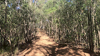
Photos of Toowoomba Mountain Bike
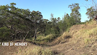
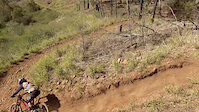
Videos of Toowoomba Mountain Bike

trail: Blue
0:15 |
115 |
Jan 13, 2021

trail: Black
5:27 |
31 |
Dec 15, 2020

trail: Green
5:35 |
73 |
Jul 31, 2020
trail: Fire Road
0:13 |
250 |
Aug 26, 2019

trail: Mackenzie Frenzy DH Trail
0:59 |
1300 |
May 14, 2019
trail: Green
3:59 |
36 |
Jul 21, 2018
trail: Mackenzie Frenzy DH Trail
2:19 |
1909 |
Jul 30, 2016

trail: Cheeseburger
0:13 |
1045 |
Jun 17, 2016
Recent Trail Reports
| status | trail | date | condition | info | user |
|---|---|---|---|---|---|
| Canyonero | May 17, 2026 @ 6:10pm (Australia/Brisbane) May 17, 2026 | Unknown | RyderQrfiEL | ||
| Anon Link 100 | Apr 18, 2026 @ 2:32pm (Australia/Brisbane) Apr 17, 2026 | Very Dry | cannaeski | ||
| Anonymous | Apr 18, 2026 @ 2:32pm (Australia/Brisbane) Apr 17, 2026 | Very Dry | cannaeski | ||
| Defibrillator | Feb 22, 2026 @ 7:18pm (Australia/Brisbane) Feb 22, 2026 | Ideal | fooddoode | ||
| Top Shelf | Feb 22, 2026 @ 7:17pm (Australia/Brisbane) Feb 22, 2026 | Dry | fooddoode | ||
| Danomite | Feb 22, 2026 @ 7:17pm (Australia/Brisbane) Feb 22, 2026 | Dry | fooddoode | ||
| Rollercat (climb) | Feb 22, 2026 @ 7:17pm (Australia/Brisbane) Feb 22, 2026 | Dry | fooddoode | ||
| Highlife Trail | Feb 22, 2026 @ 7:16pm (Australia/Brisbane) Feb 22, 2026 | Very Dry | fooddoode | ||
| Calibre | Feb 22, 2026 @ 7:16pm (Australia/Brisbane) Feb 22, 2026 | Dry | fooddoode | ||
| Ida Trail (Climb) | Feb 22, 2026 @ 7:15pm (Australia/Brisbane) Feb 22, 2026 | Dry | fooddoode |
Activity Feed
| username | action | type | title | date |
|---|---|---|---|---|
| mtbmater | add | photo | activity #96791698 | Jun 12, 2026 @ 3:05am Jun 12, 2026 |
| mtbmater | add | photo | activity #96590936 and 1 more | Jun 9, 2026 @ 1:18am Jun 9, 2026 |
| MikeSeabs | ridden | trail | activity #96351820 and 1 more | Jun 6, 2026 @ 3:12am Jun 6, 2026 |
| MikeSeabs | comment | trail | activity #96351805 and 1 more | Jun 6, 2026 @ 3:12am Jun 6, 2026 |
| MikeSeabs | ridden | trail | activity #96351758 and 1 more | Jun 6, 2026 @ 3:11am Jun 6, 2026 |
Recent Comments
| username | type | title | comment | date |
|---|---|---|---|---|
| trail | Fun track, small tech sections good for beginners | Jun 6, 2026 @ 3:14am Jun 6, 2026 | ||
| trail | Can confirm this isn’t a green trail. Track... | Jun 6, 2026 @ 3:12am Jun 6, 2026 | ||
| report | Bo90jh | Jun 28, 2025 @ 5:27pm Jun 28, 2025 | ||
| trail | In my opinion, all of the rules eg no... | Mar 30, 2025 @ 12:48am Mar 30, 2025 | ||
| trail | This is one of the only proper double blacks... | Mar 30, 2025 @ 12:38am Mar 30, 2025 |
Local Badges
-

10 Green Trails267 awarded -

10 Blue Trails200 awarded -

Epic Ride Climb 2k246 awarded -

Climbing 10k Badge96 awarded -

Climbing 100k Badge25 awarded -

Epic Ride Descent 2k271 awarded
Bike & Skill Parks
| name | type | city | rating |
|---|---|---|---|
| Stenner Street Skills Park | skill park | Toowoomba | |
| Skills Park | skill park | Toowoomba | |
| Public Bmx Track | skill park | Toowoomba | |
| Carly Hibberd mountain bike park | skill park | Toowoomba | |
| Peter Watts Criterium Track | skill park | Toowoomba |
Activity Type Stats
| activitytype | trails | distance | descent | descent distance | total vertical | rating | global rank | state rank | photos | reports | routes | ridelogs |
|---|---|---|---|---|---|---|---|---|---|---|---|---|
| Mountain Bike | 148 | 124 miles | 20,128 ft | 59 miles | 1,529 ft | #348 | #21 | 238 | 414 | 10 | 37,421 | |
| E-Bike | 62 | 40 miles | 10,423 ft | 21 miles | 1,188 ft | #759 | #57 | 1 | 352 | 2 | 3,469 | |
| Horse | 6 | 6 miles | 1,056 ft | 3 miles | 587 ft | #298 | #25 | 66 | ||||
| Hike | 91 | 100 miles | 14,829 ft | 48 miles | 1,529 ft | #1,093 | #36 | 221 | 1,030 | |||
| Trail Running | 91 | 100 miles | 14,829 ft | 48 miles | 1,529 ft | #794 | #31 | 221 | 1,454 |
Frequently Asked Questions About Toowoomba
▼
What are the best places to ride in Toowoomba?
Toowoomba has 6 areas to explore for mountain biking. The top rated areas are:
▼
What are the highest rated mountain biking trails in Toowoomba?
The highest rated mountain biking trails in Toowoomba are:
- Defibrillator (4.5/5)
- Canyonero (4.5/5)
- Cheeseburger (4.4/5)
- Danomite (4.3/5)
- The Reaper Trail (4.3/5)
▼
What is the best time of the year to ride in Toowoomba?
Based on ride log data, the most popular months to ride in Toowoomba are:
- July (135 activities)
- August (126 activities)
- September (125 activities)
▼
Where can I park to ride in Toowoomba?
There are 16 parking locations listed in Toowoomba. The most popular parking spots are: View all parking and trailhead locations on the map to plan your visit.
Activities
Trails
- By micko1000 & contributors
- Admins: TMBC
- #13215 - 36,773 views
- toowoomba activity log | embed map of Toowoomba mountain bike trails | toowoomba mountain biking points of interest polygons
Downloading of trail gps tracks in kml & gpx formats is enabled for Toowoomba.
You must login to download files.