close
-
Layers w
- Weather Layers
- Pro
- Pro
- Pro
- Pro
- Pro
- Pro
- More Layers
- Pro
- Pro
- Pro
- Pro
-
Upgrade to

3D
Trail Conditions
- Unknown
- Snow Groomed
- Snow Packed
- Snow Covered
- Snow Cover Partial
- Freeze/thaw Cycle
- Icy
- Prevalent Mud
- Wet
- Variable
- Ideal
- Dry
- Very Dry
Trail Flow (Ridden Direction)
Trailforks scans users ridelogs to determine the most popular direction each trail is ridden. A good flowing trail network will have most trails flowing in a single direction according to their intension.
The colour categories are based on what percentage of riders are riding a trail in its intended direction.
The colour categories are based on what percentage of riders are riding a trail in its intended direction.
- > 96%
- > 90%
- > 80%
- > 70%
- > 50%
- < 50%
- bi-directional trail
- no data
Trail Last Ridden
Trailforks scans ridelogs to determine the last time a trail was ridden.
- < 2 days
- < 1 week
- < 2 weeks
- < 1 month
- < 6 months
- > 6 months
Trail Ridden Direction
The intended direction a trail should be ridden.
- Downhill Only
- Downhill Primary
- Both Directions
- Uphill Primary
- Uphill Only
- One Direction
Contribute Details
Colors indicate trail is missing specified detail.
- Description
- Photos
- Description & Photos
- Videos
Trail Popularity ?
Trailforks scans ridelogs to determine which trails are ridden the most in the last 9 months.
Trails are compared with nearby trails in the same city region with a possible 25 colour shades.
Think of this as a heatmap, more rides = more kinetic energy = warmer colors.
- most popular
- popular
- less popular
- not popular
ATV/ORV/OHV Filter
Max Vehicle Width
inches
US Cell Coverage
Legend

Radar Time
Activity Recordings
Trailforks uses anonymized public activity data.
?
Activity Recordings
Trailforks uses anonymized public activity data.
?
Personal Heatmap
▶
Activity Types
all
/
none
▶
Options
2
Date range
month
–
Winter Trails
Warning
A routing network for winter maps does not exist. Selecting trails using the winter trails layer has been disabled.
Missing Trails
Most Popular
Least Popular
Trails are colored based on popularity. The more popular a trail is, the more red. Less popular trails trend towards green.
Jump Magnitude Heatmap
Heatmap of where riders jump on trails. Zoom in to see individual jumps, click circles to view jump details.
BC Backroad Status
![map legend]()
Service Road Atlas is a free to use, community-driven service for viewing and creating reports on the numerous back-country service roads around B.C. and Alberta.

Slope Aspect
Direction the slope faces
Trails Deemphasized
Trails are shown in grey.
Only show trails with no bike usage.
Suggested Layers
Based on selected activity type
Save the current map location and zoom level as your default home location whenever this page is loaded.
SaveTop Bridge was built by the Arrowsmith Mountain Bike Club and, at one point, offered eight intermediate loops. Trails have low usage ever since a new road was built down to a new pumping stn. Expect poor riding conditions.
The "B Trail" is a dual slalom course with jumps and steeper sections, this is the trail that has the most use. Park located next to a rifle range so expect occasional action.
Hook up with the 5km/3mi Top Bridge Trail at the Rathtrevor Beach end of Resort Drive, then follow the route under Highway 19, and onwards to the bike park. From there, cross the suspension bridge and connect to the RDN Regional Park trails that access the fish hatchery, continue to the end of Englishman River Rd and further to Englishman River Falls Provincial Park and the HammerFest Trail Network.
There is also several great swimming spots on the river on a hot summers day.
Primary Trail Type: Cross-Country
Land Status: Regional Recreation Area
Land Manager: City of Parksville
 google parking directions
 Access Info:
Top Bridge is a few km southeast of Parksville, just west of the junction of Highways 19 and 19A near the end of Chattell Road.
Links
Files
- top_bridge_regional_park_map.jpg (234 KB)
- TopBridge.pdf (131 KB)
Activities Click to view
- Hike
25 trails
- Mountain Bike
21 trails
- E-Bike
10 trails
- Trail Running
25 trails
Region Details
- 6
- 8
- 6
- 1
Region Status
Open as of May 8, 2026Stats
- Avg Trail Rating
- Trails (view details)
- 25
- Trails Mountain Bike
- 21
- Trails E-Bike
- 10
- Trails Horse
- 1
- Trails Hike
- 25
- Trails Trail Running
- 25
- Total Distance
- 9 miles
- Total Descent Distance
- 3 miles
- Total Descent
- 777 ft
- Total Vertical
- 219 ft
- Highest Trailhead
- 259 ft
- Reports
- 74
- Photos
- 26
- Ridden Counter
- 2,620
Popular Top Bridge/Englishman River Regional Park Trails
• 70 ★ 5.0 • 607 ft • 0 ft • 152 • • hike
Short section from Top Bridge parking to bridge and swimming options
• 50 ★ 5.0 • 3,340 ft • 85 ft • 80 •
Morrison Ck bridge in the middle, scenic.
• 60 ★ 5.0 • 1,946 ft • 11 ft • 76 •
Trail to Top Bridge trail under the Hwy and Train bridges.
• 50 ★ 5.0 • 2,684 ft • 17 ft • 71 • • hike
Moderately popular green difficulty singletrack. This hike primary trail can be used both directions and has a easy overall physical rating with a 17 ft green climb. Trail visibility is always easy to follow. On average it takes 3 minutes to complete this trail.
• 35 ★ 3.0 • 4,439 ft • 59 ft • 57 • • hike
Less popular green difficulty singletrack. This hike primary trail can be used both directions and has a easy overall physical rating with a 59 ft green climb. It features bridge. Trail visibility is always easy to follow. On average it takes 11 minutes to complete this trail.
• 25 ★ 4.0 • 2,329 ft • 0 ft • 24 • • hike
Less popular green difficulty singletrack. This hike primary trail can be used both directions. On average it takes 2 minutes to complete this trail.
• 40 ★ 0.0 • 2 miles • 15 ft • 19 •
Popular trail alongside the Englishman River from Top Bridge to fish hatchery. Well used by hikers and dog walkers so use caution. Trail can be twisty and rooty with small rolls and drops but still a fun way see the river.
Videos of Top Bridge/Englishman River Regional Park Mountain Bike
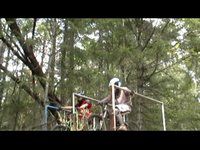
trail: B Trail
0:56 |
2297 |
Apr 8, 2012 , Parksville
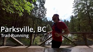
trail: Trail
16:01 |
95 |
Oct 17, 2022 , Parksville

trail: Trail to bridge
16:01 |
360 |
Oct 17, 2022 , Parksville

trail: RDN Regional Trail
16:01 |
122 |
Oct 17, 2022 , Parksville
Recent Trail Reports
Activity Feed
| username | action | type | title | date |
|---|---|---|---|---|
| islandbird | wishlist | region | activity #96204655 | Jun 3, 2026 @ 9:00pm Jun 3, 2026 |
| Cherrill | wishlist | region | activity #96194430 | Jun 3, 2026 @ 5:42pm Jun 3, 2026 |
| BoschSucks | add | report | activity #94639392 | May 13, 2026 @ 11:11am May 13, 2026 |
| rapid-roy | add | report | activity #93828829 and 4 more | May 1, 2026 @ 7:41pm May 1, 2026 |
| BoschSucks | add | report | activity #93219113 | Apr 23, 2026 @ 9:23am Apr 23, 2026 |
Recent Comments
| username | type | title | comment | date |
|---|---|---|---|---|
| trail | I | Apr 13, 2025 @ 5:38am Apr 13, 2025 | ||
| trail | A large portion of the trail going across... | Dec 26, 2023 @ 1:57pm Dec 26, 2023 | ||
| report | sorry man but they really needed it..i... | Mar 10, 2021 @ 8:33pm Mar 10, 2021 | ||
| report | I had spent a few days tuning up the lower... | Mar 8, 2021 @ 9:16pm Mar 8, 2021 |
Nearby Areas
| name | distance | ||||
|---|---|---|---|---|---|
| Northwest Bay Trails | 75 | 33 | 1.7 km | ||
| Little Mountain | 4 | 16 | 2 | 2 | 2.5 km |
| Notch Hill | 1 | 5.1 km | |||
| HammerFest | 19 | 34 | 29 | 3 | 6.1 km |
| Pheasant Glen | 33 | 58 | 7 | 6.9 km |
Local Mountain Biking Directory
-
Arrowsmith Cycling ClubClub
![Arrowsmith Cycling Club]()
-
Arrowsmith Bikes PBike Shop
![Arrowsmith Bikes P]()
-
Island CycleBike Shop
Local Products
Activity Type Stats
| activitytype | trails | distance | descent | descent distance | total vertical | rating | global rank | state rank | photos | reports | routes | ridelogs |
|---|---|---|---|---|---|---|---|---|---|---|---|---|
| Mountain Bike | 21 | 8 miles | 571 ft | 3 miles | 220 ft | #6,151 | #263 | 24 | 73 | 1,863 | ||
| E-Bike | 10 | 5 miles | 308 ft | 2 miles | 213 ft | #6,663 | #250 | 2 | 57 | 258 | ||
| Horse | 1 | 2 miles | 82 ft | 2,208 ft | 82 ft | 3 | 1 | |||||
| Hike | 25 | 9 miles | 778 ft | 3 miles | 220 ft | #8,348 | #325 | 74 | 339 | |||
| Trail Running | 25 | 9 miles | 778 ft | 3 miles | 220 ft | #8,061 | #301 | 74 | 500 |
Frequently Asked Questions About Top Bridge/Englishman River Regional Park
▼
What are the highest rated mountain biking trails in Top Bridge/Englishman River Regional Park?
The highest rated mountain biking trails in Top Bridge/Englishman River Regional Park are:
- Hatchery to Englishman River Rd (4.2/5)
- Trail to bridge (4.1/5)
- Connector to Top Bridge (4.1/5)
- Steelhead Trail (4.1/5)
- Backdoor to Top Bridge (4.1/5)
▼
What is the best time of the year to ride in Top Bridge/Englishman River Regional Park?
Based on ride log data, the most popular months to ride in Top Bridge/Englishman River Regional Park are:
- August (41 activities)
- July (35 activities)
- June (22 activities)
▼
Where can I park to ride in Top Bridge/Englishman River Regional Park?
▼
What is the longest trail in Top Bridge/Englishman River Regional Park?
The longest trail in Top Bridge/Englishman River Regional Park is RDN Englishman R. Trail at 1.8 miles. View all trails sorted by distance.
Activities
Trails
- Hard trails in Top Bridge/Englishman River Regional Park
- Easy trails in Top Bridge/Englishman River Regional Park
- Favorite trails in Top Bridge/Englishman River Regional Park
- Most ridden trails in Top Bridge/Englishman River Regional Park
- Singletrack in Top Bridge/Englishman River Regional Park
- Viewpoint trails in Top Bridge/Englishman River Regional Park
- Trails with technical features in Top Bridge/Englishman River Regional Park
Points of Interest
- top bridge/englishman river regional park activity log | embed map of Top Bridge/Englishman River Regional Park mountain bike trails | top bridge/englishman river regional park mountain biking points of interest
Downloading of trail gps tracks in kml & gpx formats is enabled for Top Bridge/Englishman River Regional Park.
You must login to download files.