close
-
Layers w
- Weather Layers
- Pro
- Pro
- Pro
- Pro
- Pro
- Pro
- More Layers
- Pro
- Pro
- Pro
- Pro
-
Upgrade to

3D
Trail Conditions
- Unknown
- Snow Groomed
- Snow Packed
- Snow Covered
- Snow Cover Partial
- Freeze/thaw Cycle
- Icy
- Prevalent Mud
- Wet
- Variable
- Ideal
- Dry
- Very Dry
Trail Flow (Ridden Direction)
Trailforks scans users ridelogs to determine the most popular direction each trail is ridden. A good flowing trail network will have most trails flowing in a single direction according to their intension.
The colour categories are based on what percentage of riders are riding a trail in its intended direction.
The colour categories are based on what percentage of riders are riding a trail in its intended direction.
- > 96%
- > 90%
- > 80%
- > 70%
- > 50%
- < 50%
- bi-directional trail
- no data
Trail Last Ridden
Trailforks scans ridelogs to determine the last time a trail was ridden.
- < 2 days
- < 1 week
- < 2 weeks
- < 1 month
- < 6 months
- > 6 months
Trail Ridden Direction
The intended direction a trail should be ridden.
- Downhill Only
- Downhill Primary
- Both Directions
- Uphill Primary
- Uphill Only
- One Direction
Contribute Details
Colors indicate trail is missing specified detail.
- Description
- Photos
- Description & Photos
- Videos
Trail Popularity ?
Trailforks scans ridelogs to determine which trails are ridden the most in the last 9 months.
Trails are compared with nearby trails in the same city region with a possible 25 colour shades.
Think of this as a heatmap, more rides = more kinetic energy = warmer colors.
- most popular
- popular
- less popular
- not popular
ATV/ORV/OHV Filter
Max Vehicle Width
inches
US Cell Coverage
Legend

Radar Time
Activity Recordings
Trailforks uses anonymized public activity data.
?
Activity Recordings
Trailforks uses anonymized public activity data.
?
Personal Heatmap
▶
Activity Types
all
/
none
▶
Options
2
Date range
month
–
Winter Trails
Warning
A routing network for winter maps does not exist. Selecting trails using the winter trails layer has been disabled.
Missing Trails
Most Popular
Least Popular
Trails are colored based on popularity. The more popular a trail is, the more red. Less popular trails trend towards green.
Jump Magnitude Heatmap
Heatmap of where riders jump on trails. Zoom in to see individual jumps, click circles to view jump details.
BC Backroad Status
![map legend]()
Service Road Atlas is a free to use, community-driven service for viewing and creating reports on the numerous back-country service roads around B.C. and Alberta.

Slope Aspect
Direction the slope faces
Trails Deemphasized
Trails are shown in grey.
Only show trails with no bike usage.
Suggested Layers
Based on selected activity type
Save the current map location and zoom level as your default home location whenever this page is loaded.
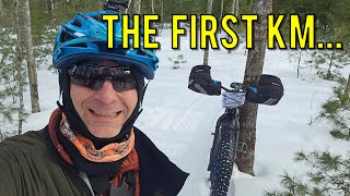
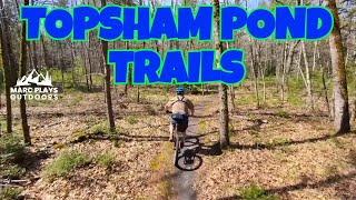
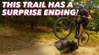
SaveTopsham is an up and coming town. This destination contains miles of doublet rack trail that can be very rugged at times. There are also a few miles of singles track and even more coming. Six Rivers NEMBA has been hard at work building new trails in town, with more trails to come This town is a great place for a little outdoor adventure! Ride on trails that vary from smooth trails along a river, to rigorous trail with lots of technical features in the middle of the Maine woods. Stop by and ride some of these sick trails!
Links
Activities Click to view
- Mountain Bike
74 trails
- E-Bike
14 trails
- Adaptive Bike
0 trails
- Winter Fat Bike
0 trails
- Horse
5 trails
- Hike
78 trails
- Trail Running
78 trails
- ATV/ORV/OHV
16 trails
- Snowmobile
19 trails
- Snowshoe
11 trails
- Nordic Ski
11 trails
Region Details
- 30
- 27
- 14
- 3
Region Status
Caution as of Jun 4, 2026Stats
- Avg Trail Rating
- Trails (view details)
- 78
- Trails Mountain Bike
- 74
- Trails E-Bike
- 14
- Trails Horse
- 5
- Trails Hike
- 78
- Trails Trail Running
- 78
- Trails ATV/ORV/OHV
- 16
- Trails Snowmobile
- 19
- Trails Snowshoe
- 11
- Trails Nordic Ski
- 11
- Total Distance
- 77 miles
- Total Descent
- 3,666 ft
- Total Vertical
- 371 ft
- Highest Trailhead
- 377 ft
- Reports
- 202
- Photos
- 26
- Ridden Counter
- 3,655
Sub Regions
-
Bowdoin ATV Trail Network
-
Topsham Trail Network
- 22
- 8
- 3
Popular Topsham Mountain Biking Trails
• 95 ★ 3.0 • 5,230 ft • 12 ft • 328 •
Popular green difficulty singletrack. This mountain bike primary trail can be used both directions. On average it takes 8 minutes to complete this trail.
• 100 ★ 3.0 • 1 mile • 5 ft • 318 •
Popular green difficulty singletrack. This mountain bike primary trail can be used both directions and has a easy overall physical rating with a 5 ft green climb. Trail visibility is always easy to follow. On average it takes 9 minutes to complete this trail.
• 100 ★ 3.6 • 3,102 ft • 42 ft • 318 •
Popular green difficulty singletrack. This mountain bike primary trail can be used both directions. On average it takes 5 minutes to complete this trail.
• 95 ★ 3.0 • 1 mile • 10 ft • 304 •
Popular green difficulty singletrack. This mountain bike primary trail can be used both directions. On average it takes 11 minutes to complete this trail.
• 95 ★ 5.0 • 3,625 ft • 11 ft • 294 •
Popular green difficulty singletrack. This mountain bike primary trail can be used both directions and has a easy overall physical rating with a 11 ft green climb. Trail visibility is always easy to follow. On average it takes 6 minutes to complete this trail.
• 100 ★ 5.0 • 1,752 ft • 0 ft • 215 •
Popular blue difficulty singletrack. This mountain bike primary trail can be used both directions. On average it takes 3 minutes to complete this trail.
• 90 ★ 0.0 • 984 ft • 0 ft • 86 •
Popular green difficulty singletrack. This mountain bike primary trail can be used both directions. On average it takes 1 minutes to complete this trail.
• 90 ★ 0.0 • 1,509 ft • 0 ft • 77 •
Popular green difficulty singletrack. This mountain bike primary trail can be used both directions. On average it takes 2 minutes to complete this trail.
Topsham Mountain Bike Routes
Photos of Topsham Mountain Bike
Videos of Topsham Mountain Bike

trail: Hellooo Rodney
11:16 |
26 |
Jan 30, 2026 , Topsham

trail: Gone Fishin 3
11:16 |
16 |
Jan 30, 2026 , Topsham
trail: Gone Fishin 1
11:16 |
20 |
Jan 30, 2026 , Topsham
trail: Gone Fishin 5
12:06 |
84 |
May 18, 2025 , Topsham

5:15 |
647 |
Sep 27, 2022
trail: Gone Fishin 1
10:10 |
501 |
Oct 11, 2020 , Topsham
Recent Trail Reports
| status | trail | date | condition | info | user |
|---|---|---|---|---|---|
| Gone Fishin 4 | May 5, 2026 @ 2:28pm (America/Moncton) May 5, 2026 | Ideal | leadvegas CCW | ||
| Double Pond Loop | May 5, 2026 @ 2:28pm (America/Moncton) May 5, 2026 | Ideal | leadvegas CCW | ||
| Hellooo Rodney | May 5, 2026 @ 2:28pm (America/Moncton) May 5, 2026 | Ideal | leadvegas CCW | ||
| Gone Fishin 1 | May 5, 2026 @ 2:28pm (America/Moncton) May 5, 2026 | Ideal | leadvegas CCW | ||
| Gone Fishin 2 | May 5, 2026 @ 2:28pm (America/Moncton) May 5, 2026 | Ideal | leadvegas CCW | ||
| Demon Connect | May 5, 2026 @ 2:28pm (America/Moncton) May 5, 2026 | Ideal | leadvegas CCW | ||
| Gone Fishin 5 | Apr 21, 2026 @ 4:28pm (America/New_York) Apr 21, 2026 | Ideal | SullyJC | ||
| Gone Fishin 3 | Apr 21, 2026 @ 4:24pm (America/New_York) Apr 21, 2026 | Ideal | SullyJC | ||
| Right Way Down | Nov 17, 2024 @ 6:27am Nov 17, 2024 | Ideal | W82zVZ | ||
| Cliff Line | Oct 24, 2024 @ 4:33pm Oct 24, 2024 | Variable | W82zVZ |
Activity Feed
| username | action | type | title | date |
|---|---|---|---|---|
| Chrisfiftyfive | vote | poi | activity #97323001 | Jun 19, 2026 @ 9:15am 1 day |
| leadvegas | add | report | activity #94113414 and 4 more | May 5, 2026 @ 2:03pm May 5, 2026 |
| leadvegas | add | report | activity #94113413 | May 5, 2026 @ 2:03pm May 5, 2026 |
| gschuft | wishlist | trail | activity #93794051 | May 1, 2026 @ 10:09am May 1, 2026 |
| TrishaGMR6R | wishlist | region | activity #93506683 | Apr 27, 2026 @ 3:23am Apr 27, 2026 |
Recent Comments
| username | type | title | comment | date |
|---|---|---|---|---|
| trail | If it isn't being sandy it is being rooty. ... | Apr 4, 2026 @ 3:18pm Apr 4, 2026 | ||
| trail | Sent it off that straight ramp. I'm glad I had... | Jun 2, 2024 @ 5:36am Jun 2, 2024 | ||
| trail | There's a few features on this one that are... | Jun 2, 2024 @ 5:35am Jun 2, 2024 | ||
| report | My ridding buddy!!! | Feb 2, 2024 @ 6:09pm Feb 2, 2024 | ||
| report | Awesome grooming!! | Feb 2, 2024 @ 6:05pm Feb 2, 2024 |
Local Badges
-

10 Green Trails125 awarded -

10 Blue Trails21 awarded -

Epic Ride Climb 2k0 awarded -

Climbing 10k Badge6 awarded -

Climbing 100k Badge0 awarded -

Epic Ride Descent 2k0 awarded
Bike & Skill Parks
| name | type | city | rating |
|---|---|---|---|
| Topsham Pump Track | skill park | Topsham |
Activity Type Stats
| activitytype | trails | distance | descent | descent distance | total vertical | rating | global rank | state rank | photos | reports | routes | ridelogs |
|---|---|---|---|---|---|---|---|---|---|---|---|---|
| Mountain Bike | 74 | 73 miles | 3,402 ft | 27 miles | 371 ft | #2,875 | #1,019 | 22 | 196 | 1 | 3,232 | |
| E-Bike | 14 | 36 miles | 732 ft | 12 miles | 266 ft | #3,992 | #1,329 | 162 | 43 | |||
| Horse | 5 | 6 miles | 213 ft | 3 miles | 141 ft | #2,601 | #1,442 | 7 | ||||
| Hike | 78 | 77 miles | 3,668 ft | 28 miles | 371 ft | #3,387 | #1,192 | 196 | 102 | |||
| Trail Running | 78 | 77 miles | 3,668 ft | 28 miles | 371 ft | #1,051 | #389 | 196 | 98 | |||
| ATV/ORV/OHV | 16 | 38 miles | 840 ft | 12 miles | 266 ft | #582 | #223 | 6 | 1 | |||
| Snowmobile | 19 | 50 miles | 1,339 ft | 18 miles | 272 ft | #187 | #84 | 9 | ||||
| Snowshoe | 11 | 19 miles | 1,037 ft | 9 miles | 272 ft | #897 | #428 | 10 | 11 | |||
| Nordic Ski | 11 | 19 miles | 1,037 ft | 9 miles | 272 ft | #977 | #402 | 10 | 15 |
Frequently Asked Questions About Topsham
▼
What are the best places to ride in Topsham?
Topsham has 2 areas to explore for mountain biking. The top rated areas are:
▼
What are the highest rated mountain biking trails in Topsham?
The highest rated mountain biking trails in Topsham are:
- Gone Fishin 5 (4.1/5)
- Hellooo Rodney (4.1/5)
- Gone Fishin 2 (3.8/5)
- Gone Fishin 3 (3.8/5)
- Gone Fishin 4 (3.8/5)
▼
What is the best time of the year to ride in Topsham?
Based on ride log data, the most popular months to ride in Topsham are:
- July (83 activities)
- May (59 activities)
- August (48 activities)
▼
Where can I park to ride in Topsham?
There are 4 parking locations listed in Topsham. The most popular parking spots are: View all parking and trailhead locations on the map to plan your visit.
Activities
- By topshammaine1
 & contributors
 - Admins: NEMBAEXEC, 6R NEMBA
- #22057 - 7,515 views
- topsham activity log | embed map of Topsham mountain bike trails | topsham mountain biking points of interest
Downloading of trail gps tracks in kml & gpx formats is enabled for Topsham.
You must login to download files.