close
-
Layers w
- Weather Layers
- Pro
- Pro
- Pro
- Pro
- Pro
- Pro
- More Layers
- Pro
- Pro
- Pro
- Pro
-
Upgrade to

3D
Trail Conditions
- Unknown
- Snow Groomed
- Snow Packed
- Snow Covered
- Snow Cover Partial
- Freeze/thaw Cycle
- Icy
- Prevalent Mud
- Wet
- Variable
- Ideal
- Dry
- Very Dry
Trail Flow (Ridden Direction)
Trailforks scans users ridelogs to determine the most popular direction each trail is ridden. A good flowing trail network will have most trails flowing in a single direction according to their intension.
The colour categories are based on what percentage of riders are riding a trail in its intended direction.
The colour categories are based on what percentage of riders are riding a trail in its intended direction.
- > 96%
- > 90%
- > 80%
- > 70%
- > 50%
- < 50%
- bi-directional trail
- no data
Trail Last Ridden
Trailforks scans ridelogs to determine the last time a trail was ridden.
- < 2 days
- < 1 week
- < 2 weeks
- < 1 month
- < 6 months
- > 6 months
Trail Ridden Direction
The intended direction a trail should be ridden.
- Downhill Only
- Downhill Primary
- Both Directions
- Uphill Primary
- Uphill Only
- One Direction
Contribute Details
Colors indicate trail is missing specified detail.
- Description
- Photos
- Description & Photos
- Videos
Trail Popularity ?
Trailforks scans ridelogs to determine which trails are ridden the most in the last 9 months.
Trails are compared with nearby trails in the same city region with a possible 25 colour shades.
Think of this as a heatmap, more rides = more kinetic energy = warmer colors.
- most popular
- popular
- less popular
- not popular
ATV/ORV/OHV Filter
Max Vehicle Width
inches
US Cell Coverage
Legend

Radar Time
Activity Recordings
Trailforks uses anonymized public activity data.
?
Activity Recordings
Trailforks uses anonymized public activity data.
?
Personal Heatmap
▶
Activity Types
all
/
none
▶
Options
2
Date range
month
–
Winter Trails
Warning
A routing network for winter maps does not exist. Selecting trails using the winter trails layer has been disabled.
Missing Trails
Most Popular
Least Popular
Trails are colored based on popularity. The more popular a trail is, the more red. Less popular trails trend towards green.
Jump Magnitude Heatmap
Heatmap of where riders jump on trails. Zoom in to see individual jumps, click circles to view jump details.
BC Backroad Status
![map legend]()
Service Road Atlas is a free to use, community-driven service for viewing and creating reports on the numerous back-country service roads around B.C. and Alberta.

Slope Aspect
Direction the slope faces
Trails Deemphasized
Trails are shown in grey.
Only show trails with no bike usage.
Suggested Layers
Based on selected activity type
Save the current map location and zoom level as your default home location whenever this page is loaded.
Save
No description for Torino has been added yet!
Login or register to submit one.
This region uses the Uk/Euro style trail grading system.
Activities Click to view
- Mountain Bike
82 trails
- E-Bike
55 trails
- Adaptive Bike
0 trails
- Winter Fat Bike
0 trails
- Hike
66 trails
- Trail Running
67 trails
Region Details
- 6
- 2
- 37
- 30
Region Status
Caution as of Jun 16, 2026Stats
- Avg Trail Rating
- Trails (view details)
- 79
- Trails Mountain Bike
- 83
- Trails E-Bike
- 55
- Trails Horse
- 1
- Trails Hike
- 66
- Trails Trail Running
- 67
- Total Distance
- 47 miles
- Total Descent
- 20,770 ft
- Total Vertical
- 1,636 ft
- Highest Trailhead
- 2,319 ft
- Reports
- 2,085
- Photos
- 97
- Ridden Counter
- 10,194
Sub Regions
-
Colle della Maddalena
- 14
- 14
-
Superga
- 1
- 23
- 14
Popular Torino Mountain Biking Trails
• 100 ★ 4.7 • 2,668 ft • 12 ft • 280 •
Very popular illegal DH trail. Trail jumps change frequently due to unautorized trail building operations.
• 95 ★ 4.2 • 1,788 ft • 0 ft • 265 •
Medium difficult trail, very fast and a little broken in some point
• 90 ★ 4.7 • 1 mile • 18 ft • 263 •
Funny trail with lot of curves and uphill sections. The last part could be easily muddy in some points.
• 90 ★ 4.8 • 3,002 ft • 6 ft • 227 •
Il of the Hill scende per il versante orientale della Maddalena. E' meno battuto del più noto Chiesetta, ma è comunque molto divertente e affascinante, soprattutto in primavera quando di solito è sempre abbastanza pulito. La sezione...
• 80 ★ 3.4 • 4,865 ft • 433 ft • 223 •
Percorribile sia in salita che in discesa ( attenzione agli escursionisti a piedi ) , e' un classico del colle della Maddalena sulla collina di Torino , sempre bello percorrerlo , Flow Molto VELOCE !!!! alcuni rilanci !!!
• 100 ★ 4.4 • 1,283 ft • 0 ft • 209 •
Popular red difficulty singletrack. This mountain bike primary trail can be used downhill only and has a moderate overall physical rating. It features berm, drop, jump, gap jump and rock face. Trail visibility is always easy to follow. On average it takes 2 minutes to complete this trail.
• 65 ★ 4.0 • 1,649 ft • 0 ft • 203 •
The continuation of the chiesetta trail, tipicaly enduro trail with only 1 hard step (a little s-gap with rocks)
Torino Mountain Bike Routes
★ 4.0 • 14 miles • 3,099 ft • 4 •
Up the 14 to Maddalena then down the 30 and up again to chiesetta, then down 10 to finish
26 miles • 3,538 ft • 4 •
Percorso con tutti i trails della prima parte verso viverone della Serra... X chi ha voglia di pedalare e...
• 6 miles • 1,314 ft • 2 •
• 12 miles • 1,710 ft • 4 •
• 7 miles • 1,605 ft • 5 •
• 10 miles • 2,609 ft • 5 •
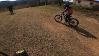
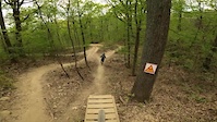
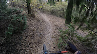
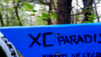
Photos of Torino Mountain Bike
Videos of Torino Mountain Bike

trail: Chiesetta 1
5:23 |
262 |
Nov 30, 2022
trail: Chiesetta 1
8:46 |
161 |
Mar 7, 2022
trail: Chiesetta 1
2:20 |
473 |
Apr 21, 2021
trail: Chiesetta 1
0:26 |
116 |
Apr 16, 2021

trail: Chiesetta 1
2:33 |
665 |
Apr 3, 2021
trail: Chiesetta 1
4:15 |
89 |
Dec 26, 2020
trail: Chiesetta 1
2:51 |
71 |
Dec 11, 2020
trail: Chiesetta 1
4:14 |
685 |
Oct 19, 2020
Recent Trail Reports
| status | trail | date | condition | info | user |
|---|---|---|---|---|---|
| 600XL | May 14, 2026 @ 12:55pm (Europe/Rome) May 14, 2026 | Ideal | andrereve | ||
| 26 to Orrido | May 14, 2026 @ 12:55pm (Europe/Rome) May 14, 2026 | Ideal | andrereve | ||
| Variante salita 26 | May 14, 2026 @ 12:55pm (Europe/Rome) May 14, 2026 | Ideal | andrereve | ||
| Galleria Rocca | Apr 23, 2026 @ 1:44pm (Europe/Rome) Apr 23, 2026 | Unknown | andrereve | ||
| 16 | Apr 22, 2026 @ 5:08pm (Europe/Monaco) Apr 22, 2026 | Ideal | enricopons | ||
| 100 Croci | Apr 21, 2026 @ 1:17pm (Europe/Monaco) Apr 21, 2026 | Ideal | andrereve | ||
| Dark Side | Apr 10, 2026 @ 3:23pm (Europe/Monaco) Apr 10, 2026 | Prevalent Mud | glauconicola | ||
| Risiko | Apr 10, 2026 @ 3:23pm (Europe/Monaco) Apr 10, 2026 | Ideal | glauconicola | ||
| Chiesetta 3 | Apr 10, 2026 @ 3:23pm (Europe/Monaco) Apr 10, 2026 | Variable | glauconicola | ||
| Chiesetta 1 | Apr 10, 2026 @ 3:23pm (Europe/Monaco) Apr 10, 2026 | Variable | glauconicola |
Activity Feed
| username | action | type | title | date |
|---|---|---|---|---|
| roberich92 | wishlist | route | activity #97308118 | Jun 19, 2026 @ 4:45am 1 day |
| Ilcava | wishlist | trail | activity #95807604 | May 29, 2026 @ 3:55pm May 29, 2026 |
| alexamerio | wishlist | trail | activity #95702815 | May 28, 2026 @ 6:31am May 28, 2026 |
| andrereve | add | report | activity #94684978 and 2 more | May 14, 2026 @ 6:22am May 14, 2026 |
| sbrazzi | difficultyvote | trail | activity #94677947 | May 14, 2026 @ 3:34am May 14, 2026 |
Recent Comments
| username | type | title | comment | date |
|---|---|---|---|---|
| trail | The sign of prohibition was installed by... | Jun 6, 2025 @ 9:45am Jun 6, 2025 | ||
| report | Ma si riesce a deviare, il resto é... | Mar 20, 2025 @ 9:18am Mar 20, 2025 | ||
| trail | Please post as a “trail report”. This area... | Aug 23, 2024 @ 5:25pm Aug 23, 2024 | ||
| trail | Really bad condition | Aug 23, 2024 @ 7:28am Aug 23, 2024 | ||
| trail | Inserisci il commento come “trail report”... | Jun 30, 2024 @ 8:00am Jun 30, 2024 |
Local Badges
-

10 Green Trails186 awarded -

Epic Ride Climb 2k457 awarded -

Climbing 10k Badge238 awarded -

Climbing 100k Badge47 awarded -

Epic Ride Descent 2k448 awarded -

Descent 10k Badge239 awarded
Bike & Skill Parks
| name | type | city | rating |
|---|---|---|---|
| Pump Track | skill park | Torino |
Activity Type Stats
| activitytype | trails | distance | descent | descent distance | total vertical | rating | global rank | state rank | photos | reports | routes | ridelogs |
|---|---|---|---|---|---|---|---|---|---|---|---|---|
| Mountain Bike | 82 | 47 miles | 20,771 ft | 30 miles | 1,637 ft | #1,275 | #29 | 97 | 2,085 | 3 | 39,121 | |
| E-Bike | 55 | 22 miles | 7,451 ft | 12 miles | 1,506 ft | #573 | #61 | 1,899 | 1 | 5,373 | ||
| Horse | 1 | 2,169 ft | 98 ft | 1,306 ft | 79 ft | 134 | ||||||
| Hike | 66 | 43 miles | 19,255 ft | 28 miles | 1,608 ft | #3,576 | #124 | 2,064 | 324 | |||
| Trail Running | 67 | 43 miles | 19,350 ft | 29 miles | 1,608 ft | #2,956 | #98 | 2,065 | 865 |
Frequently Asked Questions About Torino
▼
What are the best places to ride in Torino?
Torino has 2 areas to explore for mountain biking. The top rated areas are:
▼
What are the highest rated mountain biking trails in Torino?
The highest rated mountain biking trails in Torino are:
- Calcetano (4.6/5)
- Chiesetta 1 (4.5/5)
- 600XL (4.4/5)
- 61 (4.3/5)
- Dark Side (4.3/5)
▼
What is the best time of the year to ride in Torino?
Based on ride log data, the most popular months to ride in Torino are:
- July (186 activities)
- October (169 activities)
- September (141 activities)
▼
Where can I park to ride in Torino?
There are 4 parking locations listed in Torino. The most popular parking spots are: View all parking and trailhead locations on the map to plan your visit.
Activities
Trails
- By beppovox & contributors
- Admins: silviu86, adessoomaipiu
- #4320 - 16,502 views
- torino activity log | embed map of Torino mountain bike trails | torino mountain biking points of interest
Downloading of trail gps tracks in kml & gpx formats is enabled for Torino.
You must login to download files.