close
-
Layers w
- Weather Layers
- Pro
- Pro
- Pro
- Pro
- Pro
- Pro
- More Layers
- Pro
- Pro
- Pro
- Pro
-
Upgrade to

3D
Trail Conditions
- Unknown
- Snow Groomed
- Snow Packed
- Snow Covered
- Snow Cover Partial
- Freeze/thaw Cycle
- Icy
- Prevalent Mud
- Wet
- Variable
- Ideal
- Dry
- Very Dry
Trail Flow (Ridden Direction)
Trailforks scans users ridelogs to determine the most popular direction each trail is ridden. A good flowing trail network will have most trails flowing in a single direction according to their intension.
The colour categories are based on what percentage of riders are riding a trail in its intended direction.
The colour categories are based on what percentage of riders are riding a trail in its intended direction.
- > 96%
- > 90%
- > 80%
- > 70%
- > 50%
- < 50%
- bi-directional trail
- no data
Trail Last Ridden
Trailforks scans ridelogs to determine the last time a trail was ridden.
- < 2 days
- < 1 week
- < 2 weeks
- < 1 month
- < 6 months
- > 6 months
Trail Ridden Direction
The intended direction a trail should be ridden.
- Downhill Only
- Downhill Primary
- Both Directions
- Uphill Primary
- Uphill Only
- One Direction
Contribute Details
Colors indicate trail is missing specified detail.
- Description
- Photos
- Description & Photos
- Videos
Trail Popularity ?
Trailforks scans ridelogs to determine which trails are ridden the most in the last 9 months.
Trails are compared with nearby trails in the same city region with a possible 25 colour shades.
Think of this as a heatmap, more rides = more kinetic energy = warmer colors.
- most popular
- popular
- less popular
- not popular
ATV/ORV/OHV Filter
Max Vehicle Width
inches
US Cell Coverage
Legend

Radar Time
Activity Recordings
Trailforks uses anonymized public activity data.
?
Activity Recordings
Trailforks uses anonymized public activity data.
?
Personal Heatmap
▶
Activity Types
all
/
none
▶
Options
2
Date range
month
–
Winter Trails
Warning
A routing network for winter maps does not exist. Selecting trails using the winter trails layer has been disabled.
Missing Trails
Most Popular
Least Popular
Trails are colored based on popularity. The more popular a trail is, the more red. Less popular trails trend towards green.
Jump Magnitude Heatmap
Heatmap of where riders jump on trails. Zoom in to see individual jumps, click circles to view jump details.
BC Backroad Status
![map legend]()
Service Road Atlas is a free to use, community-driven service for viewing and creating reports on the numerous back-country service roads around B.C. and Alberta.

Slope Aspect
Direction the slope faces
Trails Deemphasized
Trails are shown in grey.
Only show trails with no bike usage.
Suggested Layers
Based on selected activity type
Save the current map location and zoom level as your default home location whenever this page is loaded.
Save
No description for Toulouse has been added yet!
Login or register to submit one.
This region uses the Uk/Euro style trail grading system.
Activities Click to view
- Mountain Bike
85 trails
- E-Bike
11 trails
- Adaptive Bike
0 trails
- Winter Fat Bike
0 trails
- Hike
77 trails
- Trail Running
77 trails
Region Details
- 18
- 3
- 28
- 30
- 3
Region Status
Open as of Jun 16, 2026Stats
- Avg Trail Rating
- Trails (view details)
- 85
- Trails Mountain Bike
- 85
- Trails E-Bike
- 11
- Trails Horse
- 2
- Trails Hike
- 77
- Trails Trail Running
- 77
- Total Distance
- 49 miles
- Total Descent
- 10,722 ft
- Total Vertical
- 885 ft
- Highest Trailhead
- 1,235 ft
- Reports
- 104
- Photos
- 176
- Ridden Counter
- 2,303
Sub Regions
-
Foret Eaunes
- 12
- 6
- 1
-
Les Coteaux Toulousains
- 6
- 2
-
Mezens / Buzet-sur-Tarn
- 16
- 15
- 2
Popular Toulouse Mountain Biking Trails
• 60 ★ 0.0 • 3,547 ft • 15 ft • 53 •
Moderately popular blue difficulty singletrack. This mountain bike primary trail can be used downhill primary. It features gap jump. On average it takes 4 minutes to complete this trail.
• 100 ★ 0.0 • 2,497 ft • 0 ft • 52 •
Popular red difficulty singletrack. This mountain bike primary trail can be used downhill primary. It features jump and gap jump. On average it takes 5 minutes to complete this trail.
• 85 ★ 0.0 • 3,049 ft • 9 ft • 51 •
Popular blue difficulty singletrack. This mountain bike primary trail can be used downhill primary. On average it takes 3 minutes to complete this trail.
• 75 ★ 0.0 • 1 mile • 198 ft • 49 •
Popular blue difficulty singletrack. This mountain bike primary trail can be used downhill primary. On average it takes 11 minutes to complete this trail.
• 85 ★ 0.0 • 1,411 ft • 0 ft • 47 •
Popular green difficulty singletrack. This mountain bike primary trail can be used both directions. On average it takes 1 minutes to complete this trail.
• 90 ★ 0.0 • 1,588 ft • 0 ft • 46 •
Popular blue difficulty singletrack. This mountain bike primary trail can be used downhill primary. On average it takes 2 minutes to complete this trail.
• 90 ★ 0.0 • 1,424 ft • 145 ft • 45 •
Popular green difficulty singletrack. This mountain bike primary trail can be used uphill primary. On average it takes 3 minutes to complete this trail.
• 75 ★ 0.0 • 3,081 ft • 93 ft • 45 •
Popular green difficulty singletrack. This mountain bike primary trail can be used both directions and has a easy overall physical rating with a 93 ft blue climb. On average it takes 9 minutes to complete this trail.
Toulouse Mountain Bike Routes
★ 5.0 • 5 miles • 680 ft • 9 • Loop •
This trail goes over all the blue descents of the Eaunes Forest and goes up using the green trails. You...
21 miles • 1,789 ft • 0 • Loop •
Tour dans les Coteaux Toulousains
20 miles • 1,655 ft • 0 • Loop •
Les Coteaux, L'Ariege, Lacroix Falgarde.
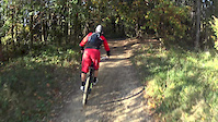
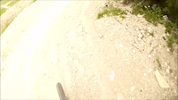
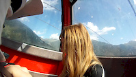
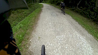
Videos of Toulouse Mountain Bike
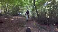
trail: La ferme
5:53 |
80 |
Aug 13, 2018
trail: liaison
8:54 |
295 |
Feb 28, 2017
trail: Bike Park
0:12 |
129 |
Dec 16, 2015
trail: ADN
2:12 |
286 |
Nov 24, 2015
trail: Bike Park
3:03 |
108 |
Jul 8, 2015
trail: Bike Park
9:26 |
226 |
Aug 19, 2014
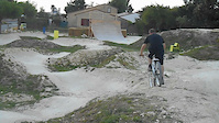
trail: Bike Park
0:34 |
782 |
Aug 13, 2014
trail: ADN
6:41 |
531 |
Aug 2, 2014
Recent Trail Reports
| status | trail | date | condition | info | user |
|---|---|---|---|---|---|
| Descente De Trinque Bandels | Jun 16, 2026 @ 11:37am (Europe/Andorra) Jun 16, 2026 | Very Dry | zaack77 | ||
| Bosc Blanc | Jun 16, 2026 @ 11:37am (Europe/Andorra) Jun 16, 2026 | Dry | zaack77 | ||
| Chemin de Fondeville | Jun 16, 2026 @ 11:37am (Europe/Andorra) Jun 16, 2026 | Dry | zaack77 | ||
| Descente de Pouvourville | Jun 16, 2026 @ 11:37am (Europe/Andorra) Jun 16, 2026 | Very Dry | zaack77 | ||
| Montée de l'antenne | Jun 16, 2026 @ 11:37am (Europe/Andorra) Jun 16, 2026 | Very Dry | zaack77 | ||
| Descente des abeilles | Jun 16, 2026 @ 11:37am (Europe/Andorra) Jun 16, 2026 | Very Dry | zaack77 | ||
| La Connection | Mar 11, 2026 @ 11:35am (Europe/Paris) Mar 11, 2026 | Unknown | Veve | ||
| DH - Petit Joueur | Dec 16, 2025 @ 4:18pm (Europe/Paris) Dec 16, 2025 | Ideal | piparide | ||
| Descente Clermont Le Fort | Sep 10, 2023 @ 6:18am Sep 10, 2023 | Dry | Olivier11 | ||
| Les Pommiers | Jan 14, 2023 @ 12:06am Jan 14, 2023 | Variable | Francois-phl |
Activity Feed
| username | action | type | title | date |
|---|---|---|---|---|
| zaack77 | add | trail | activity #97163350 | Jun 16, 2026 @ 10:29pm Jun 16, 2026 |
| zaack77 | add | report | activity #97113877 and 5 more | Jun 16, 2026 @ 8:49am Jun 16, 2026 |
| trailforks | add | video | activity #95852482 | May 30, 2026 @ 8:00am May 30, 2026 |
| Tejuls275 | ridden | trail | activity #95554204 | May 26, 2026 @ 4:06am May 26, 2026 |
| WillieJacobsz | update | region | activity #94212231 | May 7, 2026 @ 6:07am May 7, 2026 |
Recent Comments
| username | type | title | comment | date |
|---|---|---|---|---|
| trail | Lots of vegetation at this time of the year | Jun 23, 2024 @ 11:01am Jun 23, 2024 | ||
| trail | La Philou jonchée de troncs d’arbres... | Feb 19, 2023 @ 2:57am Feb 19, 2023 | ||
| trail | Video minutes 3 to 5. | May 16, 2021 @ 10:44am May 16, 2021 | ||
| report | Piste un peu laissée à l'abandon, c'est dommage | Apr 5, 2021 @ 11:53pm Apr 5, 2021 | ||
| trail | Rien de bien compliqué, mais certains... | Apr 5, 2021 @ 11:50pm Apr 5, 2021 |
Local Badges
-

10 Green Trails35 awarded -

10 Blue Trails42 awarded -

Epic Ride Climb 2k16 awarded -

Climbing 10k Badge43 awarded -

Climbing 100k Badge2 awarded -

Epic Ride Descent 2k14 awarded
Bike & Skill Parks
| name | type | city | rating |
|---|---|---|---|
| Potager Bike park | skill park | Toulouse | |
| Piste de BMX Blagnac | skill park | Toulouse | |
| Riders inc. | skill park | Toulouse |
Activity Type Stats
| activitytype | trails | distance | descent | descent distance | total vertical | rating | global rank | state rank | photos | reports | routes | ridelogs |
|---|---|---|---|---|---|---|---|---|---|---|---|---|
| Mountain Bike | 85 | 49 miles | 10,722 ft | 24 miles | 886 ft | #1,780 | #37 | 176 | 104 | 3 | 6,857 | |
| E-Bike | 11 | 8 miles | 1,440 ft | 4 miles | 276 ft | #2,893 | #166 | 95 | 2 | 393 | ||
| Horse | 2 | 3,268 ft | 112 ft | 1,654 ft | 121 ft | 10 | ||||||
| Hike | 77 | 45 miles | 10,128 ft | 23 miles | 886 ft | #2,721 | #68 | 102 | 104 | |||
| Trail Running | 77 | 45 miles | 10,128 ft | 23 miles | 886 ft | #2,160 | #59 | 102 | 265 |
Frequently Asked Questions About Toulouse
▼
What are the best places to ride in Toulouse?
Toulouse has 3 areas to explore for mountain biking. The top rated areas are:
▼
What are the highest rated mountain biking trails in Toulouse?
The highest rated mountain biking trails in Toulouse are:
- Enduro Bosc Blanc (4.1/5)
- Descente des abeilles (4.1/5)
- La Philou (4.1/5)
- Le XXL (4.1/5)
- Trail pech-david (3.8/5)
▼
What is the best time of the year to ride in Toulouse?
Based on ride log data, the most popular months to ride in Toulouse are:
- July (20 activities)
- April (20 activities)
- August (15 activities)
▼
Where can I park to ride in Toulouse?
- By EZ-Ridez & contributors
- Admins: Lucas-T
- #6041 - 11,775 views
- toulouse activity log | embed map of Toulouse mountain bike trails | toulouse mountain biking points of interest polygons
Downloading of trail gps tracks in kml & gpx formats is enabled for Toulouse.
You must login to download files.