close
-
Layers w
- Weather Layers
- Pro
- Pro
- Pro
- Pro
- Pro
- Pro
- More Layers
- Pro
- Pro
- Pro
- Pro
-
Upgrade to

3D
Trail Conditions
- Unknown
- Snow Groomed
- Snow Packed
- Snow Covered
- Snow Cover Partial
- Freeze/thaw Cycle
- Icy
- Prevalent Mud
- Wet
- Variable
- Ideal
- Dry
- Very Dry
Trail Flow (Ridden Direction)
Trailforks scans users ridelogs to determine the most popular direction each trail is ridden. A good flowing trail network will have most trails flowing in a single direction according to their intension.
The colour categories are based on what percentage of riders are riding a trail in its intended direction.
The colour categories are based on what percentage of riders are riding a trail in its intended direction.
- > 96%
- > 90%
- > 80%
- > 70%
- > 50%
- < 50%
- bi-directional trail
- no data
Trail Last Ridden
Trailforks scans ridelogs to determine the last time a trail was ridden.
- < 2 days
- < 1 week
- < 2 weeks
- < 1 month
- < 6 months
- > 6 months
Trail Ridden Direction
The intended direction a trail should be ridden.
- Downhill Only
- Downhill Primary
- Both Directions
- Uphill Primary
- Uphill Only
- One Direction
Contribute Details
Colors indicate trail is missing specified detail.
- Description
- Photos
- Description & Photos
- Videos
Trail Popularity ?
Trailforks scans ridelogs to determine which trails are ridden the most in the last 9 months.
Trails are compared with nearby trails in the same city region with a possible 25 colour shades.
Think of this as a heatmap, more rides = more kinetic energy = warmer colors.
- most popular
- popular
- less popular
- not popular
ATV/ORV/OHV Filter
Max Vehicle Width
inches
US Cell Coverage
Legend

Radar Time
Activity Recordings
Trailforks uses anonymized public activity data.
?
Activity Recordings
Trailforks uses anonymized public activity data.
?
Personal Heatmap
▶
Activity Types
all
/
none
▶
Options
2
Date range
month
–
Winter Trails
Warning
A routing network for winter maps does not exist. Selecting trails using the winter trails layer has been disabled.
Missing Trails
Most Popular
Least Popular
Trails are colored based on popularity. The more popular a trail is, the more red. Less popular trails trend towards green.
Jump Magnitude Heatmap
Heatmap of where riders jump on trails. Zoom in to see individual jumps, click circles to view jump details.
BC Backroad Status
![map legend]()
Service Road Atlas is a free to use, community-driven service for viewing and creating reports on the numerous back-country service roads around B.C. and Alberta.

Slope Aspect
Direction the slope faces
Trails Deemphasized
Trails are shown in grey.
Only show trails with no bike usage.
Suggested Layers
Based on selected activity type
Save the current map location and zoom level as your default home location whenever this page is loaded.
SaveThere are several trails around Townsville, each offering a unique experience.
Activities Click to view
- Mountain Bike
152 trails
- E-Bike
142 trails
- Gravel Bike
0 trails
- Adaptive Bike
0 trails
- Winter Fat Bike
0 trails
- Hike
106 trails
- Trail Running
107 trails
- Dirtbike/Moto
4 trails
Region Details
- 30
- 10
- 34
- 42
- 23
- 8
- 2
Region Status
Caution as of Jun 19, 2026Local Trail Association
Stats
- Avg Trail Rating
- Trails (view details)
- 152
- Trails Mountain Bike
- 152
- Trails E-Bike
- 142
- Trails Horse
- 2
- Trails Hike
- 106
- Trails Trail Running
- 107
- Trails Dirtbike/Moto
- 4
- Total Distance
- 193 miles
- Total Descent
- 24,926 ft
- Total Vertical
- 3,077 ft
- Highest Trailhead
- 3,079 ft
- Reports
- 6,570
- Photos
- 768
- Ridden Counter
- 29,117
Sub Regions
-
Alligator Creek
- 2
- 1
-
Bluewater World Heritage Wet Tropics
- 1
- 1
-
Cape Pallarenda
- 2
- 1
- 4
-
Castle Hill
- 1
- 2
- 2
- 1
-
Clemant State Forest
-
Douglas Mountain Bike Park
- 16
- 26
- 17
- 4
- 1
-
Elliot Springs
- 2
-
Hervey's Range
- 2
- 1
- 1
-
Magnetic Island
- 1
- 1
-
Mount Stuart Downhill
- 1
- 1
- 2
-
Pinnacles
-
Ross River Dam
- 11
- 3
Popular Townsville Mountain Biking Trails
• 100 ★ 4.2 • 2 miles • 644 ft • 713 •
A 5% average gradient, easier climb to mid way up the Douglas hill. Take care when descending and be sure to give way to riders heading up.
• 100 ★ 3.4 • 2,933 ft • 105 ft • 543 •
Easy contour trail linking to the Iron Bark hub, overlooking Riverside Ridge estate and water towers.
• 100 ★ 4.3 • 2,959 ft • 140 ft • 526 •
This is to the top of the hill (if you want to ride Rock n Roll). An easy trail with nice long contours to meander up to the summit. It can be ridden in both directions.
• 100 ★ 3.5 • 794 ft • 17 ft • 525 •
Short link between car park to upper middle section of Fruit Loop. Quick access to climbing trails ie: Red Tail Black, Boulderdash, 4wd trail to Flow Trail.
• 85 ★ 3.7 • 2,346 ft • 71 ft • 484 •
Wide dirt track with views out to Magnetic Island, and passing by the historic World War II forts. On the northern end of the track, walk the steps down to Shelley Cove beaches, or veer left onto single track.
• 80 ★ 4.5 • 7 miles • 813 ft • 474 •
This narrow, two-way trail is designed for cross country mountain biking. Walkers must be alert and considerate for mountain bike riders approaching from either direction. At its eastern end, UTR begins 700 m along the Shelly Cove trail...
• 95 ★ 4.2 • 3,917 ft • 8 ft • 468 •
Sweeping descent with bermed corners, pump sections, short rock gardens and rock steps.
Townsville Mountain Bike Routes
★ 3.5 • 10 miles • 1,328 ft • 20 •
Mother Nature forced us off our original course but riders don’t let down your guard. Actually, better...
3 miles • 132 ft • 4 • Loop •
New to mountain biking? This loop of easy trails on flat country is your gateway to a life's journey to...
2 miles • 232 ft • 6 •
An exciting short and fast cross-country racing on 20th March 2022. This format ignites what cross country...
★ 3.0 • 8 miles • 948 ft • 17 • Point to Point •
I created this long green trail for myself as a beginner. This route starts and ends at the carpark. All...
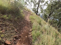
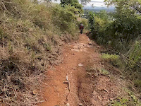
Photos of Townsville Mountain Bike
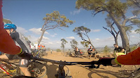
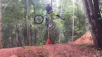
Videos of Townsville Mountain Bike
trail: Oh What A Feeling
0:18 |
16 |
Mar 17, 2026
trail: Under The Radar
0:13 |
94 |
Aug 26, 2022
trail: Lower Wedgetail
0:16 |
277 |
Jun 1, 2019
trail: Lower Wedgetail
0:16 |
212 |
Jun 1, 2019
trail: Hammerhead (Upper)
0:16 |
151 |
Jun 1, 2019
trail: Whiptail
0:16 |
132 |
Jun 1, 2019
trail: Rock and Roll 2 and 3
0:59 |
242 |
Nov 10, 2018
trail: Sticks and Stones
0:36 |
783 |
Sep 19, 2018
Current Trail Warnings
| status | trail | date | condition | user | info |
|---|---|---|---|---|---|
| Ridgeline (Gravity) | Jun 3, 2026 @ 10:44am (Australia/Brisbane) Jun 2, 2026 | Dry | Washed out needs work before interschool... | ||
| Boulderdash | Jun 3, 2026 @ 10:42am (Australia/Brisbane) Jun 2, 2026 | Very Dry | Extremly overgrown needs wippersnipping | ||
| Freshwater trail | May 31, 2026 @ 10:07am (Australia/Brisbane) May 30, 2026 | Unknown | BenSellers | The section of lagoon trail on the dam... |
Recent Trail Reports
Activity Feed
| username | action | type | title | date |
|---|---|---|---|---|
| BaZZa_AGB | add | photo | activity #96839008 and 1 more | Jun 12, 2026 @ 5:37pm Jun 12, 2026 |
| BenSellers | add | report | activity #95898514 and 1 more | May 30, 2026 @ 5:07pm May 30, 2026 |
| o0dv0o | wishlist | route | activity #95833390 | May 30, 2026 @ 3:05am May 30, 2026 |
| Miha-D | add | karma | activity #95460615 | May 24, 2026 @ 6:44pm May 24, 2026 |
| SuziYHDATH | wishlist | trail | activity #95204805 | May 21, 2026 @ 3:42pm May 21, 2026 |
Recent Comments
| username | type | title | comment | date |
|---|---|---|---|---|
| trail | When I was about halfway up the track there... | May 24, 2025 @ 9:14pm May 24, 2025 | ||
| report | Cheers Longo 🙏 | May 7, 2025 @ 4:25am May 7, 2025 | ||
| trail | good trail lots of sharp rocks and definitely... | Sep 12, 2024 @ 3:39am Sep 12, 2024 | ||
| report | Thanks, planning to ride this Sunday | Jul 24, 2024 @ 6:23pm Jul 24, 2024 | ||
| trail | Currently unrideable as it is heavily... | May 8, 2024 @ 6:34pm May 8, 2024 |
Local Badges
-

Top 10 Trails5 awarded -

Descent 100k Badge54 awarded -

Big Ride 30k10,641 awarded -

Epic Ride 50k3,281 awarded -

Descent 10k Badge180 awarded -

Completionist25 awarded
Bike & Skill Parks
| name | type | city | rating |
|---|---|---|---|
| Douglas Skills Park | skill park | Townsville |
Local Products
Local Trail Supporters
- Townsville City Council
- DH Crew
![]()
- Fazza
- Dave Bassingwait
Activity Type Stats
| activitytype | trails | distance | descent | descent distance | total vertical | rating | global rank | state rank | photos | reports | routes | ridelogs |
|---|---|---|---|---|---|---|---|---|---|---|---|---|
| Mountain Bike | 152 | 188 miles | 23,858 ft | 82 miles | 3,077 ft | #112 | #9 | 759 | 6,557 | 22 | 100,490 | |
| E-Bike | 142 | 189 miles | 23,556 ft | 82 miles | 3,077 ft | #250 | #37 | 3 | 6,094 | 2 | 6,391 | |
| Horse | 2 | 7 miles | 223 ft | 3 miles | 46 ft | 3,207 | ||||||
| Hike | 106 | 159 miles | 15,312 ft | 65 miles | 3,077 ft | #806 | #29 | 5 | 5,227 | 2,235 | ||
| Trail Running | 107 | 160 miles | 15,361 ft | 66 miles | 3,077 ft | #598 | #20 | 1 | 5,227 | 2,223 | ||
| Dirtbike/Moto | 4 | 10 miles | 374 ft | 4 miles | 49 ft | #348 | #16 | 3,208 | 5 |
Frequently Asked Questions About Townsville
▼
What are the best places to ride in Townsville?
Townsville has 13 areas to explore for mountain biking. The top rated areas are:
▼
What are the highest rated mountain biking trails in Townsville?
The highest rated mountain biking trails in Townsville are:
- Up The Backside (4.4/5)
- Taipan (4.4/5)
- Westies Track (4.3/5)
- Under The Radar (4.3/5)
- 21 Jump ST (4.2/5)
▼
What is the best time of the year to ride in Townsville?
Based on ride log data, the most popular months to ride in Townsville are:
- July (363 activities)
- August (313 activities)
- June (288 activities)
▼
Where can I park to ride in Townsville?
There are 13 parking locations listed in Townsville. The most popular parking spots are: View all parking and trailhead locations on the map to plan your visit.
Activities
Trails
Points of Interest
- The Forts Command Post Viewpoint
- Mickle's Lookout Viewpoint
- Mount Halifax Summit
- Pick Falls Sight
- Twin Falls Sight
- Sphinx Lookout Viewpoint
- The Forts - Observation Post Viewpoint
- Gun Emplacement Sight
- Gun Emplacement Sight
- Godwins Peak Summit
- Mount Elliot (1,222 m)
- Sharp Elliot (1,182 m)
- Mount Halifax (1,045 m)
- By Longo78
 TRMBC & contributors
 - Admins: TRMBC, Evocoop, broso817
- #9542 - 39,786 views
- townsville activity log | embed map of Townsville mountain bike trails | townsville mountain biking points of interest polygons
Downloading of trail gps tracks in kml & gpx formats is enabled for Townsville.
You must login to download files.