close
-
Layers w
- Weather Layers
- Pro
- Pro
- Pro
- Pro
- Pro
- Pro
- More Layers
- Pro
- Pro
- Pro
- Pro
-
Upgrade to

3D
Trail Conditions
- Unknown
- Snow Groomed
- Snow Packed
- Snow Covered
- Snow Cover Partial
- Freeze/thaw Cycle
- Icy
- Prevalent Mud
- Wet
- Variable
- Ideal
- Dry
- Very Dry
Trail Flow (Ridden Direction)
Trailforks scans users ridelogs to determine the most popular direction each trail is ridden. A good flowing trail network will have most trails flowing in a single direction according to their intension.
The colour categories are based on what percentage of riders are riding a trail in its intended direction.
The colour categories are based on what percentage of riders are riding a trail in its intended direction.
- > 96%
- > 90%
- > 80%
- > 70%
- > 50%
- < 50%
- bi-directional trail
- no data
Trail Last Ridden
Trailforks scans ridelogs to determine the last time a trail was ridden.
- < 2 days
- < 1 week
- < 2 weeks
- < 1 month
- < 6 months
- > 6 months
Trail Ridden Direction
The intended direction a trail should be ridden.
- Downhill Only
- Downhill Primary
- Both Directions
- Uphill Primary
- Uphill Only
- One Direction
Contribute Details
Colors indicate trail is missing specified detail.
- Description
- Photos
- Description & Photos
- Videos
Trail Popularity ?
Trailforks scans ridelogs to determine which trails are ridden the most in the last 9 months.
Trails are compared with nearby trails in the same city region with a possible 25 colour shades.
Think of this as a heatmap, more rides = more kinetic energy = warmer colors.
- most popular
- popular
- less popular
- not popular
ATV/ORV/OHV Filter
Max Vehicle Width
inches
US Cell Coverage
Legend

Radar Time
Activity Recordings
Trailforks uses anonymized public activity data.
?
Activity Recordings
Trailforks uses anonymized public activity data.
?
Personal Heatmap
▶
Activity Types
all
/
none
▶
Options
2
Date range
month
–
Winter Trails
Warning
A routing network for winter maps does not exist. Selecting trails using the winter trails layer has been disabled.
Missing Trails
Most Popular
Least Popular
Trails are colored based on popularity. The more popular a trail is, the more red. Less popular trails trend towards green.
Jump Magnitude Heatmap
Heatmap of where riders jump on trails. Zoom in to see individual jumps, click circles to view jump details.
BC Backroad Status
![map legend]()
Service Road Atlas is a free to use, community-driven service for viewing and creating reports on the numerous back-country service roads around B.C. and Alberta.

Slope Aspect
Direction the slope faces
Trails Deemphasized
Trails are shown in grey.
Only show trails with no bike usage.
Suggested Layers
Based on selected activity type
Save the current map location and zoom level as your default home location whenever this page is loaded.
Save
No description for Trapagaran has been added yet!
Login or register to submit one.
This region uses the Uk/Euro style trail grading system.
Activities Click to view
- Mountain Bike
245 trails
- E-Bike
242 trails
- Adaptive Bike
0 trails
- Horse
9 trails
- Hike
244 trails
- Trail Running
244 trails
Region Details
- 82
- 42
- 75
- 35
- 10
Region Status
Open as of 1 dayStats
- Avg Trail Rating
- Trails (view details)
- 244
- Trails Mountain Bike
- 245
- Trails E-Bike
- 242
- Trails Horse
- 9
- Trails Hike
- 244
- Trails Trail Running
- 244
- Trails Dirtbike/Moto
- 3
- Trails Observed Trials
- 2
- Trails ATV/ORV/OHV
- 1
- Total Distance
- 192 miles
- Total Descent Distance
- 87 miles
- Total Descent
- 50,240 ft
- Total Vertical
- 2,816 ft
- Highest Trailhead
- 2,837 ft
- Reports
- 1,498
- Photos
- 240
- Ridden Counter
- 9,373
Sub Regions
-
Montes de Triano
- 42
- 75
- 35
- 10
Popular Trapagaran Mountain Biking Trails
• 100 ★ 4.6 • 3,225 ft • 0 ft • 198 •
Parte baja de Pulmón, a partir de la pista principal. Cruza el remonte de subida en varias ocasiones, con tramos con flow y algunos pasos verticales y con raíces. Recuperada en enero de 2022 tras las talas de 2021
• 100 ★ 4.5 • 1,276 ft • 3 ft • 179 •
Bajada típica desde la pista de la ladera del Ganeran, baja la Pedales de Hierro por ahí y lo suelen arreglar. Las motos suben a veces y lo estropean. Tras cruzar dos pistas hay otro sendero ratonero con curvas entre árboles.
• 100 ★ 4.8 • 2,244 ft • 0 ft • 171 •
Nueva bajada abierta por Trailbuilders de la zona, con zonas de curvas enlazadas y peraltadas muy divertidas. REacondicionada en Febrero 2022
• 95 ★ 4.8 • 2,782 ft • 13 ft • 153 •
Zona ténica de la martxa Pulmón de Acero (Bibebike). Empieza en un camino ancho que se estecha y girando a la derecha han desbrozado una zona estrecha, rota y rápida con algún drop de rocas y una pequeña subida casi al final. Es...
• 100 ★ 5.0 • 18 miles • 2,098 ft • 143 •
Via verde de montes de hierro que sigue el trazado de un antiguo ferrocarril minero. Comienza en Gallarta y termina en la estación de tren de Traslaviña. Sencillo y sin complicación mas allá de su longitud. Recorre varios túneles...
• 95 ★ 3.0 • 456 ft • 35 ft • 132 •
Subida no muy empinada entre pinos, paralela a pero más corta. Se baja bien en XC incluso.
• 95 ★ 4.9 • 2,667 ft • 0 ft • 127 •
Bonita línea de bajada abierta en 2023 por trailbuilders locales ante la desaparición de la parte superior del Jardín. Peraltes, , saltos y muchas curvas enlazadas en una bajada muy buena. Tiene un par de pasos con mucha pendiente...
Trapagaran Mountain Bike Routes
★ 4.0 • 23 miles • 4,140 ft • 6 • Loop •
Marcha Pulmon de acero 2022
24 miles • 4,983 ft • 29 • Loop •
Ruta que enlaza las mejores bajadas endureras a fecha de Octubre 2025. Saliendo de Trapagaran, donde...
★ 2.4 • 26 miles • 5,644 ft • 17 • Loop •
Completísima compilación de bajadas por los montes de Triano, con una subida larga inicial y varios...
14 miles • 3,867 ft • 5 • Loop •
Apuko Igoera Zaramillo Enkarterri (AIZE) es un evento deportivo de montaña que tiene lugar en Zaramillo,...
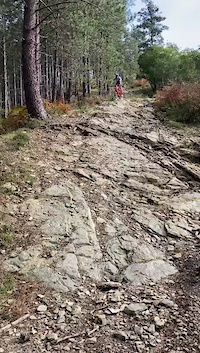
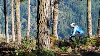
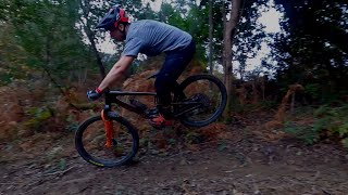
Photos of Trapagaran Mountain Bike
Videos of Trapagaran Mountain Bike
trail: Roca Castaños Erreka
0:09 |
27 |
Oct 31, 2020
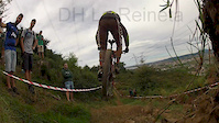
trail: La Reineta
3:36 |
243 |
Oct 10, 2013
trail: La Reineta
5:29 |
69 |
Dec 8, 2025 , Trapagaran
trail: La Calavera
6:37 |
59 |
Dec 8, 2025 , Trapagaran

trail: El Tojo
2:01 |
235 |
Jan 4, 2024 , Trapagaran
trail: Shepherds' Line
0:15 |
243 |
Nov 1, 2023 , Trapagaran
trail: Castaños Trail
0:04 |
324 |
Dec 25, 2021 , Trapagaran

trail: Pulmón Superior
0:09 |
294 |
Dec 24, 2021 , Trapagaran
Recent Trail Reports
| status | trail | date | condition | info | user |
|---|---|---|---|---|---|
| PH5 Burtzako Oiola | Jun 18, 2026 @ 6:45pm (Europe/Madrid) 1 day | Ideal | IbaiuzluNY | ||
| Pulmón Central | Jun 18, 2026 @ 6:44pm (Europe/Madrid) 1 day | Dry | IbaiuzluNY | ||
| Pulmón Superior | Jun 18, 2026 @ 6:44pm (Europe/Madrid) 1 day | Dry | IbaiuzluNY | ||
| La Calavera | Jun 18, 2026 @ 6:44pm (Europe/Madrid) 1 day | Dry | IbaiuzluNY | ||
| Parking Inferior | Jun 17, 2026 @ 5:36pm (Europe/Madrid) 2 days | Dry | IbaiuzluNY | ||
| Parking Superior | Jun 17, 2026 @ 5:15pm (Europe/Madrid) 2 days | Dry | IbaiuzluNY | ||
| La Reineta | Jun 17, 2026 @ 5:14pm (Europe/Madrid) 2 days | Dry | IbaiuzluNY | ||
| Río Angustias | Jun 7, 2026 @ 9:31am (Europe/Madrid) Jun 7, 2026 | Ideal | zigor-ark | ||
| El Jardín | Jun 7, 2026 @ 9:31am (Europe/Madrid) Jun 7, 2026 | Ideal | zigor-ark | ||
| Shepherds' Line | Jun 7, 2026 @ 9:31am (Europe/Madrid) Jun 7, 2026 | Ideal | zigor-ark |
Activity Feed
| username | action | type | title | date |
|---|---|---|---|---|
| GTX44 | wishlist | route | activity #97264357 | Jun 18, 2026 @ 11:11am 1 day |
| IbaiuzluNY | add | report | activity #97258611 and 3 more | Jun 18, 2026 @ 9:44am 1 day |
| IbaiuzluNY | add | report | activity #97184950 and 3 more | Jun 17, 2026 @ 8:14am 2 days |
| JorgezPVnRo | ridden | trail | activity #97159630 | Jun 16, 2026 @ 8:23pm 3 days |
| Pd2AUO | difficultyvote | trail | activity #97096955 | Jun 16, 2026 @ 3:21am Jun 16, 2026 |
Recent Comments
| username | type | title | comment | date |
|---|---|---|---|---|
| trail | Mira los reportes de hoy... vía libre ;-) | Mar 29, 2026 @ 8:38am Mar 29, 2026 | ||
| trail | Alguien sabe si han retirado ya los árboles?... | Mar 28, 2026 @ 9:33pm Mar 28, 2026 | ||
| trail | Alguien sabe si han retirado ya el árbol? El... | Mar 28, 2026 @ 9:31pm Mar 28, 2026 | ||
| trail | Bajada que en su mayor parte va por subidas de... | Mar 8, 2026 @ 9:18am Mar 8, 2026 | ||
| report | Vale, perfecto 💪🏻 | Feb 20, 2026 @ 6:07am Feb 20, 2026 |
Local Badges
-

Completionist0 awarded -

Epic Mountain Bike Climb 2k263 awarded -

Climbing 10k Badge106 awarded -

Mountain Biking 100k Badge8 awarded -

Epic Ride Descent 2k263 awarded -

Descent 10k Badge105 awarded
Bike & Skill Parks
| name | type | city | rating |
|---|---|---|---|
| Pista BMX Trapagaran | skill park | Trapagaran | |
| Repelega Pumptrack | skill park | Trapagaran | |
| Pumptrack y línea de saltos velódromo de Trapagaran | skill park | Trapagaran |
Activity Type Stats
| activitytype | trails | distance | descent | descent distance | total vertical | rating | global rank | state rank | photos | reports | routes | ridelogs |
|---|---|---|---|---|---|---|---|---|---|---|---|---|
| Mountain Bike | 245 | 192 miles | 50,240 ft | 87 miles | 2,815 ft | #862 | #95 | 238 | 1,498 | 4 | 9,046 | |
| E-Bike | 242 | 190 miles | 49,232 ft | 85 miles | 2,815 ft | #439 | #138 | 2 | 1,464 | 2 | 1,758 | |
| Horse | 9 | 3 miles | 1,155 ft | 2 miles | 1,824 ft | #1,712 | #142 | 19 | ||||
| Hike | 244 | 192 miles | 50,138 ft | 86 miles | 2,815 ft | #829 | #114 | 1,472 | 341 | |||
| Trail Running | 244 | 192 miles | 50,138 ft | 86 miles | 2,815 ft | #577 | #109 | 1,476 | 204 | |||
| Dirtbike/Moto | 3 | 1 mile | 617 ft | 4,675 ft | 1,204 ft | 10 | ||||||
| Observed Trials | 2 | 1,634 ft | 20 ft | 715 ft | 69 ft | |||||||
| ATV/ORV/OHV | 1 | 502 ft | 13 ft | 226 ft | 20 ft | 10 |
Frequently Asked Questions About Trapagaran
▼
What are the best places to ride in Trapagaran?
Trapagaran has 1 areas to explore for mountain biking. The top rated areas are:
▼
What are the highest rated mountain biking trails in Trapagaran?
The highest rated mountain biking trails in Trapagaran are:
- Shepherds' Line (4.4/5)
- Pulmón Central (4.3/5)
- Pulmón Superior (4.3/5)
- Pulmón Inferior (4.3/5)
- El Jardín (4.3/5)
▼
What is the best time of the year to ride in Trapagaran?
Based on ride log data, the most popular months to ride in Trapagaran are:
- October (56 activities)
- December (45 activities)
- May (40 activities)
▼
Where can I park to ride in Trapagaran?
There are 9 parking locations listed in Trapagaran. The most popular parking spots are:
- Aparcamiento Peñas Negras
- Parking El Regato
- Aparcamiento Gorostiza
- Aparcamiento MegaPark ( Barakaldo )
- Aparcamiento Argalario
Activities
Trails
Points of Interest
- By zaldun & contributors
- Admins: Altavoz, krasty1002, Altavoz, krasty1002, lagar1977
- #44832 - 1,547 views
- trapagaran activity log | embed map of Trapagaran mountain bike trails | trapagaran mountain biking points of interest
Downloading of trail gps tracks in kml & gpx formats is enabled for Trapagaran.
You must login to download files.