close
-
Layers w
- Weather Layers
- Pro
- Pro
- Pro
- Pro
- Pro
- Pro
- More Layers
- Pro
- Pro
- Pro
- Pro
-
Upgrade to

3D
Trail Conditions
- Unknown
- Snow Groomed
- Snow Packed
- Snow Covered
- Snow Cover Partial
- Freeze/thaw Cycle
- Icy
- Prevalent Mud
- Wet
- Variable
- Ideal
- Dry
- Very Dry
Trail Flow (Ridden Direction)
Trailforks scans users ridelogs to determine the most popular direction each trail is ridden. A good flowing trail network will have most trails flowing in a single direction according to their intension.
The colour categories are based on what percentage of riders are riding a trail in its intended direction.
The colour categories are based on what percentage of riders are riding a trail in its intended direction.
- > 96%
- > 90%
- > 80%
- > 70%
- > 50%
- < 50%
- bi-directional trail
- no data
Trail Last Ridden
Trailforks scans ridelogs to determine the last time a trail was ridden.
- < 2 days
- < 1 week
- < 2 weeks
- < 1 month
- < 6 months
- > 6 months
Trail Ridden Direction
The intended direction a trail should be ridden.
- Downhill Only
- Downhill Primary
- Both Directions
- Uphill Primary
- Uphill Only
- One Direction
Contribute Details
Colors indicate trail is missing specified detail.
- Description
- Photos
- Description & Photos
- Videos
Trail Popularity ?
Trailforks scans ridelogs to determine which trails are ridden the most in the last 9 months.
Trails are compared with nearby trails in the same city region with a possible 25 colour shades.
Think of this as a heatmap, more rides = more kinetic energy = warmer colors.
- most popular
- popular
- less popular
- not popular
ATV/ORV/OHV Filter
Max Vehicle Width
inches
US Cell Coverage
Legend

Radar Time
Activity Recordings
Trailforks uses anonymized public activity data.
?
Activity Recordings
Trailforks uses anonymized public activity data.
?
Personal Heatmap
▶
Activity Types
all
/
none
▶
Options
2
Date range
month
–
Winter Trails
Warning
A routing network for winter maps does not exist. Selecting trails using the winter trails layer has been disabled.
Missing Trails
Most Popular
Least Popular
Trails are colored based on popularity. The more popular a trail is, the more red. Less popular trails trend towards green.
Jump Magnitude Heatmap
Heatmap of where riders jump on trails. Zoom in to see individual jumps, click circles to view jump details.
BC Backroad Status
![map legend]()
Service Road Atlas is a free to use, community-driven service for viewing and creating reports on the numerous back-country service roads around B.C. and Alberta.

Slope Aspect
Direction the slope faces
Trails Deemphasized
Trails are shown in grey.
Only show trails with no bike usage.
Suggested Layers
Based on selected activity type
Save the current map location and zoom level as your default home location whenever this page is loaded.
Save
No description for Tremalzo has been added yet!
Login or register to submit one.
This region uses the Uk/Euro style trail grading system.
Activities Click to view
- Mountain Bike
19 trails
- E-Bike
12 trails
- Adaptive Bike
0 trails
- Hike
19 trails
- Trail Running
18 trails
Region Details
- 6
- 1
- 1
- 5
Region Status
Open as of Jun 7, 2026Stats
- Avg Trail Rating
- Trails (view details)
- 19
- Trails Mountain Bike
- 19
- Trails E-Bike
- 12
- Trails Horse
- 2
- Trails Hike
- 19
- Trails Trail Running
- 18
- Total Distance
- 30 miles
- Total Descent
- 23,154 ft
- Total Vertical
- 3,596 ft
- Highest Trailhead
- 5,700 ft
- Reports
- 146
- Photos
- 65
- Ridden Counter
- 680
Sub Regions
-
Valle di Ledro
- 1
- 1
- 4
Popular Tremalzo Mountain Biking Trails
• 90 ★ 1.5 • 1 mile • 0 ft • 159 •
Gravel road, be careful at the beginning becouse is very steep and loose.
• 60 ★ 3.8 • 2 miles • 888 ft • 93 •
Easy trail good alternative to the classical tremalzo tour. The track end in proximity of a crossroad where the trail normally goes down on the right. it's an up&down trail.
• 65 ★ 4.9 • 3 miles • 0 ft • 86 •
Highly rated moderately popular red difficulty alpine singletrack. This multi-use trail can be used downhill only and has a hard overall physical rating with a 0 ft double black diamond climb. It features rock face and rock garden. Trail visibility is always easy to follow. On average it takes 44 minutes to complete this trail.
• 80 ★ 4.2 • 2 miles • 77 ft • 76 •
Trail with flow and nice section and some techincal but rideable steep and rootsy sections.
• 70 ★ 4.8 • 4,482 ft • 0 ft • 62 •
Similar to , it has some quite steep parts and some quite technical rock roll but nothing too difficult. Mainly used after
• 75 ★ 4.4 • 1 mile • 256 ft • 61 •
The First part is very nice smooth and flowy, then the trail become steep and technical with some loose stones and it finish into a creek.
• 45 ★ 3.0 • 2 miles • 446 ft • 52 •
Moderately popular blue difficulty alpine singletrack. This multi-use trail can be used downhill only and has a moderate overall physical rating. It features teeter totter. Trail visibility is sometimes hard to follow. On average it takes 35 minutes to complete this trail.
• 30 ★ 4.3 • 2 miles • 113 ft • 43 • • hike
Highly rated less popular blue difficulty singletrack. This hike primary trail can be used downhill only. It features rock face and rock garden. Trail visibility is always easy to follow. On average it takes 47 minutes to complete this trail.
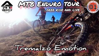
Photos of Tremalzo Mountain Bike
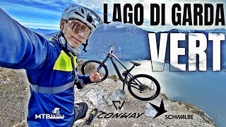
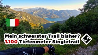
Videos of Tremalzo Mountain Bike

trail: Nota-Pregasina
14:41 |
7 |
Apr 30, 2026 , Tremalzo

trail: Prà della Rosa
18:07 |
40 |
Nov 22, 2025 , Tremalzo
trail: Prà della Rosa
13:12 |
35 |
Nov 9, 2025 , Tremalzo
trail: Creste di Reamol
19:35 |
256 |
Apr 13, 2024 , Tremalzo
youtuber
![Riding the toughest trail at Lago di Ledro -...]()

trail: Sentiero 454
4:33 |
485 |
Sep 22, 2022 , Tremalzo
youtuber
![Sentiero 454 - Lago Di Ledro | Ein episches...]()
trail: Lenzumo - Bocca Trat
22:00 |
513 |
May 13, 2022 , Tremalzo
trail: Sentiero 454
20:04 |
1457 |
Oct 29, 2019 , Tremalzo
Recent Trail Reports
| status | trail | date | condition | info | user |
|---|---|---|---|---|---|
| Variante 416 exit | Jun 7, 2026 @ 4:56pm (Europe/Rome) Jun 7, 2026 | Unknown | O9M9Q2 | ||
| Strada forestale Rossat e Preghen | May 30, 2026 @ 10:23am (Europe/Vaduz) May 30, 2026 | Ideal | LarsN | ||
| Lenzumo - Bocca Trat | May 30, 2026 @ 10:23am (Europe/Vaduz) May 30, 2026 | Dry | LarsN | ||
| Le Erte | May 8, 2026 @ 2:41pm (Europe/Rome) May 8, 2026 | Variable | mrluz | ||
| Prà della Rosa | May 7, 2026 @ 10:59pm (Europe/Rome) May 7, 2026 | Wet | mrluz | ||
| Val Fontanine | May 7, 2026 @ 10:36pm (Europe/Rome) May 7, 2026 | Wet | mrluz | ||
| Nota-Pregasina | Apr 17, 2026 @ 11:47am (Europe/Rome) Apr 17, 2026 | Ideal | mistik-mike | ||
| Ciclabile Valle di Ledro | Dec 9, 2025 @ 10:48am (Europe/Rome) Dec 9, 2025 | Variable | micheletraversi SGREBENZONE | ||
| Sentiero Botanico | Oct 3, 2025 @ 10:30am (Europe/Rome) Oct 3, 2025 | Variable | kcyw | ||
| Variante 416 | Aug 23, 2025 @ 11:35am Aug 23, 2025 | Dry | jack-sprogis |
Activity Feed
| username | action | type | title | date |
|---|---|---|---|---|
| Berschel | wishlist | trail | activity #97133402 | Jun 16, 2026 @ 1:03pm Jun 16, 2026 |
| janlieberam | wishlist | region | activity #96852051 | Jun 13, 2026 @ 12:33am Jun 13, 2026 |
| j3ronimo | wishlist | trail | activity #96696182 | Jun 10, 2026 @ 2:26pm Jun 10, 2026 |
| O9M9Q2 | add | report | activity #96461061 | Jun 7, 2026 @ 7:56am Jun 7, 2026 |
| O9M9Q2 | ridden | trail | activity #96371292 | Jun 6, 2026 @ 8:02am Jun 6, 2026 |
Recent Comments
| username | type | title | comment | date |
|---|---|---|---|---|
| trail | Purtroppo molto sporca e poco... | Nov 10, 2025 @ 2:01am Nov 10, 2025 | ||
| trail | Hi, what route did you take up there? | Aug 2, 2025 @ 2:49am Aug 2, 2025 | ||
| trail | Very scenic trail, technically not very... | Jul 3, 2025 @ 8:27am Jul 3, 2025 | ||
| trail | Good to start with to continue with the red... | May 3, 2025 @ 6:26am May 3, 2025 | ||
| trail | This trail is not even a trail. It’s a... | Apr 30, 2025 @ 6:49am Apr 30, 2025 |
Local Badges
-

Epic Mountain Bike Climb 2k1 awarded -

Climbing 10k Badge0 awarded -

Mountain Biking 100k Badge0 awarded -

Epic Ride Descent 2k1 awarded -

Descent 10k Badge0 awarded -

Descent 100k Badge0 awarded
Activity Type Stats
| activitytype | trails | distance | descent | descent distance | total vertical | rating | global rank | state rank | photos | reports | routes | ridelogs |
|---|---|---|---|---|---|---|---|---|---|---|---|---|
| Mountain Bike | 19 | 30 miles | 23,153 ft | 21 miles | 3,596 ft | #4,471 | #298 | 43 | 146 | 1,565 | ||
| E-Bike | 12 | 15 miles | 6,401 ft | 8 miles | 3,100 ft | #2,550 | #241 | 22 | 110 | 300 | ||
| Horse | 2 | 8 miles | 928 ft | 2 miles | 2,562 ft | 13 | ||||||
| Hike | 19 | 30 miles | 23,153 ft | 21 miles | 3,596 ft | #5,998 | #295 | 146 | 197 | |||
| Trail Running | 18 | 26 miles | 22,999 ft | 20 miles | 3,596 ft | #5,995 | #320 | 145 | 13 |
Frequently Asked Questions About Tremalzo
▼
What are the best places to ride in Tremalzo?
Tremalzo has 1 areas to explore for mountain biking. The top rated areas are:
▼
What are the highest rated mountain biking trails in Tremalzo?
The highest rated mountain biking trails in Tremalzo are:
- Sentiero 454 (4.5/5)
- Variante 416 (4.2/5)
- Val Fontanine (4.2/5)
- Sentiero Botanico (4.1/5)
- Caset Trail (4/5)
▼
What is the best time of the year to ride in Tremalzo?
Based on ride log data, the most popular months to ride in Tremalzo are:
- September (8 activities)
- July (8 activities)
- August (7 activities)
▼
Where can I park to ride in Tremalzo?
Activities
Trails
Points of Interest
- By orobictrails-valebg
 & contributors
 - Admins: caval, larry81541, micheletraversi
- #63618 - 1,452 views
- tremalzo activity log | embed map of Tremalzo mountain bike trails | tremalzo mountain biking points of interest
Downloading of trail gps tracks in kml & gpx formats is enabled for Tremalzo.
You must login to download files.