close
-
Layers w
- Weather Layers
- Pro
- Pro
- Pro
- Pro
- Pro
- Pro
- More Layers
- Pro
- Pro
- Pro
- Pro
-
Upgrade to

3D
Trail Conditions
- Unknown
- Snow Groomed
- Snow Packed
- Snow Covered
- Snow Cover Partial
- Freeze/thaw Cycle
- Icy
- Prevalent Mud
- Wet
- Variable
- Ideal
- Dry
- Very Dry
Trail Flow (Ridden Direction)
Trailforks scans users ridelogs to determine the most popular direction each trail is ridden. A good flowing trail network will have most trails flowing in a single direction according to their intension.
The colour categories are based on what percentage of riders are riding a trail in its intended direction.
The colour categories are based on what percentage of riders are riding a trail in its intended direction.
- > 96%
- > 90%
- > 80%
- > 70%
- > 50%
- < 50%
- bi-directional trail
- no data
Trail Last Ridden
Trailforks scans ridelogs to determine the last time a trail was ridden.
- < 2 days
- < 1 week
- < 2 weeks
- < 1 month
- < 6 months
- > 6 months
Trail Ridden Direction
The intended direction a trail should be ridden.
- Downhill Only
- Downhill Primary
- Both Directions
- Uphill Primary
- Uphill Only
- One Direction
Contribute Details
Colors indicate trail is missing specified detail.
- Description
- Photos
- Description & Photos
- Videos
Trail Popularity ?
Trailforks scans ridelogs to determine which trails are ridden the most in the last 9 months.
Trails are compared with nearby trails in the same city region with a possible 25 colour shades.
Think of this as a heatmap, more rides = more kinetic energy = warmer colors.
- most popular
- popular
- less popular
- not popular
ATV/ORV/OHV Filter
Max Vehicle Width
inches
US Cell Coverage
Legend

Radar Time
Activity Recordings
Trailforks uses anonymized public activity data.
?
Activity Recordings
Trailforks uses anonymized public activity data.
?
Personal Heatmap
▶
Activity Types
all
/
none
▶
Options
2
Date range
month
–
Winter Trails
Warning
A routing network for winter maps does not exist. Selecting trails using the winter trails layer has been disabled.
Missing Trails
Most Popular
Least Popular
Trails are colored based on popularity. The more popular a trail is, the more red. Less popular trails trend towards green.
Jump Magnitude Heatmap
Heatmap of where riders jump on trails. Zoom in to see individual jumps, click circles to view jump details.
BC Backroad Status
![map legend]()
Service Road Atlas is a free to use, community-driven service for viewing and creating reports on the numerous back-country service roads around B.C. and Alberta.

Slope Aspect
Direction the slope faces
Trails Deemphasized
Trails are shown in grey.
Only show trails with no bike usage.
Suggested Layers
Based on selected activity type
Save the current map location and zoom level as your default home location whenever this page is loaded.
SaveLa provincia autonoma di Trento, comunemente nota come Trentino è una provincia italiana del Trentino-Alto Adige di 545 183 abitanti, con capoluogo Trento, essa confina a nord con la provincia autonoma di Bolzano (Alto Adige), a est e a sud con le province venete di Belluno, Vicenza e Verona, e a ovest con le province lombarde di Brescia e Sondrio.
Insieme allo stato federato austriaco del Tirolo e all'Alto Adige/Südtirol costituisce l'Euregio Tirolo-Alto Adige-Trentino: un progetto di collaborazione transfrontaliera ed Ente di diritto comunitario che interessa il territorio della regione storica del Tirolo.
Come parte del Trentino-Alto Adige, insieme al Veneto e al Friuli-Venezia Giulia, viene incluso nelle cosiddette Tre Venezie (o Triveneto), la cui denominazione, caldeggiata in particolare nel periodo successivo all'annessione del territorio all'Italia, traeva ispirazione dalla Regio X Venetia et Histria di età imperiale romana. La regione storico-geografica trentina fu già municipium romano, ducato longobardo e contea carolingia, quindi parte del principato vescovile di Trento in seno al Sacro Romano Impero (secoli XI-XIX), infine per circa un secolo (1815-1918 ) parte meridionale, linguisticamente romanza, del Tirolo, prima austriaco, poi austro-ungarico. Il territorio annesso al Regno d'Italia nel 1919, secondo quanto stabilito dal trattato di Saint-Germain-en-Laye stipulato in seguito al primo conflitto mondiale, andò a formare la regione denominata Venezia Tridentina.
In Trentino si parla soprattutto l'italiano, ma è diffuso il dialetto trentino, parlato nei centri principali e nelle valli (dove si possono riscontrare varianti dalle differenze anche piuttosto marcate). Nel territorio sono presenti minoranze linguistiche germanofone (lingua mochena nella valle dei Mocheni e lingua cimbra nel comune di Luserna negli altipiani cimbri) e ladine (Val di Fassa) ufficialmente riconosciute. Al censimento linguistico del 2011 più di settemila abitanti della Val di Non e della Val di Sole si sono anch'essi dichiarati di lingua ladina, ma senza alcun riconoscimento giuridico.
source: Wikipedia
eBikes Allowed:
Yes
AKA: Trentino
This region uses the Uk/Euro style trail grading system.
Activities Click to view
- Mountain Bike
1,230 trails
- E-Bike
1,213 trails
- Gravel Bike
74 trails
- Horse
98 trails
- Hike
1,235 trails
- Trail Running
1,236 trails
- Dirtbike/Moto
11 trails
- Observed Trials
20 trails
- ATV/ORV/OHV
4 trails
- Snowmobile
1 trails
- Snowshoe
11 trails
- Downhill Ski
527 trails
- Backcountry Ski
20 trails
- Nordic Ski
7 trails
Region Details
- 374
- 58
- 192
- 347
- 83
- 110
- 16
Stats
- Avg Trail Rating
- Trails (view details)
- 2,002
- Trails Mountain Bike
- 1,241
- Trails E-Bike
- 1,213
- Trails Gravel Bike
- 74
- Trails Horse
- 98
- Trails Hike
- 1,235
- Trails Trail Running
- 1,236
- Trails Dirtbike/Moto
- 11
- Trails Observed Trials
- 20
- Trails ATV/ORV/OHV
- 4
- Trails Snowmobile
- 1
- Trails Snowshoe
- 11
- Trails Downhill Ski
- 527
- Trails Backcountry Ski
- 20
- Trails Nordic Ski
- 7
- Total Distance
- 2,690 miles
- Total Descent
- 1,228,835 ft
- Total Vertical
- 10,960 ft
- Highest Trailhead
- 11,163 ft
- Reports
- 10,439
- Photos
- 3,655
- Ridden Counter
- 177,056
Articles
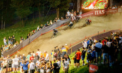
Race Report: 4X ProTour 2025 - Round 1: Val Di Sole, Italy
Jun 26, 2025 from pinkbike.com
The first round of 4x action went down under the lights over the weekend.
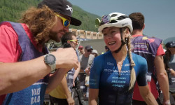
Video: WynTV Val Di Sole XCO World Cup 2025
Jun 23, 2025 from pinkbike.com
All the post-race reactions from a tough race in Italy.

Video: Ben Cathro Gets Us Up to Speed – Val di Sole
Jun 18, 2025 from pinkbike.com
Technical fresh terrain, questionable weather and a surprise announcement.
Video: Jesse Melamed Gives Questionable Cooking Advice in Val di Fassa - The Jank Files S4E3
Jun 30, 2022 from pinkbike.com
The Rocky Mountain Race Face Team takes on the Dolomites, and .
Popular Trail Networks
view all areas »Sub Regions
- Andalo (75)
- Andalo ZONE (23)
- Dolomiti Paganella Bike (43)
- Arco (34)
- Baselga di Pine' (139)
- Costalta (1)
- Sgreben Zone (134)
- Bellamonte (0)
- Borgo Valsugana (3)
- Tesino (2)
- Brentonico (3)
- Campitello (12)
- Canal San Bovo (2)
- Canazei (46)
- Fassa Bike District (40)
- Caoria (30)
- Vanoi (30)
- Cavalese (3)
- Civezzano (7)
- Santa Colomba (39)
- Cles (12)
- Val di Non (12)
- Commezzadura (102)
- Faedo (12)
- Monte Corona (11)
- Fai Della Paganella (24)
- Fai ZONE (21)
- Folgaria (10)
- Alpe Cimbra (1)
- Folgaride (2)
- Imèr (3)
- Comunità di Primiero (93)
- Lavarone (14)
- Levico Terme (59)
- Colle di Tenna (14)
- Croz de l'Anza Rossa (8)
- Panarotta (26)
- Pineta di Caldonazzo (8)
- Madonna Di Campiglio (23)
- Mezzolombardo (5)
- Moena (0)
- Molveno (25)
- Molveno Zone (13)
- Mori (6)
- Passo Del Tonale (7)
- Peio (0)
- Pergine Valsugana (53)
- Canzolin (16)
- Castel de Perzen (13)
- Valle dei Mocheni (12)
- Pinzolo (16)
- Brenta Bike Park (6)
- Val Rendena (10)
- Pomarolo (44)
- Pozza di Fassa (3)
- Penia (1)
- Ranzo (2)
- Ravina (1)
- Riva Del Garda (1)
- Rovereto (45)
- Rovereto AllSeasons (25)
- Val Terragnolo (5)
- Zugna (12)
- San Martino Di Castrozza (33)
- Sarche (48)
- Comano Terme (2)
- Trail Center Pietramurata (4)
- Valle del Sarca (41)
- Sèn Jan (1)
- Soraga (2)
- Terlago (51)
- Sorasass (22)
- Tione (10)
- Val Daone (3)
- Valle del Chiese (1)
- Torbole (112)
- Tremalzo (19)
- Valle di Ledro (17)
- Trento (121)
- Calisio (18)
- Marzola (30)
- Monte Bondone (12)
- Vigolo Vattaro (11)
- Volano (16)
- Volano Bikes (15)
Popular Trento Mountain Biking Trails
• 95 ★ 3.9 • 2 miles • 8 ft • 2,227 •
Flow trail in the Andalo Zone, from Doss Pelà to Dosson; From Dosson you can continue down to Andalo riding along the trail .
• 95 ★ 4.3 • 2 miles • 4 ft • 2,175 •
The first trail of the Andalo Zone, a long trail from the middle station of the gondola Andalo-Doss Pelà to the town centre.
• 100 ★ 4.7 • 1 mile • 11 ft • 1,966 •
An intermediate flow trail that can be funny for all riders, from beginner to pro!
• 100 ★ 4.1 • 2 miles • 277 ft • 1,782 •
famous military road. shared double track with hikers.
• 100 ★ 4.1 • 2 miles • 11 ft • 1,766 •
The most awesome flow trail of FAI zone riding area!
• 90 ★ 3.8 • 3,606 ft • 17 ft • 1,384 •
Popular red difficulty singletrack. This mountain bike primary trail can be used downhill only and has a moderate overall physical rating. It features berm and jump. Trail visibility is always easy to follow. On average it takes 4 minutes to complete this trail.
Trento Mountain Bike Routes
Stramaiolo Trail Tour Featured
★ 5.0 • 13 miles • 4,148 ft • 6 • Loop •
Partenza da località Centrale di Bedollo, si sale attraverso strada asfaltata fino a . Da li parte il...
★ 4.0 • 15 miles • 4,063 ft • 5 • Loop •
Giro ad anello volto a concatenare i trail più tecnici della Area. Il trail più tecnico è in assoluto...
★ 3.7 • 16 miles • 5,243 ft • 9 • Loop •
Giro ad anello alla scoperta dei Trail di Segonzano. Il giro è composto da una concatenazione dei Flow...
★ 4.0 • 25 miles • 5,908 ft • 1 • Loop •
Nice loop starting from riva or arco. Climb monte Velo from Massone up to passo due sassi and then to...
★ 3.0 • 18 miles • 1,406 ft • 2 • Loop •
A simple tour, accessible to many. Starting from Arco, the route covers both sides of the Sarca valley,...
10 miles • 3,242 ft • 9 • Loop •
Percorso consigliato per effettuare i tre sentieri - - Nene, partenza da Sevignano dove si comincia a...
Photos of Trento Mountain Bike
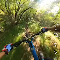
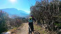
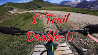
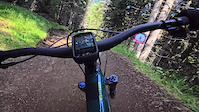
Videos of Trento Mountain Bike
trail: Training Trail
5:25 |
25 |
Jan 2, 2026
trail: Training Trail
0:15 |
20 |
Jan 1, 2026
trail: Sentiero Lastroni
2:15 |
30 |
Dec 31, 2025
0:00 |
7 |
Sep 18, 2025
4:25 |
3 |
Sep 18, 2025
trail: Tasi Line
0:10 |
64 |
Aug 25, 2025
trail: Tasi Line
0:10 |
28 |
Aug 25, 2025

trail: Peter Pan
0:00 |
19 |
Jul 1, 2025
Current Trail Warnings
| status | trail | date | condition | user | info |
|---|---|---|---|---|---|
| 409b Piazzole Trail Upper Garda Trentino Outdoor Region | Jun 22, 2026 @ 3:17pm (Europe/Rome) 18 hours | Unknown | notyoungnotalent | Large tree across the trail, possible to... | |
| Titans Fassa Bike District | Jun 22, 2026 @ 8:56am (Europe/Rome) 1 day | Variable | ale_ssia FBD | CLOSED for the UCI ENDURO WC | |
| Electric Line Fassa Bike District | Jun 22, 2026 @ 8:56am (Europe/Rome) 1 day | Variable | ale_ssia FBD | Low section closed, follow the white street |
Recent Trail Reports
| status | trail | date | condition | info | user |
|---|---|---|---|---|---|
| Big Hero Molveno Zone | Jun 22, 2026 @ 12:30pm (Europe/Rome) 21 hours | Very Dry | Manniger | ||
| Interstellar Andalo ZONE | Jun 21, 2026 @ 8:58am (Europe/Rome) 2 days | Ideal | Carlosdelafuente | ||
| Albi De Mez - Cima Paganella Andalo ZONE | Jun 21, 2026 @ 8:58am (Europe/Rome) 2 days | Ideal | Carlosdelafuente | ||
| Andalo - Doss Pelà Andalo | Jun 21, 2026 @ 8:58am (Europe/Rome) 2 days | Ideal | Carlosdelafuente | ||
| Easy Andy Andalo | Jun 21, 2026 @ 8:58am (Europe/Rome) 2 days | Ideal | Carlosdelafuente | ||
| Matrix Molveno Zone | Jun 21, 2026 @ 8:58am (Europe/Rome) 2 days | Ideal | Carlosdelafuente | ||
| Blade Runner Molveno Zone | Jun 21, 2026 @ 8:58am (Europe/Rome) 2 days | Ideal | Carlosdelafuente | ||
| Molveno - Pradel Molveno Zone | Jun 21, 2026 @ 8:58am (Europe/Rome) 2 days | Ideal | Carlosdelafuente | ||
| Zanna Bianca Andalo ZONE | Jun 21, 2026 @ 8:58am (Europe/Rome) 2 days | Ideal | Carlosdelafuente | ||
| Duel Andalo ZONE | Jun 21, 2026 @ 8:58am (Europe/Rome) 2 days | Ideal | Carlosdelafuente |
Activity Feed
| username | action | type | title | date |
|---|---|---|---|---|
| albertoritm | update | route | activity #97609552 and 1 more | Jun 23, 2026 @ 12:17am 6 mins |
| solotgz | ridden | trail | activity #97581354 | Jun 22, 2026 @ 1:09pm 11 hours |
| karlacio | ridden | trail | activity #97572799 | Jun 22, 2026 @ 10:56am 13 hours |
| notyoungnotalent | add | report | activity #97556987 | Jun 22, 2026 @ 6:17am 18 hours |
| Manniger | add | report | activity #97551229 | Jun 22, 2026 @ 3:30am 21 hours |
Recent Comments
| username | type | title | comment | date |
|---|---|---|---|---|
| trail | partly too steep for a green trail, some loose... | Jun 22, 2026 @ 3:29am 21 hours | ||
| trail | il problema è, come tornare a san martino? :) | Jun 22, 2026 @ 2:27am 22 hours | ||
| trail | What a gem! Very natural terrain. Great loam. | Jun 18, 2026 @ 1:18am Jun 18, 2026 | ||
| trail | First section of the trail is reserved for... | Jun 15, 2026 @ 7:44am Jun 15, 2026 | ||
| trail | È il vero Giuel Trail, livello S3 S3+ con... | Jun 15, 2026 @ 6:35am Jun 15, 2026 |
Local Badges
-

Epic Mountain Bike Climb 2k25 awarded -

Completionist0 awarded -
Completionist1 awarded -
Completionist0 awarded -
Completionist0 awarded -
Epic Mountain Bike Climb 2k0 awarded
Bike & Skill Parks
| name | type | city | rating |
|---|---|---|---|
| Val di Sole Bike Land | bike park | Commezzadura | |
| Fassa Bike District | bike park | Canazei | |
| Dolomiti Paganella Bike | bike park | Andalo | |
| Fai ZONE | bike park | Fai Della Paganella | |
| Molveno Zone | bike park | Molveno |
Upcoming Local Events
-
-
-
Activity Type Stats
| activitytype | trails | distance | descent | descent distance | total vertical | rating | global rank | state rank | photos | reports | routes | ridelogs |
|---|---|---|---|---|---|---|---|---|---|---|---|---|
| Mountain Bike | 1,230 | 1,744 miles | 744,911 ft | 971 miles | 8,839 ft | 3,467 | 9,598 | 92 | 83,833 | |||
| E-Bike | 1,213 | 1,709 miles | 729,744 ft | 944 miles | 8,839 ft | 82 | 9,030 | 37 | 15,465 | |||
| Gravel Bike | 74 | 120 | 1 | 863 | ||||||||
| Horse | 98 | 195 miles | 40,748 ft | 86 miles | 6,470 ft | 1 | 547 | 4 | 5 | |||
| Hike | 1,235 | 1,987 miles | 729,839 ft | 920 miles | 10,961 ft | 8 | 7,512 | 13 | 14,387 | |||
| Trail Running | 1,236 | 2,006 miles | 722,257 ft | 928 miles | 10,961 ft | 7,437 | 10 | 2,058 | ||||
| Dirtbike/Moto | 11 | 18 miles | 5,955 ft | 9 miles | 6,447 ft | 6 | 411 | 4 | 1 | |||
| Observed Trials | 20 | 17 miles | 7,408 ft | 11 miles | 4,741 ft | 48 | 1 | |||||
| ATV/ORV/OHV | 4 | 8 miles | 981 ft | 2 miles | 3,235 ft | 412 | ||||||
| Snowmobile | 1 | 3 | ||||||||||
| Snowshoe | 11 | 11 miles | 4,820 ft | 7 miles | 5,459 ft | 48 | 1 | 101 | ||||
| Downhill Ski | 527 | 314 miles | 294,111 ft | 303 miles | 8,376 ft | 845 | 9,574 | |||||
| Backcountry Ski | 20 | 34 miles | 8,337 ft | 10 miles | 7,631 ft | 57 | 1 | 2,466 | ||||
| Nordic Ski | 7 | 6 miles | 2,323 ft | 4 miles | 5,459 ft | 26 | 1,250 |
Frequently Asked Questions About Trento
▼
What are the best places to ride in Trento?
Trento has 69 areas to explore for mountain biking. The top rated areas are:
▼
What are the highest rated mountain biking trails in Trento?
The highest rated mountain biking trails in Trento are:
- Blade Runner (4.6/5)
- Sgreben (4.6/5)
- Tutti Frutti (4.6/5)
- Joel (4.5/5)
- Ribs Trail (4.5/5)
▼
What is the best time of the year to ride in Trento?
Based on ride log data, the most popular months to ride in Trento are:
- July (595 activities)
- August (592 activities)
- September (502 activities)
▼
What is the longest trail in Trento?
The longest trail in Trento is Trento - Borghetto (Ciclovia dell'Adige) at 54.4 km. View all trails sorted by distance.
Activities
- Trento Mountain Biking Trails
- Trento E-Biking Trails
- Trento Gravel Biking Trails
- Trento Horseback Trails
- Trento Hiking Trails
- Trento Trail Running Trails
- Trento Dirtbiking Trails
- Trento Observed Trials Trails
- Trento Snowshoeing Trails
- Trento Skiing Trails
- Trento Backcountry Skiing Trails
- Trento Nordic Skiing Trails
Trails
- By denitopia
 TRAILFORKS VTA & contributors
 - Admins: denitopia, marcoangeletti, cemoorelife, caval, larry81541, micheletraversi
- #11700 - 23,578 views
- trento activity log | embed map of Trento mountain bike trails | trento mountain biking points of interest polygons
Downloading of trail gps tracks in kml & gpx formats is enabled for Trento.
You must login to download files.