close
-
Layers w
- Weather Layers
- Pro
- Pro
- Pro
- Pro
- Pro
- Pro
- More Layers
- Pro
- Pro
- Pro
- Pro
-
Upgrade to

3D
Trail Conditions
- Unknown
- Snow Groomed
- Snow Packed
- Snow Covered
- Snow Cover Partial
- Freeze/thaw Cycle
- Icy
- Prevalent Mud
- Wet
- Variable
- Ideal
- Dry
- Very Dry
Trail Flow (Ridden Direction)
Trailforks scans users ridelogs to determine the most popular direction each trail is ridden. A good flowing trail network will have most trails flowing in a single direction according to their intension.
The colour categories are based on what percentage of riders are riding a trail in its intended direction.
The colour categories are based on what percentage of riders are riding a trail in its intended direction.
- > 96%
- > 90%
- > 80%
- > 70%
- > 50%
- < 50%
- bi-directional trail
- no data
Trail Last Ridden
Trailforks scans ridelogs to determine the last time a trail was ridden.
- < 2 days
- < 1 week
- < 2 weeks
- < 1 month
- < 6 months
- > 6 months
Trail Ridden Direction
The intended direction a trail should be ridden.
- Downhill Only
- Downhill Primary
- Both Directions
- Uphill Primary
- Uphill Only
- One Direction
Contribute Details
Colors indicate trail is missing specified detail.
- Description
- Photos
- Description & Photos
- Videos
Trail Popularity ?
Trailforks scans ridelogs to determine which trails are ridden the most in the last 9 months.
Trails are compared with nearby trails in the same city region with a possible 25 colour shades.
Think of this as a heatmap, more rides = more kinetic energy = warmer colors.
- most popular
- popular
- less popular
- not popular
ATV/ORV/OHV Filter
Max Vehicle Width
inches
US Cell Coverage
Legend

Radar Time
Activity Recordings
Trailforks uses anonymized public activity data.
?
Activity Recordings
Trailforks uses anonymized public activity data.
?
Personal Heatmap
▶
Activity Types
all
/
none
▶
Options
2
Date range
month
–
Winter Trails
Warning
A routing network for winter maps does not exist. Selecting trails using the winter trails layer has been disabled.
Missing Trails
Most Popular
Least Popular
Trails are colored based on popularity. The more popular a trail is, the more red. Less popular trails trend towards green.
Jump Magnitude Heatmap
Heatmap of where riders jump on trails. Zoom in to see individual jumps, click circles to view jump details.
BC Backroad Status
![map legend]()
Service Road Atlas is a free to use, community-driven service for viewing and creating reports on the numerous back-country service roads around B.C. and Alberta.

Slope Aspect
Direction the slope faces
Trails Deemphasized
Trails are shown in grey.
Only show trails with no bike usage.
Suggested Layers
Based on selected activity type
Save the current map location and zoom level as your default home location whenever this page is loaded.
Save
No description for Trenton has been added yet!
Login or register to submit one.
Activities Click to view
- Mountain Bike
23 trails
- E-Bike
5 trails
- Gravel Bike
0 trails
- Adaptive Bike
0 trails
- Horse
2 trails
- Hike
23 trails
- Trail Running
23 trails
- Dirtbike/Moto
3 trails
- ATV/ORV/OHV
3 trails
- Snowmobile
2 trails
- Snowshoe
4 trails
- Nordic Ski
2 trails
Region Details
- 6
- 6
- 9
- 2
Region Status
Caution as of May 10, 2026Local Trail Association
Stats
- Avg Trail Rating
- Trails (view details)
- 23
- Trails Mountain Bike
- 23
- Trails E-Bike
- 5
- Trails Horse
- 2
- Trails Hike
- 23
- Trails Trail Running
- 23
- Trails Dirtbike/Moto
- 3
- Trails ATV/ORV/OHV
- 3
- Trails Snowmobile
- 2
- Trails Snowshoe
- 4
- Trails Nordic Ski
- 2
- Total Distance
- 34 miles
- Total Descent
- 1,226 ft
- Total Vertical
- 278 ft
- Highest Trailhead
- 521 ft
- Reports
- 48
- Photos
- 33
- Ridden Counter
- 414
Sub Regions
-
Trenton Escarpment
- 6
- 9
- 1
Popular Trenton Mountain Biking Trails
• 100 ★ 0.0 • 5 miles • 139 ft • 32 •
Popular white difficulty rail trail. This multi-use trail can be used both directions and has a easy overall physical rating with a 139 ft green climb. Trail visibility is always easy to follow. On average it takes 27 minutes to complete this trail.
• 90 ★ 3.0 • 4 miles • 70 ft • 22 •
Rail trail currently undergoing rehabilitation. This trail connects to the PEC Millennium Trail, and is a short raod ride away from the Lower Trent Trail.
• 100 ★ 0.0 • 4,672 ft • 35 ft • 20 •
At Bleasdell Boulder Conservation Area, you can take a journey through time with a short hike to the 'Bleasdell Boulder', one of the largest known glacial erratics in North America, estimated to be 2.3 billion years old. The Bleasdell...
• 75 ★ 1.0 • 498 ft • 14 ft • 20 •
A bonus section on the end of the Blue Trail. A little more challenging then the primary trails.
• 50 ★ 0.0 • 2 miles • 42 ft • 18 •
Moderately popular white difficulty rail trail. This multi-use trail can be used both directions and has a easy overall physical rating with a 42 ft green climb. Trail visibility is always easy to follow. On average it takes 10 minutes to complete this trail.
• 45 ★ 0.0 • 1,779 ft • 25 ft • 17 •
Named after the most common flower found on the trail.
Trenton Mountain Bike Routes
4 miles • 33 ft • 0 • Point to Point •
This is the Trenton Waterfront Trail from Canal Rd. at the Murray Canal to the Tourist Information Office...
Photos of Trenton Mountain Bike
Videos of Trenton Mountain Bike
0:54 |
11 |
Aug 16, 2025
Recent Trail Reports
| status | trail | date | condition | info | user |
|---|---|---|---|---|---|
| Bleasdell Boulder Loop | May 10, 2026 @ 5:11pm (America/Toronto) May 10, 2026 | Ideal | davidsheaff | ||
| Pelion's Backside | Aug 3, 2024 @ 3:44pm Aug 3, 2024 | Ideal | davidsheaff | ||
| Green Gate Entrance | Aug 3, 2024 @ 3:43pm Aug 3, 2024 | Dry | davidsheaff | ||
| Wild Card | Aug 3, 2024 @ 3:41pm Aug 3, 2024 | Unknown | davidsheaff | ||
| 2 Dug Exit | Aug 3, 2024 @ 3:34pm Aug 3, 2024 | Dry | davidsheaff | ||
| Lower Trent Trail Frankford to Glen Ross | Jul 29, 2024 @ 8:42am Jul 29, 2024 | Ideal | timxie | ||
| Quinte Waterfront Trail Murray Canal to Trent Port Marina | Apr 4, 2021 @ 12:01pm Apr 4, 2021 | Dry | Walker613 | ||
| Hobo Camp | Oct 12, 2019 @ 11:49am Oct 12, 2019 | Variable | paulloeffelholz | ||
| Hobo Camp Extension | Oct 12, 2019 @ 11:49am Oct 12, 2019 | Variable | paulloeffelholz | ||
| Hanna Blue Trail Plus | Oct 12, 2019 @ 11:49am Oct 12, 2019 | Variable | paulloeffelholz |
Activity Feed
| username | action | type | title | date |
|---|---|---|---|---|
| Berrisch | wishlist | trail | activity #96814751 | Jun 12, 2026 @ 10:46am Jun 12, 2026 |
| davidsheaff | add | report | activity #94458743 | May 10, 2026 @ 2:11pm May 10, 2026 |
| davidsheaff | add | photo | activity #94450634 and 7 more | May 10, 2026 @ 12:29pm May 10, 2026 |
| AustenicOdqA | wishlist | trail | activity #92430093 | Apr 11, 2026 @ 3:01pm Apr 11, 2026 |
| alexh41 | wishlist | trail | activity #84074964 | Nov 13, 2025 @ 8:52am Nov 13, 2025 |
Recent Comments
| username | type | title | comment | date |
|---|---|---|---|---|
| trail | Appropriately named trail, both for the... | Aug 2, 2024 @ 3:05pm Aug 2, 2024 | ||
| report | J’n’jjtcfhn ris mjjecrnnjbgj K | Jul 30, 2018 @ 6:09pm Jul 30, 2018 |
Local Badges
-

Epic Ride Climb 2k0 awarded -

Climbing 10k Badge3 awarded -

Climbing 100k Badge1 awarded -

Epic Ride Descent 2k0 awarded -

Descent 10k Badge3 awarded -

Descent 100k Badge1 awarded
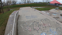
Bike & Skill Parks
| name | type | city | rating |
|---|---|---|---|
| Sky is the Limit Skatepark | skill park | Trenton |
Activity Type Stats
| activitytype | trails | distance | descent | descent distance | total vertical | rating | global rank | state rank | photos | reports | routes | ridelogs |
|---|---|---|---|---|---|---|---|---|---|---|---|---|
| Mountain Bike | 23 | 34 miles | 1,227 ft | 14 miles | 279 ft | #7,288 | #116 | 33 | 48 | 1 | 1,861 | |
| E-Bike | 5 | 28 miles | 650 ft | 11 miles | 279 ft | #4,528 | #80 | 38 | 292 | |||
| Horse | 2 | 9 miles | 56 ft | 2 miles | 118 ft | #2,327 | #41 | 22 | ||||
| Hike | 23 | 34 miles | 1,227 ft | 14 miles | 279 ft | #6,145 | #119 | 48 | 101 | |||
| Trail Running | 23 | 34 miles | 1,227 ft | 14 miles | 279 ft | #5,568 | #92 | 48 | 194 | |||
| Dirtbike/Moto | 3 | 19 miles | 430 ft | 7 miles | 197 ft | #970 | #21 | 22 | 1 | |||
| ATV/ORV/OHV | 3 | 19 miles | 430 ft | 7 miles | 197 ft | #751 | #18 | 22 | ||||
| Snowmobile | 2 | 12 miles | 400 ft | 6 miles | 197 ft | #316 | #26 | 1 | ||||
| Snowshoe | 4 | 26 miles | 623 ft | 10 miles | 279 ft | #859 | #83 | 1 | 14 | |||
| Nordic Ski | 2 | 9 miles | 217 ft | 4 miles | 161 ft | #1,293 | #99 | 1 | 4 |
Frequently Asked Questions About Trenton
▼
What are the best places to ride in Trenton?
Trenton has 1 areas to explore for mountain biking. The top rated areas are:
▼
What are the highest rated mountain biking trails in Trenton?
The highest rated mountain biking trails in Trenton are:
- Totem (3.9/5)
- Quinte Waterfront Trail Murray Canal to Trent Port Marina (3.8/5)
- 2 Dug Exit (3.8/5)
- Hanna Blue Trail Plus (3.6/5)
- Bleasdell Boulder Loop (0/5)
▼
What is the best time of the year to ride in Trenton?
Based on ride log data, the most popular months to ride in Trenton are:
- August (27 activities)
- October (8 activities)
- July (7 activities)
▼
Where can I park to ride in Trenton?
Activities
- By brenthillier
 NSMBA TRAILFORKS & contributors
 - Admins: apply
- #3504 - 6,279 views
- trenton activity log | embed map of Trenton mountain bike trails | trenton mountain biking points of interest
Downloading of trail gps tracks in kml & gpx formats is enabled for Trenton.
You must login to download files.