close
-
Layers w
- Weather Layers
- Pro
- Pro
- Pro
- Pro
- Pro
- Pro
- More Layers
- Pro
- Pro
- Pro
- Pro
-
Upgrade to

3D
Trail Conditions
- Unknown
- Snow Groomed
- Snow Packed
- Snow Covered
- Snow Cover Partial
- Freeze/thaw Cycle
- Icy
- Prevalent Mud
- Wet
- Variable
- Ideal
- Dry
- Very Dry
Trail Flow (Ridden Direction)
Trailforks scans users ridelogs to determine the most popular direction each trail is ridden. A good flowing trail network will have most trails flowing in a single direction according to their intension.
The colour categories are based on what percentage of riders are riding a trail in its intended direction.
The colour categories are based on what percentage of riders are riding a trail in its intended direction.
- > 96%
- > 90%
- > 80%
- > 70%
- > 50%
- < 50%
- bi-directional trail
- no data
Trail Last Ridden
Trailforks scans ridelogs to determine the last time a trail was ridden.
- < 2 days
- < 1 week
- < 2 weeks
- < 1 month
- < 6 months
- > 6 months
Trail Ridden Direction
The intended direction a trail should be ridden.
- Downhill Only
- Downhill Primary
- Both Directions
- Uphill Primary
- Uphill Only
- One Direction
Contribute Details
Colors indicate trail is missing specified detail.
- Description
- Photos
- Description & Photos
- Videos
Trail Popularity ?
Trailforks scans ridelogs to determine which trails are ridden the most in the last 9 months.
Trails are compared with nearby trails in the same city region with a possible 25 colour shades.
Think of this as a heatmap, more rides = more kinetic energy = warmer colors.
- most popular
- popular
- less popular
- not popular
ATV/ORV/OHV Filter
Max Vehicle Width
inches
US Cell Coverage
Legend

Radar Time
Activity Recordings
Trailforks uses anonymized public activity data.
?
Activity Recordings
Trailforks uses anonymized public activity data.
?
Personal Heatmap
▶
Activity Types
all
/
none
▶
Options
2
Date range
month
–
Winter Trails
Warning
A routing network for winter maps does not exist. Selecting trails using the winter trails layer has been disabled.
Missing Trails
Most Popular
Least Popular
Trails are colored based on popularity. The more popular a trail is, the more red. Less popular trails trend towards green.
Jump Magnitude Heatmap
Heatmap of where riders jump on trails. Zoom in to see individual jumps, click circles to view jump details.
BC Backroad Status
![map legend]()
Service Road Atlas is a free to use, community-driven service for viewing and creating reports on the numerous back-country service roads around B.C. and Alberta.

Slope Aspect
Direction the slope faces
Trails Deemphasized
Trails are shown in grey.
Only show trails with no bike usage.
Suggested Layers
Based on selected activity type
Save the current map location and zoom level as your default home location whenever this page is loaded.
Save
No description for Treviso has been added yet!
Login or register to submit one.
This region uses the Uk/Euro style trail grading system.
Activities Click to view
- Mountain Bike
84 trails
- E-Bike
84 trails
- Hike
68 trails
- Trail Running
69 trails
Region Details
- 3
- 2
- 19
- 48
Stats
- Avg Trail Rating
- Trails (view details)
- 86
- Trails Mountain Bike
- 84
- Trails E-Bike
- 84
- Trails Horse
- 1
- Trails Hike
- 68
- Trails Trail Running
- 69
- Trails Snowshoe
- 3
- Total Distance
- 77 miles
- Total Descent
- 50,372 ft
- Total Vertical
- 5,322 ft
- Highest Trailhead
- 5,673 ft
- Reports
- 689
- Photos
- 183
- Ridden Counter
- 4,751
Sub Regions
- Borso del Grappa (6)
- Conegliano (1)
- Crocetta Del Montello (6)
- Pederobba (5)
- Susegana (5)
- Treviso (9)
- Volpago del Montello (26)
- Monte Grappa (15)
Popular Treviso Mountain Biking Trails
• 100 ★ 5.0 • 2,979 ft • 0 ft • 237 •
Percorso veloce con una serie di salti nel tratto iniziale. Il percorso si sviluppa in due parti. Una prima con una serie di salti e una seconda molto più veloce e divertente, con una serie di rilanci. Verso la fine è presente un...
• 65 ★ 4.9 • 4,413 ft • 4 ft • 186 •
Percorso misto che varia dal veloce al tecnico con sezioni rocciose. Il percorso inizia con un rettilineo veloce (prestare attenzione in questo tratto perché il percorso tende spesso a essere ostruito da alberi in mezzo al sentiero)...
• 90 ★ 5.0 • 2,535 ft • 0 ft • 158 •
Sentiero, che si suddivide in due parti, è veloce e divertente. Si presenta con un fondo battuto molto scorrevole. Questa prima parte si alterna con dei tratti rettilinei, dove c'è la possibilità di pedalare, e alcuni tratti con...
• 100 ★ 4.7 • 1,844 ft • 0 ft • 157 •
Popular blue difficulty singletrack. This mountain bike primary trail can be used downhill only and has a moderate overall physical rating. It features drop and jump. Trail visibility is always easy to follow. On average it takes 1 minutes to complete this trail.
• 95 ★ 4.5 • 1,749 ft • 10 ft • 149 •
Popular blue difficulty singletrack. This mountain bike primary trail can be used downhill primary. On average it takes 3 minutes to complete this trail.
• 80 ★ 5.0 • 1 mile • 28 ft • 148 •
Popular blue difficulty singletrack. This mountain bike primary trail can be used downhill primary. On average it takes 6 minutes to complete this trail.
• 85 ★ 4.0 • 1 mile • 608 ft • 147 •
Popular green difficulty gravel path. This mountain bike primary trail can be used both directions and has a easy overall physical rating with a 608 ft blue climb. Trail visibility is always easy to follow. On average it takes 16 minutes to complete this trail.
• 55 ★ 4.0 • 3,536 ft • 19 ft • 143 •
Si tratta della seconda parte dell'ELK Line che porta a valle.
Treviso Mountain Bike Routes
41 miles • 3,820 ft • 0 •
----------------------------------------------------------
21 miles • 4,410 ft • 0 •
Il luogo in cui nel 1918 l’esercito italiano arrestò l’avanzata del nemico non può che essere...
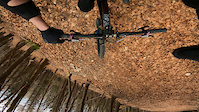
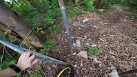
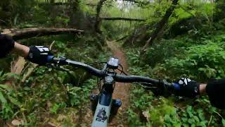
Photos of Treviso Mountain Bike
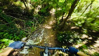
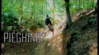
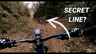
Videos of Treviso Mountain Bike
trail: DH 109 SHAKE THAT ASS
2:39 |
|
Mar 27, 2023
trail: CAI 213
0:00 |
276 |
May 28, 2018

trail: Snake
4:25 |
58 |
Sep 7, 2025 , Volpago del Montello
trail: Sabotage
4:25 |
75 |
Sep 7, 2025 , Volpago del Montello
trail: ELKontadin Trail
2:10 |
188 |
Jan 11, 2025 , Volpago del Montello
trail: Canyon S. Martino
4:07 |
80 |
Jan 11, 2025 , Volpago del Montello

trail: Gongolo
9:02 |
172 |
Feb 26, 2024 , Volpago del Montello
trail: Canyon 2020
9:02 |
192 |
Feb 24, 2024 , Volpago del Montello
Recent Trail Reports
Activity Feed
| username | action | type | title | date |
|---|---|---|---|---|
| TommasoyjxFLw | wishlist | trail | activity #97247702 | Jun 18, 2026 @ 6:29am 2 days |
| martinsalzmann | wishlist | trail | activity #96455062 | Jun 7, 2026 @ 6:41am Jun 7, 2026 |
| martinsalzmann | wishlist | trail | activity #96403519 | Jun 6, 2026 @ 1:47pm Jun 6, 2026 |
| Crist85 | ridden | trail | activity #95622798 | May 27, 2026 @ 3:31am May 27, 2026 |
| Pedrone | add | report | activity #94962718 | May 18, 2026 @ 12:39am May 18, 2026 |
Recent Comments
| username | type | title | comment | date |
|---|---|---|---|---|
| trail | È un sentiero meno tecnico ca. S2. Solo... | Apr 18, 2026 @ 11:47am Apr 18, 2026 | ||
| trail | Molto ripido e stretto con tornantini. Solo... | Apr 18, 2026 @ 11:36am Apr 18, 2026 | ||
| report | Stavano soffiando via le foglie | Nov 30, 2025 @ 1:15pm Nov 30, 2025 | ||
| report | That's absurd, sorry to hear it. | Oct 20, 2025 @ 3:22am Oct 20, 2025 | ||
| trail | The very first part is open and panoramic,... | Jul 7, 2025 @ 12:43pm Jul 7, 2025 |
Local Badges
-

Epic Ride Climb 2k50 awarded -

Climbing 10k Badge66 awarded -

Climbing 100k Badge6 awarded -

Epic Ride Descent 2k50 awarded -

Descent 10k Badge66 awarded -

Descent 100k Badge6 awarded
Bike & Skill Parks
| name | type | city | rating |
|---|---|---|---|
| Crossdromo Lago Azzurro (Paese) | skill park | Treviso | |
| S. Pietro Feletto ?? | skill park | Susegana | |
| Giavera del Montello? | skill park | Conegliano | |
| Crespano del Grappa | skill park | Borso del Grappa |
Activity Type Stats
| activitytype | trails | distance | descent | descent distance | total vertical | rating | global rank | state rank | photos | reports | routes | ridelogs |
|---|---|---|---|---|---|---|---|---|---|---|---|---|
| Mountain Bike | 84 | 76 miles | 50,358 ft | 55 miles | 5,322 ft | 179 | 689 | 2 | 24,062 | |||
| E-Bike | 84 | 76 miles | 50,358 ft | 55 miles | 5,322 ft | 2 | 568 | 1 | 1,525 | |||
| Horse | 1 | 2 miles | 1,188 ft | 2 miles | 1,132 ft | 77 | 1 | |||||
| Hike | 68 | 66 miles | 42,257 ft | 45 miles | 5,322 ft | 651 | 1 | 590 | ||||
| Trail Running | 69 | 67 miles | 44,341 ft | 47 miles | 5,322 ft | 2 | 659 | 1 | 375 | |||
| Snowshoe | 3 | 4 miles | 2,638 ft | 3 miles | 4,892 ft | 1 | 1 | 12 |
Frequently Asked Questions About Treviso
▼
What are the best places to ride in Treviso?
Treviso has 1 areas to explore for mountain biking. The top rated areas are:
▼
What are the highest rated mountain biking trails in Treviso?
The highest rated mountain biking trails in Treviso are:
- ELKontadin Trail (4.4/5)
- Gongolo (4.4/5)
- Monte Legnarola (CAI 197) (4.4/5)
- Mulattiera 105 (4.3/5)
- CAI 196 (4.3/5)
▼
What is the best time of the year to ride in Treviso?
Based on ride log data, the most popular months to ride in Treviso are:
- August (96 activities)
- May (95 activities)
- March (80 activities)
▼
What is the longest trail in Treviso?
The longest trail in Treviso is Mulattiera 105 at 8.0 km. View all trails sorted by distance.
Activities
Trails
Points of Interest
- By denitopia
 TRAILFORKS VTA & contributors
 - Admins: denitopia, marcoangeletti, cemoorelife, micheletraversi
- #11748 - 6,530 views
- treviso activity log | embed map of Treviso mountain bike trails | treviso mountain biking points of interest
Downloading of trail gps tracks in kml & gpx formats is enabled for Treviso.
You must login to download files.