close
-
Layers w
- Weather Layers
- Pro
- Pro
- Pro
- Pro
- Pro
- Pro
- More Layers
- Pro
- Pro
- Pro
- Pro
-
Upgrade to

3D
Trail Conditions
- Unknown
- Snow Groomed
- Snow Packed
- Snow Covered
- Snow Cover Partial
- Freeze/thaw Cycle
- Icy
- Prevalent Mud
- Wet
- Variable
- Ideal
- Dry
- Very Dry
Trail Flow (Ridden Direction)
Trailforks scans users ridelogs to determine the most popular direction each trail is ridden. A good flowing trail network will have most trails flowing in a single direction according to their intension.
The colour categories are based on what percentage of riders are riding a trail in its intended direction.
The colour categories are based on what percentage of riders are riding a trail in its intended direction.
- > 96%
- > 90%
- > 80%
- > 70%
- > 50%
- < 50%
- bi-directional trail
- no data
Trail Last Ridden
Trailforks scans ridelogs to determine the last time a trail was ridden.
- < 2 days
- < 1 week
- < 2 weeks
- < 1 month
- < 6 months
- > 6 months
Trail Ridden Direction
The intended direction a trail should be ridden.
- Downhill Only
- Downhill Primary
- Both Directions
- Uphill Primary
- Uphill Only
- One Direction
Contribute Details
Colors indicate trail is missing specified detail.
- Description
- Photos
- Description & Photos
- Videos
Trail Popularity ?
Trailforks scans ridelogs to determine which trails are ridden the most in the last 9 months.
Trails are compared with nearby trails in the same city region with a possible 25 colour shades.
Think of this as a heatmap, more rides = more kinetic energy = warmer colors.
- most popular
- popular
- less popular
- not popular
ATV/ORV/OHV Filter
Max Vehicle Width
inches
US Cell Coverage
Legend

Radar Time
Activity Recordings
Trailforks uses anonymized public activity data.
?
Activity Recordings
Trailforks uses anonymized public activity data.
?
Personal Heatmap
▶
Activity Types
all
/
none
▶
Options
2
Date range
month
–
Winter Trails
Warning
A routing network for winter maps does not exist. Selecting trails using the winter trails layer has been disabled.
Missing Trails
Most Popular
Least Popular
Trails are colored based on popularity. The more popular a trail is, the more red. Less popular trails trend towards green.
Jump Magnitude Heatmap
Heatmap of where riders jump on trails. Zoom in to see individual jumps, click circles to view jump details.
BC Backroad Status
![map legend]()
Service Road Atlas is a free to use, community-driven service for viewing and creating reports on the numerous back-country service roads around B.C. and Alberta.

Slope Aspect
Direction the slope faces
Trails Deemphasized
Trails are shown in grey.
Only show trails with no bike usage.
Suggested Layers
Based on selected activity type
Save the current map location and zoom level as your default home location whenever this page is loaded.
SaveThis region is Unsanctioned, Ride at your own Risk!
Tribeč @ mapy.hiking.sk
Tribeč je krajinský celok vo Fatransko-tatranskej oblasti, jadrové pohorie v oblúku Vnútorných Západných Karpát. Obklopujú ho Podunajská pahorkatina, Pohronský Inovec, Vtáčnik a Hornonitrianska kotlina. Nachádza sa v okresoch Nitra, Zlaté Moravce, Topoľčany, Partizánske na západnom Slovensku.
Tribeč je krajinský celok vo Fatransko-tatranskej oblasti, jadrové pohorie v oblúku Vnútorných Západných Karpát. Obklopujú ho Podunajská pahorkatina, Pohronský Inovec, Vtáčnik a Hornonitrianska kotlina. Nachádza sa v okresoch Nitra, Zlaté Moravce, Topoľčany, Partizánske na západnom Slovensku.
Activities Click to view
- Mountain Bike
48 trails
- E-Bike
29 trails
- Hike
37 trails
- Trail Running
38 trails
Region Details
- 12
- 12
- 17
- 4
Stats
- Avg Trail Rating
- Trails (view details)
- 48
- Trails Mountain Bike
- 49
- Trails E-Bike
- 29
- Trails Horse
- 2
- Trails Hike
- 37
- Trails Trail Running
- 38
- Trails Snowshoe
- 1
- Trails Backcountry Ski
- 1
- Trails Nordic Ski
- 1
- Total Distance
- 51 miles
- Total Descent
- 14,674 ft
- Total Vertical
- 1,830 ft
- Highest Trailhead
- 2,389 ft
- Reports
- 612
- Photos
- 145
- Ridden Counter
- 2,240
Sub Regions
- Baťove traily (11)
- Veľký Tríbeč (13)
Popular Tribeč Mountain Biking Trails
• 100 ★ 4.3 • 3,173 ft • 0 ft • 156 •
Highly rated popular blue difficulty singletrack. This mountain bike primary trail can be used downhill only and has a moderate overall physical rating. It features berm, bridge, jump and skinny. On average it takes 5 minutes to complete this trail.
• 100 ★ 4.8 • 3,333 ft • 0 ft • 150 •
Highly rated popular red difficulty singletrack. This mountain bike primary trail can be used downhill only and has a moderate overall physical rating. It features berm, bridge, drop, jump, gap jump, ladder bridge, rock garden and skinny. Trail visibility is always easy to follow. On average it takes 5 minutes to complete this trail.
• 95 ★ 4.4 • 5,098 ft • 387 ft • 111 •
Popular green difficulty singletrack. This multi-use trail can be used uphill primary and has a moderate overall physical rating with a 387 ft blue climb. On average it takes 14 minutes to complete this trail.
• 75 ★ 3.8 • 3,474 ft • 0 ft • 87 •
Popular blue difficulty mixed. This multi-use trail can be used downhill primary and has a easy overall physical rating. On average it takes 19 minutes to complete this trail.
• 90 ★ 4.5 • 4,698 ft • 3 ft • 83 •
Natural trail with some built units, rockgarden and beautiful panoramatic view.
• 80 ★ 3.5 • 1,378 ft • 0 ft • 74 •
Popular red difficulty singletrack. This multi-use trail can be used downhill primary. On average it takes 1 minutes to complete this trail.
Tribeč Mountain Bike Routes
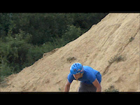
Photos of Tribeč Mountain Bike
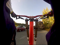
Videos of Tribeč Mountain Bike
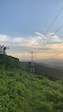
trail: Panorama trail
0:12 |
183 |
Feb 15, 2023
0:04 |
|
Mar 1, 2021
trail: Sunset
0:00 |
243 |
Jul 3, 2019
trail: Sunset
2:06 |
395 |
Nov 1, 2015
trail: Sunset
0:17 |
618 |
Feb 16, 2014
trail: Sunset
9:29 |
289 |
Aug 27, 2012
trail: Green Rock
29:41 |
71 |
Aug 26, 2025 , Partizánske
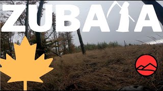
trail: Zubatá
3:11 |
193 |
Nov 6, 2023 , Topoľčany
Recent Trail Reports
| status | trail | date | condition | info | user |
|---|---|---|---|---|---|
| Mr. Johns trail Veľký Tríbeč | Apr 7, 2026 @ 3:39pm (Europe/Bratislava) Apr 7, 2026 | Dry | JurajJedlicka | ||
| Srnkáč Veľký Tríbeč | Apr 7, 2026 @ 3:39pm (Europe/Bratislava) Apr 7, 2026 | Dry | JurajJedlicka | ||
| Pozerák Veľký Tríbeč | Apr 7, 2026 @ 3:39pm (Europe/Bratislava) Apr 7, 2026 | Variable | JurajJedlicka | ||
| Trhlina uphill Veľký Tríbeč | Apr 7, 2026 @ 3:39pm (Europe/Bratislava) Apr 7, 2026 | Dry | JurajJedlicka | ||
| Uphill Zubata Veľký Tríbeč | Apr 7, 2026 @ 3:39pm (Europe/Bratislava) Apr 7, 2026 | Dry | JurajJedlicka | ||
| Dole "jamou" DH Baťove traily | Mar 1, 2026 @ 3:18pm (Europe/Bratislava) Mar 1, 2026 | Ideal | RichiG | ||
| Klizsky trail Partizánske | Dec 24, 2025 @ 11:48am (Europe/Bratislava) Dec 24, 2025 | Prevalent Mud | RichiG | ||
| Bagaňa trail Partizánske | Nov 15, 2025 @ 1:21pm (Europe/Bratislava) Nov 15, 2025 | Variable | RichiG | ||
| Kozlica Veľký Tríbeč | Nov 15, 2025 @ 1:21pm (Europe/Bratislava) Nov 15, 2025 | Variable | RichiG | ||
| Hukot Partizánske | Nov 18, 2025 @ 8:12pm (Europe/Bratislava) Nov 18, 2025 | Unknown | giant95617 |
Activity Feed
| username | action | type | title | date |
|---|---|---|---|---|
| DominicWilbrink | add | video | activity #96826710 | Jun 12, 2026 @ 2:00pm Jun 12, 2026 |
| SvajlenkaF90 | ridden | trail | activity #96119171 and 1 more | Jun 2, 2026 @ 4:47pm Jun 2, 2026 |
| MiShreds | ridden | trail | activity #94878612 | May 17, 2026 @ 1:42am May 17, 2026 |
| MiShreds | ridden | trail | activity #94878574 and 2 more | May 17, 2026 @ 1:41am May 17, 2026 |
| gajertomi | wishlist | region | activity #94478557 | May 10, 2026 @ 10:19pm May 10, 2026 |
Recent Comments
| username | type | title | comment | date |
|---|---|---|---|---|
| trail | Maybe some parts are a bit steep, but overall... | Aug 21, 2023 @ 8:43am Aug 21, 2023 | ||
| trail | True enduro trail. Technical and fairly... | Aug 21, 2023 @ 8:32am Aug 21, 2023 | ||
| trail | With exception of one steep rock garden and... | Aug 21, 2023 @ 8:26am Aug 21, 2023 | ||
| trail | Wide and smooth with all kind of objects.... | Aug 21, 2023 @ 7:29am Aug 21, 2023 | ||
| trail | Very good flow, well taken care of at the time... | Aug 21, 2023 @ 7:23am Aug 21, 2023 |
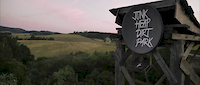
Bike & Skill Parks
| name | type | city | rating |
|---|---|---|---|
| Pumptrack Topoľčany | skill park | Topoľčany | |
| Pumptrack | skill park | Partizánske |
Activity Type Stats
| activitytype | trails | distance | descent | descent distance | total vertical | rating | global rank | state rank | photos | reports | routes | ridelogs |
|---|---|---|---|---|---|---|---|---|---|---|---|---|
| Mountain Bike | 48 | 51 miles | 14,675 ft | 27 miles | 1,831 ft | 145 | 615 | 1 | 3,501 | |||
| E-Bike | 29 | 28 miles | 8,940 ft | 15 miles | 1,831 ft | 545 | 573 | |||||
| Horse | 2 | 7 miles | 148 ft | 4,275 ft | 1,788 ft | 44 | ||||||
| Hike | 37 | 43 miles | 10,548 ft | 20 miles | 1,831 ft | 583 | 68 | |||||
| Trail Running | 38 | 42 miles | 10,581 ft | 20 miles | 1,831 ft | 585 | 25 | |||||
| Snowshoe | 1 | 6 miles | 125 ft | 3,665 ft | 1,663 ft | |||||||
| Backcountry Ski | 1 | 6 miles | 125 ft | 3,665 ft | 1,663 ft | 2 | ||||||
| Nordic Ski | 1 | 6 miles | 125 ft | 3,665 ft | 1,663 ft |
Frequently Asked Questions About Tribeč
▼
What are the best places to ride in Tribeč?
Tribeč has 2 areas to explore for mountain biking. The top rated areas are:
▼
What are the highest rated mountain biking trails in Tribeč?
The highest rated mountain biking trails in Tribeč are:
- Buddy trail (4.5/5)
- Zubatá (4.5/5)
- Výšľapový trail (4.4/5)
- Pozerák (4.3/5)
- Hrdovicka (4.2/5)
▼
What is the best time of the year to ride in Tribeč?
Based on ride log data, the most popular months to ride in Tribeč are:
- July (20 activities)
- May (15 activities)
- August (15 activities)
▼
What is the longest trail in Tribeč?
The longest trail in Tribeč is Amfiteáter at 3.9 km. View all trails sorted by distance.
Activities
Trails
- By jxxw
 TRAILFORKS & contributors
 - Admins: jxxw
- #23910 - 4,440 views
- tribeč activity log | embed map of Tribeč mountain bike trails | tribeč mountain biking points of interest
Downloading of trail gps tracks in kml & gpx formats is enabled for Tribeč.
You must login to download files.