close
-
Layers w
- Weather Layers
- Pro
- Pro
- Pro
- Pro
- Pro
- Pro
- More Layers
- Pro
- Pro
- Pro
- Pro
-
Upgrade to

3D
Trail Conditions
- Unknown
- Snow Groomed
- Snow Packed
- Snow Covered
- Snow Cover Partial
- Freeze/thaw Cycle
- Icy
- Prevalent Mud
- Wet
- Variable
- Ideal
- Dry
- Very Dry
Trail Flow (Ridden Direction)
Trailforks scans users ridelogs to determine the most popular direction each trail is ridden. A good flowing trail network will have most trails flowing in a single direction according to their intension.
The colour categories are based on what percentage of riders are riding a trail in its intended direction.
The colour categories are based on what percentage of riders are riding a trail in its intended direction.
- > 96%
- > 90%
- > 80%
- > 70%
- > 50%
- < 50%
- bi-directional trail
- no data
Trail Last Ridden
Trailforks scans ridelogs to determine the last time a trail was ridden.
- < 2 days
- < 1 week
- < 2 weeks
- < 1 month
- < 6 months
- > 6 months
Trail Ridden Direction
The intended direction a trail should be ridden.
- Downhill Only
- Downhill Primary
- Both Directions
- Uphill Primary
- Uphill Only
- One Direction
Contribute Details
Colors indicate trail is missing specified detail.
- Description
- Photos
- Description & Photos
- Videos
Trail Popularity ?
Trailforks scans ridelogs to determine which trails are ridden the most in the last 9 months.
Trails are compared with nearby trails in the same city region with a possible 25 colour shades.
Think of this as a heatmap, more rides = more kinetic energy = warmer colors.
- most popular
- popular
- less popular
- not popular
ATV/ORV/OHV Filter
Max Vehicle Width
inches
US Cell Coverage
Legend

Radar Time
Activity Recordings
Trailforks uses anonymized public activity data.
?
Activity Recordings
Trailforks uses anonymized public activity data.
?
Personal Heatmap
▶
Activity Types
all
/
none
▶
Options
2
Date range
month
–
Winter Trails
Warning
A routing network for winter maps does not exist. Selecting trails using the winter trails layer has been disabled.
Missing Trails
Most Popular
Least Popular
Trails are colored based on popularity. The more popular a trail is, the more red. Less popular trails trend towards green.
Jump Magnitude Heatmap
Heatmap of where riders jump on trails. Zoom in to see individual jumps, click circles to view jump details.
BC Backroad Status
![map legend]()
Service Road Atlas is a free to use, community-driven service for viewing and creating reports on the numerous back-country service roads around B.C. and Alberta.

Slope Aspect
Direction the slope faces
Trails Deemphasized
Trails are shown in grey.
Only show trails with no bike usage.
Suggested Layers
Based on selected activity type
Save the current map location and zoom level as your default home location whenever this page is loaded.
SaveWhat goes up will eventually come down
 google parking directions
 Activities Click to view
- Mountain Bike
13 trails
- E-Bike
13 trails
- Horse
4 trails
- Hike
15 trails
- Trail Running
14 trails
- Dirtbike/Moto
6 trails
- ATV/ORV/OHV
5 trails
Region Details
- 8
- 4
- 1
Region Status
Caution as of Jan 25, 2026Stats
- Avg Trail Rating
- Trails (view details)
- 16
- Trails Mountain Bike
- 13
- Trails E-Bike
- 13
- Trails Horse
- 4
- Trails Hike
- 15
- Trails Trail Running
- 14
- Trails Dirtbike/Moto
- 6
- Trails Observed Trials
- 1
- Trails ATV/ORV/OHV
- 5
- Trails Snowmobile
- 1
- Total Distance
- 66 miles
- Total Descent Distance
- 23 miles
- Total Descent
- 9,883 ft
- Total Vertical
- 4,249 ft
- Highest Trailhead
- 4,265 ft
- Reports
- 29
- Photos
- 35
- Ridden Counter
- 464
Popular Troubridge Mountain Biking Trails
• 45 ★ 4.0 • 3 miles • 0 ft • 54 •
This trail originated as a bike trail in the 80’s but is now also part of the . Expect and be respectful of hikers using trail. Some dark blue/ black portions of trail.
• 35 ★ 0.0 • 2 miles • 292 ft • 32 • • hike
Part of the . Expect and respect hikers. Some very minor hike-a-bike but worth the lakeshore views. Good way to loop back after riding .
• 45 ★ 2.5 • 2 miles • 50 ft • 24 •
Some parts of flow blue and some minor hike-a-bike dark blue/black sections. This trail is now also part of the Sunshine Coast Trail. Expect and be respectful of hikers using trail.
• 30 ★ 5.0 • 2 miles • 102 ft • 11 •
This trail originated as a bike trail in the 80’s but is now also part of the . Expect and be respectful of hikers using trail. Some dark blue/ black portions of trail. Top section is most enjoyable for riding, middle is a little more...
Photos of Troubridge Mountain Bike
Videos of Troubridge Mountain Bike
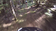
2:21 |
317 |
Jul 13, 2017
Recent Trail Reports
| status | trail | date | condition | info | user |
|---|---|---|---|---|---|
| Lois Lakeshore | Jan 25, 2026 @ 8:24pm (America/Vancouver) Jan 25, 2026 | Ideal | iceman-paul | ||
| Spring Lake Main | Sep 1, 2025 @ 10:21am Sep 1, 2025 | Very Dry | hartbronco | ||
| Stillwater Main Forest Service Road | Sep 1, 2025 @ 10:21am Sep 1, 2025 | Very Dry | hartbronco | ||
| Elephant Lakes Trail | Jun 24, 2025 @ 8:27am Jun 24, 2025 | Variable | lshunt | ||
| Lois Point | Apr 27, 2025 @ 10:26am Apr 27, 2025 | Variable | miriampalacios | ||
| Suicide Pass | Apr 20, 2025 @ 11:27am Apr 20, 2025 | Variable | thehoffmanian | ||
| Branch 41 Connector | Apr 30, 2022 @ 11:17am Apr 30, 2022 | Ideal | K1E | ||
| Lois Lake Branch 3 ("Branch 41") | Aug 31, 2019 @ 3:43pm Aug 31, 2019 | Dry | Dave6 |
Activity Feed
| username | action | type | title | date |
|---|---|---|---|---|
| iceman-paul | wishlist | trail | activity #96244627 | Jun 4, 2026 @ 12:11pm Jun 4, 2026 |
| MLMcK | wishlist | trail | activity #91359011 | Mar 26, 2026 @ 8:15pm Mar 26, 2026 |
| claudiamp27 | wishlist | trail | activity #90454707 | Mar 12, 2026 @ 1:07pm Mar 12, 2026 |
| iceman-paul | add | report | activity #87832786 | Jan 25, 2026 @ 8:24pm Jan 25, 2026 |
| cuscocanuck | wishlist | region | activity #86920341 | Jan 9, 2026 @ 4:10pm Jan 9, 2026 |
Nearby Areas
| name | distance | ||||
|---|---|---|---|---|---|
| Blue Ridge | 2 | 1 | 5.2 km | ||
| Suncoast | 10 | 19 | 1 | 8.9 km | |
| Duck Lake Trails | 13 | 53 | 9 | 10.7 km | |
| West Lake Trails | 6 | 19 | 8 | 1 | 11 km |
| Mt. Mahony | 8 | 11 | 12 | 12.8 km |
Activity Type Stats
| activitytype | trails | distance | descent | descent distance | total vertical | rating | global rank | state rank | photos | reports | routes | ridelogs |
|---|---|---|---|---|---|---|---|---|---|---|---|---|
| Mountain Bike | 13 | 51 miles | 5,574 ft | 16 miles | 2,979 ft | #8,131 | #324 | 35 | 27 | 261 | ||
| E-Bike | 13 | 51 miles | 5,574 ft | 16 miles | 2,979 ft | #3,185 | #112 | 26 | 8 | |||
| Horse | 4 | 12 miles | 725 ft | 3 miles | 2,674 ft | #2,247 | #67 | 3 | ||||
| Hike | 15 | 43 miles | 9,081 ft | 17 miles | 4,249 ft | #5,093 | #214 | 29 | 210 | |||
| Trail Running | 14 | 41 miles | 9,012 ft | 17 miles | 4,249 ft | #4,757 | #165 | 29 | 45 | |||
| Dirtbike/Moto | 6 | 34 miles | 1,391 ft | 8 miles | 2,352 ft | #738 | #68 | 4 | 6 | |||
| Observed Trials | 1 | 17 miles | 161 ft | 3 miles | 1,952 ft | |||||||
| ATV/ORV/OHV | 5 | 28 miles | 1,214 ft | 7 miles | 2,051 ft | #524 | #47 | 11 | ||||
| Snowmobile | 1 | 17 miles | 161 ft | 3 miles | 1,952 ft |
Frequently Asked Questions About Troubridge
▼
What are the highest rated mountain biking trails in Troubridge?
The highest rated mountain biking trails in Troubridge are:
- Suicide Pass (4.1/5)
- Branch 41 Trail (4/5)
- Elephant Lakes Trail (3.6/5)
- Lois Lakeshore (0/5)
▼
What is the best time of the year to ride in Troubridge?
Based on ride log data, the most popular months to ride in Troubridge are:
- July (10 activities)
- August (7 activities)
- September (4 activities)
▼
Where can I park to ride in Troubridge?
There are 1 parking locations listed in Troubridge. The most popular parking spots are:
▼
What is the longest trail in Troubridge?
The longest trail in Troubridge is Branch 41 Trail at 2.7 miles. View all trails sorted by distance.
Activities
Trails
- By Rubrewer
 & contributors
 - Admins: QRCA, MMSC
- #15313 - 2,452 views
- troubridge activity log | embed map of Troubridge mountain bike trails | troubridge mountain biking points of interest
Downloading of trail gps tracks in kml & gpx formats is enabled for Troubridge.
You must login to download files.