close
-
Layers w
- Weather Layers
- Pro
- Pro
- Pro
- Pro
- Pro
- Pro
- More Layers
- Pro
- Pro
- Pro
- Pro
-
Upgrade to

3D
Trail Conditions
- Unknown
- Snow Groomed
- Snow Packed
- Snow Covered
- Snow Cover Partial
- Freeze/thaw Cycle
- Icy
- Prevalent Mud
- Wet
- Variable
- Ideal
- Dry
- Very Dry
Trail Flow (Ridden Direction)
Trailforks scans users ridelogs to determine the most popular direction each trail is ridden. A good flowing trail network will have most trails flowing in a single direction according to their intension.
The colour categories are based on what percentage of riders are riding a trail in its intended direction.
The colour categories are based on what percentage of riders are riding a trail in its intended direction.
- > 96%
- > 90%
- > 80%
- > 70%
- > 50%
- < 50%
- bi-directional trail
- no data
Trail Last Ridden
Trailforks scans ridelogs to determine the last time a trail was ridden.
- < 2 days
- < 1 week
- < 2 weeks
- < 1 month
- < 6 months
- > 6 months
Trail Ridden Direction
The intended direction a trail should be ridden.
- Downhill Only
- Downhill Primary
- Both Directions
- Uphill Primary
- Uphill Only
- One Direction
Contribute Details
Colors indicate trail is missing specified detail.
- Description
- Photos
- Description & Photos
- Videos
Trail Popularity ?
Trailforks scans ridelogs to determine which trails are ridden the most in the last 9 months.
Trails are compared with nearby trails in the same city region with a possible 25 colour shades.
Think of this as a heatmap, more rides = more kinetic energy = warmer colors.
- most popular
- popular
- less popular
- not popular
ATV/ORV/OHV Filter
Max Vehicle Width
inches
US Cell Coverage
Legend

Radar Time
Activity Recordings
Trailforks uses anonymized public activity data.
?
Activity Recordings
Trailforks uses anonymized public activity data.
?
Personal Heatmap
▶
Activity Types
all
/
none
▶
Options
2
Date range
month
–
Winter Trails
Warning
A routing network for winter maps does not exist. Selecting trails using the winter trails layer has been disabled.
Missing Trails
Most Popular
Least Popular
Trails are colored based on popularity. The more popular a trail is, the more red. Less popular trails trend towards green.
Jump Magnitude Heatmap
Heatmap of where riders jump on trails. Zoom in to see individual jumps, click circles to view jump details.
BC Backroad Status
![map legend]()
Service Road Atlas is a free to use, community-driven service for viewing and creating reports on the numerous back-country service roads around B.C. and Alberta.

Slope Aspect
Direction the slope faces
Trails Deemphasized
Trails are shown in grey.
Only show trails with no bike usage.
Suggested Layers
Based on selected activity type
Save the current map location and zoom level as your default home location whenever this page is loaded.
SaveQuintessential New England technical XC riding. Couple good loops with some very decent vert. Singletrack linked by some fireroads.
Some hiker only trails. Closed to Mt Bikes from Jan 1 - April 30 and 24 hours after rains.
Note: As of May 2020, there are no dogs allowed. The preserve has five entrances, all with parking, and Bradley Road has limited parking. Print a hiking map, find the access roads, and spread yourselves out.
Trout Brook Valley Preserve (TBV)—owned and managed by the Aspetuck Land Trust—is actually composed of three parcels, the Trout Brook Valley, Crow Hill, and Jump Hill Preserves.
TBV is one of the best hiking and technical XC parks in the county. Most of the trails are tight twisty singletrack with technically challenging sections (loads of rocks, steep climbs, etc.
Primary Trail Type: Cross-Country
Land Status: Conservation Reserve
Access Info:
Parking lots on Bradley Road near valley forge rd and Elm Drive
Links
Activities Click to view
- Mountain Bike
13 trails
- Hike
17 trails
- Trail Running
17 trails
Region Details
- 5
- 6
- 2
Region Status
Caution as of Feb 22, 2025Stats
- Avg Trail Rating
- Trails (view details)
- 17
- Trails Mountain Bike
- 13
- Trails Hike
- 17
- Trails Trail Running
- 17
- Trails Snowshoe
- 1
- Trails Nordic Ski
- 1
- Total Distance
- 16 miles
- Total Descent
- 1,785 ft
- Total Vertical
- 397 ft
- Highest Trailhead
- 549 ft
- Reports
- 34
- Photos
- 32
- Ridden Counter
- 1,558
Popular Trout Brook Valley Mountain Biking Trails
• 100 ★ 4.0 • 3,711 ft • 183 ft • 181 •
Popular black diamond difficulty singletrack. This multi-use trail can be used both directions. On average it takes 13 minutes to complete this trail.
• 95 ★ 5.0 • 1 mile • 35 ft • 169 •
Popular blue difficulty singletrack. This multi-use trail can be used both directions. On average it takes 12 minutes to complete this trail.
• 85 ★ 4.0 • 2 miles • 89 ft • 123 •
Popular green difficulty singletrack. This multi-use trail can be used both directions. On average it takes 12 minutes to complete this trail.
• 45 ★ 4.2 • 3 miles • 449 ft • 121 •
Moderately popular blue difficulty singletrack. This multi-use trail can be used both directions and has a hard overall physical rating with a 449 ft blue climb. Trail visibility is always easy to follow. On average it takes 39 minutes to complete this trail.
• 25 ★ 5.0 • 3,642 ft • 22 ft • 109 •
Less popular green difficulty singletrack. This multi-use trail can be used both directions and has a easy overall physical rating with a 22 ft blue climb. Trail visibility is always easy to follow. On average it takes 7 minutes to complete this trail.
• 50 ★ 5.0 • 1 mile • 269 ft • 107 •
Moderately popular blue difficulty singletrack. This multi-use trail can be used both directions. On average it takes 16 minutes to complete this trail.
• 70 ★ 4.0 • 3,615 ft • 36 ft • 106 •
Popular blue difficulty singletrack. This multi-use trail can be used both directions and has a moderate overall physical rating with a 36 ft blue climb. Trail visibility is sometimes hard to follow. On average it takes 10 minutes to complete this trail.
• 60 ★ 0.0 • 325 ft • 0 ft • 105 •
Moderately popular green difficulty family friendly singletrack. This multi-use trail can be used both directions and has a easy overall physical rating with a 0 ft green climb. Trail visibility is always easy to follow. On average it takes 1 minutes to complete this trail.
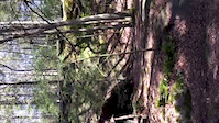
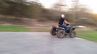
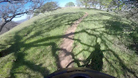
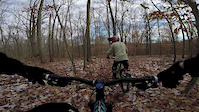
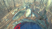
Photos of Trout Brook Valley Mountain Bike
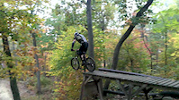
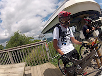
Videos of Trout Brook Valley Mountain Bike
trail: Green
0:10 |
145 |
Apr 18, 2016
trail: Yellow (Ruth’s Trail)
0:52 |
313 |
Apr 14, 2016
trail: Green
2:34 |
509 |
Feb 15, 2015
trail: Green
0:59 |
502 |
Nov 30, 2014
trail: Red
12:23 |
317 |
Nov 16, 2013
trail: Red
0:07 |
440 |
Oct 7, 2013
trail: Green Trail
8:23 |
342 |
Aug 9, 2013
trail: Red
0:30 |
106 |
Nov 23, 2012
Recent Trail Reports
| status | trail | date | condition | info | user |
|---|---|---|---|---|---|
| Grey/White | Nov 7, 2024 @ 5:33am Nov 7, 2024 | Dry | hankvpl | ||
| Blue/White Trail | Oct 22, 2024 @ 1:07pm Oct 22, 2024 | Very Dry | shmoonboon2023 | ||
| Blue Blaze Trail | Oct 22, 2024 @ 1:07pm Oct 22, 2024 | Very Dry | shmoonboon2023 | ||
| Green Trail | Oct 22, 2024 @ 1:07pm Oct 22, 2024 | Very Dry | shmoonboon2023 | ||
| White Trail | May 29, 2023 @ 4:18pm May 29, 2023 | Dry | GREGORYjmkBPd | ||
| Green | May 1, 2022 @ 9:56am May 1, 2022 | Ideal | Whenyoucometoaforkintheroad | ||
| Wells Hill Road Connector | May 1, 2022 @ 9:56am May 1, 2022 | Variable | Whenyoucometoaforkintheroad | ||
| Red/White Trail | Jun 13, 2021 @ 6:23am Jun 13, 2021 | Dry | Whenyoucometoaforkintheroad | ||
| Magenta | May 25, 2021 @ 3:16pm May 25, 2021 | Dry | Whenyoucometoaforkintheroad | ||
| Orange Trail | Nov 25, 2020 @ 6:33am Nov 25, 2020 | Ideal | iammakbeth |
Activity Feed
| username | action | type | title | date |
|---|---|---|---|---|
| lines | add | video | activity #97719114 and 1 more | Jun 24, 2026 @ 1:00pm 2 days |
| trailforks | add | video | activity #97714979 | Jun 24, 2026 @ 12:01pm 2 days |
| mezcode | wishlist | trail | activity #93078847 | Apr 21, 2026 @ 7:23am Apr 21, 2026 |
| bcbenn | wishlist | region | activity #92863394 | Apr 18, 2026 @ 8:18am Apr 18, 2026 |
| lHjwnCCn | wishlist | region | activity #80919407 | Sep 22, 2025 @ 3:51pm Sep 22, 2025 |
Recent Comments
| username | type | title | comment | date |
|---|---|---|---|---|
| trail | A lot of sharp rocks - had to walk bike on... | Aug 31, 2023 @ 10:47am Aug 31, 2023 | ||
| trail | This trail goes along the edge of the orchard... | Aug 21, 2022 @ 1:57pm Aug 21, 2022 | ||
| trail | This trail is now blazed pink. It is the... | Aug 21, 2022 @ 1:55pm Aug 21, 2022 | ||
| trail | No idea why this is rated blue - it's NOT... | Sep 29, 2020 @ 7:20am Sep 29, 2020 | ||
| trail | incredible trail - definitely a black diamond,... | Sep 15, 2020 @ 3:06pm Sep 15, 2020 |
Nearby Areas
| name | distance | ||||
|---|---|---|---|---|---|
| Wilton Woods | 4 | 2 | 1 | 5.8 km | |
| Cherry Lane Park | 2 | 6 | 1 | 5.8 km | |
| NRVT | 1 | 6.1 km | |||
| Old Mine | 6.1 km | ||||
| Collis P Huntington State Park | 7 | 17 | 4 | 6.1 km |
Activity Type Stats
| activitytype | trails | distance | descent | descent distance | total vertical | rating | global rank | state rank | photos | reports | routes | ridelogs |
|---|---|---|---|---|---|---|---|---|---|---|---|---|
| Mountain Bike | 13 | 12 miles | 1,201 ft | 5 miles | 397 ft | #5,358 | #1,945 | 28 | 34 | 2,703 | ||
| Hike | 17 | 16 miles | 1,785 ft | 6 miles | 397 ft | #9,395 | #3,603 | 4 | 34 | 227 | ||
| Trail Running | 17 | 16 miles | 1,785 ft | 6 miles | 397 ft | #8,942 | #3,183 | 33 | 162 | |||
| Snowshoe | 1 | 3 miles | 164 ft | 3,209 ft | 364 ft | 1 | 1 | |||||
| Nordic Ski | 1 | 3 miles | 164 ft | 3,209 ft | 364 ft | 1 |
Frequently Asked Questions About Trout Brook Valley
▼
What are the highest rated mountain biking trails in Trout Brook Valley?
The highest rated mountain biking trails in Trout Brook Valley are:
- Blue/White Trail (4.2/5)
- Green/White (4.1/5)
- Blue Blaze Trail (4.1/5)
- Orange Trail (4.1/5)
- White Trail (4.1/5)
▼
What is the best time of the year to ride in Trout Brook Valley?
Based on ride log data, the most popular months to ride in Trout Brook Valley are:
- July (57 activities)
- June (55 activities)
- May (55 activities)
▼
Where can I park to ride in Trout Brook Valley?
Check the Trout Brook Valley trail map for trailhead and parking information. Community members regularly update access and parking details for trails in the area.
▼
What is the longest trail in Trout Brook Valley?
The longest trail in Trout Brook Valley is White Trail at 2.8 miles. View all trails sorted by distance.
Activities
- By tjbiker38
 & contributors
 - Admins: FC NEMBA
- #4423 - 16,970 views
- trout brook valley activity log | embed map of Trout Brook Valley mountain bike trails |
Downloading of trail gps tracks in kml & gpx formats is enabled for Trout Brook Valley.
You must login to download files.