close
-
Layers w
- Weather Layers
- Pro
- Pro
- Pro
- Pro
- Pro
- Pro
- More Layers
- Pro
- Pro
- Pro
- Pro
-
Upgrade to

3D
Trail Conditions
- Unknown
- Snow Groomed
- Snow Packed
- Snow Covered
- Snow Cover Partial
- Freeze/thaw Cycle
- Icy
- Prevalent Mud
- Wet
- Variable
- Ideal
- Dry
- Very Dry
Trail Flow (Ridden Direction)
Trailforks scans users ridelogs to determine the most popular direction each trail is ridden. A good flowing trail network will have most trails flowing in a single direction according to their intension.
The colour categories are based on what percentage of riders are riding a trail in its intended direction.
The colour categories are based on what percentage of riders are riding a trail in its intended direction.
- > 96%
- > 90%
- > 80%
- > 70%
- > 50%
- < 50%
- bi-directional trail
- no data
Trail Last Ridden
Trailforks scans ridelogs to determine the last time a trail was ridden.
- < 2 days
- < 1 week
- < 2 weeks
- < 1 month
- < 6 months
- > 6 months
Trail Ridden Direction
The intended direction a trail should be ridden.
- Downhill Only
- Downhill Primary
- Both Directions
- Uphill Primary
- Uphill Only
- One Direction
Contribute Details
Colors indicate trail is missing specified detail.
- Description
- Photos
- Description & Photos
- Videos
Trail Popularity ?
Trailforks scans ridelogs to determine which trails are ridden the most in the last 9 months.
Trails are compared with nearby trails in the same city region with a possible 25 colour shades.
Think of this as a heatmap, more rides = more kinetic energy = warmer colors.
- most popular
- popular
- less popular
- not popular
ATV/ORV/OHV Filter
Max Vehicle Width
inches
US Cell Coverage
Legend

Radar Time
Activity Recordings
Trailforks uses anonymized public activity data.
?
Activity Recordings
Trailforks uses anonymized public activity data.
?
Personal Heatmap
▶
Activity Types
all
/
none
▶
Options
2
Date range
month
–
Winter Trails
Warning
A routing network for winter maps does not exist. Selecting trails using the winter trails layer has been disabled.
Missing Trails
Most Popular
Least Popular
Trails are colored based on popularity. The more popular a trail is, the more red. Less popular trails trend towards green.
Jump Magnitude Heatmap
Heatmap of where riders jump on trails. Zoom in to see individual jumps, click circles to view jump details.
BC Backroad Status
![map legend]()
Service Road Atlas is a free to use, community-driven service for viewing and creating reports on the numerous back-country service roads around B.C. and Alberta.

Slope Aspect
Direction the slope faces
Trails Deemphasized
Trails are shown in grey.
Only show trails with no bike usage.
Suggested Layers
Based on selected activity type
Save the current map location and zoom level as your default home location whenever this page is loaded.
Save1: Tucson is absolutely a year-round riding destination. Don't be afraid of it in the summer. When it's hot in town, it'll be considerably cooler up on the mountain. Case in point: When it was 108 degrees in town, it was 70 degrees at the summit on the day I rode Aspen Draw. During the winter months, the summit trails might actually be snowed it, but the trails down low are going to be full tilt.
2: Bike choice: There is enough terrain here for all bikes. You can bring the DH rig down Aspen Draw, and most of Mount Lemmon can be ridden on a mid to long travel trail bike. Roadies love it here too, and you'll pass scores of them making the 27 mile, 7,000 vertical foot climb as you drive up Lemmon to ride trail.
3: Mount Lemmon is massive, and there are several true backcountry opportunities on the mountain. Consider using Homegrown MTB as a shuttle or guide service if you've never been. Tara, Art and the rest of the team will make your trip that much better for it. They even offer bike rentals.
Pinkbike article: https://www.pinkbike.com/news/local-flavors-the-complete-guide-to-riding-in-tucson-az.html
Region Supporters & Maintainers
![IMBA Silver Ride Center]()
IMBA Silver Ride CenterSponsor
Activities Click to view
- Mountain Bike
391 trails
- E-Bike
111 trails
- Gravel Bike
19 trails
- Adaptive Bike
2 trails
- Winter Fat Bike
0 trails
- Horse
365 trails
- Hike
542 trails
- Trail Running
533 trails
- Dirtbike/Moto
59 trails
- Observed Trials
6 trails
- ATV/ORV/OHV
56 trails
Region Details
- 139
- 5
- 122
- 70
- 29
- 16
Region Status
Open as of Jun 27, 2026Stats
- Avg Trail Rating
- Trails (view details)
- 560
- Trails Mountain Bike
- 392
- Trails E-Bike
- 111
- Trails Gravel Bike
- 19
- Trails Adaptive Bike
- 2
- Trails Horse
- 365
- Trails Hike
- 542
- Trails Trail Running
- 533
- Trails Dirtbike/Moto
- 59
- Trails Observed Trials
- 6
- Trails ATV/ORV/OHV
- 56
- Trails Downhill Ski
- 20
- Total Distance
- 904 miles
- Total Descent
- 128,930 ft
- Total Vertical
- 7,401 ft
- Highest Trailhead
- 9,443 ft
- Reports
- 2,670
- Photos
- 1,338
- Ridden Counter
- 105,215
Articles

Destination Showcase - Tucson, AZ
Jun 30, 2025 from pinkbike.com
Everything you need to know about riding in the Arizona desert.
Traveling on a Budget? These 10 U.S. National Parks Are the Most Affordable to Visit.
Jun 16, 2024 from outsideonline.com
Our parks expert has put together long weekend trips for as little as $204, with details on free entrance fees and campsites, and active...
Photo Epic: Keegan Swenson & Lael Wilcox Win the 24 Hours in the Old Pueblo 2022
Feb 22, 2022 from pinkbike.com
Keegan Swenson put down a record-breaking 21 laps and Lael Wilcox put down an impressive 17.

Destination Showcase - Tucson, Arizona
Jan 21, 2020 from pinkbike.com
Everything you need to know about riding in Tucson, Arizona.
Sub Regions
-
Catalina State Park / 50-Year
- 11
- 8
- 1
-
Coronado National Forest - Santa Rita Mountains
- 4
- 8
- 3
-
Las Cienegas NCA
-
Mt Lemmon - Lower
- 1
- 5
- 3
- 1
-
Mt Lemmon - Upper
- 2
- 7
- 5
-
Pusch Ridge Wilderness
- 1
- 2
- 1
-
Saguaro National Park - Rincon Mountain District
- 10
- 1
-
Tucson Mountain Park
- 2
- 60
- 37
- 13
- 6
-
Voyager Road Vortex
- 7
Popular Tucson Mountain Biking Trails
• 95 ★ 4.7 • 5 miles • 528 ft • 1,697 •
This is probably the most popular trail on Mt. Lemmon and one of the most popular in all if Tucson. Its a great start to Mt Lemmon riding for the fact that is one of the easier trails on the mountain. It is still difficult but its a...
• 85 ★ 4.1 • 2 miles • 133 ft • 1,282 •
This is a little connector section of the Arizona Trail. Usually ridden in conjunction with Bug Spring Trail. It has some nice rock features, small drops, and fast singletrack. One of the best intro trails to Mt Lemmon riding.
• 100 ★ 4.0 • 2 miles • 336 ft • 1,225 •
Fun twisty XC trail with a few rock features to grab your attention.
• 100 ★ 4.0 • 1 mile • 165 ft • 1,174 •
A cross-country trail with fun twists and turns and a handful of small rock features to weave through.
• 100 ★ 3.6 • 2 miles • 289 ft • 1,110 •
A fun, rocky cross country trail that passes through beautiful desert. Starting from the Richard Genser trailhead you will ride between Cholla, climb up some tricky, rocky switchbacks and eventually rip down a fast and very fun downhill...
• 100 ★ 4.4 • 1,736 ft • 88 ft • 1,097 •
New connector between and trails to bypass the Wall. Features a 130ft armored section for more sustainable construction. Please use caution when riding for the first time as the tread is still somewhat loose in places.
• 85 ★ 4.5 • 4 miles • 287 ft • 1,028 •
The beauty of this trail is that its rocky steep nature provides oodles of drops, launches and hucks as well as high speed flow with gnar tech at every turn. The trail provides panoramic views of the Redington valley and the Coronado...
Tucson Mountain Bike Routes
★ 3.3 • 10 miles • 764 ft • 7 • Loop •
Classic loop of the best trails on the east side of the mountain park. Starting at TH, taking , , , , and...
★ 5.0 • 10 miles • 659 ft • 14 • Loop •
Ride most of the easy and intermediate trails in the Robles Pass area of Tucson Mountain Park. If you want...
★ 4.0 • 30 miles • 2,508 ft • 38 • Loop •
A longer ride from the main TH, including and , some of the more technical trails in the Tucson Mountain...
★ 2.9 • 12 miles • 314 ft • 13 • Loop •
Loop the many easier trails on the west side of Kinney Rd. Fast and fun, albeit a little sandy when...
Expert Ride - Lemmon Meringue Featured
19 miles • 3,254 ft • 21 •
Park at the Trailhead, ride up the road to Secret, 1918, and trails, before climbing up to the summit and...
Expert Ride - CDO: Canada del Oro Featured
★ 1.0 • 24 miles • 1,664 ft • 6 • Shuttled •
The uber classic, CDO. Ride from the top of Mt. Lemmon to the 50-year trailhead in Oro Valley. This is a...
Photos of Tucson Mountain Bike
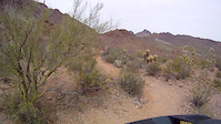
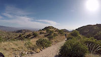
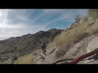
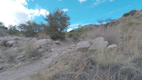
Videos of Tucson Mountain Bike
trail: AZT/BP - Bug Springs #10
0:08 |
277 |
Sep 14, 2022
trail: Golden Gate (upper)
9:03 |
225 |
Mar 31, 2021
trail: Explorer
5:25 |
260 |
May 26, 2018
trail: AZT/BP - Bug Springs #10
9:56 |
180 |
May 11, 2018
trail: AZT/BP - Bug Springs #10
0:46 |
84 |
Mar 26, 2018
trail: AZT - Molino Basin
0:12 |
393 |
Mar 11, 2018
trail: La Milagrosa
2:01 |
853 |
Dec 21, 2017

trail: Aspen Draw
4:02 |
533 |
Aug 1, 2017
Recent Trail Reports
Activity Feed
| username | action | type | title | date |
|---|---|---|---|---|
| Gerios | ridden | trail | activity #98336294 | Jul 3, 2026 @ 8:03am 1 day |
| VO2i49 | ridden | trail | activity #98179137 | Jun 30, 2026 @ 10:01pm Jun 30, 2026 |
| Dslag6 | add | photo | activity #98068603 and 13 more | Jun 29, 2026 @ 9:18am Jun 29, 2026 |
| Dslag6 | add | report | activity #97984442 and 7 more | Jun 28, 2026 @ 6:43am Jun 28, 2026 |
| davar16 | add | report | activity #97957595 and 1 more | Jun 27, 2026 @ 7:52pm Jun 27, 2026 |
Recent Comments
| username | type | title | comment | date |
|---|---|---|---|---|
| trail | Theres some really fun and committing features... | Apr 21, 2026 @ 5:37pm Apr 21, 2026 | ||
| trail | Kinda a crap trail for riding. Im a strong... | Apr 21, 2026 @ 5:33pm Apr 21, 2026 | ||
| trail | MikeBOnes is absolutely correct!! | Apr 11, 2026 @ 3:43pm Apr 11, 2026 | ||
| trail | Doesn’t look like this trail exists anymore | Mar 31, 2026 @ 11:57am Mar 31, 2026 | ||
| report | Trail has been adjusted to compensate for home... | Mar 31, 2026 @ 11:42am Mar 31, 2026 |
Local Badges
-

Completionist12 awarded -

10 Expert Trails71 awarded -

Top 10 Trails2 awarded -
Completionist0 awarded -
Completionist0 awarded -
Completionist0 awarded
Bike & Skill Parks
| name | type | city | rating |
|---|---|---|---|
| MC Motorsports Park | skill park | Tucson |
Upcoming Local Events
Local Trail Supporters
![]()
- Tucson Off-road Cyclists and Activists
![Arizona NST]()
![TORCA]()
Local Trail Supporters
![]()
- Tucson Off-road Cyclists and Activists
![Arizona NST]()
![TORCA]()
Activity Type Stats
| activitytype | trails | distance | descent | descent distance | total vertical | rating | global rank | state rank | photos | reports | routes | ridelogs |
|---|---|---|---|---|---|---|---|---|---|---|---|---|
| Mountain Bike | 391 | 592 miles | 59,997 ft | 217 miles | 7,060 ft | #118 | #45 | 1,207 | 2,654 | 50 | 122,550 | |
| E-Bike | 111 | 259 miles | 8,094 ft | 66 miles | 6,132 ft | #394 | #703 | 7 | 2,166 | 2 | 2,851 | |
| Gravel Bike | 19 | 20 miles | 1,939 ft | 8 miles | 6,670 ft | #212 | #846 | 115 | 3 | 544 | ||
| Adaptive Bike | 2 | #267 | #1,532 | 1 | 2 | |||||||
| Horse | 365 | 612 miles | 110,778 ft | 263 miles | 7,060 ft | #6 | #305 | 863 | 6 | 7 | ||
| Hike | 542 | 867 miles | 124,724 ft | 330 miles | 7,402 ft | #32 | #31 | 113 | 2,639 | 66 | 14,581 | |
| Trail Running | 533 | 860 miles | 122,507 ft | 327 miles | 7,402 ft | #42 | #30 | 7 | 2,639 | 33 | 7,228 | |
| Dirtbike/Moto | 59 | 172 miles | 9,501 ft | 56 miles | 5,735 ft | #100 | #62 | 585 | 57 | |||
| Observed Trials | 6 | 13 miles | 1,909 ft | 7 miles | 886 ft | #63 | #18 | 7 | 12 | |||
| ATV/ORV/OHV | 56 | 168 miles | 9,337 ft | 53 miles | 5,735 ft | #44 | #26 | 582 | 28 | |||
| Downhill Ski | 20 | 4 miles | 3,638 ft | 4 miles | 755 ft | 12 | 6 |
Frequently Asked Questions About Tucson
▼
What are the best places to ride in Tucson?
Tucson has 12 areas to explore for mountain biking. The top rated areas are:
▼
What are the highest rated mountain biking trails in Tucson?
The highest rated mountain biking trails in Tucson are:
- AZT/BP - Bug Springs #10 (4.6/5)
- Aspen Draw (4.5/5)
- Secret (4.5/5)
- La Milagrosa (4.4/5)
- AZT/BP - Incinerator Ridge #18A (4.4/5)
▼
What is the best time of the year to ride in Tucson?
Based on ride log data, the most popular months to ride in Tucson are:
- February (1,357 activities)
- January (1,011 activities)
- December (997 activities)
▼
Where can I park to ride in Tucson?
There are 69 parking locations listed in Tucson. The most popular parking spots are: View all parking and trailhead locations on the map to plan your visit.
Activities
Trails
Points of Interest
- Spencer Canyon Campground Camping
- Summerhaven Sight
- Spud Rock Summit
- Mica Mountain Summit
- Manning Camp Camping
- Grass Shack Campground Camping
- Enzenberg Canyon Sight
- Fish Canyon Sight
- Saddle Sight
- Tunnel Spring [Trailhead] Other
- Mount Wrightson (2,885 m)
- Mount Lemmon (2,789 m)
- Mica Mountain (2,640 m)
- By brenthillier
 NSMBA TRAILFORKS & contributors
 - Admins: TORCA, SDMB
- #3729 - 89,798 views
- tucson activity log | embed map of Tucson mountain bike trails | tucson mountain biking points of interest
Downloading of trail gps tracks in kml & gpx formats is enabled for Tucson.
You must login to download files.