close
-
Layers w
- Weather Layers
- Pro
- Pro
- Pro
- Pro
- Pro
- Pro
- More Layers
- Pro
- Pro
- Pro
- Pro
-
Upgrade to

3D
Trail Conditions
- Unknown
- Snow Groomed
- Snow Packed
- Snow Covered
- Snow Cover Partial
- Freeze/thaw Cycle
- Icy
- Prevalent Mud
- Wet
- Variable
- Ideal
- Dry
- Very Dry
Trail Flow (Ridden Direction)
Trailforks scans users ridelogs to determine the most popular direction each trail is ridden. A good flowing trail network will have most trails flowing in a single direction according to their intension.
The colour categories are based on what percentage of riders are riding a trail in its intended direction.
The colour categories are based on what percentage of riders are riding a trail in its intended direction.
- > 96%
- > 90%
- > 80%
- > 70%
- > 50%
- < 50%
- bi-directional trail
- no data
Trail Last Ridden
Trailforks scans ridelogs to determine the last time a trail was ridden.
- < 2 days
- < 1 week
- < 2 weeks
- < 1 month
- < 6 months
- > 6 months
Trail Ridden Direction
The intended direction a trail should be ridden.
- Downhill Only
- Downhill Primary
- Both Directions
- Uphill Primary
- Uphill Only
- One Direction
Contribute Details
Colors indicate trail is missing specified detail.
- Description
- Photos
- Description & Photos
- Videos
Trail Popularity ?
Trailforks scans ridelogs to determine which trails are ridden the most in the last 9 months.
Trails are compared with nearby trails in the same city region with a possible 25 colour shades.
Think of this as a heatmap, more rides = more kinetic energy = warmer colors.
- most popular
- popular
- less popular
- not popular
ATV/ORV/OHV Filter
Max Vehicle Width
inches
US Cell Coverage
Legend

Radar Time
Activity Recordings
Trailforks uses anonymized public activity data.
?
Activity Recordings
Trailforks uses anonymized public activity data.
?
Personal Heatmap
▶
Activity Types
all
/
none
▶
Options
2
Date range
month
–
Winter Trails
Warning
A routing network for winter maps does not exist. Selecting trails using the winter trails layer has been disabled.
Missing Trails
Most Popular
Least Popular
Trails are colored based on popularity. The more popular a trail is, the more red. Less popular trails trend towards green.
Jump Magnitude Heatmap
Heatmap of where riders jump on trails. Zoom in to see individual jumps, click circles to view jump details.
BC Backroad Status
![map legend]()
Service Road Atlas is a free to use, community-driven service for viewing and creating reports on the numerous back-country service roads around B.C. and Alberta.

Slope Aspect
Direction the slope faces
Trails Deemphasized
Trails are shown in grey.
Only show trails with no bike usage.
Suggested Layers
Based on selected activity type
Save the current map location and zoom level as your default home location whenever this page is loaded.
SaveTudela es un municipio y ciudad española de la Comunidad Foral de Navarra, situada a 94 km de la capital de la comunidad, Pamplona. Es la cabeza del partido judicial homónimo, cabeza de la merindad homónima y el centro económico y comercial de la Ribera de Navarra. También es el segundo municipio más poblado de Navarra con una población de 37 008 habitantes (INE 2021).
This region uses the Uk/Euro style trail grading system.
Activities Click to view
- Mountain Bike
492 trails
- E-Bike
490 trails
- Gravel Bike
17 trails
- Adaptive Bike
10 trails
- Winter Fat Bike
4 trails
- Horse
29 trails
- Hike
485 trails
- Trail Running
471 trails
Region Details
- 400
- 2
- 3
- 82
- 4
- 1
Region Status
Open as of Mar 28, 2026Stats
- Avg Trail Rating
- Trails (view details)
- 493
- Trails Mountain Bike
- 492
- Trails E-Bike
- 490
- Trails Gravel Bike
- 17
- Trails Adaptive Bike
- 10
- Trails Winter Fat Bike
- 4
- Trails Horse
- 29
- Trails Hike
- 485
- Trails Trail Running
- 471
- Total Distance
- 760 miles
- Total Descent Distance
- 290 miles
- Total Descent
- 40,236 ft
- Total Vertical
- 1,678 ft
- Highest Trailhead
- 2,405 ft
- Reports
- 98
- Photos
- 66
- Ridden Counter
- 2,281
Sub Regions
-
Ablitas-Cascante
- 1
-
Bardenas Reales
- 10
- 1
-
Fitero-Corella
- 14
-
Peralta-Funes
- 1
- 2
- 41
- 3
- 1
Popular Tudela Mountain Biking Trails
• 90 ★ 4.0 • 2 miles • 55 ft • 29 •
Popular blue difficulty singletrack. This multi-use trail can be used downhill primary and has a moderate overall physical rating with a 55 ft blue climb. Trail visibility is sometimes hard to follow. On average it takes 34 minutes to complete this trail.
• 85 ★ 2.0 • 4,928 ft • 26 ft • 20 •
Popular blue difficulty singletrack. This multi-use trail can be used downhill primary and has a moderate overall physical rating with a 26 ft blue climb. Trail visibility is sometimes hard to follow. On average it takes 9 minutes to complete this trail.
• 90 ★ 3.0 • 1,877 ft • 28 ft • 20 •
Sendero flow, con algún repechón, media ladera con algo de exposición un pequeño tramo
• 80 ★ 3.0 • 3,048 ft • 44 ft • 19 •
Popular blue difficulty singletrack. This multi-use trail can be used downhill primary and has a moderate overall physical rating. Trail visibility is sometimes hard to follow. On average it takes 5 minutes to complete this trail.
• 70 ★ 2.0 • 1,755 ft • 10 ft • 17 •
Popular blue difficulty singletrack. This multi-use trail can be used both directions and has a moderate overall physical rating with a 10 ft blue climb. Trail visibility is sometimes hard to follow. On average it takes 3 minutes to complete this trail.
• 85 ★ 4.0 • 4,541 ft • 15 ft • 16 •
Popular blue difficulty singletrack. This multi-use trail can be used both directions and has a moderate overall physical rating with a 15 ft blue climb. Trail visibility is sometimes hard to follow. On average it takes 8 minutes to complete this trail.
• 90 ★ 3.0 • 581 ft • 0 ft • 16 •
hay que tener cuidado al final...entra entre casas y hay peligro de encontrar peatones.
• 95 ★ 4.0 • 922 ft • 104 ft • 15 •
Popular blue difficulty singletrack. This multi-use trail can be used both directions and has a moderate overall physical rating with a 104 ft blue climb. Trail visibility is sometimes hard to follow. On average it takes 4 minutes to complete this trail.
Tudela Mountain Bike Routes
27 miles • 1,371 ft • 1 • Loop •
06btt. Sancho Abarca I (Bardena Negra) Completo itinerario para conocer la Bardena Negra y la Reserva de...
31 miles • 1,301 ft • 6 • Loop •
La ruta comienza en el aparcamiento de El Ferial, situado en las Bardenas Reales. Tiene un restaurante,...
27 miles • 1,371 ft • 5 • Loop •
Completo itinerario para conocer la Bardena Negra y la Reserva de las Caídas de transitando por la...
22 miles • 2,832 ft • 24 • Loop •
Combinación de senderos entre Funes y Peralta. Muy divertida.
★ 3.0 • 22 miles • 2,911 ft • 15 • Loop •
Ruta Perfecta para dias frios.El terreno aguanta la humedad. Exigente y entretenida.Parte de Peralta cruza...
8 miles • 200 ft • 0 • Loop •
En el entorno de Rada encontramos algunas de las rutas más sencillas de la Zona Media. Un buen ejemplo es...
Recent Trail Reports
| status | trail | date | condition | info | user |
|---|---|---|---|---|---|
| Matapiojos | Mar 28, 2026 @ 9:13am (Europe/Andorra) Mar 28, 2026 | Ideal | xatxo | ||
| Paso del Ciervo | Mar 28, 2026 @ 9:13am (Europe/Andorra) Mar 28, 2026 | Ideal | xatxo | ||
| Cuesta de Lucas y El Cuevon | Mar 28, 2026 @ 9:13am (Europe/Andorra) Mar 28, 2026 | Ideal | xatxo | ||
| Cabecico Maraca | Mar 28, 2026 @ 9:13am (Europe/Andorra) Mar 28, 2026 | Ideal | xatxo | ||
| Salvador | Jan 5, 2026 @ 8:41am (Europe/Madrid) Jan 4, 2026 | Dry | EduHuarte | ||
| Los Portales | May 23, 2025 @ 10:49am May 23, 2025 | Dry | NicoWatteau | ||
| Portillolobo | May 22, 2025 @ 2:36pm May 22, 2025 | Dry | NicoWatteau | ||
| Enlace Plana de Tan | May 22, 2025 @ 2:36pm May 22, 2025 | Dry | NicoWatteau | ||
| Acceso Sancho Abarca | May 22, 2025 @ 2:36pm May 22, 2025 | Ideal | NicoWatteau | ||
| Jorge Merino | Jan 29, 2025 @ 6:58am Jan 29, 2025 | Ideal | Quimic |
National Scenic Trails & Official Routes
-
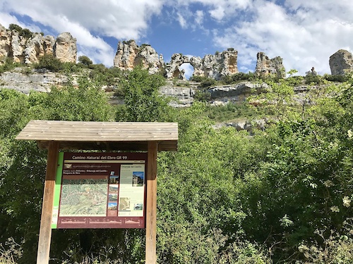
GR 99 Camino Natural del Ebro
- Mountain Bike
- E-Bike
- Horse
- Hike
- Trail Running
Activity Feed
| username | action | type | title | date |
|---|---|---|---|---|
| xatxo | add | report | activity #91457261 and 3 more | Mar 28, 2026 @ 11:35am Mar 28, 2026 |
| elorga | wishlist | route | activity #89193514 | Feb 19, 2026 @ 2:14pm Feb 19, 2026 |
| elorga | wishlist | route | activity #89007313 and 1 more | Feb 16, 2026 @ 1:07am Feb 16, 2026 |
| Angelreing | update | route | activity #88472631 | Feb 6, 2026 @ 10:50pm Feb 6, 2026 |
| Quimic | add | route | activity #88472613 | Feb 6, 2026 @ 10:48pm Feb 6, 2026 |
Recent Comments
| username | type | title | comment | date |
|---|---|---|---|---|
| trail | Unglaublicher Trail. Man kann an der Straße... | Aug 28, 2025 @ 3:54am Aug 28, 2025 | ||
| trail | El supuesto sendero es una pista... | Jan 2, 2023 @ 12:07am Jan 2, 2023 |
Local Badges
-

Completionist0 awarded -

Epic Mountain Bike Climb 2k10 awarded -

Climbing 10k Badge8 awarded -

Mountain Biking 100k Badge2 awarded -

Epic Ride Descent 2k10 awarded -

Descent 10k Badge8 awarded
Bike & Skill Parks
| name | type | city | rating |
|---|---|---|---|
| Pumptrack Murchante | skill park | Tudela |
Activity Type Stats
| activitytype | trails | distance | descent | descent distance | total vertical | rating | global rank | state rank | photos | reports | routes | ridelogs |
|---|---|---|---|---|---|---|---|---|---|---|---|---|
| Mountain Bike | 492 | 758 miles | 40,223 ft | 290 miles | 1,680 ft | #254 | #33 | 56 | 98 | 6 | 3,070 | |
| E-Bike | 490 | 757 miles | 40,171 ft | 289 miles | 1,680 ft | #51 | #35 | 95 | 6 | 253 | ||
| Gravel Bike | 17 | 35 miles | 1,001 ft | 14 miles | 571 ft | #327 | #73 | 8 | 1 | 23 | ||
| Adaptive Bike | 10 | 36 miles | 446 ft | 12 miles | 315 ft | #330 | #140 | 1 | ||||
| Winter Fat Bike | 4 | 20 miles | 203 ft | 6 miles | 82 ft | #182 | #17 | 1 | ||||
| Horse | 29 | 71 miles | 2,943 ft | 24 miles | 1,522 ft | #858 | #49 | 8 | ||||
| Hike | 485 | 751 miles | 39,459 ft | 288 miles | 1,680 ft | #96 | #27 | 4 | 96 | 6 | 118 | |
| Trail Running | 471 | 723 miles | 37,507 ft | 275 miles | 1,680 ft | #85 | #29 | 95 | 2 | 90 |
Frequently Asked Questions About Tudela
▼
What are the best places to ride in Tudela?
Tudela has 4 areas to explore for mountain biking. The top rated areas are:
▼
What are the highest rated mountain biking trails in Tudela?
The highest rated mountain biking trails in Tudela are:
- Dragon Khan (4.1/5)
- Paso de los Ciervos (4/5)
- Entorno del Piskerra (4/5)
- Salvacas (4/5)
- Royuela SuperFlow (4/5)
▼
What is the best time of the year to ride in Tudela?
Based on ride log data, the most popular months to ride in Tudela are:
- April (18 activities)
- July (17 activities)
- September (14 activities)
▼
Where can I park to ride in Tudela?
There are 6 parking locations listed in Tudela. The most popular parking spots are: View all parking and trailhead locations on the map to plan your visit.
Activities
Trails
- By Angelreing
 TFSPAIN Ezkaba & contributors
 - Admins: mul0w, elyari, AMG, juanx, Angelreing, Angelreing, raullopezch
- #50183 - 1,357 views
- tudela activity log | embed map of Tudela mountain bike trails | tudela mountain biking points of interest polygons
Downloading of trail gps tracks in kml & gpx formats is enabled for Tudela.
You must login to download files.