close
-
Layers w
- Weather Layers
- Pro
- Pro
- Pro
- Pro
- Pro
- Pro
- More Layers
- Pro
- Pro
- Pro
- Pro
-
Upgrade to

3D
Trail Conditions
- Unknown
- Snow Groomed
- Snow Packed
- Snow Covered
- Snow Cover Partial
- Freeze/thaw Cycle
- Icy
- Prevalent Mud
- Wet
- Variable
- Ideal
- Dry
- Very Dry
Trail Flow (Ridden Direction)
Trailforks scans users ridelogs to determine the most popular direction each trail is ridden. A good flowing trail network will have most trails flowing in a single direction according to their intension.
The colour categories are based on what percentage of riders are riding a trail in its intended direction.
The colour categories are based on what percentage of riders are riding a trail in its intended direction.
- > 96%
- > 90%
- > 80%
- > 70%
- > 50%
- < 50%
- bi-directional trail
- no data
Trail Last Ridden
Trailforks scans ridelogs to determine the last time a trail was ridden.
- < 2 days
- < 1 week
- < 2 weeks
- < 1 month
- < 6 months
- > 6 months
Trail Ridden Direction
The intended direction a trail should be ridden.
- Downhill Only
- Downhill Primary
- Both Directions
- Uphill Primary
- Uphill Only
- One Direction
Contribute Details
Colors indicate trail is missing specified detail.
- Description
- Photos
- Description & Photos
- Videos
Trail Popularity ?
Trailforks scans ridelogs to determine which trails are ridden the most in the last 9 months.
Trails are compared with nearby trails in the same city region with a possible 25 colour shades.
Think of this as a heatmap, more rides = more kinetic energy = warmer colors.
- most popular
- popular
- less popular
- not popular
ATV/ORV/OHV Filter
Max Vehicle Width
inches
US Cell Coverage
Legend

Radar Time
Activity Recordings
Trailforks uses anonymized public activity data.
?
Activity Recordings
Trailforks uses anonymized public activity data.
?
Personal Heatmap
▶
Activity Types
all
/
none
▶
Options
2
Date range
month
–
Winter Trails
Warning
A routing network for winter maps does not exist. Selecting trails using the winter trails layer has been disabled.
Missing Trails
Most Popular
Least Popular
Trails are colored based on popularity. The more popular a trail is, the more red. Less popular trails trend towards green.
Jump Magnitude Heatmap
Heatmap of where riders jump on trails. Zoom in to see individual jumps, click circles to view jump details.
BC Backroad Status
![map legend]()
Service Road Atlas is a free to use, community-driven service for viewing and creating reports on the numerous back-country service roads around B.C. and Alberta.

Slope Aspect
Direction the slope faces
Trails Deemphasized
Trails are shown in grey.
Only show trails with no bike usage.
Suggested Layers
Based on selected activity type
Save the current map location and zoom level as your default home location whenever this page is loaded.
Save
No description for Tulare County has been added yet!
Login or register to submit one.
Activities Click to view
- Mountain Bike
95 trails
- E-Bike
178 trails
- Horse
21 trails
- Hike
232 trails
- Trail Running
231 trails
- Snowshoe
3 trails
Region Details
- 38
- 16
- 29
- 11
- 1
Stats
- Avg Trail Rating
- Trails (view details)
- 234
- Trails Mountain Bike
- 95
- Trails E-Bike
- 178
- Trails Gravel Bike
- 11
- Trails Horse
- 21
- Trails Hike
- 232
- Trails Trail Running
- 231
- Trails Dirtbike/Moto
- 4
- Trails ATV/ORV/OHV
- 2
- Trails Snowmobile
- 1
- Trails Snowshoe
- 3
- Trails Backcountry Ski
- 1
- Total Distance
- 704 miles
- Total Descent
- 123,889 ft
- Total Vertical
- 12,386 ft
- Highest Trailhead
- 12,450 ft
- Reports
- 953
- Photos
- 378
- Ridden Counter
- 7,602
Articles
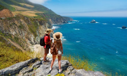
Wanna Hike in California? These Are the 13 Most Stunning Trails.
Jul 18, 2024 from outsideonline.com
A longtime Golden State hiker reveals her dream list of the most beautiful, must-see routes in California

See a Perfect Sunset in Sequoia National Park, California
Oct 8, 2019 from backpacker.com
Private lake views and a show are a good enough reason to tackle this 3-day trek.
Sub Regions
- Camp Nelson (3)
- Hartland (17)
- Redwood Mountain (13)
- Ponderosa (1)
- Porterville (20)
- Three Rivers (56)
- Case Mountain (45)
- Sequoia National Park (4)
- Tulare (1)
- Wilsonia (3)
Popular Tulare County Mountain Biking Trails
• 100 ★ 3.8 • 551 ft • 0 ft • 175 •
Popular blue difficulty singletrack. This mountain bike primary trail can be used downhill primary. It features berm, jump and rock garden. On average it takes 1 minutes to complete this trail.
• 95 ★ 3.9 • 3,241 ft • 4 ft • 143 •
Popular blue difficulty singletrack. This mountain bike primary trail can be used downhill primary. On average it takes 11 minutes to complete this trail.
• 100 ★ 3.8 • 598 ft • 5 ft • 135 •
Popular blue difficulty singletrack. This mountain bike primary trail can be used downhill primary. On average it takes 1 minutes to complete this trail.
• 90 ★ 4.0 • 495 ft • 0 ft • 128 •
Popular black diamond difficulty singletrack. This mountain bike primary trail can be used downhill primary. On average it takes minutes to complete this trail.
• 75 ★ 3.6 • 2,648 ft • 3 ft • 115 •
Popular blue difficulty singletrack. This mountain bike primary trail can be used downhill primary. On average it takes 4 minutes to complete this trail.
• 80 ★ 3.8 • 1,549 ft • 0 ft • 108 •
Popular green difficulty singletrack. This mountain bike primary trail can be used downhill primary. On average it takes 1 minutes to complete this trail.
• 70 ★ 3.6 • 4,252 ft • 0 ft • 107 •
Popular black diamond difficulty singletrack. This mountain bike primary trail can be used downhill primary. On average it takes 8 minutes to complete this trail.
• 95 ★ 3.0 • 1,634 ft • 0 ft • 105 •
Quick flow with some Three Rivers Chunk and several jumps
Tulare County Mountain Bike Routes
5 miles • 1,009 ft • 9 • Loop •
Route takes you on the most popular trails in the lower mountain area. Climb up to the start of Mud Hen,...
2 miles • 365 ft • 1 •
★ 3.0 • 4 miles • 819 ft • 4 • Out & Back •
A common out & back ride that is both quick and fun. The climb is easy and the downhill is fast and...
3 miles • 459 ft • 4 •
★ 3.2 • 8 miles • 2,042 ft • 31 • Loop •
A common route/loop for the Case Mountain area. This route includes a few of the best trails in the area:...
7 miles • 1,470 ft • 4 •
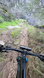
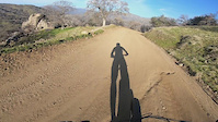
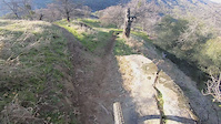
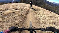
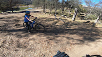
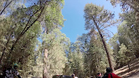
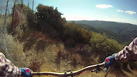
Photos of Tulare County Mountain Bike
Videos of Tulare County Mountain Bike
trail: Chutes & Ladders
0:11 |
74 |
Dec 29, 2025
trail: Lower Connector
0:17 |
93 |
Dec 3, 2020
trail: Upper Connector
0:27 |
85 |
Dec 3, 2020
trail: Mud Room
2:24 |
|
Dec 3, 2020
trail: Bear Crack
3:25 |
70 |
Dec 2, 2020
trail: Creek Trail
5:24 |
418 |
Sep 5, 2014
trail: Ridge Trail
4:29 |
534 |
Nov 21, 2013
trail: Creek Trail
6:57 |
250 |
Sep 22, 2011
Recent Trail Reports
Activity Feed
| username | action | type | title | date |
|---|---|---|---|---|
| theboosh | wishlist | region | activity #96657225 | Jun 10, 2026 @ 12:30am Jun 10, 2026 |
| 3rsager | add | report | activity #96305894 and 8 more | Jun 5, 2026 @ 10:15am Jun 5, 2026 |
| lancemason15 | wishlist | route | activity #95457996 | May 24, 2026 @ 5:39pm May 24, 2026 |
| MikeJensen2145 | wishlist | region | activity #94868585 | May 16, 2026 @ 7:02pm May 16, 2026 |
| Wanderwegger | wishlist | region | activity #94176876 | May 6, 2026 @ 2:07pm May 6, 2026 |
Recent Comments
| username | type | title | comment | date |
|---|---|---|---|---|
| trail | Extremely challenging climb, but worth it if... | Oct 7, 2025 @ 9:50pm Oct 7, 2025 | ||
| trail | Super rutty and not very well maintained. I... | Oct 7, 2025 @ 9:48pm Oct 7, 2025 | ||
| trail | Another hiking trail turned into mtb for some... | Aug 10, 2025 @ 10:41am Aug 10, 2025 | ||
| trail | Closed due to wildfire damage | Jun 5, 2025 @ 9:13am Jun 5, 2025 | ||
| trail | Challenging spots with rocks on this one. ... | Dec 14, 2024 @ 8:44pm Dec 14, 2024 |
Local Badges
-

Epic Ride Descent 2k4 awarded -

Descent 100k Badge0 awarded -

Descent 10k Badge0 awarded -

Big Ride 30k11 awarded -

Mountain Biking 100k Badge0 awarded -

Climbing 10k Badge0 awarded
Bike & Skill Parks
| name | type | city | rating |
|---|---|---|---|
| DT1 MX Park | skill park | Tulare | |
| Porterville OHV Area | skill park | Porterville |
Activity Type Stats
| activitytype | trails | distance | descent | descent distance | total vertical | rating | global rank | state rank | photos | reports | routes | ridelogs |
|---|---|---|---|---|---|---|---|---|---|---|---|---|
| Mountain Bike | 95 | 214 miles | 38,491 ft | 94 miles | 8,363 ft | 366 | 952 | 16 | 6,556 | |||
| E-Bike | 178 | 530 miles | 100,256 ft | 222 miles | 12,385 ft | 348 | 1 | 682 | ||||
| Gravel Bike | 11 | 27 miles | 2,375 ft | 6 miles | 5,128 ft | 104 | 1 | 8 | ||||
| Horse | 21 | 109 miles | 19,544 ft | 50 miles | 9,357 ft | 102 | 9 | |||||
| Hike | 232 | 697 miles | 120,413 ft | 277 miles | 12,385 ft | 9 | 951 | 105 | 3,482 | |||
| Trail Running | 231 | 693 miles | 119,255 ft | 275 miles | 12,385 ft | 3 | 902 | 104 | 501 | |||
| Dirtbike/Moto | 4 | 34 miles | 4,298 ft | 14 miles | 3,901 ft | 49 | 6 | |||||
| ATV/ORV/OHV | 2 | 8 miles | 1,585 ft | 4 miles | 650 ft | 49 | ||||||
| Snowmobile | 1 | 4 miles | 1,161 ft | 2 miles | 594 ft | |||||||
| Snowshoe | 3 | 10 miles | 3,297 ft | 6 miles | 2,162 ft | 10 | 3 | |||||
| Backcountry Ski | 1 | 7 miles | 3,281 ft | 6 miles | 2,759 ft | 70 |
Frequently Asked Questions About Tulare County
▼
What are the best places to ride in Tulare County?
Tulare County has 5 areas to explore for mountain biking. The top rated areas are:
▼
What are the highest rated mountain biking trails in Tulare County?
The highest rated mountain biking trails in Tulare County are:
- Face (4.2/5)
- Seven Teacups Trail (4.1/5)
- Paradise Ridge - Redwood Meadows Trail (4.1/5)
- Quaking Aspen Trail (4.1/5)
- Bedrock (4.1/5)
▼
What is the best time of the year to ride in Tulare County?
Based on ride log data, the most popular months to ride in Tulare County are:
- February (37 activities)
- July (31 activities)
- October (30 activities)
▼
What is the longest trail in Tulare County?
The longest trail in Tulare County is Paradise Ridge - Redwood Meadows Trail at 5.8 miles. View all trails sorted by distance.
Activities
Trails
Points of Interest
- Boardwalk Bridge
- Granite Pass Summit
- Giant Forest Museum Other
- Mist Falls Sight
- Little Baldy Summit
- 3 Springs Sight
- Stony Creek Campground Camping
- Back Country Camp Camping
- Back Country Camp Camping
- Black Rock Pass 3565m - 11696ft Summit
- Mount Kaweah (13,796 ft)
- Red Kaweah (13,714 ft)
- Black Kaweah (13,619 ft)
- By brenthillier
 NSMBA TRAILFORKS & contributors
 - Admins: jpmcghee, sanfret, brianpetry, TheAngryTomato, CMSCTC
- #7912 - 9,809 views
- tulare county activity log | embed map of Tulare County mountain bike trails | tulare county mountain biking points of interest
Downloading of trail gps tracks in kml & gpx formats is enabled for Tulare County.
You must login to download files.