close
-
Layers w
- Weather Layers
- Pro
- Pro
- Pro
- Pro
- Pro
- Pro
- More Layers
- Pro
- Pro
- Pro
- Pro
-
Upgrade to

3D
Trail Conditions
- Unknown
- Snow Groomed
- Snow Packed
- Snow Covered
- Snow Cover Partial
- Freeze/thaw Cycle
- Icy
- Prevalent Mud
- Wet
- Variable
- Ideal
- Dry
- Very Dry
Trail Flow (Ridden Direction)
Trailforks scans users ridelogs to determine the most popular direction each trail is ridden. A good flowing trail network will have most trails flowing in a single direction according to their intension.
The colour categories are based on what percentage of riders are riding a trail in its intended direction.
The colour categories are based on what percentage of riders are riding a trail in its intended direction.
- > 96%
- > 90%
- > 80%
- > 70%
- > 50%
- < 50%
- bi-directional trail
- no data
Trail Last Ridden
Trailforks scans ridelogs to determine the last time a trail was ridden.
- < 2 days
- < 1 week
- < 2 weeks
- < 1 month
- < 6 months
- > 6 months
Trail Ridden Direction
The intended direction a trail should be ridden.
- Downhill Only
- Downhill Primary
- Both Directions
- Uphill Primary
- Uphill Only
- One Direction
Contribute Details
Colors indicate trail is missing specified detail.
- Description
- Photos
- Description & Photos
- Videos
Trail Popularity ?
Trailforks scans ridelogs to determine which trails are ridden the most in the last 9 months.
Trails are compared with nearby trails in the same city region with a possible 25 colour shades.
Think of this as a heatmap, more rides = more kinetic energy = warmer colors.
- most popular
- popular
- less popular
- not popular
ATV/ORV/OHV Filter
Max Vehicle Width
inches
US Cell Coverage
Legend

Radar Time
Activity Recordings
Trailforks uses anonymized public activity data.
?
Activity Recordings
Trailforks uses anonymized public activity data.
?
Personal Heatmap
▶
Activity Types
all
/
none
▶
Options
2
Date range
month
–
Winter Trails
Warning
A routing network for winter maps does not exist. Selecting trails using the winter trails layer has been disabled.
Missing Trails
Most Popular
Least Popular
Trails are colored based on popularity. The more popular a trail is, the more red. Less popular trails trend towards green.
Jump Magnitude Heatmap
Heatmap of where riders jump on trails. Zoom in to see individual jumps, click circles to view jump details.
BC Backroad Status
![map legend]()
Service Road Atlas is a free to use, community-driven service for viewing and creating reports on the numerous back-country service roads around B.C. and Alberta.

Slope Aspect
Direction the slope faces
Trails Deemphasized
Trails are shown in grey.
Only show trails with no bike usage.
Suggested Layers
Based on selected activity type
Save the current map location and zoom level as your default home location whenever this page is loaded.
Save
No description for Tunbridge Wells has been added yet!
Login or register to submit one.
This region uses the Uk/Euro style trail grading system.
Activities Click to view
- Mountain Bike
45 trails
- E-Bike
10 trails
- Gravel Bike
0 trails
- Adaptive Bike
0 trails
- Winter Fat Bike
0 trails
- Hike
30 trails
- Trail Running
30 trails
Region Details
- 16
- 5
- 5
- 15
- 1
Region Status
Open as of May 2, 2026Stats
- Avg Trail Rating
- Trails (view details)
- 42
- Trails Mountain Bike
- 45
- Trails E-Bike
- 10
- Trails Hike
- 30
- Trails Trail Running
- 30
- Total Distance
- 19 miles
- Total Descent
- 1,794 ft
- Total Vertical
- 262 ft
- Highest Trailhead
- 472 ft
- Reports
- 990
- Photos
- 42
- Ridden Counter
- 22,403
Sub Regions
-
Bedgebury Forest
- 4
- 5
- 15
- 1
Popular Tunbridge Wells Mountain Biking Trails
• 100 ★ 5.0 • 1,814 ft • 0 ft • 864 •
Easy red, no drops or jumps. Good intro to single track for young riders and novices. Fun and flowing for more skilled riders, just mind the trees when your speed builds!
• 85 ★ 3.9 • 2,008 ft • 13 ft • 858 •
Part of Bedgebury XC route. Fun segment with few rollers that can be used to get some air.
• 95 ★ 3.8 • 751 ft • 0 ft • 856 •
Popular red difficulty singletrack. This mountain bike primary trail can be used downhill primary. On average it takes minutes to complete this trail.
• 95 ★ 5.0 • 1,900 ft • 13 ft • 852 •
Easy trail, in pleasant surroundings. Red graded but no technical features to worry about, would be a Blue anywhere else. Ups and downs but nothing significant. A few roots and potholes but all easily manageable. Even on a hybrid or CX...
• 60 ★ 4.4 • 1,752 ft • 0 ft • 835 •
Highly rated moderately popular blue difficulty singletrack. This mountain bike primary trail and has a moderate overall physical rating with a 0 ft blue climb. It features berm. Trail visibility is always easy to follow. On average it takes 5 minutes to complete this trail.
• 90 ★ 3.7 • 1,299 ft • 17 ft • 816 •
Popular green difficulty family friendly singletrack. This mountain bike primary trail can be used uphill primary and has a easy overall physical rating with a 17 ft blue climb. On average it takes 1 minutes to complete this trail.
Tunbridge Wells Mountain Bike Routes
★ 5.0 • 10 miles • 805 ft • 25 • Loop •
A route beginning from parking of . Hits most of the trails within Bedgebury with a stop at the Bedgebury...
★ 3.4 • 9 miles • 786 ft • 45 • Loop •
The route is well marked from the car park. The parking fee is £12, but annual membership at around £60...
★ 3.0 • 11 miles • 985 ft • 47 • Loop •
The route is well marked from the car park. The parking fee is £12, but annual membership at around £60...
★ 4.0 • 12 miles • 701 ft • 0 • Loop •
A looped route around the Bewl Water reservoir on mixed trail and country roads. Trail maintained by Bewl...
• 15 miles • 1,550 ft • 25 •
• 19 miles • 1,809 ft • 43 •
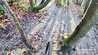
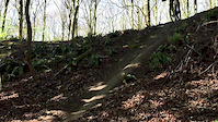
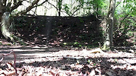
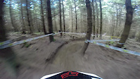
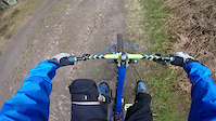
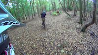
Photos of Tunbridge Wells Mountain Bike
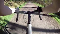
Videos of Tunbridge Wells Mountain Bike
trail: Holby
0:04 |
413 |
Nov 28, 2020
trail: Gloomy Wood
0:00 |
386 |
Dec 7, 2017
trail: bomb hole
0:08 |
187 |
Jun 2, 2015
trail: bomb hole
0:36 |
137 |
Jun 2, 2015
trail: bomb hole
3:13 |
334 |
Apr 6, 2015
trail: Helter Skelter
5:05 |
405 |
Mar 3, 2015
trail: Magic Carpet
0:29 |
395 |
Oct 25, 2013

trail: bomb hole
0:09 |
277 |
Aug 10, 2013
Recent Trail Reports
| status | trail | date | condition | info | user |
|---|---|---|---|---|---|
| Cake Run | May 2, 2026 @ 11:07pm (Europe/London) May 2, 2026 | Very Dry | sneezing7 | ||
| Show of Hands | Apr 27, 2026 @ 2:27pm (Europe/London) Apr 27, 2026 | Variable | Rich24 | ||
| Holby | Apr 13, 2026 @ 10:58pm (Europe/London) Apr 13, 2026 | Dry | al-smith67 | ||
| Helter Skelter | Apr 6, 2026 @ 10:58am (Europe/London) Apr 6, 2026 | Very Dry | seanmccrory | ||
| Dad's Army | Apr 6, 2026 @ 10:58am (Europe/London) Apr 6, 2026 | Dry | seanmccrory | ||
| Genesis | Apr 6, 2026 @ 10:58am (Europe/London) Apr 6, 2026 | Dry | seanmccrory | ||
| Starvegoose | Apr 6, 2026 @ 10:58am (Europe/London) Apr 6, 2026 | Dry | seanmccrory | ||
| Feed the Goose | Apr 6, 2026 @ 10:58am (Europe/London) Apr 6, 2026 | Dry | seanmccrory | ||
| Not So Pointless | Apr 6, 2026 @ 10:58am (Europe/London) Apr 6, 2026 | Very Dry | seanmccrory | ||
| Fibreglass Trees | Apr 6, 2026 @ 10:58am (Europe/London) Apr 6, 2026 | Dry | seanmccrory |
Activity Feed
| username | action | type | title | date |
|---|---|---|---|---|
| Chriswww89 | ridden | trail | activity #95915556 | May 31, 2026 @ 1:34am May 31, 2026 |
| funkydanger | wishlist | trail | activity #94913445 | May 17, 2026 @ 9:36am May 17, 2026 |
| PellisBlud | ridden | route | activity #94282785 | May 8, 2026 @ 3:45pm May 8, 2026 |
| sneezing7 | add | report | activity #93897957 | May 2, 2026 @ 3:07pm May 2, 2026 |
| Rich24 | add | report | activity #93528733 and 1 more | Apr 27, 2026 @ 10:59am Apr 27, 2026 |
Recent Comments
| username | type | title | comment | date |
|---|---|---|---|---|
| trail | Still runs just not many features | Aug 24, 2021 @ 10:16am Aug 24, 2021 | ||
| trail | Watch out for the narrow gaps through the... | Mar 2, 2021 @ 10:56pm Mar 2, 2021 | ||
| trail | This is the best part of the Bedgebury red route | Mar 2, 2021 @ 10:43pm Mar 2, 2021 | ||
| trail | Challenging beginning with climbing up on rock... | Sep 13, 2020 @ 10:54pm Sep 13, 2020 | ||
| trail | Fast and fun, but It's not a red really. | Dec 6, 2017 @ 11:38pm Dec 6, 2017 |
Local Badges
-

Epic Ride Climb 2k9 awarded -

Climbing 10k Badge32 awarded -

Climbing 100k Badge1 awarded -

Epic Ride Descent 2k8 awarded -

Descent 10k Badge32 awarded -

Descent 100k Badge1 awarded
Activity Type Stats
| activitytype | trails | distance | descent | descent distance | total vertical | rating | global rank | state rank | photos | reports | routes | ridelogs |
|---|---|---|---|---|---|---|---|---|---|---|---|---|
| Mountain Bike | 45 | 19 miles | 1,795 ft | 9 miles | 262 ft | #1,042 | #41 | 42 | 983 | 4 | 7,731 | |
| E-Bike | 10 | 2 miles | 358 ft | 1 mile | 249 ft | #4,602 | #187 | 889 | 2 | 890 | ||
| Hike | 30 | 15 miles | 1,391 ft | 7 miles | 256 ft | #6,661 | #177 | 918 | 1 | 423 | ||
| Trail Running | 30 | 15 miles | 1,391 ft | 7 miles | 256 ft | #6,096 | #164 | 918 | 1 | 380 |
Frequently Asked Questions About Tunbridge Wells
▼
What are the best places to ride in Tunbridge Wells?
Tunbridge Wells has 2 areas to explore for mountain biking. The top rated areas are:
▼
What are the highest rated mountain biking trails in Tunbridge Wells?
The highest rated mountain biking trails in Tunbridge Wells are:
- Dad's Army (4.5/5)
- Quarry Descent (4.3/5)
- Sweetness (4.3/5)
- Show of Hands (4.2/5)
- Genesis (4.2/5)
▼
What is the best time of the year to ride in Tunbridge Wells?
Based on ride log data, the most popular months to ride in Tunbridge Wells are:
- August (49 activities)
- July (41 activities)
- October (40 activities)
▼
Where can I park to ride in Tunbridge Wells?
Check the Tunbridge Wells trail map for trailhead and parking information. Community members regularly update access and parking details for trails in the area.
Activities
Trails
Points of Interest
- By trailforks
 Trailforks & contributors
 - Admins: wisey, MathieuC, cemoorelife
- #10830 - 7,571 views
- tunbridge wells activity log | embed map of Tunbridge Wells mountain bike trails | tunbridge wells mountain biking points of interest
Downloading of trail gps tracks in kml & gpx formats is enabled for Tunbridge Wells.
You must login to download files.