close
-
Layers w
- Weather Layers
- Pro
- Pro
- Pro
- Pro
- Pro
- Pro
- More Layers
- Pro
- Pro
- Pro
- Pro
-
Upgrade to

3D
Trail Conditions
- Unknown
- Snow Groomed
- Snow Packed
- Snow Covered
- Snow Cover Partial
- Freeze/thaw Cycle
- Icy
- Prevalent Mud
- Wet
- Variable
- Ideal
- Dry
- Very Dry
Trail Flow (Ridden Direction)
Trailforks scans users ridelogs to determine the most popular direction each trail is ridden. A good flowing trail network will have most trails flowing in a single direction according to their intension.
The colour categories are based on what percentage of riders are riding a trail in its intended direction.
The colour categories are based on what percentage of riders are riding a trail in its intended direction.
- > 96%
- > 90%
- > 80%
- > 70%
- > 50%
- < 50%
- bi-directional trail
- no data
Trail Last Ridden
Trailforks scans ridelogs to determine the last time a trail was ridden.
- < 2 days
- < 1 week
- < 2 weeks
- < 1 month
- < 6 months
- > 6 months
Trail Ridden Direction
The intended direction a trail should be ridden.
- Downhill Only
- Downhill Primary
- Both Directions
- Uphill Primary
- Uphill Only
- One Direction
Contribute Details
Colors indicate trail is missing specified detail.
- Description
- Photos
- Description & Photos
- Videos
Trail Popularity ?
Trailforks scans ridelogs to determine which trails are ridden the most in the last 9 months.
Trails are compared with nearby trails in the same city region with a possible 25 colour shades.
Think of this as a heatmap, more rides = more kinetic energy = warmer colors.
- most popular
- popular
- less popular
- not popular
ATV/ORV/OHV Filter
Max Vehicle Width
inches
US Cell Coverage
Legend

Radar Time
Activity Recordings
Trailforks uses anonymized public activity data.
?
Activity Recordings
Trailforks uses anonymized public activity data.
?
Personal Heatmap
▶
Activity Types
all
/
none
▶
Options
2
Date range
month
–
Winter Trails
Warning
A routing network for winter maps does not exist. Selecting trails using the winter trails layer has been disabled.
Missing Trails
Most Popular
Least Popular
Trails are colored based on popularity. The more popular a trail is, the more red. Less popular trails trend towards green.
Jump Magnitude Heatmap
Heatmap of where riders jump on trails. Zoom in to see individual jumps, click circles to view jump details.
BC Backroad Status
![map legend]()
Service Road Atlas is a free to use, community-driven service for viewing and creating reports on the numerous back-country service roads around B.C. and Alberta.

Slope Aspect
Direction the slope faces
Trails Deemphasized
Trails are shown in grey.
Only show trails with no bike usage.
Suggested Layers
Based on selected activity type
Save the current map location and zoom level as your default home location whenever this page is loaded.
SaveArrondissement Turnhout:
Arendonk, Baarle-Hertog, Balen, Beerse, Dessel, Geel, Grobbendonk, Herentals, Herenthout, Herselt, Hoogstraten, Hulshout, Kasterlee, Laakdal, Lille, Meerhout, Merksplas, Mol, Olen, Oud-Turnhout, Ravels, Retie, Rijkevorsel, Turnhout, Vorselaar, Vosselaar, Westerlo
Arendonk, Baarle-Hertog, Balen, Beerse, Dessel, Geel, Grobbendonk, Herentals, Herenthout, Herselt, Hoogstraten, Hulshout, Kasterlee, Laakdal, Lille, Meerhout, Merksplas, Mol, Olen, Oud-Turnhout, Ravels, Retie, Rijkevorsel, Turnhout, Vorselaar, Vosselaar, Westerlo
This region uses the Uk/Euro style trail grading system.
Activities Click to view
- Mountain Bike
39 trails
- E-Bike
20 trails
- Adaptive Bike
0 trails
- Winter Fat Bike
0 trails
- Horse
4 trails
- Hike
32 trails
- Trail Running
33 trails
Region Details
- 8
- 24
- 7
Region Status
Open as of Jun 6, 2026Stats
- Avg Trail Rating
- Trails (view details)
- 40
- Trails Mountain Bike
- 39
- Trails E-Bike
- 20
- Trails Horse
- 4
- Trails Hike
- 32
- Trails Trail Running
- 33
- Trails Dirtbike/Moto
- 1
- Total Distance
- 35 miles
- Total Descent
- 2,226 ft
- Total Vertical
- 143 ft
- Highest Trailhead
- 163 ft
- Reports
- 133
- Photos
- 18
- Ridden Counter
- 3,696
Popular Turnhout Mountain Biking Trails
• 95 ★ 0.0 • 2,986 ft • 126 ft • 260 •
Up en down in the woods of Kasterlee. lots of roots
• 85 ★ 0.0 • 2 miles • 451 ft • 228 •
Popular green difficulty singletrack. This mountain bike primary trail can be used both directions and has a easy overall physical rating with a 451 ft green climb. Trail visibility is always easy to follow. On average it takes 11 minutes to complete this trail.
• 90 ★ 0.0 • 1,486 ft • 8 ft • 213 •
Popular green difficulty singletrack. This mountain bike primary trail can be used both directions. On average it takes 1 minutes to complete this trail.
• 70 ★ 4.0 • 4,728 ft • 113 ft • 184 •
Popular blue difficulty singletrack. This mountain bike primary trail can be used one direction and has a hard overall physical rating with a 113 ft black diamond climb. On average it takes 10 minutes to complete this trail.
• 75 ★ 4.0 • 1 mile • 46 ft • 163 •
Popular blue difficulty singletrack. This mountain bike primary trail can be used one direction and has a moderate overall physical rating. Trail visibility is always easy to follow. On average it takes 14 minutes to complete this trail.
• 65 ★ 0.0 • 2,835 ft • 31 ft • 152 •
Moderately popular green difficulty singletrack. This mountain bike primary trail can be used both directions. It features drop. On average it takes 2 minutes to complete this trail.
• 90 ★ 0.0 • 3,220 ft • 141 ft • 126 •
Popular green difficulty singletrack. This mountain bike primary trail can be used both directions and has a easy overall physical rating with a 141 ft green climb. Trail visibility is always easy to follow. On average it takes 3 minutes to complete this trail.
Turnhout Mountain Bike Routes
34 miles • 473 ft • 0 • Loop •
Mooie fietstocht die die na een goed aantal kilometers langs een beachbar komt. Rijd voornamelijk over...
38 miles • 635 ft • 0 • Loop •
Startplaats: Sportpark Brasel Sportpark 2, 2480 Dessel
Photos of Turnhout Mountain Bike
Videos of Turnhout Mountain Bike
youtuber
![De Beste XC MTB Route van België ligt net...]()
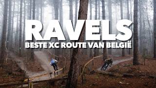
trail: ATB Kempen
5:49 |
55 |
Nov 2, 2025 , Turnhout
youtuber
![Herentals]()
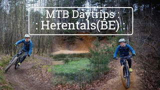
trail: BLOSO Zwart Part 2
8:32 |
164 |
Apr 29, 2024 , Turnhout
youtuber
![Herentals]()

trail: Singletrack BLOSO rood
8:32 |
138 |
Apr 29, 2024 , Turnhout
youtuber
![Herentals]()

trail: BLOSO Zwart Part 1
8:32 |
149 |
Apr 29, 2024 , Turnhout
Recent Trail Reports
| status | trail | date | condition | info | user |
|---|---|---|---|---|---|
| Singletrack Golf | Mar 14, 2026 @ 1:39pm (Europe/Brussels) Mar 14, 2026 | Wet | Rafmo21 | ||
| Epelaar | Mar 14, 2026 @ 1:39pm (Europe/Brussels) Mar 14, 2026 | Wet | Rafmo21 | ||
| Singletrack Lichtaart | Mar 7, 2026 @ 8:46am (Europe/Brussels) Mar 6, 2026 | Ideal | Rafmo21 | ||
| Rastaartven | Mar 22, 2025 @ 11:07am Mar 22, 2025 | Ideal | Rafmo21 | ||
| Singletrack Gemeentelijke visvijver 't Gewad | Dec 15, 2024 @ 10:22am Dec 15, 2024 | Wet | MaDeVo | ||
| Den Diel | Dec 17, 2023 @ 4:21am Dec 17, 2023 | Wet | MaDeVo | ||
| Singletrack BLOSO rood | Oct 22, 2023 @ 2:48am Oct 22, 2023 | Variable | TheHill MTBTheHill | ||
| Alt. BLOSO rood met drop | Oct 22, 2023 @ 2:48am Oct 22, 2023 | Variable | TheHill MTBTheHill | ||
| Cyclocross Trainingparcours | Oct 22, 2023 @ 2:48am Oct 22, 2023 | Variable | TheHill MTBTheHill | ||
| Verbinding Wijngaard - Kerkhof | Oct 22, 2023 @ 2:48am Oct 22, 2023 | Variable | TheHill MTBTheHill |
Activity Feed
| username | action | type | title | date |
|---|---|---|---|---|
| ThorMichielsen | ridden | trail | activity #94109430 | May 5, 2026 @ 12:43pm May 5, 2026 |
| yentelb16 | ridden | trail | activity #93026859 and 1 more | Apr 20, 2026 @ 10:30am Apr 20, 2026 |
| jkIjXrC | ridden | trail | activity #91190482 and 1 more | Mar 24, 2026 @ 2:03am Mar 24, 2026 |
| Rafmo21 | add | report | activity #90583181 and 1 more | Mar 14, 2026 @ 2:17pm Mar 14, 2026 |
| Rafmo21 | add | report | activity #90144212 | Mar 7, 2026 @ 11:55am Mar 7, 2026 |
Local Badges
-

Epic Ride Climb 2k9 awarded -

Climbing 10k Badge76 awarded -

Climbing 100k Badge5 awarded -

Epic Ride Descent 2k9 awarded -

Descent 10k Badge75 awarded -

Descent 100k Badge5 awarded
Bike & Skill Parks
| name | type | city | rating |
|---|---|---|---|
| M.C. Lille motocross | skill park | Turnhout |
Activity Type Stats
| activitytype | trails | distance | descent | descent distance | total vertical | rating | global rank | state rank | photos | reports | routes | ridelogs |
|---|---|---|---|---|---|---|---|---|---|---|---|---|
| Mountain Bike | 39 | 31 miles | 2,211 ft | 12 miles | 144 ft | #2,070 | #18 | 18 | 130 | 3 | 19,792 | |
| E-Bike | 20 | 17 miles | 1,660 ft | 7 miles | 144 ft | #1,374 | #15 | 115 | 1 | 1,095 | ||
| Horse | 4 | 3 miles | 161 ft | 4,964 ft | 43 ft | #553 | #7 | 16 | ||||
| Hike | 32 | 25 miles | 1,834 ft | 10 miles | 144 ft | #2,027 | #19 | 129 | 350 | |||
| Trail Running | 33 | 26 miles | 1,847 ft | 10 miles | 144 ft | #1,510 | #19 | 129 | 442 | |||
| Dirtbike/Moto | 1 | 3,481 ft | 10 ft | 636 ft | 10 ft | 6 |
Frequently Asked Questions About Turnhout
▼
What are the highest rated mountain biking trails in Turnhout?
The highest rated mountain biking trails in Turnhout are:
- Route Poppel (4/5)
- Singletrack Gemeentelijke visvijver 't Gewad (4/5)
- BLOSO Zwart Part 2 (4/5)
- BLOSO Zwart Part 1 (4/5)
- Rauw Put Trail 1 (3.9/5)
▼
What is the best time of the year to ride in Turnhout?
Based on ride log data, the most popular months to ride in Turnhout are:
- July (72 activities)
- October (61 activities)
- December (59 activities)
▼
Where can I park to ride in Turnhout?
Check the Turnhout trail map for trailhead and parking information. Community members regularly update access and parking details for trails in the area.
▼
What is the longest trail in Turnhout?
The longest trail in Turnhout is ATB Kempen at 3.2 miles. View all trails sorted by distance.
- By Jenstin
 TRAILFORKS & contributors
 - Admins: apply
- #24365 - 3,825 views
- turnhout activity log | embed map of Turnhout mountain bike trails |
Downloading of trail gps tracks in kml & gpx formats is enabled for Turnhout.
You must login to download files.