close
-
Layers w
- Weather Layers
- Pro
- Pro
- Pro
- Pro
- Pro
- Pro
- More Layers
- Pro
- Pro
- Pro
- Pro
-
Upgrade to

3D
Trail Conditions
- Unknown
- Snow Groomed
- Snow Packed
- Snow Covered
- Snow Cover Partial
- Freeze/thaw Cycle
- Icy
- Prevalent Mud
- Wet
- Variable
- Ideal
- Dry
- Very Dry
Trail Flow (Ridden Direction)
Trailforks scans users ridelogs to determine the most popular direction each trail is ridden. A good flowing trail network will have most trails flowing in a single direction according to their intension.
The colour categories are based on what percentage of riders are riding a trail in its intended direction.
The colour categories are based on what percentage of riders are riding a trail in its intended direction.
- > 96%
- > 90%
- > 80%
- > 70%
- > 50%
- < 50%
- bi-directional trail
- no data
Trail Last Ridden
Trailforks scans ridelogs to determine the last time a trail was ridden.
- < 2 days
- < 1 week
- < 2 weeks
- < 1 month
- < 6 months
- > 6 months
Trail Ridden Direction
The intended direction a trail should be ridden.
- Downhill Only
- Downhill Primary
- Both Directions
- Uphill Primary
- Uphill Only
- One Direction
Contribute Details
Colors indicate trail is missing specified detail.
- Description
- Photos
- Description & Photos
- Videos
Trail Popularity ?
Trailforks scans ridelogs to determine which trails are ridden the most in the last 9 months.
Trails are compared with nearby trails in the same city region with a possible 25 colour shades.
Think of this as a heatmap, more rides = more kinetic energy = warmer colors.
- most popular
- popular
- less popular
- not popular
ATV/ORV/OHV Filter
Max Vehicle Width
inches
US Cell Coverage
Legend

Radar Time
Activity Recordings
Trailforks uses anonymized public activity data.
?
Activity Recordings
Trailforks uses anonymized public activity data.
?
Personal Heatmap
▶
Activity Types
all
/
none
▶
Options
2
Date range
month
–
Winter Trails
Warning
A routing network for winter maps does not exist. Selecting trails using the winter trails layer has been disabled.
Missing Trails
Most Popular
Least Popular
Trails are colored based on popularity. The more popular a trail is, the more red. Less popular trails trend towards green.
Jump Magnitude Heatmap
Heatmap of where riders jump on trails. Zoom in to see individual jumps, click circles to view jump details.
BC Backroad Status
![map legend]()
Service Road Atlas is a free to use, community-driven service for viewing and creating reports on the numerous back-country service roads around B.C. and Alberta.

Slope Aspect
Direction the slope faces
Trails Deemphasized
Trails are shown in grey.
Only show trails with no bike usage.
Suggested Layers
Based on selected activity type
Save the current map location and zoom level as your default home location whenever this page is loaded.
Save
No description for Tyrebagger has been added yet!
Login or register to submit one.
 google parking directions
google parking directionsThis region uses the Uk/Euro style trail grading system.
Activities Click to view
- Mountain Bike
23 trails
- E-Bike
15 trails
- Hike
24 trails
- Trail Running
24 trails
Region Details
- 11
- 3
- 7
- 2
Region Status
Caution as of Dec 27, 2025Stats
- Avg Trail Rating
- Trails (view details)
- 23
- Trails Mountain Bike
- 24
- Trails E-Bike
- 15
- Trails Hike
- 24
- Trails Trail Running
- 24
- Total Distance
- 11 miles
- Total Descent
- 2,112 ft
- Total Vertical
- 552 ft
- Highest Trailhead
- 866 ft
- Reports
- 72
- Photos
- 15
- Ridden Counter
- 1,503
Popular Tyrebagger Mountain Biking Trails
• 65 ★ 0.0 • 2,516 ft • 0 ft • 110 •
Moderately popular blue difficulty singletrack. This mountain bike primary trail can be used both directions. On average it takes 3 minutes to complete this trail.
• 60 ★ 3.0 • 4,544 ft • 0 ft • 104 •
Natural mixed descent from the top of Brimmond Hill
• 45 ★ 4.0 • 1 mile • 398 ft • 58 •
Lovely singletrack climb to top of Brimmond hill - Can be used as a downhill too. More of a red graded downhill at the very top.
• 50 ★ 0.0 • 541 ft • 0 ft • 38 • • hike
Moderately popular green difficulty singletrack. This hike primary trail can be used both directions. On average it takes minutes to complete this trail.
• 20 ★ 0.0 • 1,204 ft • 0 ft • 36 •
Less popular red difficulty singletrack. This mountain bike primary trail can be used downhill primary. On average it takes 1 minutes to complete this trail.
• 25 ★ 0.0 • 895 ft • 0 ft • 26 •
Less popular blue difficulty singletrack. This mountain bike primary trail can be used downhill primary. On average it takes 1 minutes to complete this trail.
• 5 ★ 0.0 • 495 ft • 0 ft • 23 •
Less popular blue difficulty singletrack. This mountain bike primary trail can be used downhill primary and has a easy overall physical rating with a 0 ft blue climb. On average it takes 1 minutes to complete this trail.
• 20 ★ 0.0 • 1,652 ft • 4 ft • 18 •
Less popular blue difficulty singletrack. This mountain bike primary trail can be used downhill primary and has a moderate overall physical rating with a 4 ft blue climb. It features jump. On average it takes 1 minutes to complete this trail.
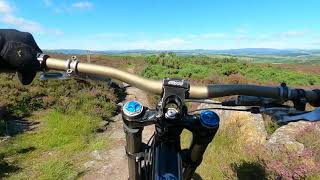
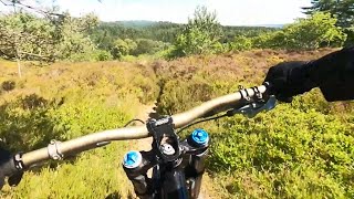
Photos of Tyrebagger Mountain Bike
Videos of Tyrebagger Mountain Bike
trail: Mast Descent
4:32 |
248 |
Jul 30, 2023 , Aberdeen
trail: Watch out for walkers!
2:14 |
177 |
Jul 30, 2023 , Aberdeen
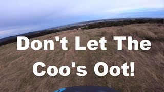
trail: Don't Let The Coo's Oot !!
2:32 |
496 |
Jun 20, 2020 , Aberdeen

trail: Mast Descent
4:09 |
753 |
Jun 19, 2020 , Aberdeen
Recent Trail Reports
| status | trail | date | condition | info | user |
|---|---|---|---|---|---|
| Forest Path | Dec 27, 2025 @ 7:25am (Europe/London) Dec 26, 2025 | Wet | Nick68S | ||
| Golf anyone? | May 9, 2025 @ 3:45pm May 9, 2025 | Very Dry | Nick68S | ||
| Brimmond Singletrack climb | Mar 11, 2023 @ 3:22am Mar 11, 2023 | Icy | smd13 | ||
| Forest Path | Jan 25, 2023 @ 6:54am Jan 25, 2023 | Dry | rookeez69 | ||
| Mast Descent | Jan 25, 2023 @ 6:51am Jan 25, 2023 | Wet | rookeez69 | ||
| Forest Path | Sep 19, 2022 @ 2:38am Sep 19, 2022 | Dry | Nick68S | ||
| Down from Elrick | Sep 19, 2022 @ 2:38am Sep 19, 2022 | Dry | Nick68S | ||
| Don't Let The Coo's Oot !! | Sep 12, 2021 @ 10:01pm Sep 12, 2021 | Dry | Nick68S | ||
| Path | Mar 24, 2021 @ 3:05am Mar 24, 2021 | Icy | Nick68S | ||
| Up to the masts | Mar 24, 2021 @ 3:05am Mar 24, 2021 | Variable | Nick68S |
Activity Feed
| username | action | type | title | date |
|---|---|---|---|---|
| Rossy55 | ridden | trail | activity #94012834 and 12 more | May 4, 2026 @ 2:51am May 4, 2026 |
| ig82 | ridden | trail | activity #92461333 | Apr 12, 2026 @ 4:42am Apr 12, 2026 |
| Nick68S | add | report | activity #86151542 | Dec 27, 2025 @ 9:19am Dec 27, 2025 |
| Nick68S | add | report | activity #71313040 and 1 more | May 9, 2025 @ 1:38pm May 9, 2025 |
| Nick68S | add | report | activity #68513445 and 1 more | Mar 27, 2025 @ 10:32am Mar 27, 2025 |
Recent Comments
| username | type | title | comment | date |
|---|---|---|---|---|
| trail | Wish I read the previous comment | Sep 16, 2021 @ 5:48am Sep 16, 2021 | ||
| trail | Whoever named this trail Rush. can you remove... | Nov 13, 2020 @ 9:39am Nov 13, 2020 | ||
| trail | Some quite difficult rock gardens and chunky... | Jul 27, 2020 @ 3:49pm Jul 27, 2020 | ||
| trail | Short. Sweet. Simple. | Jul 27, 2020 @ 3:44pm Jul 27, 2020 | ||
| trail | Tarmac path, handy for climbing back to the... | Jun 24, 2020 @ 1:22pm Jun 24, 2020 |
Nearby Areas
| name | distance | ||||
|---|---|---|---|---|---|
| Kirkhill Forest | 2 | 9 | 1.4 km | ||
| Countesswells | 6 | 13 | 3.4 km | ||
| Hazlehead Park | 4.2 km | ||||
| Foggieton Woods | 5 | 3 | 4.2 km | ||
| Cults Woods | 4.8 km |
Local Badges
-

Completionist0 awarded
Activity Type Stats
| activitytype | trails | distance | descent | descent distance | total vertical | rating | global rank | state rank | photos | reports | routes | ridelogs |
|---|---|---|---|---|---|---|---|---|---|---|---|---|
| Mountain Bike | 23 | 11 miles | 2,113 ft | 6 miles | 551 ft | #7,588 | #248 | 15 | 77 | 2,730 | ||
| E-Bike | 15 | 7 miles | 1,286 ft | 4 miles | 551 ft | #6,594 | #315 | 68 | 116 | |||
| Hike | 24 | 11 miles | 2,113 ft | 6 miles | 551 ft | #8,744 | #226 | 77 | 63 | |||
| Trail Running | 24 | 11 miles | 2,113 ft | 6 miles | 551 ft | #8,976 | #256 | 77 | 145 |
Frequently Asked Questions About Tyrebagger
▼
What are the highest rated mountain biking trails in Tyrebagger?
The highest rated mountain biking trails in Tyrebagger are:
- Rush (4.2/5)
- Brimmond Singletrack climb (4/5)
- Mast Descent (3.8/5)
- Doon tae the Coos (3.8/5)
- Don't Let The Coo's Oot !! (0/5)
▼
What is the best time of the year to ride in Tyrebagger?
Based on ride log data, the most popular months to ride in Tyrebagger are:
- May (21 activities)
- June (16 activities)
- September (13 activities)
▼
Where can I park to ride in Tyrebagger?
▼
What is the longest trail in Tyrebagger?
The longest trail in Tyrebagger is Brimmond Singletrack climb at 2.0 km. View all trails sorted by distance.
Activities
Trails
Points of Interest
- tyrebagger activity log | embed map of Tyrebagger mountain bike trails | tyrebagger mountain biking points of interest
Downloading of trail gps tracks in kml & gpx formats is enabled for Tyrebagger.
You must login to download files.