close
-
Layers w
- Weather Layers
- Pro
- Pro
- Pro
- Pro
- Pro
- Pro
- More Layers
- Pro
- Pro
- Pro
- Pro
-
Upgrade to

3D
Trail Conditions
- Unknown
- Snow Groomed
- Snow Packed
- Snow Covered
- Snow Cover Partial
- Freeze/thaw Cycle
- Icy
- Prevalent Mud
- Wet
- Variable
- Ideal
- Dry
- Very Dry
Trail Flow (Ridden Direction)
Trailforks scans users ridelogs to determine the most popular direction each trail is ridden. A good flowing trail network will have most trails flowing in a single direction according to their intension.
The colour categories are based on what percentage of riders are riding a trail in its intended direction.
The colour categories are based on what percentage of riders are riding a trail in its intended direction.
- > 96%
- > 90%
- > 80%
- > 70%
- > 50%
- < 50%
- bi-directional trail
- no data
Trail Last Ridden
Trailforks scans ridelogs to determine the last time a trail was ridden.
- < 2 days
- < 1 week
- < 2 weeks
- < 1 month
- < 6 months
- > 6 months
Trail Ridden Direction
The intended direction a trail should be ridden.
- Downhill Only
- Downhill Primary
- Both Directions
- Uphill Primary
- Uphill Only
- One Direction
Contribute Details
Colors indicate trail is missing specified detail.
- Description
- Photos
- Description & Photos
- Videos
Trail Popularity ?
Trailforks scans ridelogs to determine which trails are ridden the most in the last 9 months.
Trails are compared with nearby trails in the same city region with a possible 25 colour shades.
Think of this as a heatmap, more rides = more kinetic energy = warmer colors.
- most popular
- popular
- less popular
- not popular
ATV/ORV/OHV Filter
Max Vehicle Width
inches
US Cell Coverage
Legend

Radar Time
Activity Recordings
Trailforks uses anonymized public activity data.
?
Activity Recordings
Trailforks uses anonymized public activity data.
?
Personal Heatmap
▶
Activity Types
all
/
none
▶
Options
2
Date range
month
–
Winter Trails
Warning
A routing network for winter maps does not exist. Selecting trails using the winter trails layer has been disabled.
Missing Trails
Most Popular
Least Popular
Trails are colored based on popularity. The more popular a trail is, the more red. Less popular trails trend towards green.
Jump Magnitude Heatmap
Heatmap of where riders jump on trails. Zoom in to see individual jumps, click circles to view jump details.
BC Backroad Status
![map legend]()
Service Road Atlas is a free to use, community-driven service for viewing and creating reports on the numerous back-country service roads around B.C. and Alberta.

Slope Aspect
Direction the slope faces
Trails Deemphasized
Trails are shown in grey.
Only show trails with no bike usage.
Suggested Layers
Based on selected activity type
Save the current map location and zoom level as your default home location whenever this page is loaded.
SavePopular Trail Networks
view all areas »
No description for Tirol has been added yet!
Login or register to submit one.
AKA: Tyrol
This region uses the Uk/Euro style trail grading system.
Region Details
- 139
- 39
- 96
- 81
- 28
- 4
Stats
- Avg Trail Rating
- Trails (view details)
- 1,533
- Trails Mountain Bike
- 394
- Trails E-Bike
- 345
- Trails Gravel Bike
- 27
- Trails Adaptive Bike
- 96
- Trails Winter Fat Bike
- 83
- Trails Horse
- 5
- Trails Hike
- 495
- Trails Trail Running
- 491
- Trails Dirtbike/Moto
- 2
- Trails Observed Trials
- 7
- Trails ATV/ORV/OHV
- 2
- Trails Snowmobile
- 5
- Trails Snowshoe
- 12
- Trails Downhill Ski
- 679
- Trails Backcountry Ski
- 197
- Trails Nordic Ski
- 6
- Total Distance
- 1,985 miles
- Total Descent
- 1,029,370 ft
- Total Vertical
- 9,763 ft
- Highest Trailhead
- 11,279 ft
- Reports
- 4,619
- Photos
- 2,010
- Ridden Counter
- 197,987
Articles
Bike Republic Sölden Expands for 2026 with New Lines & Smart Connections
May 12, 2026 from pinkbike.com
Get the first look at the redesigned Traien and Ohn Lines ahead of the BRS Festival and season kickoff on June 4.
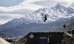
Rasoulution Shares Details on BRS Festival, Including Swatch Nines, World Records, & Parties
Aug 8, 2025 from pinkbike.com
The world’s best slopestyle and freeride athletes return to the flowy alpine nation to once again push the limits of MTB.
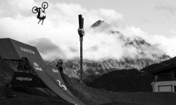
Video: 'Riders of the Storm' - Official 26-Minute Swatch Nines Documentary
Sep 19, 2024 from pinkbike.com
Rain, mud, sun, snow and a whole lot of send.
Details Announced for Bike Republic Sölden 2024 Opening
May 14, 2024 from pinkbike.com
Bikes can roll in Sölden from June 7.
Sub Regions
- Außerfern (50)
- Ehrwald (9)
- Lermoos (22)
- Reutte (6)
- Trailarea Urisee (4)
- Tannheim (8)
- Tannheimer Tal (2)
- Zöblen (3)
- Mühlwaldtrails (3)
- Bike Park Zugspitze (3)
- Ehrwald (9)
- Imst (62)
- Längenfeld (1)
- Nassereith (3)
- Oetz (7)
- Sölden (44)
- Bike Republic Sölden (42)
- Pitztal (6)
- Längenfeld (1)
- Innsbruck (53)
- Innsbruck (58)
- Bichl Trails (9)
- Bikepark Katzenkopf Leutasch (5)
- Innsbruck (23)
- Innsbruck (58)
- Innsbruck-Land (22)
- Absam (7)
- Neustift (10)
- Seefeld (1)
- Steinach am Brenner (4)
- Bikepark Tirol (2)
- Zirl (1)
- Stubaital (1)
- Kitzbühel (56)
- Brixen im Thale (5)
- Fieberbrunn (9)
- Kirchberg in Tirol (13)
- Kitzbühel (12)
- Oberndorf in Tirol (5)
- OD Trails (5)
- St.johann in tirol (5)
- KitzBike - 360° Flow Trails Kitzbühel Kirchberg (24)
- Brixen im Thale (5)
- Kufstein District (3)
- Landeck (128)
- Fendels (1)
- Galtür (8)
- Silva Trails (8)
- Ischgl (45)
- Serfaus-Fiss-Ladis (33)
- St. Anton am Arlberg (3)
- 3-Länder Enduro Trails (49)
- Fendels (1)
- Osttirol (16)
- Kals am Großglockner (10)
- Großglockner Resort (10)
- Lienz (6)
- Bikepark Lienz (5)
- Kals am Großglockner (10)
- Schwaz District (23)
- Fügen (1)
- Gerlos (8)
- Mayrhofen (4)
- Pertisau (6)
- Zillertal Arena Singletrails (5)
- Fügen (1)
- St. Leonhard im Pitztal (0)
- Pitztal (0)
Popular Tirol Mountain Biking Trails
• 95 ★ 4.7 • 4,396 ft • 0 ft • 2,158 •
Starting point of this trail is the historic high above the Resia Lake. This trail is a partly precipitous, slightly rough trail and is recommendable for well-advanced riders. ### Ausgangspunkt dieses ikonischen, teilweise neu...
• 100 ★ 4.2 • 3,117 ft • 0 ft • 2,141 •
Highly rated popular green difficulty singletrack. This mountain bike primary trail can be used downhill primary. On average it takes 2 minutes to complete this trail.
• 95 ★ 4.7 • 1 mile • 0 ft • 1,823 •
Very natural trail, not too difficult but some technical sections make it a black one.
• 90 ★ 4.7 • 3,333 ft • 0 ft • 1,790 •
The is accessible right above Resia/Reschen and has its name of the second longest river of Italy, which rises right next door. As the extention of the , this easy trail leads you down to the village Resia and to the Resia Lake. After...
• 100 ★ 4.9 • 4,875 ft • 0 ft • 1,771 •
Very natural trail again, very fun. Gets really steep at the end.
• 75 ★ 4.4 • 4,268 ft • 0 ft • 1,613 •
Very fast transfer over to the gondola. Der untere Teil des Spin Trails ähnelt dem oberen Teil. Er stellt die Verbindung zum (Richtung ) oder zum (Richtung Schöneben) her. Er ist aber aufgrund des atemberaubenden Ambientes weit mehr,...
• 55 ★ 4.0 • 1 mile • 52 ft • 1,409 •
Purpose built Enduro trail, it's the fast final section of the
Tirol Mountain Bike Routes
2 miles • 60 ft • 0 • Point to Point •
Von der Gaisbergbahn zur Fleckalmbahn geht s schnell und zügig der Straße durch Kirchberg entlang. Am...
52 miles • 19,214 ft • 27 • Loop •
This is my improved version of 3 (actually 2) Länder Enduro circle. The original one is buggy and...
13 miles • 4,023 ft • 6 • Loop •
This is a "small loop" version from The original complete loop
31 miles • 8,752 ft • 4 • Loop •
The tour starts in Ischgl and utilizes the to reach Idalp followed by the to the Äußeres Viderjoch. From...
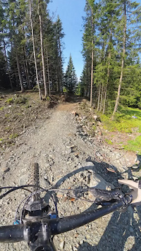
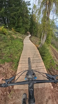
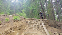
Photos of Tirol Mountain Bike
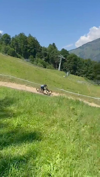
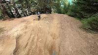
Videos of Tirol Mountain Bike
trail: Kirchberg Trail
0:48 |
35 |
Feb 27, 2026
trail: Kirchberg Trail
0:27 |
27 |
Feb 27, 2026
trail: Kirchberg Trail
0:33 |
24 |
Feb 27, 2026
trail: Lakata Trail
0:16 |
27 |
Apr 30, 2025
0:05 |
17 |
Nov 26, 2024
trail: Unterer Schöneben Trail
0:12 |
78 |
Aug 3, 2024
0:23 |
3 |
Jan 18, 2024
trail: Unterer Schöneben Trail
0:05 |
89 |
Sep 16, 2023
Current Trail Warnings
| status | trail | date | condition | user | info |
|---|---|---|---|---|---|
| Bärenbadalm Pertisau | May 16, 2026 @ 5:52pm (Europe/Vienna) May 16, 2026 | Snow Covered | Rabuntzel | E-Bike | |
| Nordkette Singletrail Innsbruck | May 11, 2026 @ 11:02am (Europe/Vienna) May 11, 2026 | Unknown | charliechar | permanently closed |
Recent Trail Reports
National Scenic Trails & Official Routes
-
Trans-Altarezia Bike #32
- Mountain Bike
- E-Bike

Activity Feed
| username | action | type | title | date |
|---|---|---|---|---|
| AperolSpritz | add | report | activity #96359342 | Jun 6, 2026 @ 5:25am 1 hours |
| ThorstenUsc7pa | wishlist | trail | activity #96343232 | Jun 5, 2026 @ 10:31pm 8 hours |
| MarcSan88 | add | report | activity #96341932 and 5 more | Jun 5, 2026 @ 9:29pm 9 hours |
| micmuec | ridden | trail | activity #96318279 and 2 more | Jun 5, 2026 @ 1:31pm 17 hours |
| lines | ridden | trail | activity #96286542 | Jun 5, 2026 @ 4:46am 1 day |
Recent Comments
| username | type | title | comment | date |
|---|---|---|---|---|
| trail | Im Zuge der Errichtung der schwarzen Jumpline... | May 30, 2026 @ 1:47am May 30, 2026 | ||
| trail | Im Zuge der Errichtung der schwarzen Jumpline... | May 30, 2026 @ 1:46am May 30, 2026 | ||
| trail | verstehe nicht, warum der trail immer mehr in... | May 27, 2026 @ 3:14pm May 27, 2026 | ||
| trail | Trail wird vrsl. 2027 endgültig fürs... | May 27, 2026 @ 2:08pm May 27, 2026 | ||
| trail | The trail is absolutely amazing and incredibly... | May 26, 2026 @ 12:51pm May 26, 2026 |
Local Badges
-

Epic Ride Descent 2k22 awarded -

Descent 10k Badge3 awarded -
Descent 10k Badge12 awarded -
Epic Ride Descent 2k68 awarded -
Descent 10k Badge3 awarded -
Epic Ride Descent 2k33 awarded
Bike & Skill Parks
| name | type | city | rating |
|---|---|---|---|
| Innsbruck | bike park | Innsbruck | |
| 3-Länder Enduro Trails | bike park | Nauders | |
| Bike Republic Sölden | bike park | Sölden | |
| Bike Serfaus-Fiss-Ladis | bike park | Serfaus-Fiss-Ladis | |
| Bikepark Lienz | bike park | Lienz |
Upcoming Local Events
Activity Type Stats
| activitytype | trails | distance | descent | descent distance | total vertical | rating | global rank | state rank | photos | reports | routes | ridelogs |
|---|---|---|---|---|---|---|---|---|---|---|---|---|
| Mountain Bike | 394 | 795 miles | 226,785 ft | 363 miles | 7,615 ft | 1,961 | 4,582 | 22 | 81,142 | |||
| E-Bike | 345 | 729 miles | 197,392 ft | 328 miles | 7,615 ft | 17 | 4,074 | 8 | 9,490 | |||
| Gravel Bike | 27 | 60 miles | 11,972 ft | 15 miles | 5,141 ft | 198 | 1 | 652 | ||||
| Adaptive Bike | 96 | 384 miles | 35,295 ft | 112 miles | 7,434 ft | 490 | 1 | 7 | ||||
| Winter Fat Bike | 83 | 299 miles | 44,623 ft | 117 miles | 7,434 ft | 500 | ||||||
| Horse | 5 | 18 miles | 1,745 ft | 2 miles | 3,967 ft | 386 | 7 | |||||
| Hike | 495 | 956 miles | 378,842 ft | 458 miles | 8,835 ft | 2 | 3,979 | 4 | 15,731 | |||
| Trail Running | 491 | 948 miles | 376,781 ft | 456 miles | 8,835 ft | 3,979 | 3 | 1,737 | ||||
| Dirtbike/Moto | 2 | 7 miles | 1,309 ft | 1 mile | 3,264 ft | 375 | 1 | |||||
| Observed Trials | 7 | 12 miles | 2,464 ft | 2 miles | 4,619 ft | 1 | 2 | |||||
| ATV/ORV/OHV | 2 | 7 miles | 1,309 ft | 1 mile | 3,264 ft | 375 | 6 | |||||
| Snowmobile | 5 | 18 miles | 1,417 ft | 2 miles | 4,291 ft | 1 | 1 | |||||
| Snowshoe | 12 | 39 miles | 2,028 ft | 3 miles | 6,421 ft | 19 | 136 | |||||
| Downhill Ski | 679 | 461 miles | 442,897 ft | 407 miles | 8,533 ft | 20 | 26,889 | |||||
| Backcountry Ski | 197 | 428 miles | 86,070 ft | 90 miles | 8,970 ft | 19 | 7,866 | |||||
| Nordic Ski | 6 | 20 miles | 1,417 ft | 2 miles | 4,291 ft | 17 | 4,367 |
Activities
- Tirol Mountain Biking Trails
- Tirol E-Biking Trails
- Tirol Gravel Biking Trails
- Tirol Adaptive Biking Trails
- Tirol Winter Fat Biking Trails
- Tirol Horseback Trails
- Tirol Hiking Trails
- Tirol Trail Running Trails
- Tirol Observed Trials Trails
- Tirol Snowmobiling Trails
- Tirol Snowshoeing Trails
- Tirol Skiing Trails
- Tirol Backcountry Skiing Trails
- Tirol Nordic Skiing Trails
Trails
Points of Interest
- Chairlift Pick-Up (Langeggbahn) Other
- Cableway Drop-Off (Almkopfbahn Bichlbach) Other
- Cableway Pick-Up (Almkopfbahn Bichlbach) Other
- Cableway Drop-Off (Dias-Kabinenbahn) Other
- Cableway Pick-Up (Dias-Kabinenbahn) Other
- Cableway Pick-Up (Fendels-Ried-Bahn) Other
- Cableway Drop-Off (Fendels-Ried-Bahn) Other
- Cableway Drop-Off (Galzigbahn) Other
- Cableway Pick-Up (Galzigbahn) Other
- Cableway Pick-Up (Rosenalmbahn) Other
- Hofmannspitze (3,667 m)
- Teufelshorn (3,651 m)
- Kleinglockner (3,573 m)
- By brenthillier
 NSMBA TRAILFORKS & contributors
 - Admins: ktm-boy-69, mpecsi, lines, larry81541, PatrickMeraner
- #9911 - 14,016 views
- tirol activity log | embed map of Tirol mountain bike trails | tirol mountain biking points of interest polygons
Downloading of trail gps tracks in kml & gpx formats is enabled for Tirol.
You must login to download files.