close
-
Layers w
- Weather Layers
- Pro
- Pro
- Pro
- Pro
- Pro
- Pro
- More Layers
- Pro
- Pro
- Pro
- Pro
-
Upgrade to

3D
Trail Conditions
- Unknown
- Snow Groomed
- Snow Packed
- Snow Covered
- Snow Cover Partial
- Freeze/thaw Cycle
- Icy
- Prevalent Mud
- Wet
- Variable
- Ideal
- Dry
- Very Dry
Trail Flow (Ridden Direction)
Trailforks scans users ridelogs to determine the most popular direction each trail is ridden. A good flowing trail network will have most trails flowing in a single direction according to their intension.
The colour categories are based on what percentage of riders are riding a trail in its intended direction.
The colour categories are based on what percentage of riders are riding a trail in its intended direction.
- > 96%
- > 90%
- > 80%
- > 70%
- > 50%
- < 50%
- bi-directional trail
- no data
Trail Last Ridden
Trailforks scans ridelogs to determine the last time a trail was ridden.
- < 2 days
- < 1 week
- < 2 weeks
- < 1 month
- < 6 months
- > 6 months
Trail Ridden Direction
The intended direction a trail should be ridden.
- Downhill Only
- Downhill Primary
- Both Directions
- Uphill Primary
- Uphill Only
- One Direction
Contribute Details
Colors indicate trail is missing specified detail.
- Description
- Photos
- Description & Photos
- Videos
Trail Popularity ?
Trailforks scans ridelogs to determine which trails are ridden the most in the last 9 months.
Trails are compared with nearby trails in the same city region with a possible 25 colour shades.
Think of this as a heatmap, more rides = more kinetic energy = warmer colors.
- most popular
- popular
- less popular
- not popular
ATV/ORV/OHV Filter
Max Vehicle Width
inches
US Cell Coverage
Legend

Radar Time
Activity Recordings
Trailforks uses anonymized public activity data.
?
Activity Recordings
Trailforks uses anonymized public activity data.
?
Personal Heatmap
▶
Activity Types
all
/
none
▶
Options
2
Date range
month
–
Winter Trails
Warning
A routing network for winter maps does not exist. Selecting trails using the winter trails layer has been disabled.
Missing Trails
Most Popular
Least Popular
Trails are colored based on popularity. The more popular a trail is, the more red. Less popular trails trend towards green.
Jump Magnitude Heatmap
Heatmap of where riders jump on trails. Zoom in to see individual jumps, click circles to view jump details.
BC Backroad Status
![map legend]()
Service Road Atlas is a free to use, community-driven service for viewing and creating reports on the numerous back-country service roads around B.C. and Alberta.

Slope Aspect
Direction the slope faces
Trails Deemphasized
Trails are shown in grey.
Only show trails with no bike usage.
Suggested Layers
Based on selected activity type
Save the current map location and zoom level as your default home location whenever this page is loaded.
SavePopular Trail Networks
view all areas »
No description for Udine has been added yet!
Login or register to submit one.
This region uses the Uk/Euro style trail grading system.
Activities Click to view
- Mountain Bike
778 trails
- E-Bike
429 trails
- Horse
11 trails
- Hike
714 trails
- Trail Running
694 trails
- Dirtbike/Moto
12 trails
- Downhill Ski
31 trails
Region Details
- 207
- 27
- 111
- 224
- 89
- 35
Stats
- Avg Trail Rating
- Trails (view details)
- 767
- Trails Mountain Bike
- 783
- Trails E-Bike
- 429
- Trails Gravel Bike
- 1
- Trails Winter Fat Bike
- 1
- Trails Horse
- 11
- Trails Hike
- 714
- Trails Trail Running
- 694
- Trails Dirtbike/Moto
- 12
- Trails ATV/ORV/OHV
- 1
- Trails Snowshoe
- 1
- Trails Downhill Ski
- 31
- Trails Backcountry Ski
- 3
- Trails Nordic Ski
- 1
- Total Distance
- 1,237 miles
- Total Descent
- 439,833 ft
- Total Vertical
- 7,582 ft
- Highest Trailhead
- 7,585 ft
- Reports
- 4,374
- Photos
- 1,814
- Ridden Counter
- 31,753
Articles
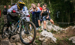
Tommaso Francardo & Nadine Ellecosta Win the Enduro Italian Championship 2025
Oct 1, 2025 from pinkbike.com
The competition took place in San Pietro al Natisone, featuring a diverse range of trails suitable for a high-level race.
Sub Regions
- Ampezzo (6)
- Ampezzo (5)
- Arta Terme (3)
- Artegna (7)
- Faeit (Artegna) (7)
- Attimis (10)
- Porzus (9)
- Buja (5)
- Chiusaforte (19)
- Scluse (9)
- Sella Nevea (9)
- Cividale del Friuli (23)
- Matajur (8)
- Faedis (17)
- Canebola (9)
- Valle di Soffumbergo (7)
- Fagagna (1)
- Forni Avoltri (18)
- Forni di Sopra (26)
- Gemona del Friuli (46)
- Interneppo (6)
- Lauco (4)
- Lusevera (2)
- Moggio Udinese (44)
- Val Aupa (42)
- Montenars (13)
- Faeit (Montenars) (8)
- Iof (5)
- Moruzzo (10)
- Nimis (64)
- Ovaro (1)
- Paluzza (9)
- Paularo (5)
- Dimon (3)
- Pontebba (6)
- Pramollo (5)
- Povoletto (3)
- Prato Carnico (9)
- Val Pesarina (9)
- Preone (8)
- Ragogna (7)
- Muris (6)
- Raveo (7)
- Reana Del Rojale (3)
- Qualso (3)
- Remanzacco (3)
- Resia (36)
- Val Resia (32)
- San Leonardo (16)
- San Pietro Al Natisone (50)
- Sappada (3)
- Sauris - Zahre (12)
- Socchieve (8)
- Sutrio (27)
- Taipana (17)
- Taipana (8)
- Valle del Cornappo (8)
- Tarcento (18)
- Tarvisio (57)
- Camporosso - Ugovizza (15)
- Tarvisio - Val Romana (19)
- Valbruna (21)
- Tolmezzo (50)
- Torreano (24)
- Torreano (5)
- Val Chiarò (18)
- Trasaghis (9)
- Covria (8)
- Tricesimo (5)
- Udine (40)
- Cormor (12)
- Lignano (17)
- Torre (Udine) (8)
- Venzone (18)
- Venzonassa (14)
Popular Udine Mountain Biking Trails
• 55 ★ 4.8 • 7 miles • 182 ft • 325 •
The King of Trails of Natisone Bike Arena! A long 12 km natural trail from the edge of Mt. Matajur to the valley bottom near Sorzento's village after 1.450 mt of negative descent. Voted by readers of a most-known bike website as one of...
• 100 ★ 0.0 • 1 mile • 348 ft • 313 •
From Alpe Adria Cycle Path by taking this other one you climb untile the first Lake of Fusine
• 100 ★ 0.0 • 7 miles • 493 ft • 276 •
Cycle Path that links Tarvisio to Rateče villages
• 95 ★ 4.6 • 2 miles • 17 ft • 241 •
Please use this instead of old Machete 2.0. The trail is CLOSED on wednesdays and sundays from 01.09 to 31.12 One of the most famous and fulfilling trails of the Natisone Bike Arena. A very mixed trail with different difficulties and...
• 95 ★ 4.8 • 1 mile • 7 ft • 228 •
Highly rated popular red difficulty alpine singletrack. This mountain bike primary trail can be used downhill primary and has a moderate overall physical rating with a 7 ft blue climb. On average it takes 20 minutes to complete this trail.
• 95 ★ 4.6 • 3,986 ft • 0 ft • 219 •
Trail corto ma divertente con diverse linee possibili. Ideale per collegare la parte più alta dell'area (partenza in comune con il Machete) con i vari trails che partono più in basso ( / , , Vernasso easy Dh trail, Tarci Trail). Trail...
• 85 ★ 4.5 • 5 miles • 254 ft • 218 •
The first third starts on the alpine medow beside the Acomizza hut which is part of the "Alpe Adria trail." The moderate descend will take you trough a scenic forest where you encounter some switchbacks (at the end of this section...
Udine Mountain Bike Routes
★ 5.0 • 7 miles • 927 ft • 4 •
Un anello di 12 km immerso nei boschi sopra Nimis, lungo il torrente Lugnesie. Unisce i trail , e ,...
★ 5.0 • 21 miles • 3,137 ft • 11 • Loop •
A PARTIRE DA SABATO 12 APRILE, IL SENTIERO FORTE BASSO SARÀ APERTO IL SABATO E LA DOMENICA, SALVO LAVORI...
★ 5.0 • 19 miles • 5,059 ft • 1 • Loop •
Bel giro, lungo ma molto remunerativo nella discesa: bel trail facile nella parte iniziale (pochi gradoni,...
★ 5.0 • 21 miles • 5,182 ft • 1 • Point to Point •
Tough route that starts in Pulfero (170 mt altitude) and reach the Matajur mountain (1.650 mt. altitude)...
29 miles • 4,668 ft • 21 • Loop •
AVVISO IMPORTANTE PER I BIKER A partire da sabato 12 aprile, il sentiero FORTE BASSO sarà aperto il...
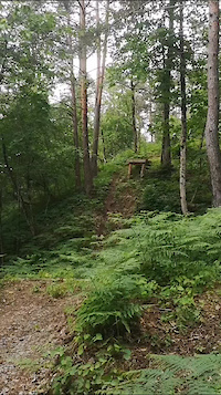
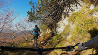
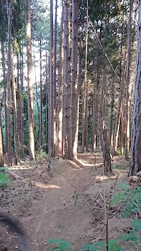
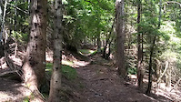
Photos of Udine Mountain Bike
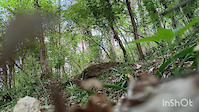
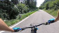
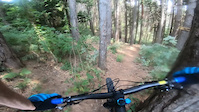
Videos of Udine Mountain Bike
trail: Troi di Julie
0:08 |
8 |
Apr 6, 2026
trail: Troi da Cjocolate
0:08 |
73 |
Jun 9, 2024
trail: Lope
0:10 |
150 |
Nov 2, 2021
trail: Troi dal Lollo
0:57 |
230 |
Aug 26, 2021
trail: Troi dal Acaro
2:26 |
220 |
Aug 24, 2021
trail: Troi dal Lollo
0:50 |
207 |
Aug 23, 2021
trail: Casera Valdaier DH
0:16 |
138 |
Jun 19, 2021
trail: Casera Valdaier DH
0:15 |
90 |
Jun 19, 2021
Current Trail Warnings
| status | trail | date | condition | user | info |
|---|---|---|---|---|---|
| PALA TRAIL Val Chiarò | Jun 19, 2026 @ 6:52am (Europe/Rome) Jun 18, 2026 | Very Dry | Loribeach | ||
| Casera Valdaier DH Dimon | May 26, 2026 @ 9:09am (Europe/Rome) May 26, 2026 | Variable | LjOc5z | Passable, but not very nice. Just one log... |
Recent Trail Reports
| status | trail | date | condition | info | user |
|---|---|---|---|---|---|
| Zuc de cros Quarnanat Iof | Jun 23, 2026 @ 1:08am (Europe/Rome) 3 hours | Ideal | mlivon | ||
| Cuarnan connector Cuarnan | Jun 23, 2026 @ 12:28am (Europe/Rome) 4 hours | Ideal | mlivon | ||
| Belvedere DH Faeit (Montenars) | Jun 22, 2026 @ 8:20pm (Europe/Rome) 8 hours | Ideal | Davidew57d7Z | ||
| Cragnolini DH Campeon | Jun 22, 2026 @ 8:19pm (Europe/Rome) 8 hours | Ideal | Davidew57d7Z | ||
| Monte Stivane Val Resia | Jun 22, 2026 @ 4:13pm (Europe/Rome) 12 hours | Ideal | trailaddicted | ||
| Verzan Venzone | Jun 22, 2026 @ 4:12pm (Europe/Rome) 12 hours | Dry | trailaddicted | ||
| Troi dal k&co Val Aupa | Jun 21, 2026 @ 8:04pm (Europe/Rome) 1 day | Ideal | trailaddicted | ||
| Cjasut dal Sior Val Aupa | Jun 21, 2026 @ 8:04pm (Europe/Rome) 1 day | Ideal | trailaddicted | ||
| Malga Lavareit Tenchia | Jun 20, 2026 @ 11:46am (Europe/Ljubljana) 3 days | Ideal | Fabrizior | ||
| Cobra Torreano | Jun 18, 2026 @ 9:45pm (Europe/Rome) Jun 18, 2026 | Ideal | Z9NYWs |
Activity Feed
| username | action | type | title | date |
|---|---|---|---|---|
| mlivon | add | photo | activity #97590952 | Jun 22, 2026 @ 4:23pm 3 hours |
| mlivon | add | video | activity #97590657 | Jun 22, 2026 @ 4:16pm 3 hours |
| mlivon | add | report | activity #97590536 | Jun 22, 2026 @ 4:14pm 3 hours |
| mlivon | add | video | activity #97589834 | Jun 22, 2026 @ 4:00pm 3 hours |
| mlivon | add | photo | activity #97589709 and 7 more | Jun 22, 2026 @ 3:58pm 3 hours |
Recent Comments
| username | type | title | comment | date |
|---|---|---|---|---|
| trail | Prima parte un po’ sdrucciolevole, il resto... | Jun 7, 2026 @ 6:33am Jun 7, 2026 | ||
| trail | Bel trail provato dino a bivio cjoccolade | Jun 7, 2026 @ 6:32am Jun 7, 2026 | ||
| trail | Sentiero TOP | Jun 7, 2026 @ 6:32am Jun 7, 2026 | ||
| trail | Einstieg ist stark verwildert - eher nicht... | May 25, 2026 @ 9:03am May 25, 2026 | ||
| trail | Strada forestale di collegamento tra Taipana e... | May 9, 2026 @ 11:36pm May 9, 2026 |
Local Badges
-

Epic Mountain Bike Climb 2k19 awarded -

Top 10 Trails0 awarded -
Top 10 Trails0 awarded -

Completionist0 awarded -
Top 10 Trails0 awarded -
Epic Mountain Bike Climb 2k42 awarded
Bike & Skill Parks
| name | type | city | rating |
|---|---|---|---|
| Ugovizza Pump Track | skill park | Tarvisio | |
| Centro Sportivo Ampezzano | skill park | Ampezzo |
Local Trail Supporters
- Moggio Udinese MTB in to the Wild
![]()
![]()
Activity Type Stats
| activitytype | trails | distance | descent | descent distance | total vertical | rating | global rank | state rank | photos | reports | routes | ridelogs |
|---|---|---|---|---|---|---|---|---|---|---|---|---|
| Mountain Bike | 778 | 1,215 miles | 420,725 ft | 584 miles | 7,582 ft | 1,804 | 4,388 | 43 | 45,330 | |||
| E-Bike | 429 | 654 miles | 200,131 ft | 295 miles | 7,582 ft | 10 | 3,272 | 22 | 4,553 | |||
| Gravel Bike | 1 | 11 | 1 | 862 | ||||||||
| Winter Fat Bike | 1 | 22 | ||||||||||
| Horse | 11 | 30 miles | 2,146 ft | 6 miles | 6,033 ft | 268 | ||||||
| Hike | 714 | 1,130 miles | 368,346 ft | 532 miles | 7,418 ft | 7 | 4,180 | 2 | 4,995 | |||
| Trail Running | 694 | 1,102 miles | 348,425 ft | 513 miles | 7,418 ft | 4,156 | 6 | 1,288 | ||||
| Dirtbike/Moto | 12 | 24 miles | 5,157 ft | 7 miles | 5,102 ft | 270 | 1 | |||||
| ATV/ORV/OHV | 1 | 259 | 7 | |||||||||
| Snowshoe | 1 | 1 mile | 1,339 ft | 1 mile | 1,332 ft | 11 | 36 | |||||
| Downhill Ski | 31 | 13 miles | 15,833 ft | 13 miles | 2,041 ft | 10 | 2,098 | |||||
| Backcountry Ski | 3 | 7 miles | 2,031 ft | 2 miles | 3,369 ft | 11 | 1,170 | |||||
| Nordic Ski | 1 | 10 | 475 |
Frequently Asked Questions About Udine
▼
What are the best places to ride in Udine?
Udine has 48 areas to explore for mountain biking. The top rated areas are:
▼
What are the highest rated mountain biking trails in Udine?
The highest rated mountain biking trails in Udine are:
- Matadown Trail (4.6/5)
- Gobbe Trail (4.6/5)
- Malga Cuarnan (ps1) (4.6/5)
- Monte Nebria DH 1 (4.5/5)
- Machete 3.0 (4.5/5)
▼
What is the best time of the year to ride in Udine?
Based on ride log data, the most popular months to ride in Udine are:
- August (230 activities)
- July (222 activities)
- October (179 activities)
▼
What is the longest trail in Udine?
The longest trail in Udine is FVG1 Alpe Adria (tratto Pontebba - Venzone) at 22.1 miles. View all trails sorted by distance.
Activities
Trails
- By denitopia
 TRAILFORKS VTA & contributors
 - Admins: denitopia, marcoangeletti, cemoorelife, maxmisdaris
- #11681 - 12,911 views
- udine activity log | embed map of Udine mountain bike trails | udine mountain biking points of interest polygons
Downloading of trail gps tracks in kml & gpx formats is enabled for Udine.
You must login to download files.