close
-
Layers w
- Weather Layers
- Pro
- Pro
- Pro
- Pro
- Pro
- Pro
- More Layers
- Pro
- Pro
- Pro
- Pro
-
Upgrade to

3D
Trail Conditions
- Unknown
- Snow Groomed
- Snow Packed
- Snow Covered
- Snow Cover Partial
- Freeze/thaw Cycle
- Icy
- Prevalent Mud
- Wet
- Variable
- Ideal
- Dry
- Very Dry
Trail Flow (Ridden Direction)
Trailforks scans users ridelogs to determine the most popular direction each trail is ridden. A good flowing trail network will have most trails flowing in a single direction according to their intension.
The colour categories are based on what percentage of riders are riding a trail in its intended direction.
The colour categories are based on what percentage of riders are riding a trail in its intended direction.
- > 96%
- > 90%
- > 80%
- > 70%
- > 50%
- < 50%
- bi-directional trail
- no data
Trail Last Ridden
Trailforks scans ridelogs to determine the last time a trail was ridden.
- < 2 days
- < 1 week
- < 2 weeks
- < 1 month
- < 6 months
- > 6 months
Trail Ridden Direction
The intended direction a trail should be ridden.
- Downhill Only
- Downhill Primary
- Both Directions
- Uphill Primary
- Uphill Only
- One Direction
Contribute Details
Colors indicate trail is missing specified detail.
- Description
- Photos
- Description & Photos
- Videos
Trail Popularity ?
Trailforks scans ridelogs to determine which trails are ridden the most in the last 9 months.
Trails are compared with nearby trails in the same city region with a possible 25 colour shades.
Think of this as a heatmap, more rides = more kinetic energy = warmer colors.
- most popular
- popular
- less popular
- not popular
ATV/ORV/OHV Filter
Max Vehicle Width
inches
US Cell Coverage
Legend

Radar Time
Activity Recordings
Trailforks uses anonymized public activity data.
?
Activity Recordings
Trailforks uses anonymized public activity data.
?
Personal Heatmap
▶
Activity Types
all
/
none
▶
Options
2
Date range
month
–
Winter Trails
Warning
A routing network for winter maps does not exist. Selecting trails using the winter trails layer has been disabled.
Missing Trails
Most Popular
Least Popular
Trails are colored based on popularity. The more popular a trail is, the more red. Less popular trails trend towards green.
Jump Magnitude Heatmap
Heatmap of where riders jump on trails. Zoom in to see individual jumps, click circles to view jump details.
BC Backroad Status
![map legend]()
Service Road Atlas is a free to use, community-driven service for viewing and creating reports on the numerous back-country service roads around B.C. and Alberta.

Slope Aspect
Direction the slope faces
Trails Deemphasized
Trails are shown in grey.
Only show trails with no bike usage.
Suggested Layers
Based on selected activity type
Save the current map location and zoom level as your default home location whenever this page is loaded.
Save
No description for Ulia has been added yet!
Login or register to submit one.
 google parking directions
Primary Trail Type: All-Mountain & Downhill
eBikes Allowed:
Yes
google parking directionsThis region uses the Uk/Euro style trail grading system.
Activities Click to view
- Mountain Bike
27 trails
- E-Bike
27 trails
- Hike
28 trails
- Trail Running
28 trails
Region Details
- 5
- 3
- 16
- 3
Region Status
Caution as of Mar 29, 2026Stats
- Avg Trail Rating
- Trails (view details)
- 27
- Trails Mountain Bike
- 28
- Trails E-Bike
- 27
- Trails Hike
- 28
- Trails Trail Running
- 28
- Total Distance
- 13 miles
- Total Descent
- 4,371 ft
- Total Vertical
- 609 ft
- Highest Trailhead
- 734 ft
- Reports
- 410
- Photos
- 25
- Ridden Counter
- 1,842
Popular Ulia Mountain Biking Trails
• 95 ★ 4.3 • 2,799 ft • 0 ft • 86 •
Bajada rápida y facilita con un par de pasos técnicos. Ideal para iniciarse.
• 95 ★ 3.0 • 2,021 ft • 3 ft • 75 •
Ojo a unos 15 metros de la entrada, hay una bajadita empinada o un zig zag opcional.
• 100 ★ 0.0 • 2,923 ft • 192 ft • 69 •
Popular blue difficulty wilderness trail. This multi-use trail can be used both directions. Trail visibility is always easy to follow. On average it takes 12 minutes to complete this trail.
• 90 ★ 0.0 • 935 ft • 0 ft • 64 •
Bajada rápida y técnica por un bosque oscuro. Zonas de raices y rodera alternadas por zonas rápidas con grandes apoyos.
• 85 ★ 5.0 • 1,414 ft • 0 ft • 57 •
Bajada bastante técnica, con mucha piedra y raiz. Cuidado en mojado,
Ulia Mountain Bike Routes
★ 5.0 • 20 miles • 4,763 ft • 18 • Loop •
De nuevo el confinamiento como impulsor de una gran tarde de mountain bike. Por un lado, por la amenaza...
3 miles • 907 ft • 2 • Point to Point •
El subsuelo del Monte Ulía está constituido por la acumulación de rocas sedimentarias depositadas en un...
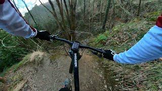
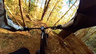
Photos of Ulia Mountain Bike
Videos of Ulia Mountain Bike
trail: Desllanter
0:32 |
157 |
May 8, 2025 , Donostia/San Sebastian
trail: Pig FLow
0:36 |
135 |
May 8, 2025 , Donostia/San Sebastian
Recent Trail Reports
| status | trail | date | condition | info | user |
|---|---|---|---|---|---|
| Bidebieta | Mar 29, 2026 @ 4:05pm (Europe/Madrid) Mar 29, 2026 | Wet | howlsy | ||
| Tranbiabidea | Mar 22, 2026 @ 8:59am (Europe/Madrid) Mar 22, 2026 | Wet | Mitxi | ||
| Bamboo | Oct 18, 2025 @ 3:36pm (Europe/Madrid) Oct 18, 2025 | Ideal | AlpKA5hw | ||
| Luze | Oct 18, 2025 @ 3:36pm (Europe/Madrid) Oct 18, 2025 | Ideal | AlpKA5hw | ||
| Pig FLow | Oct 16, 2025 @ 4:05pm (Europe/Madrid) Oct 16, 2025 | Variable | AlpKA5hw | ||
| Hippies | Sep 23, 2025 @ 7:44pm (Europe/Madrid) Sep 23, 2025 | Wet | NoTaSnUrFeR | ||
| Lower Tirador | Aug 4, 2025 @ 1:40am Aug 4, 2025 | Ideal | miguelelcuaz | ||
| Kostaldeko | Dec 27, 2024 @ 10:09am Dec 27, 2024 | Variable | Angelreing TFSPAIN | ||
| Aranagatxikiko | Dec 27, 2024 @ 10:09am Dec 27, 2024 | Variable | Angelreing TFSPAIN | ||
| Mendiola | Dec 27, 2024 @ 10:09am Dec 27, 2024 | Variable | Angelreing TFSPAIN |
Activity Feed
| username | action | type | title | date |
|---|---|---|---|---|
| MartinPpsDyc | ridden | trail | activity #96917610 | Jun 13, 2026 @ 2:38pm Jun 13, 2026 |
| Angel3 | wishlist | trail | activity #94860501 | May 16, 2026 @ 4:27pm May 16, 2026 |
| Yetistrampler | wishlist | trail | activity #93001605 and 2 more | Apr 19, 2026 @ 10:23pm Apr 19, 2026 |
| Yetistrampler | wishlist | region | activity #93001598 | Apr 19, 2026 @ 10:23pm Apr 19, 2026 |
| jozumar | difficultyvote | trail | activity #92342681 | Apr 10, 2026 @ 2:12pm Apr 10, 2026 |
Recent Comments
| username | type | title | comment | date |
|---|---|---|---|---|
| trail | Bista earrak | Sep 23, 2025 @ 10:42am Sep 23, 2025 | ||
| trail | Fun single track- voted it difficult though | Sep 8, 2023 @ 12:38pm Sep 8, 2023 | ||
| trail | can get slippy when wet and rocks are good... | Sep 8, 2023 @ 12:36pm Sep 8, 2023 | ||
| trail | Mostly single track w/ some steep climbs-... | Sep 8, 2023 @ 12:33pm Sep 8, 2023 | ||
| trail | A good section with challenging climbs and... | Sep 8, 2023 @ 12:25pm Sep 8, 2023 |
Nearby Areas
| name | distance | ||||
|---|---|---|---|---|---|
| Jaizkibel | 19 | 5.7 km | |||
| Elatzeta - Zubeltzu | 1 | 5 | 7.4 km | ||
| Andatza | 15 | 7.7 km | |||
| Adarra | 1 | 5 | 8.3 km | ||
| Aiako Harriak | 6 | 36 | 8.6 km |
Local Badges
-

Completionist0 awarded
Activity Type Stats
| activitytype | trails | distance | descent | descent distance | total vertical | rating | global rank | state rank | photos | reports | routes | ridelogs |
|---|---|---|---|---|---|---|---|---|---|---|---|---|
| Mountain Bike | 27 | 13 miles | 4,370 ft | 7 miles | 610 ft | #5,571 | #413 | 25 | 412 | 1,604 | ||
| E-Bike | 27 | 12 miles | 4,206 ft | 7 miles | 610 ft | #4,393 | #759 | 396 | 303 | |||
| Hike | 28 | 13 miles | 4,370 ft | 7 miles | 610 ft | #7,720 | #764 | 381 | 257 | |||
| Trail Running | 28 | 13 miles | 4,370 ft | 7 miles | 610 ft | #6,888 | #750 | 381 | 182 |
Frequently Asked Questions About Ulia
▼
What are the highest rated mountain biking trails in Ulia?
The highest rated mountain biking trails in Ulia are:
- Desllanter (4.2/5)
- Bitxo (4.1/5)
- Errazegia (4.1/5)
- Pig FLow (4.1/5)
- Bamboo (4.1/5)
▼
What is the best time of the year to ride in Ulia?
Based on ride log data, the most popular months to ride in Ulia are:
- August (3 activities)
- November (2 activities)
- June (2 activities)
▼
Where can I park to ride in Ulia?
There are 2 parking locations listed in Ulia. The most popular parking spots are:
▼
What is the longest trail in Ulia?
The longest trail in Ulia is Kostaldeko at 2.4 km. View all trails sorted by distance.
Activities
Trails
Points of Interest
- By pcorreas
 TFSPAIN & contributors
 - Admins: Altavoz, krasty1002
- #45408 - 3,396 views
- ulia activity log | embed map of Ulia mountain bike trails | ulia mountain biking points of interest
Downloading of trail gps tracks in kml & gpx formats is enabled for Ulia.
You must login to download files.