close
-
Layers w
- Weather Layers
- Pro
- Pro
- Pro
- Pro
- Pro
- Pro
- More Layers
- Pro
- Pro
- Pro
- Pro
-
Upgrade to

3D
Trail Conditions
- Unknown
- Snow Groomed
- Snow Packed
- Snow Covered
- Snow Cover Partial
- Freeze/thaw Cycle
- Icy
- Prevalent Mud
- Wet
- Variable
- Ideal
- Dry
- Very Dry
Trail Flow (Ridden Direction)
Trailforks scans users ridelogs to determine the most popular direction each trail is ridden. A good flowing trail network will have most trails flowing in a single direction according to their intension.
The colour categories are based on what percentage of riders are riding a trail in its intended direction.
The colour categories are based on what percentage of riders are riding a trail in its intended direction.
- > 96%
- > 90%
- > 80%
- > 70%
- > 50%
- < 50%
- bi-directional trail
- no data
Trail Last Ridden
Trailforks scans ridelogs to determine the last time a trail was ridden.
- < 2 days
- < 1 week
- < 2 weeks
- < 1 month
- < 6 months
- > 6 months
Trail Ridden Direction
The intended direction a trail should be ridden.
- Downhill Only
- Downhill Primary
- Both Directions
- Uphill Primary
- Uphill Only
- One Direction
Contribute Details
Colors indicate trail is missing specified detail.
- Description
- Photos
- Description & Photos
- Videos
Trail Popularity ?
Trailforks scans ridelogs to determine which trails are ridden the most in the last 9 months.
Trails are compared with nearby trails in the same city region with a possible 25 colour shades.
Think of this as a heatmap, more rides = more kinetic energy = warmer colors.
- most popular
- popular
- less popular
- not popular
ATV/ORV/OHV Filter
Max Vehicle Width
inches
US Cell Coverage
Legend

Radar Time
Activity Recordings
Trailforks uses anonymized public activity data.
?
Activity Recordings
Trailforks uses anonymized public activity data.
?
Personal Heatmap
▶
Activity Types
all
/
none
▶
Options
2
Date range
month
–
Winter Trails
Warning
A routing network for winter maps does not exist. Selecting trails using the winter trails layer has been disabled.
Missing Trails
Most Popular
Least Popular
Trails are colored based on popularity. The more popular a trail is, the more red. Less popular trails trend towards green.
Jump Magnitude Heatmap
Heatmap of where riders jump on trails. Zoom in to see individual jumps, click circles to view jump details.
BC Backroad Status
![map legend]()
Service Road Atlas is a free to use, community-driven service for viewing and creating reports on the numerous back-country service roads around B.C. and Alberta.

Slope Aspect
Direction the slope faces
Trails Deemphasized
Trails are shown in grey.
Only show trails with no bike usage.
Suggested Layers
Based on selected activity type
Save the current map location and zoom level as your default home location whenever this page is loaded.
Save
No description for Ulladulla has been added yet!
Login or register to submit one.
Activities Click to view
- Mountain Bike
34 trails
- E-Bike
23 trails
- Adaptive Bike
0 trails
- Winter Fat Bike
0 trails
- Horse
4 trails
- Hike
38 trails
- Trail Running
39 trails
- Dirtbike/Moto
4 trails
Region Details
- 2
- 3
- 19
- 7
- 3
Region Status
Caution as of Mar 11, 2026Stats
- Avg Trail Rating
- Trails (view details)
- 35
- Trails Mountain Bike
- 34
- Trails E-Bike
- 23
- Trails Horse
- 4
- Trails Hike
- 38
- Trails Trail Running
- 39
- Trails Dirtbike/Moto
- 4
- Trails ATV/ORV/OHV
- 1
- Total Distance
- 16 miles
- Total Descent
- 1,853 ft
- Total Vertical
- 2,105 ft
- Highest Trailhead
- 2,163 ft
- Reports
- 96
- Photos
- 28
- Ridden Counter
- 3,333
Sub Regions
-
Kings Point
- 3
- 12
- 4
- 3
-
Woodburn
- 6
- 3
Popular Ulladulla Mountain Biking Trails
• 95 ★ 3.5 • 2,024 ft • 31 ft • 238 •
Popular green difficulty singletrack. This mountain bike primary trail can be used both directions. On average it takes 3 minutes to complete this trail.
• 80 ★ 2.0 • 2,441 ft • 34 ft • 214 •
Tight and twisty trail weaving it's way through the wattle
• 95 ★ 0.0 • 745 ft • 9 ft • 119 •
Skills loop to sample what the network has to offer
Ulladulla Mountain Bike Routes
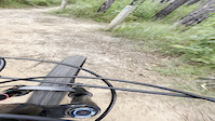
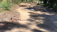
Photos of Ulladulla Mountain Bike
Videos of Ulladulla Mountain Bike
trail: Barnunj
2:09 |
|
Feb 10, 2022
trail: Pass the Sewage Works
0:22 |
91 |
May 18, 2021

trail: garbage
0:37 |
1350 |
May 24, 2010
Recent Trail Reports
| status | trail | date | condition | info | user |
|---|---|---|---|---|---|
| Borneo and The Switchbacks | Mar 1, 2026 @ 8:34am (Australia/Sydney) Feb 28, 2026 | Variable | Rohanmax | ||
| Never Never Land | Jan 26, 2026 @ 10:35am (Australia/Sydney) Jan 25, 2026 | Dry | obrien-r | ||
| Oompa Loompa | Jan 26, 2026 @ 10:35am (Australia/Sydney) Jan 25, 2026 | Dry | obrien-r | ||
| South Side Slide | Jan 26, 2026 @ 10:35am (Australia/Sydney) Jan 25, 2026 | Dry | obrien-r | ||
| Link Trail | Jan 26, 2026 @ 10:35am (Australia/Sydney) Jan 25, 2026 | Dry | obrien-r | ||
| Red Belly Black | Jan 26, 2026 @ 10:35am (Australia/Sydney) Jan 25, 2026 | Dry | obrien-r | ||
| Pines & Needles | Jul 12, 2025 @ 6:23am Jul 12, 2025 | Dry | ashmckenzie | ||
| Barnunj | Apr 9, 2025 @ 2:21am Apr 9, 2025 | Dry | Lewis-56 | ||
| Burnt to a Crisp | Dec 30, 2024 @ 12:59pm Dec 30, 2024 | Dry | REJB | ||
| Sherpa | Dec 30, 2024 @ 12:59pm Dec 30, 2024 | Dry | REJB |
Activity Feed
| username | action | type | title | date |
|---|---|---|---|---|
| logan1414 | ridden | trail | activity #94678397 and 8 more | May 14, 2026 @ 3:48am May 14, 2026 |
| logan1414 | ridden | trail | activity #94678314 | May 14, 2026 @ 3:45am May 14, 2026 |
| logan1414 | ridden | trail | activity #94678304 and 3 more | May 14, 2026 @ 3:45am May 14, 2026 |
| mic2005 | add | report | activity #90423836 | Mar 11, 2026 @ 10:46pm Mar 11, 2026 |
| George867 | wishlist | region | activity #90170403 | Mar 7, 2026 @ 7:21pm Mar 7, 2026 |
Recent Comments
| username | type | title | comment | date |
|---|---|---|---|---|
| trail | Tree blocking trail after recent storms. | Jul 12, 2025 @ 6:21am Jul 12, 2025 | ||
| trail | This whole bike park needs updating on TF to... | Apr 9, 2025 @ 2:25am Apr 9, 2025 | ||
| trail | Wooden berms/wall rides are fun. Wooden drop... | Apr 9, 2025 @ 2:23am Apr 9, 2025 | ||
| trail | Fun ride | Oct 9, 2024 @ 9:09pm Oct 9, 2024 | ||
| trail | Top half great, bottom half very eroded with... | Jun 12, 2024 @ 1:34am Jun 12, 2024 |
Local Badges
-

Epic Ride Climb 2k9 awarded -

Climbing 10k Badge10 awarded -

Climbing 100k Badge1 awarded -

Epic Ride Descent 2k9 awarded -

Descent 10k Badge10 awarded -

Descent 100k Badge2 awarded
Activity Type Stats
| activitytype | trails | distance | descent | descent distance | total vertical | rating | global rank | state rank | photos | reports | routes | ridelogs |
|---|---|---|---|---|---|---|---|---|---|---|---|---|
| Mountain Bike | 34 | 14 miles | 1,778 ft | 7 miles | 233 ft | #4,263 | #169 | 26 | 96 | 1 | 4,328 | |
| E-Bike | 23 | 9 miles | 1,286 ft | 4 miles | 233 ft | #3,220 | #156 | 86 | 582 | |||
| Horse | 4 | 1 mile | 174 ft | 3,573 ft | 164 ft | #758 | #35 | 4 | ||||
| Hike | 38 | 15 miles | 1,781 ft | 6 miles | 2,106 ft | #4,337 | #125 | 85 | 452 | |||
| Trail Running | 39 | 15 miles | 1,781 ft | 6 miles | 2,106 ft | #4,057 | #123 | 85 | 81 | |||
| Dirtbike/Moto | 4 | 1 mile | 174 ft | 3,573 ft | 164 ft | #469 | #20 | 4 | 6 | |||
| ATV/ORV/OHV | 1 | 515 ft | 13 ft | 2 | 2 | 1 |
Frequently Asked Questions About Ulladulla
▼
What are the best places to ride in Ulladulla?
Ulladulla has 3 areas to explore for mountain biking. The top rated areas are:
▼
What are the highest rated mountain biking trails in Ulladulla?
The highest rated mountain biking trails in Ulladulla are:
- Sherpas ext (4.2/5)
- Plan B (4.1/5)
- Barnunj (4.1/5)
- Leeches (4/5)
- Rocky Horror (4/5)
▼
What is the best time of the year to ride in Ulladulla?
Based on ride log data, the most popular months to ride in Ulladulla are:
- September (60 activities)
- February (52 activities)
- April (49 activities)
▼
Where can I park to ride in Ulladulla?
There are 3 parking locations listed in Ulladulla. The most popular parking spots are: View all parking and trailhead locations on the map to plan your visit.
Activities
Trails
Points of Interest
- By Addzz
 TRAILFORKS NEMTB & contributors
 - Admins: stuartrichardson
- #22050 - 21,988 views
- ulladulla activity log | embed map of Ulladulla mountain bike trails | ulladulla mountain biking points of interest
Downloading of trail gps tracks in kml & gpx formats is enabled for Ulladulla.
You must login to download files.