close
-
Layers w
- Weather Layers
- Pro
- Pro
- Pro
- Pro
- Pro
- Pro
- More Layers
- Pro
- Pro
- Pro
- Pro
-
Upgrade to

3D
Trail Conditions
- Unknown
- Snow Groomed
- Snow Packed
- Snow Covered
- Snow Cover Partial
- Freeze/thaw Cycle
- Icy
- Prevalent Mud
- Wet
- Variable
- Ideal
- Dry
- Very Dry
Trail Flow (Ridden Direction)
Trailforks scans users ridelogs to determine the most popular direction each trail is ridden. A good flowing trail network will have most trails flowing in a single direction according to their intension.
The colour categories are based on what percentage of riders are riding a trail in its intended direction.
The colour categories are based on what percentage of riders are riding a trail in its intended direction.
- > 96%
- > 90%
- > 80%
- > 70%
- > 50%
- < 50%
- bi-directional trail
- no data
Trail Last Ridden
Trailforks scans ridelogs to determine the last time a trail was ridden.
- < 2 days
- < 1 week
- < 2 weeks
- < 1 month
- < 6 months
- > 6 months
Trail Ridden Direction
The intended direction a trail should be ridden.
- Downhill Only
- Downhill Primary
- Both Directions
- Uphill Primary
- Uphill Only
- One Direction
Contribute Details
Colors indicate trail is missing specified detail.
- Description
- Photos
- Description & Photos
- Videos
Trail Popularity ?
Trailforks scans ridelogs to determine which trails are ridden the most in the last 9 months.
Trails are compared with nearby trails in the same city region with a possible 25 colour shades.
Think of this as a heatmap, more rides = more kinetic energy = warmer colors.
- most popular
- popular
- less popular
- not popular
ATV/ORV/OHV Filter
Max Vehicle Width
inches
US Cell Coverage
Legend

Radar Time
Activity Recordings
Trailforks uses anonymized public activity data.
?
Activity Recordings
Trailforks uses anonymized public activity data.
?
Personal Heatmap
▶
Activity Types
all
/
none
▶
Options
2
Date range
month
–
Winter Trails
Warning
A routing network for winter maps does not exist. Selecting trails using the winter trails layer has been disabled.
Missing Trails
Most Popular
Least Popular
Trails are colored based on popularity. The more popular a trail is, the more red. Less popular trails trend towards green.
Jump Magnitude Heatmap
Heatmap of where riders jump on trails. Zoom in to see individual jumps, click circles to view jump details.
BC Backroad Status
![map legend]()
Service Road Atlas is a free to use, community-driven service for viewing and creating reports on the numerous back-country service roads around B.C. and Alberta.

Slope Aspect
Direction the slope faces
Trails Deemphasized
Trails are shown in grey.
Only show trails with no bike usage.
Suggested Layers
Based on selected activity type
Save the current map location and zoom level as your default home location whenever this page is loaded.
SaveUlzamaldea fue una comarca y una subzona de la Comunidad Foral de Navarra (España) entre los años 2000 y 2019, mientras estuvo en vigor la zonificación de Navarra del año 2000.1 Esta comarca estaba formada por 9 municipios y formaba parte de la Merindad de Pamplona.
Primary Trail Type: All-Mountain & Downhill
eBikes Allowed:
Yes
AKA: Ulzama
This region uses the Uk/Euro style trail grading system.
Activities Click to view
- Mountain Bike
140 trails
- E-Bike
137 trails
- Horse
8 trails
- Hike
141 trails
- Trail Running
140 trails
Region Details
- 68
- 3
- 29
- 1
Region Status
Open as of Jun 2, 2026Stats
- Avg Trail Rating
- Trails (view details)
- 101
- Trails Mountain Bike
- 140
- Trails E-Bike
- 137
- Trails Horse
- 8
- Trails Hike
- 141
- Trails Trail Running
- 140
- Trails Backcountry Ski
- 1
- Trails Nordic Ski
- 1
- Total Distance
- 118 miles
- Total Descent Distance
- 53 miles
- Total Descent
- 19,927 ft
- Total Vertical
- 2,246 ft
- Highest Trailhead
- 3,571 ft
- Reports
- 164
- Photos
- 51
- Ridden Counter
- 961
Popular Ultzamaldea Mountain Biking Trails
• 95 ★ 3.9 • 2 miles • 33 ft • 79 •
Sendero que recorre alguna de las antiguas minas romanas de Lanz. El sendero termina en la borda Xinborneko, al pasarla deberemos ir a la izquierda para llegar al pueblo de Lanz.
• 95 ★ 4.0 • 3,730 ft • 97 ft • 25 •
Antigua trocha de saca de madera, convertida a sendero por no uso de vehículos
• 90 ★ 3.0 • 3,727 ft • 264 ft • 24 •
Sencillo y comodo tramo de senda de subida. Solo hay una pequeña zona de rockgarden de subida compleja. El resto es muy sencillo. La subida por pista alternativa a su Izda es mas dura por rampas duras que este sendero.
• 70 ★ 0.0 • 2,392 ft • 0 ft • 22 • • hike
Pista de acceso a desde el alto de Egozkue. Es muy empinada y tocara portear la bici en algún punto.
• 75 ★ 3.0 • 2,530 ft • 157 ft • 21 •
Subida por GR a la cima del monte ,con mts muy duros por desnivel pero se puede...y merece la pena por las vistas.
• 90 ★ 3.8 • 1 mile • 0 ft • 20 •
Senda que se puede combinar con . Es completamente natural sin pasos técnicos muy difíciles.
Ultzamaldea Mountain Bike Routes
22 miles • 4,934 ft • 20 • Loop •
Tres subidas y tres buenas bajadas en la ladera Oeste del cordal. La primera de las subidas por el es...
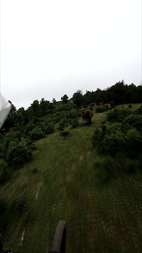
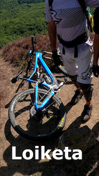
Photos of Ultzamaldea Mountain Bike
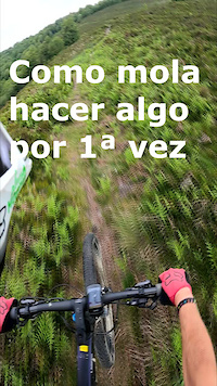
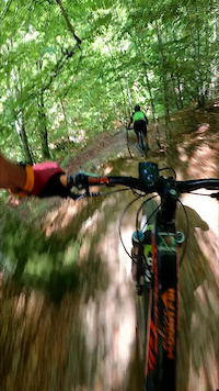
Videos of Ultzamaldea Mountain Bike

trail: Apordoki Porteo
0:43 |
34 |
May 28, 2023

trail: Apordoki
0:43 |
7 |
May 28, 2023
trail: Iturribeltx
0:14 |
22 |
May 27, 2023
trail: Irazabal
0:43 |
8 |
May 27, 2023
trail: Indieta
0:16 |
53 |
Sep 12, 2022
trail: Minas de Lanz
0:29 |
102 |
Sep 12, 2022

trail: Gereziain 3
0:47 |
2 |
Sep 12, 2022

trail: Gereziain 2
0:47 |
10 |
Sep 12, 2022
Recent Trail Reports
| status | trail | date | condition | info | user |
|---|---|---|---|---|---|
| Iturribeltx | Mar 19, 2026 @ 5:25pm (Europe/Madrid) Mar 19, 2026 | Unknown | rokoko | ||
| Karatongo Bidea | Nov 2, 2025 @ 9:16am (Europe/Andorra) Nov 2, 2025 | Variable | Mikelx | ||
| Iturrozko Bidea 2 | Nov 2, 2025 @ 9:16am (Europe/Andorra) Nov 2, 2025 | Variable | Mikelx | ||
| Eride | Nov 2, 2025 @ 9:16am (Europe/Andorra) Nov 2, 2025 | Variable | Mikelx | ||
| Urdanatz | Oct 13, 2025 @ 8:09am (Europe/Madrid) Oct 12, 2025 | Dry | Shuco636 | ||
| Iturrioz | Sep 14, 2025 @ 10:16am (Europe/Andorra) Sep 14, 2025 | Dry | PatriEH | ||
| Berdonegi | Sep 14, 2025 @ 10:16am (Europe/Andorra) Sep 14, 2025 | Dry | PatriEH | ||
| Agiñeta | Sep 14, 2025 @ 10:16am (Europe/Andorra) Sep 14, 2025 | Dry | PatriEH | ||
| Xuritxeta | Sep 14, 2025 @ 10:16am (Europe/Andorra) Sep 14, 2025 | Dry | PatriEH | ||
| Errekabelz,Retorno de Lanz | Sep 14, 2025 @ 10:16am (Europe/Andorra) Sep 14, 2025 | Dry | PatriEH |
Activity Feed
| username | action | type | title | date |
|---|---|---|---|---|
| mariosendit | ridden | trail | activity #93218058 | Apr 23, 2026 @ 9:07am Apr 23, 2026 |
| rokoko | add | report | activity #90862522 | Mar 19, 2026 @ 9:25am Mar 19, 2026 |
| Mikelx | vote | trail | activity #83613471 and 1 more | Nov 5, 2025 @ 5:34am Nov 5, 2025 |
| Mikelx | add | report | activity #83447219 and 2 more | Nov 2, 2025 @ 8:08am Nov 2, 2025 |
| Shuco636 | add | report | activity #82258354 | Oct 12, 2025 @ 11:09pm Oct 12, 2025 |
Recent Comments
| username | type | title | comment | date |
|---|---|---|---|---|
| report | A mi me parece una de las mejores bajadas de... | Jul 6, 2025 @ 10:13am Jul 6, 2025 | ||
| trail | Encontrar el acceso desde Sasoan es difícil,... | May 4, 2025 @ 1:27pm May 4, 2025 | ||
| trail | Las maquinas de sacar madera han dejado mal la... | Aug 16, 2024 @ 8:02am Aug 16, 2024 | ||
| trail | Sendero muy sucio que de subida casi seguro te... | Aug 13, 2024 @ 9:54am Aug 13, 2024 | ||
| trail | Sendero que podemos dividir en tres partes, la... | Aug 5, 2024 @ 10:52am Aug 5, 2024 |
Nearby Areas
| name | distance | ||||
|---|---|---|---|---|---|
| Muskitz/Imotz | 1 | 25 | 4 km | ||
| Eltxumendi | 4 | 17 | 6.4 km | ||
| Basaburua | 21 | 49 | 7.4 km | ||
| Irurtzun | 19 | 8 km | |||
| Ezkaba/Iruña Norte | 6 | 70 | 8.2 km |
Local Badges
-

Completionist0 awarded
Activity Type Stats
| activitytype | trails | distance | descent | descent distance | total vertical | rating | global rank | state rank | photos | reports | routes | ridelogs |
|---|---|---|---|---|---|---|---|---|---|---|---|---|
| Mountain Bike | 140 | 117 miles | 19,724 ft | 53 miles | 2,247 ft | #2,597 | #207 | 33 | 165 | 1 | 76 | |
| E-Bike | 137 | 114 miles | 19,072 ft | 51 miles | 2,247 ft | #897 | #283 | 9 | 161 | 1 | 36 | |
| Horse | 8 | 9 miles | 2,388 ft | 4 miles | 1,654 ft | #1,954 | #171 | 12 | ||||
| Hike | 141 | 118 miles | 19,928 ft | 53 miles | 2,247 ft | #1,248 | #167 | 9 | 164 | 11 | 31 | |
| Trail Running | 140 | 116 miles | 18,924 ft | 51 miles | 2,247 ft | #751 | #148 | 165 | 1 | 12 | ||
| Backcountry Ski | 1 | 2 miles | 1,001 ft | 2 miles | 932 ft | 2 | ||||||
| Nordic Ski | 1 | 2 miles | 1,001 ft | 2 miles | 932 ft | 2 |
Frequently Asked Questions About Ultzamaldea
▼
What are the highest rated mountain biking trails in Ultzamaldea?
The highest rated mountain biking trails in Ultzamaldea are:
- Karatongo Bidea (4.1/5)
- Errekabelz,Retorno de Lanz (4/5)
- Baltzoko (4/5)
- Urkisuko (4/5)
- Indieta (4/5)
▼
Where can I park to ride in Ultzamaldea?
Check the Ultzamaldea trail map for trailhead and parking information. Community members regularly update access and parking details for trails in the area.
▼
What is the longest trail in Ultzamaldea?
The longest trail in Ultzamaldea is Beunza-Guelbenzu at 3.2 miles. View all trails sorted by distance.
▼
What are the best & highest rated hiking trails in Ultzamaldea?
The best hiking trails in Ultzamaldea are: View all hiking trails sorted by popularity score.
Activities
Trails
Points of Interest
- ultzamaldea activity log | embed map of Ultzamaldea mountain bike trails | ultzamaldea mountain biking points of interest
Downloading of trail gps tracks in kml & gpx formats is enabled for Ultzamaldea.
You must login to download files.