close
-
Layers w
- Weather Layers
- Pro
- Pro
- Pro
- Pro
- Pro
- Pro
- More Layers
- Pro
- Pro
- Pro
- Pro
-
Upgrade to

3D
Trail Conditions
- Unknown
- Snow Groomed
- Snow Packed
- Snow Covered
- Snow Cover Partial
- Freeze/thaw Cycle
- Icy
- Prevalent Mud
- Wet
- Variable
- Ideal
- Dry
- Very Dry
Trail Flow (Ridden Direction)
Trailforks scans users ridelogs to determine the most popular direction each trail is ridden. A good flowing trail network will have most trails flowing in a single direction according to their intension.
The colour categories are based on what percentage of riders are riding a trail in its intended direction.
The colour categories are based on what percentage of riders are riding a trail in its intended direction.
- > 96%
- > 90%
- > 80%
- > 70%
- > 50%
- < 50%
- bi-directional trail
- no data
Trail Last Ridden
Trailforks scans ridelogs to determine the last time a trail was ridden.
- < 2 days
- < 1 week
- < 2 weeks
- < 1 month
- < 6 months
- > 6 months
Trail Ridden Direction
The intended direction a trail should be ridden.
- Downhill Only
- Downhill Primary
- Both Directions
- Uphill Primary
- Uphill Only
- One Direction
Contribute Details
Colors indicate trail is missing specified detail.
- Description
- Photos
- Description & Photos
- Videos
Trail Popularity ?
Trailforks scans ridelogs to determine which trails are ridden the most in the last 9 months.
Trails are compared with nearby trails in the same city region with a possible 25 colour shades.
Think of this as a heatmap, more rides = more kinetic energy = warmer colors.
- most popular
- popular
- less popular
- not popular
ATV/ORV/OHV Filter
Max Vehicle Width
inches
US Cell Coverage
Legend

Radar Time
Activity Recordings
Trailforks uses anonymized public activity data.
?
Activity Recordings
Trailforks uses anonymized public activity data.
?
Personal Heatmap
▶
Activity Types
all
/
none
▶
Options
2
Date range
month
–
Winter Trails
Warning
A routing network for winter maps does not exist. Selecting trails using the winter trails layer has been disabled.
Missing Trails
Most Popular
Least Popular
Trails are colored based on popularity. The more popular a trail is, the more red. Less popular trails trend towards green.
Jump Magnitude Heatmap
Heatmap of where riders jump on trails. Zoom in to see individual jumps, click circles to view jump details.
BC Backroad Status
![map legend]()
Service Road Atlas is a free to use, community-driven service for viewing and creating reports on the numerous back-country service roads around B.C. and Alberta.

Slope Aspect
Direction the slope faces
Trails Deemphasized
Trails are shown in grey.
Only show trails with no bike usage.
Suggested Layers
Based on selected activity type
Save the current map location and zoom level as your default home location whenever this page is loaded.
Save
No description for Upper Freehold has been added yet!
Login or register to submit one.
Activities Click to view
- Mountain Bike
63 trails
- Horse
15 trails
- Hike
72 trails
- Trail Running
72 trails
Region Details
- 7
- 2
- 21
- 23
- 1
Region Status
Open as of May 28, 2026Local Trail Association
Stats
- Avg Trail Rating
- Global Ranking
- #2,295
- State Ranking
- #825
- Trails (view details)
- 57
- Trails Mountain Bike
- 63
- Trails E-Bike
- 2
- Trails Horse
- 15
- Trails Hike
- 72
- Trails Trail Running
- 72
- Trails ATV/ORV/OHV
- 2
- Trails Nordic Ski
- 1
- Total Distance
- 33 miles
- Total Descent Distance
- 15 miles
- Total Descent
- 1,820 ft
- Total Vertical
- 262 ft
- Highest Trailhead
- 346 ft
- Reports
- 394
- Photos
- 59
- Ridden Counter
- 7,348
Sub Regions
-
Clayton Park
- 4
- 7
Popular Upper Freehold Mountain Biking Trails
• 60 ★ 5.0 • 4,275 ft • 90 ft • 522 •
Doctors Creek trail follows a ridge along the creek through beautiful hardwood forest, and then splits into a loop. The loop reaches a 4-way intersection with the (with a confusing signpost marked “Doctor’s Creek Trail” on three...
• 45 ★ 3.7 • 1 mile • 88 ft • 470 •
This trail consists of a “stem” segment that splits into a loop. The southern leg of the loop parallels the trail, but on a different ridge. The trail bends around toward the creek below and meets again with the Trail before...
• 50 ★ 5.0 • 2,818 ft • 60 ft • 465 •
An easy 0.7 mile (1.1 km) loop trail through the solitude of the forest. The trail starts behind the kiosk. In about 100 feet it splits in a “Y” at a trail sign post. Go left, and shortly come to a “T” where you may take either...
• 100 ★ 5.0 • 1,847 ft • 99 ft • 458 •
Popular blue difficulty singletrack. This mountain bike primary trail. On average it takes 2 minutes to complete this trail.
• 95 ★ 5.0 • 1,722 ft • 30 ft • 430 •
Popular blue difficulty singletrack. This mountain bike primary trail can be used both directions. On average it takes 2 minutes to complete this trail.
• 85 ★ 0.0 • 2,451 ft • 42 ft • 402 •
Popular blue difficulty singletrack. This mountain bike primary trail. It features bridge. On average it takes 2 minutes to complete this trail.
• 25 ★ 5.0 • 2 miles • 174 ft • 386 •
The has two possible entrances. One is behind the kiosk a short distance along the . Go this way to access the longer Doctors Creek and trails. The other entrance is to the left of the parking lot as you face the kiosk, near Emley’s...
• 75 ★ 0.0 • 456 ft • 0 ft • 330 •
Popular green difficulty singletrack. This multi-use trail can be used both directions. On average it takes minutes to complete this trail.
Upper Freehold Mountain Bike Routes
• 23 miles • 675 ft • 2 •
• 14 miles • 947 ft • 16 •
• 27 miles • 591 ft • 2 •
• 11 miles • 870 ft • 14 •
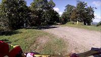
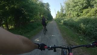
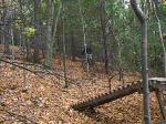
Photos of Upper Freehold Mountain Bike
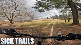
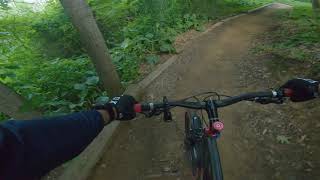
Videos of Upper Freehold Mountain Bike
trail: Glen
3:23 |
553 |
Sep 27, 2013
11:08 |
346 |
Dec 28, 2023

trail: Glen
3:32 |
273 |
Jul 21, 2010
trail: Glen
5:59 |
429 |
Apr 25, 2010
1:12:26 |
304 |
Jul 18, 2021

1:21:31 |
387 |
Jun 12, 2021
trail: Union Transportation Trail
1:31:59 |
355 |
May 31, 2021 , Upper Freehold
trail: Glen
0:09 |
619 |
Feb 18, 2008
Recent Trail Reports
| status | trail | date | condition | info | user |
|---|---|---|---|---|---|
| Old Forge 2 | May 28, 2026 @ 2:39pm (America/New_York) May 28, 2026 | Ideal | AbeFroman462 | ||
| Doctor's Creek 2 | May 28, 2026 @ 2:39pm (America/New_York) May 28, 2026 | Ideal | AbeFroman462 | ||
| Doctor’s Cut | May 28, 2026 @ 2:39pm (America/New_York) May 28, 2026 | Ideal | AbeFroman462 | ||
| Bridges | May 28, 2026 @ 2:39pm (America/New_York) May 28, 2026 | Ideal | AbeFroman462 | ||
| Doctor's Creek | May 28, 2026 @ 2:39pm (America/New_York) May 28, 2026 | Ideal | AbeFroman462 | ||
| Doctor’s Creek 3 | May 28, 2026 @ 2:39pm (America/New_York) May 28, 2026 | Ideal | AbeFroman462 | ||
| Old Forge | Nov 9, 2025 @ 8:05am (America/New_York) Nov 9, 2025 | Ideal | JuggernautMTB JORBA 6MR | ||
| Gary | Nov 9, 2025 @ 8:05am (America/New_York) Nov 9, 2025 | Ideal | JuggernautMTB JORBA 6MR | ||
| Glen | Nov 9, 2025 @ 8:05am (America/New_York) Nov 9, 2025 | Ideal | JuggernautMTB JORBA 6MR | ||
| Emley’s Hill | Sep 5, 2024 @ 4:04pm Sep 5, 2024 | Very Dry | Jdellaira |
Activity Feed
| username | action | type | title | date |
|---|---|---|---|---|
| JGoose | wishlist | region | activity #96781201 | Jun 11, 2026 @ 8:11pm Jun 11, 2026 |
| AbeFroman462 | add | report | activity #95742212 and 5 more | May 28, 2026 @ 4:51pm May 28, 2026 |
| Matts_mtbcrew | add | report | activity #94971130 | May 18, 2026 @ 6:05am May 18, 2026 |
| jstewart14 | wishlist | region | activity #94593754 | May 12, 2026 @ 4:48pm May 12, 2026 |
| brettpalumbo | update | trail | activity #94273027 and 1 more | May 8, 2026 @ 12:16pm May 8, 2026 |
Recent Comments
| username | type | title | comment | date |
|---|---|---|---|---|
| report | Thank you for the time and effort. | Mar 19, 2026 @ 7:53am Mar 19, 2026 | ||
| report | Thank you for the hard work. | Mar 19, 2026 @ 7:53am Mar 19, 2026 | ||
| trail | Excellent downhill | Jul 2, 2023 @ 7:31am Jul 2, 2023 |
Local Badges
-

Completionist1 awarded -

10 Blue Trails198 awarded -

Epic Mountain Bike Climb 2k0 awarded -

Climbing 10k Badge18 awarded -

Mountain Biking 100k Badge1 awarded -

Epic Ride Descent 2k0 awarded
Activity Type Stats
| activitytype | trails | distance | descent | descent distance | total vertical | rating | global rank | state rank | photos | reports | routes | ridelogs |
|---|---|---|---|---|---|---|---|---|---|---|---|---|
| Mountain Bike | 63 | 32 miles | 1,683 ft | 14 miles | 262 ft | #2,295 | #825 | 59 | 394 | 3 | 9,357 | |
| E-Bike | 2 | 296 | 1 | 268 | ||||||||
| Horse | 15 | 14 miles | 384 ft | 7 miles | 262 ft | #2,414 | #1,332 | 66 | 1 | 1 | ||
| Hike | 72 | 33 miles | 1,821 ft | 15 miles | 262 ft | #5,677 | #1,998 | 394 | 1 | 251 | ||
| Trail Running | 72 | 33 miles | 1,821 ft | 15 miles | 262 ft | #5,192 | #1,627 | 394 | 1 | 31 | ||
| ATV/ORV/OHV | 2 | 50 | 5 | |||||||||
| Nordic Ski | 1 | 1 |
Frequently Asked Questions About Upper Freehold
▼
What are the best places to ride in Upper Freehold?
Upper Freehold has 2 areas to explore for mountain biking. The top rated areas are:
▼
What are the highest rated mountain biking trails in Upper Freehold?
The highest rated mountain biking trails in Upper Freehold are:
- Old Forge 2 (4.2/5)
- Doctor's Creek (4.1/5)
- Glen (4.1/5)
- Bridges (4.1/5)
- Doctor’s Creek 3 (4.1/5)
▼
What is the best time of the year to ride in Upper Freehold?
Based on ride log data, the most popular months to ride in Upper Freehold are:
- August (84 activities)
- July (83 activities)
- June (76 activities)
▼
Where can I park to ride in Upper Freehold?
There are 5 parking locations listed in Upper Freehold. The most popular parking spots are: View all parking and trailhead locations on the map to plan your visit.
Activities
Trails
Points of Interest
- By Dig-Dug & contributors
- Admins: JORBA, JARJORBA
- #8056 - 3,117 views
- upper freehold activity log | embed map of Upper Freehold mountain bike trails | upper freehold mountain biking points of interest
Downloading of trail gps tracks in kml & gpx formats is enabled for Upper Freehold.
You must login to download files.