close
-
Layers w
- Weather Layers
- Pro
- Pro
- Pro
- Pro
- Pro
- Pro
- More Layers
- Pro
- Pro
- Pro
- Pro
-
Upgrade to

3D
Trail Conditions
- Unknown
- Snow Groomed
- Snow Packed
- Snow Covered
- Snow Cover Partial
- Freeze/thaw Cycle
- Icy
- Prevalent Mud
- Wet
- Variable
- Ideal
- Dry
- Very Dry
Trail Flow (Ridden Direction)
Trailforks scans users ridelogs to determine the most popular direction each trail is ridden. A good flowing trail network will have most trails flowing in a single direction according to their intension.
The colour categories are based on what percentage of riders are riding a trail in its intended direction.
The colour categories are based on what percentage of riders are riding a trail in its intended direction.
- > 96%
- > 90%
- > 80%
- > 70%
- > 50%
- < 50%
- bi-directional trail
- no data
Trail Last Ridden
Trailforks scans ridelogs to determine the last time a trail was ridden.
- < 2 days
- < 1 week
- < 2 weeks
- < 1 month
- < 6 months
- > 6 months
Trail Ridden Direction
The intended direction a trail should be ridden.
- Downhill Only
- Downhill Primary
- Both Directions
- Uphill Primary
- Uphill Only
- One Direction
Contribute Details
Colors indicate trail is missing specified detail.
- Description
- Photos
- Description & Photos
- Videos
Trail Popularity ?
Trailforks scans ridelogs to determine which trails are ridden the most in the last 9 months.
Trails are compared with nearby trails in the same city region with a possible 25 colour shades.
Think of this as a heatmap, more rides = more kinetic energy = warmer colors.
- most popular
- popular
- less popular
- not popular
ATV/ORV/OHV Filter
Max Vehicle Width
inches
US Cell Coverage
Legend

Radar Time
Activity Recordings
Trailforks uses anonymized public activity data.
?
Activity Recordings
Trailforks uses anonymized public activity data.
?
Personal Heatmap
▶
Activity Types
all
/
none
▶
Options
2
Date range
month
–
Winter Trails
Warning
A routing network for winter maps does not exist. Selecting trails using the winter trails layer has been disabled.
Missing Trails
Most Popular
Least Popular
Trails are colored based on popularity. The more popular a trail is, the more red. Less popular trails trend towards green.
Jump Magnitude Heatmap
Heatmap of where riders jump on trails. Zoom in to see individual jumps, click circles to view jump details.
BC Backroad Status
![map legend]()
Service Road Atlas is a free to use, community-driven service for viewing and creating reports on the numerous back-country service roads around B.C. and Alberta.

Slope Aspect
Direction the slope faces
Trails Deemphasized
Trails are shown in grey.
Only show trails with no bike usage.
Suggested Layers
Based on selected activity type
Save the current map location and zoom level as your default home location whenever this page is loaded.
SavePopular Trail Networks
view all areas »
No description for Upper Peninsula has been added yet!
Login or register to submit one.
AKA: UP
Region Details
- 218
- 26
- 428
- 459
- 150
- 40
- 1
Stats
- Avg Trail Rating
- Trails (view details)
- 2,483
- Trails Mountain Bike
- 1,379
- Trails E-Bike
- 955
- Trails Gravel Bike
- 128
- Trails Adaptive Bike
- 125
- Trails Winter Fat Bike
- 242
- Trails Horse
- 220
- Trails Hike
- 1,677
- Trails Trail Running
- 1,637
- Trails Dirtbike/Moto
- 16
- Trails Observed Trials
- 1
- Trails ATV/ORV/OHV
- 43
- Trails Snowmobile
- 41
- Trails Snowshoe
- 631
- Trails Downhill Ski
- 472
- Trails Backcountry Ski
- 288
- Trails Nordic Ski
- 565
- Total Distance
- 3,024 miles
- Total Descent
- 239,948 ft
- Total Vertical
- 1,390 ft
- Highest Trailhead
- 1,970 ft
- Reports
- 7,013
- Photos
- 2,453
- Ridden Counter
- 272,099
Articles
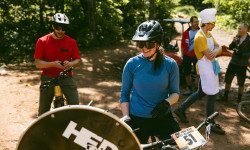
Copper Harbor Expands Its Most Entertaining Endurance Race to Include the Kids
Jun 15, 2026 from pinkbike.com
The 'All You Can East Bluffet' returns to Michigan’s Upper Peninsula with a chaotic format: pedal to the top, spin a wheel, and pray you don't...
Event Preview: The 4th Annual Rough Stuff Rally in Copper Harbor, MI
Mar 18, 2026 from pinkbike.com
With 22 and 43-mile route options, Friday night shuttles, and a $120 registration fee, the Rally is the ultimate way to explore Michigan’s...
Video: Brice Shirbach Explores the Tiny MTB Haven of Copper Harbor in ‘Underexposed’
Sep 9, 2025 from pinkbike.com
It’s a mission to get there, but worth it for the chance to immerse yourself in a bustling MTB scene.
Video: How To Make Or Break Your Backcountry MTB Adventure
Aug 16, 2024 from pinkbike.com
Christina and Matt rack their brains for the best backcountry mountain bike tips and setups.
Sub Regions
- Alger County (101)
- Chatham (0)
- Grand Island (11)
- Grand Marais (6)
- Munising (84)
- Bay de Noc to Grand Island (4)
- Bruno's Run (6)
- Hiawatha National Forest (6)
- Munising Bay Trails (17)
- Pine Marten (15)
- Valley Spur (19)
- Chatham (0)
- Baraga County (28)
- Baraga (5)
- Covington (0)
- L'Anse (7)
- Craig Lake State Park (4)
- Chippewa County (25)
- Paradise (1)
- Sault Ste Marie (20)
- Algonquin Pathway (14)
- Pine Bowl Pathway (6)
- Hiawatha National Forest (4)
- Paradise (1)
- Delta County (25)
- Escanaba (10)
- Gladstone (7)
- Days River (7)
- Dickinson County (100)
- Iron Mountain (54)
- Fumee Lake Natural Area (10)
- Millie Hill (16)
- Pewabic Hill (7)
- Pine Mountain Ski (17)
- Norway (43)
- Cyclops (8)
- Marion Park (12)
- Merriman East Trails (7)
- Ogee North (4)
- Piers Gorge Natural Area (6)
- Strawberry Lake Park (6)
- Iron Mountain (54)
- Gogebic County (82)
- Bessemer (12)
- Ironwood (67)
- Copper Peak (10)
- Miners Park (32)
- Mt. Zion Park (1)
- Riverside Trails (3)
- Wolverine Nordic Trails (12)
- Ironwood Township (3)
- Watersmeet (0)
- Houghton County (339)
- Calumet (43)
- Chassell (25)
- Hancock (192)
- Houghton (74)
- Ottawa National Forest (Houghton County Section) (4)
- Iron County (34)
- Crystal falls (12)
- Iron River (18)
- Mirkwood (4)
- Taproot Community Farm (2)
- Telmarine Hill (4)
- Keweenaw County (111)
- Copper Harbor (105)
- Eagle Harbor (2)
- Lac La Belle (0)
- Mohawk (1)
- Luce County (30)
- Newberry (30)
- Canada Lakes Pathway (20)
- Newberry (30)
- Mackinac County (72)
- Mackinac Island (61)
- Moran (0)
- Saint Ignace (6)
- Silver Mountain (1)
- Peek-A-Boo (3)
- Marquette County (472)
- Big Bay (23)
- Gwinn (13)
- Ishpeming (159)
- Al Quaal Recreation Area (13)
- RAMBA Trails (134)
- Marquette (271)
- Michigamme (6)
- Ontonagon County (55)
- Bergland (0)
- Greenland (26)
- Mass City (0)
- Rockland (3)
- White Pine (26)
- Bergland (0)
- Marquette (1)
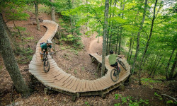
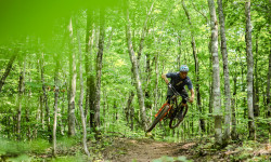
Popular Upper Peninsula Mountain Biking Trails
• 100 ★ 4.6 • 1,519 ft • 0 ft • 2,086 •
Highly rated popular blue difficulty singletrack. This mountain bike primary trail can be used downhill primary. On average it takes 1 minutes to complete this trail.
• 100 ★ 4.4 • 955 ft • 17 ft • 1,706 •
Popular green difficulty singletrack. This mountain bike primary trail can be used both directions. On average it takes 1 minutes to complete this trail.
• 60 ★ 4.5 • 3 miles • 109 ft • 1,650 •
is the backbone trail on the southern side of Brockway Mountain. This fun flow trail is one of the oldest trails built in Copper Harbor and a classic ride that should not be missed. The upper portions of the trail near the golf course...
• 90 ★ 3.9 • 2,398 ft • 14 ft • 1,618 •
Popular blue difficulty singletrack. This multi-use trail can be used both directions and has a moderate overall physical rating with a 14 ft blue climb. Trail visibility is always easy to follow. On average it takes 5 minutes to complete this trail.
• 95 ★ 3.4 • 2,664 ft • 0 ft • 1,593 •
A gentle connector from the end of back to the Copper Harbor trailhead.
• 5 ★ 3.5 • 3 miles • 384 ft • 1,583 •
Less popular blue difficulty singletrack. This multi-use trail can be used both directions. On average it takes 24 minutes to complete this trail.
• 100 ★ 4.6 • 1 mile • 93 ft • 1,562 •
is a fun and easy going connection between and the . The first half of the trail is level on the roll-out followed by a gradual descent with some gentle in-sloped carving singletrack. The forest through here has an open floor with a...
• 95 ★ 4.0 • 1 mile • 130 ft • 1,555 •
Highly rated popular blue difficulty singletrack. This multi-use trail can be used both directions and has a moderate overall physical rating with a 130 ft blue climb. It features berm. Winter use: Groomed Smooth snow grooming. On average it takes 11 minutes to complete this trail.
Upper Peninsula Mountain Bike Routes
★ 5.0 • 8 miles • 668 ft • 20 • Loop •
Perfect intro to the South Trails, with rolling climbs and descents, riding past and over waterfalls....
★ 5.0 • 9 miles • 810 ft • 3 • Loop •
This route takes you to the top of Lookout Mountain Road where the Catamount starts.
★ 5.0 • 20 miles • 1,784 ft • 30 • Loop •
A longer loop around the Maasto Hiihto and Churning Rapids trail system, showcasing many of the highlights...
★ 5.0 • 3 miles • 293 ft • 7 • Loop •
A quick and easy loop around Churning Rapids that hits some of the best and flowiest trails. Be sure to...
★ 5.0 • 12 miles • 997 ft • 16 • Loop •
A short loop around the Maasto Hiihto side of the Maasto Hiihto and Churning Rapids trail system,...
★ 5.0 • 8 miles • 665 ft • 20 • Loop •
Begins with the Access Road climb, then starts with a relatively flat but slightly rocky single track...
Photos of Upper Peninsula Mountain Bike
Videos of Upper Peninsula Mountain Bike
featured
![Don't Think - Michigan Tech Trails in Houghton, MI]()
trail: Don't Think
0:01 |
81 |
Nov 2, 2025 , Houghton
trail: Ebb's
0:09 |
17 |
Dec 18, 2025

trail: Highlands
0:12 |
|
Sep 6, 2024
trail: Highlands
0:16 |
|
Sep 4, 2024
trail: NTN Raging River
0:08 |
|
Sep 1, 2024
trail: Rome
0:10 |
69 |
Jun 24, 2024
trail: Ninja Chippy
0:11 |
|
Jun 24, 2024
trail: Bertha
0:09 |
116 |
May 31, 2024
Current Trail Warnings
| status | trail | date | condition | user | info |
|---|---|---|---|---|---|
| Fort Holmes Secret Mackinac Island State park | Jun 18, 2026 @ 12:06pm (America/Menominee) Jun 18, 2026 | Wet | mij2011 | ||
| Airport Fence-Line Mackinac Island State park | Jun 17, 2026 @ 9:57am (America/Menominee) Jun 17, 2026 | Ideal | mij2011 | ||
| Pine Creek Pass Norway | Jun 16, 2026 @ 11:36pm (America/Chicago) Jun 16, 2026 | Unknown | DTNTrails DTN | Boardwalk in need of significant repair.... |
Recent Trail Reports
Activity Feed
| username | action | type | title | date |
|---|---|---|---|---|
| Joboo1967 | add | report | activity #97670616 and 2 more | Jun 23, 2026 @ 7:49pm 51 mins |
| zawilk | update | region | activity #97663845 | Jun 23, 2026 @ 5:42pm 3 hours |
| 6x6sA4 | ridden | trail | activity #97657973 and 4 more | Jun 23, 2026 @ 4:12pm 4 hours |
| 6x6sA4 | ridden | trail | activity #97657396 | Jun 23, 2026 @ 4:03pm 5 hours |
| 6x6sA4 | wishlist | trail | activity #97657179 | Jun 23, 2026 @ 4:01pm 5 hours |
Recent Comments
| username | type | title | comment | date |
|---|---|---|---|---|
| report | Trail is in dire need of overhaul. Boardwalk... | Jun 17, 2026 @ 6:02am Jun 17, 2026 | ||
| report | Haha | Jun 14, 2026 @ 10:26am Jun 14, 2026 | ||
| trail | one of the most visually stunning trails I've... | Jun 13, 2026 @ 10:29am Jun 13, 2026 | ||
| trail | Steeper trail off of Jethro, with some added... | Jun 12, 2026 @ 6:39am Jun 12, 2026 | ||
| trail | Fun line of some doubles. The jumps at the... | Jun 12, 2026 @ 6:36am Jun 12, 2026 |
Local Badges
-

Epic Mountain Bike Climb 2k0 awarded -

10 Green Trails18 awarded -
Epic Mountain Bike Climb 2k0 awarded -
Epic Mountain Bike Climb 2k0 awarded -

Completionist0 awarded -

Climbing 10k Badge0 awarded
Bike & Skill Parks
| name | type | city | rating |
|---|---|---|---|
| Marquette Mountain Resort | bike park | Marquette | |
| Copper Peak | bike park | Ironwood | |
| Big Powderhorn Mountain Resort | bike park | Ironwood | |
| Black River Basin | bike park | Ironwood | |
| Vandenboom School Pumptrack | skill park | Marquette |
Upcoming Local Events
-
-
-
-
Activity Type Stats
| activitytype | trails | distance | descent | descent distance | total vertical | rating | global rank | state rank | photos | reports | routes | ridelogs |
|---|---|---|---|---|---|---|---|---|---|---|---|---|
| Mountain Bike | 1,379 | 1,664 miles | 103,533 ft | 608 miles | 1,237 ft | 2,238 | 6,845 | 121 | 132,000 | |||
| E-Bike | 955 | 1,126 miles | 73,904 ft | 462 miles | 1,237 ft | 20 | 5,631 | 22 | 3,470 | |||
| Gravel Bike | 128 | 322 miles | 12,936 ft | 135 miles | 1,142 ft | 514 | 1 | 424 | ||||
| Adaptive Bike | 125 | 125 miles | 8,340 ft | 47 miles | 1,099 ft | 743 | 6 | |||||
| Winter Fat Bike | 242 | 179 miles | 15,843 ft | 63 miles | 1,066 ft | 718 | 3 | 234 | ||||
| Horse | 220 | 767 miles | 15,984 ft | 233 miles | 1,106 ft | 1,262 | 1 | 56 | ||||
| Hike | 1,677 | 2,723 miles | 152,835 ft | 924 miles | 1,391 ft | 103 | 6,661 | 26 | 12,781 | |||
| Trail Running | 1,637 | 2,624 miles | 146,575 ft | 899 miles | 1,391 ft | 3 | 6,668 | 21 | 5,027 | |||
| Dirtbike/Moto | 16 | 347 miles | 3,917 ft | 159 miles | 1,083 ft | 1,252 | 57 | |||||
| Observed Trials | 1 | 3,045 ft | 16 ft | 171 ft | 95 ft | 26 | 1 | 31 | ||||
| ATV/ORV/OHV | 43 | 509 miles | 8,428 ft | 212 miles | 1,089 ft | 1,301 | 53 | |||||
| Snowmobile | 41 | 485 miles | 7,136 ft | 205 miles | 1,106 ft | 82 | 18 | |||||
| Snowshoe | 631 | 1,038 miles | 55,528 ft | 347 miles | 1,293 ft | 2 | 527 | 14 | 1,457 | |||
| Downhill Ski | 472 | 100 miles | 61,549 ft | 87 miles | 1,211 ft | 4 | 86 | 3,214 | ||||
| Backcountry Ski | 288 | 312 miles | 42,251 ft | 126 miles | 1,270 ft | 1 | 324 | 7 | 946 | |||
| Nordic Ski | 565 | 868 miles | 32,461 ft | 268 miles | 1,230 ft | 68 | 861 | 24 | 7,532 |
Activities
- Upper Peninsula Mountain Biking Trails
- Upper Peninsula E-Biking Trails
- Upper Peninsula Gravel Biking Trails
- Upper Peninsula Adaptive Biking Trails
- Upper Peninsula Winter Fat Biking Trails
- Upper Peninsula Horseback Trails
- Upper Peninsula Hiking Trails
- Upper Peninsula Trail Running Trails
- Upper Peninsula Dirtbiking Trails
- Upper Peninsula ATVing/Offroading Trails
- Upper Peninsula Snowmobiling Trails
- Upper Peninsula Snowshoeing Trails
- Upper Peninsula Skiing Trails
- Upper Peninsula Backcountry Skiing Trails
- Upper Peninsula Nordic Skiing Trails
Trails
Points of Interest
- Top of Luge Viewpoint
- Gleason Falls Sight
- Bluff Viewpoint
- Lookout Tower Viewpoint
- Norwich Cemetery Sight
- Manger-Lynch Shelter Cabin
- Victoria Mine "New" Shaft No. 2 Hoist House Sight
- Tamarack Dam Overlook Viewpoint
- Scenic Outlook Viewpoint
- Lodging Lodge
- Summit Peak (1,942 ft)
- Summit Mountain (1,873 ft)
- Government Peak (1,837 ft)
- By brenthillier
 NSMBA TRAILFORKS & contributors
 - Admins: M MOTO, truebleve, NCT-PWC
- #10885 - 20,662 views
- upper peninsula activity log | embed map of Upper Peninsula mountain bike trails | upper peninsula mountain biking points of interest polygons
Downloading of trail gps tracks in kml & gpx formats is enabled for Upper Peninsula.
You must login to download files.