close
-
Layers w
- Weather Layers
- Pro
- Pro
- Pro
- Pro
- Pro
- Pro
- More Layers
- Pro
- Pro
- Pro
- Pro
-
Upgrade to

3D
Trail Conditions
- Unknown
- Snow Groomed
- Snow Packed
- Snow Covered
- Snow Cover Partial
- Freeze/thaw Cycle
- Icy
- Prevalent Mud
- Wet
- Variable
- Ideal
- Dry
- Very Dry
Trail Flow (Ridden Direction)
Trailforks scans users ridelogs to determine the most popular direction each trail is ridden. A good flowing trail network will have most trails flowing in a single direction according to their intension.
The colour categories are based on what percentage of riders are riding a trail in its intended direction.
The colour categories are based on what percentage of riders are riding a trail in its intended direction.
- > 96%
- > 90%
- > 80%
- > 70%
- > 50%
- < 50%
- bi-directional trail
- no data
Trail Last Ridden
Trailforks scans ridelogs to determine the last time a trail was ridden.
- < 2 days
- < 1 week
- < 2 weeks
- < 1 month
- < 6 months
- > 6 months
Trail Ridden Direction
The intended direction a trail should be ridden.
- Downhill Only
- Downhill Primary
- Both Directions
- Uphill Primary
- Uphill Only
- One Direction
Contribute Details
Colors indicate trail is missing specified detail.
- Description
- Photos
- Description & Photos
- Videos
Trail Popularity ?
Trailforks scans ridelogs to determine which trails are ridden the most in the last 9 months.
Trails are compared with nearby trails in the same city region with a possible 25 colour shades.
Think of this as a heatmap, more rides = more kinetic energy = warmer colors.
- most popular
- popular
- less popular
- not popular
ATV/ORV/OHV Filter
Max Vehicle Width
inches
US Cell Coverage
Legend

Radar Time
Activity Recordings
Trailforks uses anonymized public activity data.
?
Activity Recordings
Trailforks uses anonymized public activity data.
?
Personal Heatmap
▶
Activity Types
all
/
none
▶
Options
2
Date range
month
–
Winter Trails
Warning
A routing network for winter maps does not exist. Selecting trails using the winter trails layer has been disabled.
Missing Trails
Most Popular
Least Popular
Trails are colored based on popularity. The more popular a trail is, the more red. Less popular trails trend towards green.
Jump Magnitude Heatmap
Heatmap of where riders jump on trails. Zoom in to see individual jumps, click circles to view jump details.
BC Backroad Status
![map legend]()
Service Road Atlas is a free to use, community-driven service for viewing and creating reports on the numerous back-country service roads around B.C. and Alberta.

Slope Aspect
Direction the slope faces
Trails Deemphasized
Trails are shown in grey.
Only show trails with no bike usage.
Suggested Layers
Based on selected activity type
Save the current map location and zoom level as your default home location whenever this page is loaded.
Save
No description for Urbania has been added yet!
Login or register to submit one.
This region uses the Uk/Euro style trail grading system.
Activities Click to view
- Mountain Bike
23 trails
- E-Bike
15 trails
- Gravel Bike
0 trails
- Adaptive Bike
0 trails
- Winter Fat Bike
0 trails
- Horse
4 trails
- Hike
21 trails
- Trail Running
20 trails
- Dirtbike/Moto
5 trails
Region Details
- 9
- 4
- 1
- 7
Region Status
Open as of Mar 31, 2026Stats
- Avg Trail Rating
- Trails (view details)
- 23
- Trails Mountain Bike
- 23
- Trails E-Bike
- 15
- Trails Horse
- 4
- Trails Hike
- 21
- Trails Trail Running
- 20
- Trails Dirtbike/Moto
- 5
- Total Distance
- 24 miles
- Total Descent
- 7,588 ft
- Total Vertical
- 2,002 ft
- Highest Trailhead
- 3,090 ft
- Reports
- 45
- Photos
- 21
- Ridden Counter
- 544
Popular Urbania Mountain Biking Trails
• 95 ★ 5.0 • 1 mile • 0 ft • 24 •
Popular blue difficulty singletrack. This mountain bike primary trail can be used downhill primary.
• 80 ★ 0.0 • 1 mile • 11 ft • 13 •
Popular white difficulty gravel path. This multi-use trail can be used both directions.
• 60 ★ 0.0 • 3,510 ft • 0 ft • 13 •
Moderately popular blue difficulty singletrack. This multi-use trail can be used downhill primary.
• 5 ★ 1.0 • 3 miles • 223 ft • 9 •
Less popular blue difficulty singletrack. This mountain bike primary trail can be used downhill only and has a moderate overall physical rating. Trail visibility is sometimes hard to follow. On average it takes 26 minutes to complete this trail.
• 75 ★ 0.0 • 1 mile • 29 ft • 8 •
Popular blue difficulty singletrack. This multi-use trail can be used downhill primary.
Photos of Urbania Mountain Bike
Videos of Urbania Mountain Bike
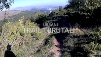
trail: Brutali
4:02 |
104 |
Oct 6, 2017
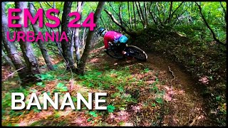
trail: Banana
5:25 |
99 |
Sep 20, 2024 , Urbania
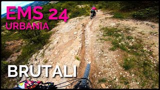
trail: Brutali
5:30 |
76 |
Sep 20, 2024 , Urbania

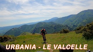
trail: Valcelle
6:43 |
90 |
May 18, 2023 , Urbania

trail: Montiego uphill
8:25 |
117 |
May 5, 2022 , Urbania
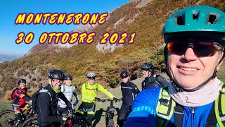
trail: Monte Nerone
6:29 |
135 |
Nov 11, 2021 , Urbania
Recent Trail Reports
| status | trail | date | condition | info | user |
|---|---|---|---|---|---|
| Connector | Mar 31, 2026 @ 10:23am (Europe/Rome) Mar 31, 2026 | Wet | riccardolucchi-92 | ||
| Brutali | Mar 31, 2026 @ 10:23am (Europe/Rome) Mar 31, 2026 | Wet | riccardolucchi-92 | ||
| San Martino | Mar 31, 2026 @ 10:23am (Europe/Rome) Mar 31, 2026 | Wet | riccardolucchi-92 | ||
| Banana | Mar 31, 2026 @ 10:23am (Europe/Rome) Mar 31, 2026 | Prevalent Mud | riccardolucchi-92 | ||
| Access Trek 2 | Mar 8, 2026 @ 8:20am (Europe/San_Marino) Mar 7, 2026 | Ideal | Primieri | ||
| King | Mar 8, 2026 @ 8:20am (Europe/San_Marino) Mar 7, 2026 | Ideal | Primieri | ||
| Provinciale to Proverso Gravel | Mar 8, 2026 @ 8:20am (Europe/San_Marino) Mar 7, 2026 | Ideal | Primieri | ||
| Access Trek 3 | Mar 8, 2026 @ 8:20am (Europe/San_Marino) Mar 7, 2026 | Ideal | Primieri | ||
| Access Trek 1 | Mar 8, 2026 @ 8:20am (Europe/San_Marino) Mar 7, 2026 | Ideal | Primieri | ||
| Valcelle | Jan 31, 2026 @ 8:24am (Europe/San_Marino) Jan 30, 2026 | Variable | Primieri |
Activity Feed
| username | action | type | title | date |
|---|---|---|---|---|
| kIkfji | ridden | trail | activity #93832469 | May 1, 2026 @ 9:49pm May 1, 2026 |
| riccardolucchi-92 | add | report | activity #91650139 and 3 more | Mar 31, 2026 @ 8:51am Mar 31, 2026 |
| Primieri | add | report | activity #90221466 and 4 more | Mar 8, 2026 @ 12:27pm Mar 8, 2026 |
| Primieri | add | report | activity #88178704 and 1 more | Feb 1, 2026 @ 12:24pm Feb 1, 2026 |
| niko80 | ridden | trail | activity #85233018 | Dec 7, 2025 @ 7:41am Dec 7, 2025 |
Recent Comments
| username | type | title | comment | date |
|---|---|---|---|---|
| trail | i sentieri sono fantastici e anche stabili,... | Mar 20, 2024 @ 5:39am Mar 20, 2024 | ||
| trail | Molto molto bello. Fatto il 16/4/22 in... | Apr 21, 2022 @ 2:26am Apr 21, 2022 | ||
| trail | No signs on site difficult to follow. Easy to... | Aug 23, 2017 @ 10:03am Aug 23, 2017 |
Local Badges
-

Epic Mountain Bike Climb 2k0 awarded -

Climbing 10k Badge0 awarded -

Mountain Biking 100k Badge0 awarded -

Epic Ride Descent 2k0 awarded -

Descent 10k Badge0 awarded -

Descent 100k Badge0 awarded
Activity Type Stats
| activitytype | trails | distance | descent | descent distance | total vertical | rating | global rank | state rank | photos | reports | routes | ridelogs |
|---|---|---|---|---|---|---|---|---|---|---|---|---|
| Mountain Bike | 23 | 24 miles | 7,589 ft | 10 miles | 2,001 ft | #6,405 | #504 | 21 | 45 | 677 | ||
| E-Bike | 15 | 3 miles | 686 ft | 4,990 ft | 1,010 ft | #7,257 | #787 | 41 | 219 | |||
| Horse | 4 | 1 mile | 663 ft | 3,986 ft | 604 ft | #2,396 | #166 | 4 | ||||
| Hike | 21 | 20 miles | 3,940 ft | 6 miles | 1,991 ft | #7,596 | #435 | 43 | 56 | |||
| Trail Running | 20 | 19 miles | 3,278 ft | 6 miles | 1,991 ft | #7,263 | #432 | 43 | ||||
| Dirtbike/Moto | 5 | 1 mile | 663 ft | 3,986 ft | 604 ft | #993 | #54 | 4 |
Frequently Asked Questions About Urbania
▼
What are the highest rated mountain biking trails in Urbania?
The highest rated mountain biking trails in Urbania are:
- Brutali (4.2/5)
- San Martino (4.1/5)
- Banana (4.1/5)
- Valcelle (3.6/5)
- Trek Trail (3.5/5)
▼
What is the best time of the year to ride in Urbania?
Based on ride log data, the most popular months to ride in Urbania are:
- October (8 activities)
- September (5 activities)
- July (5 activities)
▼
Where can I park to ride in Urbania?
▼
What is the longest trail in Urbania?
The longest trail in Urbania is Std. Bianche per Monte Proverso Gravel at 5.3 km. View all trails sorted by distance.
Activities
Trails
Points of Interest
- By cheorch
 & contributors
 - Admins: rew187
- #10523 - 3,007 views
- urbania activity log | embed map of Urbania mountain bike trails | urbania mountain biking points of interest
Downloading of trail gps tracks in kml & gpx formats is enabled for Urbania.
You must login to download files.