close
-
Layers w
- Weather Layers
- Pro
- Pro
- Pro
- Pro
- Pro
- Pro
- More Layers
- Pro
- Pro
- Pro
- Pro
-
Upgrade to

3D
Trail Conditions
- Unknown
- Snow Groomed
- Snow Packed
- Snow Covered
- Snow Cover Partial
- Freeze/thaw Cycle
- Icy
- Prevalent Mud
- Wet
- Variable
- Ideal
- Dry
- Very Dry
Trail Flow (Ridden Direction)
Trailforks scans users ridelogs to determine the most popular direction each trail is ridden. A good flowing trail network will have most trails flowing in a single direction according to their intension.
The colour categories are based on what percentage of riders are riding a trail in its intended direction.
The colour categories are based on what percentage of riders are riding a trail in its intended direction.
- > 96%
- > 90%
- > 80%
- > 70%
- > 50%
- < 50%
- bi-directional trail
- no data
Trail Last Ridden
Trailforks scans ridelogs to determine the last time a trail was ridden.
- < 2 days
- < 1 week
- < 2 weeks
- < 1 month
- < 6 months
- > 6 months
Trail Ridden Direction
The intended direction a trail should be ridden.
- Downhill Only
- Downhill Primary
- Both Directions
- Uphill Primary
- Uphill Only
- One Direction
Contribute Details
Colors indicate trail is missing specified detail.
- Description
- Photos
- Description & Photos
- Videos
Trail Popularity ?
Trailforks scans ridelogs to determine which trails are ridden the most in the last 9 months.
Trails are compared with nearby trails in the same city region with a possible 25 colour shades.
Think of this as a heatmap, more rides = more kinetic energy = warmer colors.
- most popular
- popular
- less popular
- not popular
ATV/ORV/OHV Filter
Max Vehicle Width
inches
US Cell Coverage
Legend

Radar Time
Activity Recordings
Trailforks uses anonymized public activity data.
?
Activity Recordings
Trailforks uses anonymized public activity data.
?
Personal Heatmap
▶
Activity Types
all
/
none
▶
Options
2
Date range
month
–
Winter Trails
Warning
A routing network for winter maps does not exist. Selecting trails using the winter trails layer has been disabled.
Missing Trails
Most Popular
Least Popular
Trails are colored based on popularity. The more popular a trail is, the more red. Less popular trails trend towards green.
Jump Magnitude Heatmap
Heatmap of where riders jump on trails. Zoom in to see individual jumps, click circles to view jump details.
BC Backroad Status
![map legend]()
Service Road Atlas is a free to use, community-driven service for viewing and creating reports on the numerous back-country service roads around B.C. and Alberta.

Slope Aspect
Direction the slope faces
Trails Deemphasized
Trails are shown in grey.
Only show trails with no bike usage.
Suggested Layers
Based on selected activity type
Save the current map location and zoom level as your default home location whenever this page is loaded.
Save
No description for Ústecký has been added yet!
Login or register to submit one.
AKA: Ústí nad Labem
This region uses the Uk/Euro style trail grading system.
Region Details
- 11
- 8
- 24
- 8
- 4
Stats
- Avg Trail Rating
- Trails (view details)
- 66
- Trails Mountain Bike
- 68
- Trails E-Bike
- 14
- Trails Hike
- 33
- Trails Trail Running
- 33
- Trails Backcountry Ski
- 2
- Total Distance
- 62 miles
- Total Descent
- 26,530 ft
- Total Vertical
- 2,110 ft
- Highest Trailhead
- 2,691 ft
- Reports
- 291
- Photos
- 76
- Ridden Counter
- 2,393
Sub Regions
- Děčín (13)
- Litoměřice (19)
- Louny (3)
- Most (23)
- Sport Areál Klíny (21)
- Ústí nad Labem (10)
- T.MTB.S (10)
Popular Ústecký Mountain Biking Trails
• 95 ★ 3.7 • 4,570 ft • 0 ft • 157 •
Popular red difficulty singletrack. This mountain bike primary trail can be used downhill only. It features berm, bridge, jump, gap jump, skinny, teeter totter and wallride. On average it takes 5 minutes to complete this trail.
• 90 ★ 2.6 • 4,990 ft • 7 ft • 149 •
Spousta velkých klopenek, boulí a lavic. Stále ale poměrně lehká v nízké rychlosti a s upraveným povrchem
• 80 ★ 4.0 • 1,142 ft • 18 ft • 140 •
Popular black diamond difficulty singletrack. This mountain bike primary trail can be used downhill only. It features bridge, drop, jump and gap jump. On average it takes 1 minutes to complete this trail.
• 100 ★ 4.2 • 3,323 ft • 0 ft • 135 •
Převažuje flow charakter se , místy kořenatá/kamenitá pasáž
• 60 ★ 4.5 • 1 mile • 0 ft • 85 •
Moderately popular red difficulty singletrack. This mountain bike primary trail can be used downhill only and has a moderate overall physical rating. Trail visibility is always easy to follow. On average it takes 13 minutes to complete this trail.
• 50 ★ 4.0 • 1 mile • 0 ft • 83 •
Moderately popular blue difficulty singletrack. This mountain bike primary trail can be used downhill only. On average it takes 8 minutes to complete this trail.
Ústecký Mountain Bike Routes
17 miles • 2,659 ft • 0 • Loop •
Pěkný okruh na odpoledne po nezpevněném povrchu v lesích
9 miles • 1,567 ft • 0 • Loop •
Okruh kolem Zubrnic, lze na XC, gravel i E-Mtb
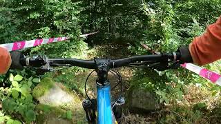
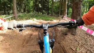
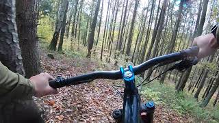
Photos of Ústecký Mountain Bike
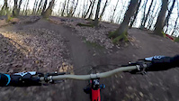
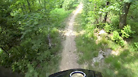
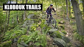
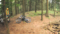
Videos of Ústecký Mountain Bike
trail: Skoky
4:26 |
63 |
Dec 28, 2018
trail: Ovesná Enduro
0:16 |
734 |
Jun 23, 2015
trail: Druhá Vlna
14:02 |
36 |
Mar 18, 2026 , Děčín
trail: Ovesná Enduro
19:11 |
871 |
Nov 19, 2011
trail: Dam
10:47 |
214 |
Oct 6, 2023 , Most
trail: Ore
11:33 |
158 |
Oct 5, 2023 , Most

trail: Sněžník North Shore
3:52 |
1440 |
Aug 4, 2020 , Děčín
trail: Ovesná Enduro
6:36 |
674 |
Mar 25, 2020 , Děčín
Recent Trail Reports
| status | trail | date | condition | info | user |
|---|---|---|---|---|---|
| Deer Sport Areál Klíny | Apr 26, 2026 @ 5:59pm (Europe/Prague) Apr 26, 2026 | Unknown | Richard64PWZj | ||
| Černá středem Sport Areál Klíny | Aug 16, 2025 @ 11:55am Aug 16, 2025 | Very Dry | tomasonthetrail | ||
| Zelená Sport Areál Klíny | Aug 16, 2025 @ 11:55am Aug 16, 2025 | Dry | tomasonthetrail | ||
| Černá přes bobovku Sport Areál Klíny | Aug 16, 2025 @ 11:55am Aug 16, 2025 | Very Dry | tomasonthetrail | ||
| Modrá Sport Areál Klíny | Aug 16, 2025 @ 11:55am Aug 16, 2025 | Very Dry | tomasonthetrail | ||
| Červená od parkoviště Sport Areál Klíny | Aug 16, 2025 @ 11:55am Aug 16, 2025 | Very Dry | tomasonthetrail | ||
| Padáček k lanovce Sport Areál Klíny | Aug 16, 2025 @ 11:55am Aug 16, 2025 | Very Dry | tomasonthetrail | ||
| Červená po sjezdovce Sport Areál Klíny | Aug 16, 2025 @ 11:55am Aug 16, 2025 | Very Dry | tomasonthetrail | ||
| Soutěska Rytina Litoměřice | Apr 2, 2025 @ 11:55pm Apr 2, 2025 | Variable | superrvenca | ||
| Oto toto T.MTB.S | Mar 27, 2025 @ 10:02am Mar 27, 2025 | Variable | Novic2004 |
Activity Feed
| username | action | type | title | date |
|---|---|---|---|---|
| Oidup9 | wishlist | trail | activity #96946027 | Jun 14, 2026 @ 2:07am Jun 14, 2026 |
| ViktoriePc6pZB | wishlist | trail | activity #96061999 | Jun 1, 2026 @ 9:38pm Jun 1, 2026 |
| ViktoriePc6pZB | wishlist | trail | activity #96061575 and 1 more | Jun 1, 2026 @ 9:20pm Jun 1, 2026 |
| ViktoriePc6pZB | wishlist | trail | activity #96061527 | Jun 1, 2026 @ 9:18pm Jun 1, 2026 |
| BertramYy6iNc | ridden | trail | activity #95490098 and 2 more | May 25, 2026 @ 8:14am May 25, 2026 |
Recent Comments
| username | type | title | comment | date |
|---|---|---|---|---|
| trail | Někdo to parádně pročistil. Cestou dolu... | Apr 2, 2025 @ 11:53pm Apr 2, 2025 | ||
| trail | hodně zapadané stromy, chvílema dost free... | Apr 2, 2025 @ 11:50pm Apr 2, 2025 | ||
| trail | Popadané stromy, třetina trailu rozrytá od... | Jun 4, 2024 @ 11:25am Jun 4, 2024 | ||
| trail | Keep in mind that this is an undulating trail... | Sep 4, 2023 @ 3:52am Sep 4, 2023 | ||
| trail | Neprůjezdné v první třetině, popadané... | Aug 26, 2023 @ 6:35am Aug 26, 2023 |
Local Badges
-

Big Ride 30k410 awarded -

Climbing 10k Badge0 awarded -

Epic Mountain Bike Climb 2k0 awarded -

Epic Ride 50k281 awarded -

Mountain Biking 100k Badge0 awarded -
Mountain Biking 100k Badge1 awarded
Bike & Skill Parks
| name | type | city | rating |
|---|---|---|---|
| Sport Areál Klíny | bike park | Most | |
| BMX Litoměřice | skill park | Litoměřice | |
| Seiffen motocross | skill park | Most | |
| Skillzone | skill park | Most |
Local Mountain Biking Directory
-
Kur SportBike Shop
-
Cyklo&HobbyBike Shop
Activity Type Stats
| activitytype | trails | distance | descent | descent distance | total vertical | rating | global rank | state rank | photos | reports | routes | ridelogs |
|---|---|---|---|---|---|---|---|---|---|---|---|---|
| Mountain Bike | 68 | 62 miles | 26,296 ft | 40 miles | 2,110 ft | 76 | 289 | 2 | 15,549 | |||
| E-Bike | 14 | 11 miles | 5,174 ft | 9 miles | 1,358 ft | 249 | 1 | 1,585 | ||||
| Hike | 33 | 41 miles | 16,171 ft | 26 miles | 2,031 ft | 254 | 1,951 | |||||
| Trail Running | 33 | 41 miles | 16,171 ft | 26 miles | 2,031 ft | 254 | 158 | |||||
| Backcountry Ski | 2 | 1,847 ft | 236 ft | 1,558 ft | 249 ft | 59 |
Activities
Trails
Points of Interest
- By brenthillier
 NSMBA TRAILFORKS & contributors
 - Admins: ČeMBA, ČeMBA, ČeMBA, ČeMBA, ČeMBA, ČeMBA, ČeMBA, ČeMBA, ČeMBA, ČeMBA
- #9747 - 3,539 views
- Ústecký activity log | embed map of Ústecký mountain bike trails | Ústecký mountain biking points of interest
Downloading of trail gps tracks in kml & gpx formats is enabled for Ústecký.
You must login to download files.