close
-
Layers w
- Weather Layers
- Pro
- Pro
- Pro
- Pro
- Pro
- Pro
- More Layers
- Pro
- Pro
- Pro
- Pro
-
Upgrade to

3D
Trail Conditions
- Unknown
- Snow Groomed
- Snow Packed
- Snow Covered
- Snow Cover Partial
- Freeze/thaw Cycle
- Icy
- Prevalent Mud
- Wet
- Variable
- Ideal
- Dry
- Very Dry
Trail Flow (Ridden Direction)
Trailforks scans users ridelogs to determine the most popular direction each trail is ridden. A good flowing trail network will have most trails flowing in a single direction according to their intension.
The colour categories are based on what percentage of riders are riding a trail in its intended direction.
The colour categories are based on what percentage of riders are riding a trail in its intended direction.
- > 96%
- > 90%
- > 80%
- > 70%
- > 50%
- < 50%
- bi-directional trail
- no data
Trail Last Ridden
Trailforks scans ridelogs to determine the last time a trail was ridden.
- < 2 days
- < 1 week
- < 2 weeks
- < 1 month
- < 6 months
- > 6 months
Trail Ridden Direction
The intended direction a trail should be ridden.
- Downhill Only
- Downhill Primary
- Both Directions
- Uphill Primary
- Uphill Only
- One Direction
Contribute Details
Colors indicate trail is missing specified detail.
- Description
- Photos
- Description & Photos
- Videos
Trail Popularity ?
Trailforks scans ridelogs to determine which trails are ridden the most in the last 9 months.
Trails are compared with nearby trails in the same city region with a possible 25 colour shades.
Think of this as a heatmap, more rides = more kinetic energy = warmer colors.
- most popular
- popular
- less popular
- not popular
ATV/ORV/OHV Filter
Max Vehicle Width
inches
US Cell Coverage
Legend

Radar Time
Activity Recordings
Trailforks uses anonymized public activity data.
?
Activity Recordings
Trailforks uses anonymized public activity data.
?
Personal Heatmap
▶
Activity Types
all
/
none
▶
Options
2
Date range
month
–
Winter Trails
Warning
A routing network for winter maps does not exist. Selecting trails using the winter trails layer has been disabled.
Missing Trails
Most Popular
Least Popular
Trails are colored based on popularity. The more popular a trail is, the more red. Less popular trails trend towards green.
Jump Magnitude Heatmap
Heatmap of where riders jump on trails. Zoom in to see individual jumps, click circles to view jump details.
BC Backroad Status
![map legend]()
Service Road Atlas is a free to use, community-driven service for viewing and creating reports on the numerous back-country service roads around B.C. and Alberta.

Slope Aspect
Direction the slope faces
Trails Deemphasized
Trails are shown in grey.
Only show trails with no bike usage.
Suggested Layers
Based on selected activity type
Save the current map location and zoom level as your default home location whenever this page is loaded.
SaveUuperi Bike Park
http://www.uuperinrinteet.fi/
http://www.uuperinrinteet.fi/
source: http://www.uuperinrinteet.fi/
Primary Trail Type: All-Mountain & Downhill
Shuttleable: YES
Land Status: City Managed
 google parking directions
 Access Info:
Viirankankaantie 237
Links
Activities Click to view
- Mountain Bike
8 trails
- Hike
0 trails
- Trail Running
0 trails
Bike Park Details
- 3
- 1
- 2
Region Status
Open as of Jul 9, 2025- Day Ticket
- €20 EUR
- Uplift Type
- T-Bar
- Season start
- Jun 10
- Season end
- Sep 25
Stats
- Global Ranking
- #12,373
- State Ranking
- #60
- Trails (view details)
- 8
- Trails Mountain Bike
- 8
- Total Distance
- 2 miles
- Total Descent
- 961 ft
- Total Vertical
- 167 ft
- Highest Trailhead
- 235 ft
- Reports
- 7
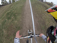
Popular Uuperi Mountain Biking Trails
• 5 ★ 0.0 • 2,116 ft • 6 ft •
Less popular green difficulty singletrack. This mountain bike primary trail can be used downhill primary and has a easy overall physical rating. It features bridge.
• 5 ★ 0.0 • 1,567 ft • 0 ft •
Less popular black diamond difficulty singletrack. This mountain bike primary trail can be used downhill primary. It features bridge and jump.
• 5 ★ 0.0 • 887 ft • 0 ft •
Less popular green difficulty singletrack. This mountain bike primary trail can be used downhill primary and has a easy overall physical rating. It features jump.
• 5 ★ 0.0 • 594 ft • 0 ft •
Less popular green difficulty singletrack. This mountain bike primary trail can be used downhill primary and has a easy overall physical rating.
• 5 ★ 0.0 • 1,011 ft • 3 ft •
Less popular blue difficulty singletrack. This mountain bike primary trail can be used downhill primary and has a easy overall physical rating. It features bridge.

Recent Trail Reports
no previous reports, add one now!
Activity Feed
| username | action | type | title | date |
|---|---|---|---|---|
| KareK | update | region | activity #3235634 | Oct 30, 2018 @ 7:16am Oct 30, 2018 |
| markholloway | update | trail | activity #2997589 and 4 more | Sep 24, 2018 @ 4:17pm Sep 24, 2018 |
| LeGuillotine | add | poi | activity #1178708 | Sep 14, 2017 @ 2:38pm Sep 14, 2017 |
| LeGuillotine | add | poi | activity #892235 and 1 more | Jul 5, 2017 @ 11:14pm Jul 5, 2017 |
| hirvi | add | trail | activity #131635 and 7 more | Sep 15, 2015 @ 11:52pm Sep 15, 2015 |
Nearby Areas
| name | distance | ||||
|---|---|---|---|---|---|
| Metsola | 5 | 11 | 3 | 11.5 km | |
| Huutjärvi | 14.4 km | ||||
| Mielakka Bikepark | 1 | 3 | 19.7 km |
Frequently Asked Questions About Uuperi
▼
What are the highest rated mountain biking trails in Uuperi?
The highest rated mountain biking trails in Uuperi are:
- DeeHoo (0/5)
- Safari (0/5)
- Hyppyrimäki (0/5)
- Viidakkosafari (0/5)
- Ylämummo (0/5)
▼
What is the best time of the year to ride in Uuperi?
Based on ride log data, the most popular months to ride in Uuperi are:
- September (1 activities)
▼
Where can I park to ride in Uuperi?
▼
What is the longest trail in Uuperi?
The longest trail in Uuperi is Ylämummo at 2,116 ft. View all trails sorted by distance.
- By hirvi & contributors
- Admins: apply
- #10264 - 4,605 views
- uuperi activity log | embed map of Uuperi mountain bike trails | uuperi mountain biking points of interest
Downloading of trail gps tracks in kml & gpx formats is enabled for Uuperi.
You must login to download files.