close
-
Layers w
- Weather Layers
- Pro
- Pro
- Pro
- Pro
- Pro
- Pro
- More Layers
- Pro
- Pro
- Pro
- Pro
-
Upgrade to

3D
Trail Conditions
- Unknown
- Snow Groomed
- Snow Packed
- Snow Covered
- Snow Cover Partial
- Freeze/thaw Cycle
- Icy
- Prevalent Mud
- Wet
- Variable
- Ideal
- Dry
- Very Dry
Trail Flow (Ridden Direction)
Trailforks scans users ridelogs to determine the most popular direction each trail is ridden. A good flowing trail network will have most trails flowing in a single direction according to their intension.
The colour categories are based on what percentage of riders are riding a trail in its intended direction.
The colour categories are based on what percentage of riders are riding a trail in its intended direction.
- > 96%
- > 90%
- > 80%
- > 70%
- > 50%
- < 50%
- bi-directional trail
- no data
Trail Last Ridden
Trailforks scans ridelogs to determine the last time a trail was ridden.
- < 2 days
- < 1 week
- < 2 weeks
- < 1 month
- < 6 months
- > 6 months
Trail Ridden Direction
The intended direction a trail should be ridden.
- Downhill Only
- Downhill Primary
- Both Directions
- Uphill Primary
- Uphill Only
- One Direction
Contribute Details
Colors indicate trail is missing specified detail.
- Description
- Photos
- Description & Photos
- Videos
Trail Popularity ?
Trailforks scans ridelogs to determine which trails are ridden the most in the last 9 months.
Trails are compared with nearby trails in the same city region with a possible 25 colour shades.
Think of this as a heatmap, more rides = more kinetic energy = warmer colors.
- most popular
- popular
- less popular
- not popular
ATV/ORV/OHV Filter
Max Vehicle Width
inches
US Cell Coverage
Legend

Radar Time
Activity Recordings
Trailforks uses anonymized public activity data.
?
Activity Recordings
Trailforks uses anonymized public activity data.
?
Personal Heatmap
▶
Activity Types
all
/
none
▶
Options
2
Date range
month
–
Winter Trails
Warning
A routing network for winter maps does not exist. Selecting trails using the winter trails layer has been disabled.
Missing Trails
Most Popular
Least Popular
Trails are colored based on popularity. The more popular a trail is, the more red. Less popular trails trend towards green.
Jump Magnitude Heatmap
Heatmap of where riders jump on trails. Zoom in to see individual jumps, click circles to view jump details.
BC Backroad Status
![map legend]()
Service Road Atlas is a free to use, community-driven service for viewing and creating reports on the numerous back-country service roads around B.C. and Alberta.

Slope Aspect
Direction the slope faces
Trails Deemphasized
Trails are shown in grey.
Only show trails with no bike usage.
Suggested Layers
Based on selected activity type
Save the current map location and zoom level as your default home location whenever this page is loaded.
SavePopular Trail Networks
view all areas »
No description for Uxbridge has been added yet!
Login or register to submit one.
Activities Click to view
- Mountain Bike
377 trails
- E-Bike
187 trails
- Gravel Bike
37 trails
- Adaptive Bike
0 trails
- Winter Fat Bike
2 trails
- Horse
80 trails
- Hike
353 trails
- Trail Running
343 trails
- Snowshoe
295 trails
- Downhill Ski
42 trails
- Nordic Ski
198 trails
Region Details
- 48
- 56
- 136
- 99
- 18
- 9
Region Status
Caution as of Jun 22, 2026Stats
- Avg Trail Rating
- Trails (view details)
- 410
- Trails Mountain Bike
- 377
- Trails E-Bike
- 187
- Trails Gravel Bike
- 37
- Trails Winter Fat Bike
- 2
- Trails Horse
- 80
- Trails Hike
- 353
- Trails Trail Running
- 343
- Trails ATV/ORV/OHV
- 1
- Trails Snowshoe
- 295
- Trails Downhill Ski
- 42
- Trails Backcountry Ski
- 3
- Trails Nordic Ski
- 198
- Total Distance
- 164 miles
- Total Descent
- 14,487 ft
- Total Vertical
- 492 ft
- Highest Trailhead
- 1,327 ft
- Reports
- 13,081
- Photos
- 688
- Ridden Counter
- 203,281
Sub Regions
-
Brock Tract
- 15
- 4
-
CountrySide Preserve
- 2
- 2
- 1
-
Dagmar North Trails
- 2
- 9
- 9
- 6
-
Durham Forest Main Tract
- 1
- 32
- 33
- 4
-
Durham Regional Forest - Brookdale Tract
- 3
- 1
- 1
-
Durham Regional Forest - Clubine/Norton Tract
- 1
- 1
- 1
-
Durham Regional Forest - Goodwood Tract
- 3
-
Durham Regional Forest - Roseville Track
- 5
-
Durham Regional Forest - Timbers Tract
- 5
- 3
-
Glen Major Forest
- 10
- 24
- 1
- 1
-
Higgins
-
North Walkers Woods
- 6
- 5
-
Secord Forest and Wildlife Area
- 3
- 1
-
Town Of Uxbridge
- 40
- 1
- 1
-
Trail Hub
- 9
- 12
- 5
-
TRCA Skyloft
- 3
- 4
-
Walker Woods
- 1
- 34
- 5
Popular Uxbridge Mountain Biking Trails
• 100 ★ 4.2 • 3,130 ft • 30 ft • 2,389 •
COVID 19 (Dec 2021) update - via LSCA - DIRECTIONAL SIGNAGE removed.. Flow through pines NW to SW. Berms. Rollers. Some excellent banked sections. Inset rocks and power climbs.
• 100 ★ 4.1 • 2,303 ft • 55 ft • 2,337 •
COVID 19 (Dec 2021) update - via LSCA - DIRECTIONAL SIGNAGE removed.
• 100 ★ 4.1 • 1 mile • 77 ft • 2,321 •
Highly rated popular blue difficulty singletrack. This mountain bike primary trail can be used both directions and has a moderate overall physical rating with a 77 ft blue climb. Trail visibility is always easy to follow. On average it takes 9 minutes to complete this trail.
• 100 ★ 4.1 • 1,650 ft • 22 ft • 2,299 •
Highly rated popular black diamond difficulty singletrack. This mountain bike primary trail and has a moderate overall physical rating with a 22 ft blue climb. It features berm, drop, jump, roller coaster and other. Trail visibility is always easy to follow. On average it takes 2 minutes to complete this trail.
• 100 ★ 3.8 • 1,640 ft • 6 ft • 2,221 •
COVID 19 (Dec 2021) update - via LSCA - DIRECTIONAL SIGNAGE removed. 2017 Edition
• 100 ★ 4.6 • 1,093 ft • 13 ft • 2,205 •
COVID 19 (Dec 2021) update - via LSCA - DIRECTIONAL SIGNAGE removed..
• 100 ★ 4.5 • 3,228 ft • 59 ft • 2,183 •
leading to doubletrack and Oakie Dokey leading to .
• 100 ★ 3.8 • 1,896 ft • 74 ft • 2,162 •
COVID 19 (Dec 2021) update - via LSCA - DIRECTIONAL SIGNAGE removed..
Uxbridge Mountain Bike Routes
★ 5.0 • 9 miles • 882 ft • 8 • Loop •
As most of the trails now are one way, this route completes the entire single track routes with minimum...
★ 3.8 • 8 miles • 796 ft • 19 • Loop •
uni-directional loop starting at the Houston parking lot
★ 5.0 • 26 miles • 2,002 ft • 45 • Loop •
47km of black blue singletrack Durham Walkers GlenMajor Dagmar Forest Loop with 870meters of climbing....
★ 5.0 • 7 miles • 566 ft • 12 • Loop •
Fun loop lots of flow, try it out and let me know!
★ 5.0 • 11 miles • 970 ft • 28 • Loop •
Longer version of "EPSI FLOW - 11 KM - SHORT" and has a wider loop of trails and more climb involved....
★ 5.0 • 22 miles • 2,180 ft • 41 • Loop •
Just a loop I am working on recently.
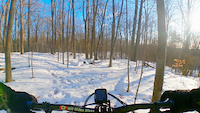
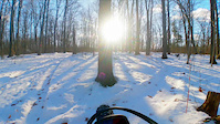
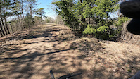
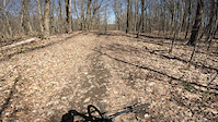
Photos of Uxbridge Mountain Bike
Videos of Uxbridge Mountain Bike
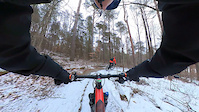
trail: Sliders Upper
2:04 |
9 |
Dec 22, 2025
trail: Lava Chicken
0:53 |
14 |
Dec 22, 2025
trail: Rock, Paper, Scissors
4:58 |
225 |
Apr 16, 2024
trail: Rock, Paper, Scissors
2:03 |
63 |
Apr 16, 2024
trail: Burnt Toast
0:13 |
91 |
Feb 13, 2024
trail: Razors Edge
18:55 |
31 |
Oct 14, 2022
trail: Lunartic Way
0:49 |
271 |
Oct 19, 2019
trail: Superfly Alley
3:55 |
320 |
Oct 19, 2019
Current Trail Warnings
| status | trail | date | condition | user | info |
|---|---|---|---|---|---|
| Duck Soup | May 30, 2026 @ 10:28am (America/Toronto) May 30, 2026 | Ideal | ptonev | Large tree down across trail, blocking... |
Recent Trail Reports
| status | trail | date | condition | info | user |
|---|---|---|---|---|---|
| Buzek to Durham Forest Access | Jun 22, 2026 @ 5:42pm (America/Toronto) Jun 22, 2026 | Dry | will-rides-bikes | ||
| Stone Soup | Jun 22, 2026 @ 5:42pm (America/Toronto) Jun 22, 2026 | Ideal | will-rides-bikes | ||
| The Maze (Stone Soup - Logs) | Jun 22, 2026 @ 5:42pm (America/Toronto) Jun 22, 2026 | Ideal | will-rides-bikes | ||
| Logs Over Easy | Jun 22, 2026 @ 5:42pm (America/Toronto) Jun 22, 2026 | Ideal | will-rides-bikes | ||
| Ogre and Out | Jun 22, 2026 @ 5:42pm (America/Toronto) Jun 22, 2026 | Ideal | will-rides-bikes | ||
| Ogre Entrance | Jun 22, 2026 @ 5:42pm (America/Toronto) Jun 22, 2026 | Ideal | will-rides-bikes | ||
| Return to Sender | Jun 22, 2026 @ 5:42pm (America/Toronto) Jun 22, 2026 | Ideal | will-rides-bikes | ||
| Sliders Lower | Jun 22, 2026 @ 5:42pm (America/Toronto) Jun 22, 2026 | Ideal | will-rides-bikes | ||
| Lunatic Way New | Jun 22, 2026 @ 5:42pm (America/Toronto) Jun 22, 2026 | Ideal | will-rides-bikes | ||
| Sliders Upper | Jun 22, 2026 @ 5:42pm (America/Toronto) Jun 22, 2026 | Ideal | will-rides-bikes |
Activity Feed
| username | action | type | title | date |
|---|---|---|---|---|
| daniel1472 | ridden | trail | activity #97936045 | Jun 27, 2026 @ 2:07pm 6 hours |
| mudpupzey | wishlist | route | activity #97844520 and 1 more | Jun 26, 2026 @ 10:46am 1 day |
| TacocaTatat | wishlist | region | activity #97826192 | Jun 26, 2026 @ 4:54am 2 days |
| TacocaTatat | wishlist | region | activity #97826178 | Jun 26, 2026 @ 4:53am 2 days |
| Gorman83 | ridden | trail | activity #97766860 and 7 more | Jun 25, 2026 @ 7:25am 3 days |
Recent Comments
| username | type | title | comment | date |
|---|---|---|---|---|
| trail | Connector trail used to access Superfly Alley... | Jun 9, 2026 @ 8:06am Jun 9, 2026 | ||
| report | Please email... | Jun 8, 2026 @ 5:28am Jun 8, 2026 | ||
| report | Did you email DMBA about the tree? If not,... | Jun 4, 2026 @ 5:47am Jun 4, 2026 | ||
| report | Likely to end the fun | May 31, 2026 @ 8:12am May 31, 2026 | ||
| report | thx on the route thing idk brain fart and the... | Apr 27, 2026 @ 7:00am Apr 27, 2026 |
Local Badges
-

Completionist217 awarded -
Completionist0 awarded -

Big Ride 30k8,652 awarded -

Epic Ride 50k3,349 awarded -

Top 10 Trails1,168 awarded -
Completionist2 awarded
Bike & Skill Parks
| name | type | city | rating |
|---|---|---|---|
| Uxbridge Pump Track and Skate Park | skill park | Uxbridge |
Activity Type Stats
| activitytype | trails | distance | descent | descent distance | total vertical | rating | global rank | state rank | photos | reports | routes | ridelogs |
|---|---|---|---|---|---|---|---|---|---|---|---|---|
| Mountain Bike | 377 | 154 miles | 11,444 ft | 57 miles | 492 ft | #30 | #2 | 649 | 12,956 | 56 | 80,938 | |
| E-Bike | 187 | 85 miles | 5,745 ft | 29 miles | 492 ft | #941 | #38 | 4 | 10,996 | 16 | 1,375 | |
| Gravel Bike | 37 | #269 | #37 | 335 | 4 | 322 | ||||||
| Winter Fat Bike | 2 | #46 | #55 | 4 | 148 | 5 | 109 | |||||
| Horse | 80 | 16 miles | 902 ft | 5 miles | 400 ft | #859 | #15 | 1,476 | 15 | |||
| Hike | 353 | 149 miles | 9,944 ft | 54 miles | 492 ft | #546 | #11 | 29 | 12,852 | 13 | 2,664 | |
| Trail Running | 343 | 147 miles | 9,875 ft | 53 miles | 492 ft | #539 | #10 | 2 | 12,842 | 26 | 1,557 | |
| ATV/ORV/OHV | 1 | 1 mile | 30 ft | 1 mile | 30 ft | 1,006 | 3 | |||||
| Snowshoe | 295 | 78 miles | 4,708 ft | 26 miles | 486 ft | #40 | #7 | 1,493 | 7 | 251 | ||
| Downhill Ski | 42 | 6 miles | 2,713 ft | 6 miles | 305 ft | #120 | #4 | 124 | 342 | |||
| Backcountry Ski | 3 | 4,777 ft | 121 ft | 2,615 ft | 174 ft | 157 | 1 | 46 | ||||
| Nordic Ski | 198 | 54 miles | 3,245 ft | 19 miles | 472 ft | #142 | #9 | 811 | 1 | 492 |
Frequently Asked Questions About Uxbridge
▼
What are the best places to ride in Uxbridge?
Uxbridge has 20 areas to explore for mountain biking. The top rated areas are:
▼
What are the highest rated mountain biking trails in Uxbridge?
The highest rated mountain biking trails in Uxbridge are:
- Sliders Upper (4.6/5)
- Skin & Bones (4.4/5)
- Lunatic Way New (4.4/5)
- Superfly Alley (4.4/5)
- Bowes Trail (4.4/5)
▼
What is the best time of the year to ride in Uxbridge?
Based on ride log data, the most popular months to ride in Uxbridge are:
- July (2,150 activities)
- June (2,057 activities)
- August (1,898 activities)
▼
Where can I park to ride in Uxbridge?
There are 27 parking locations listed in Uxbridge. The most popular parking spots are: View all parking and trailhead locations on the map to plan your visit.
Activities
Trails
Points of Interest
- Trail Kiosk - Trail Map Information
- Trail Hub - Trail Head Information
- Dog Walking Park Information
- Creek Bridge
- NO Parking Information
- Information Kiosk
- Map/Directional Sign (TRCA) Information
- Ski Lift Hut - closed to the public. Cabin
- Communication Towers (private area not for visitors) Summit
- Trail Hub Lodge
- By Red6 & contributors
- Admins: DMBA
- #3280 - 49,830 views
- uxbridge activity log | embed map of Uxbridge mountain bike trails | uxbridge mountain biking points of interest polygons
Downloading of trail gps tracks in kml & gpx formats is enabled for Uxbridge.
You must login to download files.