close
-
Layers w
- Weather Layers
- Pro
- Pro
- Pro
- Pro
- Pro
- Pro
- More Layers
- Pro
- Pro
- Pro
- Pro
-
Upgrade to

3D
Trail Conditions
- Unknown
- Snow Groomed
- Snow Packed
- Snow Covered
- Snow Cover Partial
- Freeze/thaw Cycle
- Icy
- Prevalent Mud
- Wet
- Variable
- Ideal
- Dry
- Very Dry
Trail Flow (Ridden Direction)
Trailforks scans users ridelogs to determine the most popular direction each trail is ridden. A good flowing trail network will have most trails flowing in a single direction according to their intension.
The colour categories are based on what percentage of riders are riding a trail in its intended direction.
The colour categories are based on what percentage of riders are riding a trail in its intended direction.
- > 96%
- > 90%
- > 80%
- > 70%
- > 50%
- < 50%
- bi-directional trail
- no data
Trail Last Ridden
Trailforks scans ridelogs to determine the last time a trail was ridden.
- < 2 days
- < 1 week
- < 2 weeks
- < 1 month
- < 6 months
- > 6 months
Trail Ridden Direction
The intended direction a trail should be ridden.
- Downhill Only
- Downhill Primary
- Both Directions
- Uphill Primary
- Uphill Only
- One Direction
Contribute Details
Colors indicate trail is missing specified detail.
- Description
- Photos
- Description & Photos
- Videos
Trail Popularity ?
Trailforks scans ridelogs to determine which trails are ridden the most in the last 9 months.
Trails are compared with nearby trails in the same city region with a possible 25 colour shades.
Think of this as a heatmap, more rides = more kinetic energy = warmer colors.
- most popular
- popular
- less popular
- not popular
ATV/ORV/OHV Filter
Max Vehicle Width
inches
US Cell Coverage
Legend

Radar Time
Activity Recordings
Trailforks uses anonymized public activity data.
?
Activity Recordings
Trailforks uses anonymized public activity data.
?
Personal Heatmap
▶
Activity Types
all
/
none
▶
Options
2
Date range
month
–
Winter Trails
Warning
A routing network for winter maps does not exist. Selecting trails using the winter trails layer has been disabled.
Missing Trails
Most Popular
Least Popular
Trails are colored based on popularity. The more popular a trail is, the more red. Less popular trails trend towards green.
Jump Magnitude Heatmap
Heatmap of where riders jump on trails. Zoom in to see individual jumps, click circles to view jump details.
BC Backroad Status
![map legend]()
Service Road Atlas is a free to use, community-driven service for viewing and creating reports on the numerous back-country service roads around B.C. and Alberta.

Slope Aspect
Direction the slope faces
Trails Deemphasized
Trails are shown in grey.
Only show trails with no bike usage.
Suggested Layers
Based on selected activity type
Save the current map location and zoom level as your default home location whenever this page is loaded.
Save
No description for Vålådalen has been added yet!
Login or register to submit one.
 google parking directions
Primary Trail Type: Cross-Country
google parking directionsThis region uses the Uk/Euro style trail grading system.
Activities Click to view
- Mountain Bike
26 trails
- E-Bike
1 trails
- Hike
38 trails
- Trail Running
38 trails
- Backcountry Ski
9 trails
- Nordic Ski
26 trails
Region Details
- 6
- 6
- 3
- 9
- 1
Region Status
Caution as of Jun 6, 2026Stats
- Avg Trail Rating
- Trails (view details)
- 39
- Trails Mountain Bike
- 26
- Trails E-Bike
- 1
- Trails Hike
- 38
- Trails Trail Running
- 38
- Trails Downhill Ski
- 1
- Trails Backcountry Ski
- 9
- Trails Nordic Ski
- 26
- Total Distance
- 76 miles
- Total Descent Distance
- 34 miles
- Total Descent
- 11,251 ft
- Total Vertical
- 1,996 ft
- Highest Trailhead
- 3,619 ft
- Reports
- 102
- Photos
- 68
- Ridden Counter
- 1,591
Popular Vålådalen Mountain Biking Trails
• 5 ★ 4.2 • 6 miles • 604 ft • 206 •
Highly rated less popular red difficulty alpine singletrack. This multi-use trail can be used one direction and has a moderate overall physical rating with a 604 ft blue climb. It features bridge and skinny. On average it takes 1 hour37 minutes to complete this trail.
• 75 ★ 3.7 • 4 miles • 545 ft • 169 •
Popular red difficulty singletrack. This multi-use trail can be used both directions and has a moderate overall physical rating with a 545 ft blue climb. It features bridge, ladder bridge, rock garden and skinny. On average it takes 1 hour1 minutes to complete this trail.
• 35 ★ 4.0 • 6 miles • 451 ft • 126 •
Less popular red difficulty singletrack. This multi-use trail can be used both directions and has a hard overall physical rating with a 451 ft black diamond climb. It features bridge, ladder bridge and skinny. On average it takes 2 hours6 minutes to complete this trail.
• 70 ★ 4.1 • 3 miles • 187 ft • 88 •
Highly rated popular red difficulty singletrack. This multi-use trail can be used one direction and has a moderate overall physical rating with a 187 ft blue climb. It features bridge and skinny. On average it takes 1 hour20 minutes to complete this trail.
• 65 ★ 3.0 • 2 miles • 153 ft • 58 •
Oftast bred stig. Enstaka partier där barn och vuxna fick gå. Vintertid har spåret till viss del en annan sträckning
• 5 ★ 4.0 • 3 miles • 110 ft • 31 •
Less popular red difficulty singletrack. This multi-use trail can be used both directions and has a moderate overall physical rating with a 110 ft blue climb. It features bridge and skinny. On average it takes 41 minutes to complete this trail.
• 70 ★ 0.0 • 1 mile • 236 ft • 23 •
Observera att endast en begränsad del av spåret är preparerat vintertid.
• 75 ★ 0.0 • 833 ft • 0 ft • 21 •
Popular green difficulty singletrack. This multi-use trail can be used both directions and has a easy overall physical rating with a 0 ft green climb. Trail visibility is always easy to follow. On average it takes minutes to complete this trail.
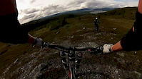
Photos of Vålådalen Mountain Bike
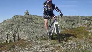
Videos of Vålådalen Mountain Bike
trail: Hottögsfjället
0:57 |
210 |
Aug 20, 2014
trail: Hottögsfjället
2:46 |
715 |
Aug 7, 2020 , Åre
Recent Trail Reports
| status | trail | date | condition | info | user |
|---|---|---|---|---|---|
| Bäverkroken | Jul 23, 2025 @ 3:20pm Jul 23, 2025 | Dry | Pihu | ||
| Nulltjärnsrundan Nulltjärnsgården | Jul 24, 2024 @ 1:30pm Jul 24, 2024 | Variable | HemsoMTB | ||
| Öflon | Jul 18, 2024 @ 11:07pm Jul 18, 2024 | Ideal | FU9Mpe | ||
| Vålåleden | Jul 18, 2024 @ 11:07pm Jul 18, 2024 | Ideal | FU9Mpe | ||
| Vålåleden Fångåmon | Jul 18, 2024 @ 11:07pm Jul 18, 2024 | Ideal | FU9Mpe | ||
| Blanktjärn 2 | Jul 11, 2022 @ 2:29am Jul 11, 2022 | Dry | EUNE | ||
| Issjödalen | Aug 31, 2020 @ 12:04am Aug 31, 2020 | Ideal | PerGelang | ||
| Grönvallen | Aug 31, 2020 @ 12:04am Aug 31, 2020 | Ideal | PerGelang | ||
| Hottögsfjället | Aug 1, 2020 @ 8:55am Aug 1, 2020 | Ideal | ekefalk | ||
| Vålådalen-Vallbo | Jun 8, 2017 @ 5:45am Jun 8, 2017 | Variable | leyaway |
Activity Feed
| username | action | type | title | date |
|---|---|---|---|---|
| Cykeljohan | add | trail | activity #85101614 | Dec 3, 2025 @ 8:00am Dec 3, 2025 |
| nD0ai | ridden | trail | activity #80680842 | Sep 19, 2025 @ 12:18pm Sep 19, 2025 |
| htrutt | ridden | trail | activity #77005820 | Jul 30, 2025 @ 12:11am Jul 30, 2025 |
| Pihu | add | report | activity #76557334 | Jul 23, 2025 @ 3:19pm Jul 23, 2025 |
| epic-drifter | wishlist | trail | activity #75441943 | Jul 8, 2025 @ 12:57am Jul 8, 2025 |
Recent Comments
| username | type | title | comment | date |
|---|---|---|---|---|
| trail | Gör gärna en stigrapport (Trail Report)... | Jul 24, 2024 @ 8:33am Jul 24, 2024 | ||
| trail | Oftast bred stig. Enstaka partier där barn... | Jul 24, 2024 @ 7:12am Jul 24, 2024 | ||
| trail | I really enjoyed this one! :-) | Oct 2, 2022 @ 12:52am Oct 2, 2022 | ||
| trail | A fast wide track, dry and great for interval... | Oct 2, 2022 @ 12:11am Oct 2, 2022 | ||
| trail | Fin cykling på relativt platt mark. Vi tog... | Aug 23, 2020 @ 12:52am Aug 23, 2020 |
Nearby Areas
| name | distance | ||||
|---|---|---|---|---|---|
| Välliste | 2 | 9.9 km | |||
| Såå/Undersåker | 11 | 14.6 km | |||
| Duved & Tege | 2 | 4 | 16.2 km | ||
| Förberget | 17 km | ||||
| Åre Bike Park Trail | 5 | 10 | 17.8 km |
Local Badges
-

Completionist0 awarded
Activity Type Stats
| activitytype | trails | distance | descent | descent distance | total vertical | rating | global rank | state rank | photos | reports | routes | ridelogs |
|---|---|---|---|---|---|---|---|---|---|---|---|---|
| Mountain Bike | 26 | 44 miles | 6,230 ft | 20 miles | 1,998 ft | #5,849 | #208 | 68 | 102 | 762 | ||
| E-Bike | 1 | 1,988 ft | 7 ft | #4,111 | #329 | 90 | 6 | |||||
| Hike | 38 | 57 miles | 8,484 ft | 27 miles | 1,998 ft | #3,710 | #136 | 62 | 232 | |||
| Trail Running | 38 | 57 miles | 8,484 ft | 27 miles | 1,998 ft | #2,940 | #137 | 62 | 96 | |||
| Downhill Ski | 1 | 272 ft | 7 ft | |||||||||
| Backcountry Ski | 9 | 21 miles | 3,701 ft | 10 miles | 1,148 ft | #91 | #12 | 13 | ||||
| Nordic Ski | 26 | 41 miles | 6,883 ft | 19 miles | 1,309 ft | #282 | #22 | 1 | 324 |
Frequently Asked Questions About Vålådalen
▼
What are the highest rated mountain biking trails in Vålådalen?
The highest rated mountain biking trails in Vålådalen are:
- Issjödalen (4.1/5)
- Bäverkroken (4.1/5)
- Vålådalen-Vallbo (4/5)
- Blanktjärn 2 (4/5)
- Grönvallen (3.9/5)
▼
What is the best time of the year to ride in Vålådalen?
Based on ride log data, the most popular months to ride in Vålådalen are:
- July (58 activities)
- August (23 activities)
- June (10 activities)
▼
Where can I park to ride in Vålådalen?
There are 3 parking locations listed in Vålådalen. The most popular parking spots are: View all parking and trailhead locations on the map to plan your visit.
▼
What is the longest trail in Vålådalen?
The longest trail in Vålådalen is Vålådalen Lahti at 9.6 km. View all trails sorted by distance.
Activities
- By Glisseur
 & contributors
 - Admins: OrjanX
- #10687 - 5,616 views
- vålådalen activity log | embed map of Vålådalen mountain bike trails | vålådalen mountain biking points of interest polygons
Downloading of trail gps tracks in kml & gpx formats is enabled for Vålådalen.
You must login to download files.