close
-
Layers w
- Weather Layers
- Pro
- Pro
- Pro
- Pro
- Pro
- Pro
- More Layers
- Pro
- Pro
- Pro
- Pro
-
Upgrade to

3D
Trail Conditions
- Unknown
- Snow Groomed
- Snow Packed
- Snow Covered
- Snow Cover Partial
- Freeze/thaw Cycle
- Icy
- Prevalent Mud
- Wet
- Variable
- Ideal
- Dry
- Very Dry
Trail Flow (Ridden Direction)
Trailforks scans users ridelogs to determine the most popular direction each trail is ridden. A good flowing trail network will have most trails flowing in a single direction according to their intension.
The colour categories are based on what percentage of riders are riding a trail in its intended direction.
The colour categories are based on what percentage of riders are riding a trail in its intended direction.
- > 96%
- > 90%
- > 80%
- > 70%
- > 50%
- < 50%
- bi-directional trail
- no data
Trail Last Ridden
Trailforks scans ridelogs to determine the last time a trail was ridden.
- < 2 days
- < 1 week
- < 2 weeks
- < 1 month
- < 6 months
- > 6 months
Trail Ridden Direction
The intended direction a trail should be ridden.
- Downhill Only
- Downhill Primary
- Both Directions
- Uphill Primary
- Uphill Only
- One Direction
Contribute Details
Colors indicate trail is missing specified detail.
- Description
- Photos
- Description & Photos
- Videos
Trail Popularity ?
Trailforks scans ridelogs to determine which trails are ridden the most in the last 9 months.
Trails are compared with nearby trails in the same city region with a possible 25 colour shades.
Think of this as a heatmap, more rides = more kinetic energy = warmer colors.
- most popular
- popular
- less popular
- not popular
ATV/ORV/OHV Filter
Max Vehicle Width
inches
US Cell Coverage
Legend

Radar Time
Activity Recordings
Trailforks uses anonymized public activity data.
?
Activity Recordings
Trailforks uses anonymized public activity data.
?
Personal Heatmap
▶
Activity Types
all
/
none
▶
Options
2
Date range
month
–
Winter Trails
Warning
A routing network for winter maps does not exist. Selecting trails using the winter trails layer has been disabled.
Missing Trails
Most Popular
Least Popular
Trails are colored based on popularity. The more popular a trail is, the more red. Less popular trails trend towards green.
Jump Magnitude Heatmap
Heatmap of where riders jump on trails. Zoom in to see individual jumps, click circles to view jump details.
BC Backroad Status
![map legend]()
Service Road Atlas is a free to use, community-driven service for viewing and creating reports on the numerous back-country service roads around B.C. and Alberta.

Slope Aspect
Direction the slope faces
Trails Deemphasized
Trails are shown in grey.
Only show trails with no bike usage.
Suggested Layers
Based on selected activity type
Save the current map location and zoom level as your default home location whenever this page is loaded.
SaveTrilhas de todos os níveis e com infraestrutura.
Primary Trail Type: Cross-Country
Land Status: Private Property
 google parking directions
 Activities Click to view
- Mountain Bike
69 trails
- E-Bike
53 trails
- Horse
6 trails
- Hike
59 trails
- Trail Running
59 trails
- Dirtbike/Moto
5 trails
- Observed Trials
4 trails
- ATV/ORV/OHV
4 trails
Region Details
- 4
- 10
- 39
- 11
- 5
Region Status
Open as of May 11, 2026Local Trail Association
Stats
- Avg Trail Rating
- Trails (view details)
- 70
- Trails Mountain Bike
- 69
- Trails E-Bike
- 53
- Trails Horse
- 6
- Trails Hike
- 59
- Trails Trail Running
- 59
- Trails Dirtbike/Moto
- 5
- Trails Observed Trials
- 4
- Trails ATV/ORV/OHV
- 4
- Total Distance
- 36 miles
- Total Descent
- 10,929 ft
- Total Vertical
- 2,097 ft
- Highest Trailhead
- 5,037 ft
- Reports
- 256
- Photos
- 29
- Ridden Counter
- 13,091
Popular Vale do Sol Mountain Biking Trails
• 100 ★ 5.0 • 2,854 ft • 0 ft • 515 •
Popular blue difficulty family friendly singletrack. This mountain bike primary trail can be used downhill primary and has a easy overall physical rating with a 0 ft blue climb. It features gap jump. On average it takes 4 minutes to complete this trail.
• 100 ★ 0.0 • 434 ft • 28 ft • 440 •
Trilha simples unindo a Estrada Poeirenta com o Tour The France
• 90 ★ 5.0 • 2 miles • 447 ft • 412 •
Popular green difficulty singletrack. This mountain bike primary trail can be used uphill primary and has a moderate overall physical rating with a 447 ft blue climb. On average it takes 18 minutes to complete this trail.
• 100 ★ 4.9 • 4,510 ft • 60 ft • 397 •
Highly rated popular double black diamond difficulty singletrack. This mountain bike primary trail can be used downhill only with a 60 ft double black diamond climb. On average it takes 6 minutes to complete this trail.
• 100 ★ 4.0 • 5,207 ft • 219 ft • 382 •
Estrada de terra com cascalho. atravessa para o outro lado da montanha. Acesso para a ou Atalho da Quarentena
• 100 ★ 0.0 • 2,123 ft • 30 ft • 374 •
Singletrack que conecta a entrada da matinha com o Tour de France. Cruza a montanha, por um curva de nível. Em época de chuva quando a Matinha vira um rio melhor opção para ir para o outro lado da montanha.
• 90 ★ 0.0 • 1,283 ft • 74 ft • 333 •
Trilha de acesso ao topo da montanha
Vale do Sol Mountain Bike Routes
★ 5.0 • 10 miles • 1,233 ft • 39 • Loop •
Rota saindo do Retiro das Pedras até o Vale do Sol
15 miles • 1,985 ft • 30 • Loop •
Circuito divertido de nivel tecnico e fisico intermediario com alguns trechos desafiadores, passando pelas...
13 miles • 1,486 ft • 13 • Loop •
Rota no retiro do chalé com dificuldade de fácil a moderada. A parte mais que exige mais habilidades...
17 miles • 1,738 ft • 15 • Loop •
Percurso com kms de vantagens hahaha. Tranquilo mas longo. Levem hidratação e comida, não sujem a...
Photos of Vale do Sol Mountain Bike
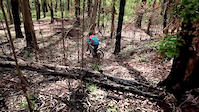
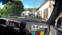
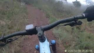
Videos of Vale do Sol Mountain Bike
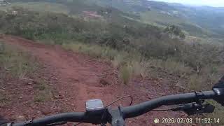
trail: Globo Da Morte
2:21 |
23 |
Jun 6, 2022

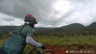
trail: Damatta
0:49 |
85 |
Sep 13, 2017
trail: Damatta
0:55 |
28 |
Mar 10, 2017
trail: Damatta
0:55 |
28 |
Dec 22, 2016
trail: Damatta
6:29 |
11 |
Feb 11, 2026 , Nova Lima
trail: Boca de Sapo
4:45 |
15 |
Feb 11, 2026 , Nova Lima
trail: Favo De Mel
4:25 |
16 |
Feb 11, 2026 , Nova Lima
youtuber
![MTB Enduro: Trilha Calibre 121 com 24% de...]()
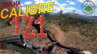
trail: Calibre 121
4:05 |
74 |
Dec 7, 2024 , Nova Lima
Recent Trail Reports
Activity Feed
| username | action | type | title | date |
|---|---|---|---|---|
| chbrito | add | report | activity #94495985 and 4 more | May 11, 2026 @ 8:20am May 11, 2026 |
| Sartini | add | report | activity #93475316 and 2 more | Apr 26, 2026 @ 1:46pm Apr 26, 2026 |
| chbrito | add | report | activity #91061306 and 11 more | Mar 22, 2026 @ 5:03am Mar 22, 2026 |
| CastilhoJunioU712rf | difficultyvote | trail | activity #91014741 | Mar 21, 2026 @ 12:23pm Mar 21, 2026 |
| Pedro1Nm1Ts | wishlist | trail | activity #90023480 | Mar 5, 2026 @ 12:03pm Mar 5, 2026 |
Recent Comments
| username | type | title | comment | date |
|---|---|---|---|---|
| trail | Steep and loose | Nov 13, 2025 @ 11:18am Nov 13, 2025 | ||
| trail | With the current conditions (perfect surface... | Nov 13, 2025 @ 11:17am Nov 13, 2025 | ||
| trail | Trilha não é pedalavel, descida sentido a... | Nov 20, 2024 @ 4:18pm Nov 20, 2024 | ||
| trail | Interditado pela VALE!!! | Jul 26, 2021 @ 5:10am Jul 26, 2021 | ||
| trail | No trecho final, antes de chegar na cerca do... | Jul 26, 2021 @ 5:09am Jul 26, 2021 |
Nearby Areas
| name | distance | ||||
|---|---|---|---|---|---|
| Serra da Calçada | 41 | 40 | 14 | 10 | 1.5 km |
| Eko Bike Park | 2.5 km | ||||
| BBC | 4 | 1 | 1 | 6 | 2.8 km |
| Parque Rola Moça | 3 | 1 | 3.3 km | ||
| Casa Branca | 4 km |
Local Badges
-

Completionist0 awarded
Activity Type Stats
| activitytype | trails | distance | descent | descent distance | total vertical | rating | global rank | state rank | photos | reports | routes | ridelogs |
|---|---|---|---|---|---|---|---|---|---|---|---|---|
| Mountain Bike | 69 | 34 miles | 9,236 ft | 18 miles | 2,096 ft | #546 | #7 | 29 | 254 | 14 | 13,431 | |
| E-Bike | 53 | 18 miles | 4,993 ft | 10 miles | 1,588 ft | #606 | #19 | 246 | 9 | 3,529 | ||
| Horse | 6 | #470 | #18 | 24 | ||||||||
| Hike | 59 | 33 miles | 9,144 ft | 17 miles | 2,096 ft | #1,141 | #16 | 250 | 317 | |||
| Trail Running | 59 | 33 miles | 9,144 ft | 17 miles | 2,096 ft | #629 | #17 | 250 | 176 | |||
| Dirtbike/Moto | 5 | #401 | #19 | 24 | 2 | |||||||
| Observed Trials | 4 | #137 | #8 | |||||||||
| ATV/ORV/OHV | 4 | #269 | #8 | 24 |
Frequently Asked Questions About Vale do Sol
▼
What are the highest rated mountain biking trails in Vale do Sol?
The highest rated mountain biking trails in Vale do Sol are:
- Globo Da Morte (4.5/5)
- Matinha Do Morro (4.2/5)
- Gangrena Do Luan (4.1/5)
- Boca da Morte (4.1/5)
- Gorilas (4.1/5)
▼
What is the best time of the year to ride in Vale do Sol?
Based on ride log data, the most popular months to ride in Vale do Sol are:
- April (35 activities)
- March (32 activities)
- October (30 activities)
▼
Where can I park to ride in Vale do Sol?
There are 2 parking locations listed in Vale do Sol. The most popular parking spots are:
▼
What is the longest trail in Vale do Sol?
The longest trail in Vale do Sol is Casarões at 5.2 miles. View all trails sorted by distance.
Activities
Trails
Points of Interest
- By chpw
 TFB WTFB & contributors
 - Admins: Proj Trilhas, TFB, Phcareca, ATF, leuzinho
- #19976 - 5,987 views
- vale do sol activity log | embed map of Vale do Sol mountain bike trails | vale do sol mountain biking points of interest
Downloading of trail gps tracks in kml & gpx formats is enabled for Vale do Sol.
You must login to download files.