close
-
Layers w
- Weather Layers
- Pro
- Pro
- Pro
- Pro
- Pro
- Pro
- More Layers
- Pro
- Pro
- Pro
- Pro
-
Upgrade to

3D
Trail Conditions
- Unknown
- Snow Groomed
- Snow Packed
- Snow Covered
- Snow Cover Partial
- Freeze/thaw Cycle
- Icy
- Prevalent Mud
- Wet
- Variable
- Ideal
- Dry
- Very Dry
Trail Flow (Ridden Direction)
Trailforks scans users ridelogs to determine the most popular direction each trail is ridden. A good flowing trail network will have most trails flowing in a single direction according to their intension.
The colour categories are based on what percentage of riders are riding a trail in its intended direction.
The colour categories are based on what percentage of riders are riding a trail in its intended direction.
- > 96%
- > 90%
- > 80%
- > 70%
- > 50%
- < 50%
- bi-directional trail
- no data
Trail Last Ridden
Trailforks scans ridelogs to determine the last time a trail was ridden.
- < 2 days
- < 1 week
- < 2 weeks
- < 1 month
- < 6 months
- > 6 months
Trail Ridden Direction
The intended direction a trail should be ridden.
- Downhill Only
- Downhill Primary
- Both Directions
- Uphill Primary
- Uphill Only
- One Direction
Contribute Details
Colors indicate trail is missing specified detail.
- Description
- Photos
- Description & Photos
- Videos
Trail Popularity ?
Trailforks scans ridelogs to determine which trails are ridden the most in the last 9 months.
Trails are compared with nearby trails in the same city region with a possible 25 colour shades.
Think of this as a heatmap, more rides = more kinetic energy = warmer colors.
- most popular
- popular
- less popular
- not popular
ATV/ORV/OHV Filter
Max Vehicle Width
inches
US Cell Coverage
Legend

Radar Time
Activity Recordings
Trailforks uses anonymized public activity data.
?
Activity Recordings
Trailforks uses anonymized public activity data.
?
Personal Heatmap
▶
Activity Types
all
/
none
▶
Options
2
Date range
month
–
Winter Trails
Warning
A routing network for winter maps does not exist. Selecting trails using the winter trails layer has been disabled.
Missing Trails
Most Popular
Least Popular
Trails are colored based on popularity. The more popular a trail is, the more red. Less popular trails trend towards green.
Jump Magnitude Heatmap
Heatmap of where riders jump on trails. Zoom in to see individual jumps, click circles to view jump details.
BC Backroad Status
![map legend]()
Service Road Atlas is a free to use, community-driven service for viewing and creating reports on the numerous back-country service roads around B.C. and Alberta.

Slope Aspect
Direction the slope faces
Trails Deemphasized
Trails are shown in grey.
Only show trails with no bike usage.
Suggested Layers
Based on selected activity type
Save the current map location and zoom level as your default home location whenever this page is loaded.
SavePopular Trail Networks
view all areas »
No description for Valencia has been added yet!
Login or register to submit one.
AKA: València
This region uses the Uk/Euro style trail grading system.
Activities Click to view
- Mountain Bike
7,159 trails
- E-Bike
7,142 trails
- Horse
1,089 trails
- Hike
7,195 trails
- Trail Running
7,202 trails
- Dirtbike/Moto
96 trails
- Observed Trials
8 trails
- ATV/ORV/OHV
9 trails
- Snowmobile
0 trails
- Snowshoe
0 trails
- Downhill Ski
0 trails
- Backcountry Ski
0 trails
- Nordic Ski
0 trails
Region Details
- 3,271
- 33
- 949
- 2,173
- 610
- 51
Stats
- Avg Trail Rating
- Trails (view details)
- 7,127
- Trails Mountain Bike
- 7,159
- Trails E-Bike
- 7,142
- Trails Gravel Bike
- 19
- Trails Adaptive Bike
- 11
- Trails Horse
- 1,089
- Trails Hike
- 7,195
- Trails Trail Running
- 7,202
- Trails Dirtbike/Moto
- 96
- Trails Observed Trials
- 8
- Trails ATV/ORV/OHV
- 9
- Total Distance
- 4,932 miles
- Total Descent
- 949,127 ft
- Total Vertical
- 6,003 ft
- Highest Trailhead
- 6,006 ft
- Reports
- 7,639
- Photos
- 1,048
- Ridden Counter
- 118,222
Sub Regions
- Ademuz (138)
- Bocairent (77)
- Serra de L'Ombria (74)
- Gandia (448)
- Cullera (23)
- La Safor (116)
- Llutxent-Pinet (85)
- Monduver (72)
- Oliva-Puig del Frare (60)
- Serra de les Agulles (63)
- Higueruelas (212)
- Bike and Flow (205)
- Jalance (253)
- Jalance-Jarafuel (137)
- Sierra de Ayora-Almansa (24)
- Valle de Ayora-Cofrentes (88)
- Lliria (469)
- Calderona-Olocau (141)
- Camp de Turia (298)
- Ontinyent (202)
- Benicadell (131)
- Sierra de Agullent (63)
- Paterna (311)
- La Vallesa (249)
- Requena (550)
- El Rebollar (108)
- Hoces del Cabriel (368)
- La Serratilla (68)
- Sagunto (621)
- Calderona Norte (114)
- Calderona-Gilet (162)
- Jérica-Viver (121)
- Quart de les Valls-Benifairó de les Valls (148)
- Riu Palancia (68)
- Siete Aguas (338)
- Malacara-Siete Aguas (114)
- Siete Aguas-Norte(A3) (223)
- Sinarcas (30)
- Sot de Chera (120)
- Torrent (75)
- El Vedat (20)
- Serra Perenxisa (55)
- Utiel (544)
- Benagéber-Pantano (90)
- Camporrobles-Fuenterrobles (198)
- El Remedio (260)
- Valencia (2,299)
- Aras de los Olmos (22)
- Buñol-El Gallo (49)
- Buñol-Farrajón (113)
- Calderona-Porta Coeli (168)
- Chelva-Tuéjar (47)
- Chulilla (42)
- Cofrentes (65)
- El Tello (308)
- Forata (24)
- La Ceja-Macastre-Alborache (32)
- Les Valletes (17)
- Malacara-Buñol (125)
- Malacara-Yátova (130)
- Montserrat y Alrededores (82)
- Muela de Cortes (19)
- Muntanyeta del Salvador-Alzira (19)
- Ninyerola y La Mola (61)
- Pedralba-Bugarra (206)
- Ribarroja y Rodanas (155)
- Serra-Náquera (235)
- Sierra de Chiva (81)
- Sierra de Martés (22)
- Sierra del Ave (4)
- Tabarla-Mijares (29)
- Titaguas (32)
- Tous-Carlet (98)
- Turís (29)
- Villar del Arzobispo-Losa del Obispo (127)
- Xativa (558)
- Barxeta (79)
- Benigànim (11)
- Chella-Anna-Estubeny-Sellent (80)
- L'Olleria (116)
- La Canal de Navarrés (62)
- La Font de la Figuera-Sierra de Navalón (11)
- Moixent-Vallada-El Penyó (46)
- Santa Ana-Llosa de Ranes (68)
- Serra Grossa. Moixent-Vallada (29)
- Serra Vernissa (22)
- Sumacárcer (23)
Popular Valencia Mountain Biking Trails
• 100 ★ 0.0 • 3,501 ft • 6 ft • 205 •
Popular green difficulty family friendly singletrack. This multi-use trail can be used both directions and has a easy overall physical rating with a 6 ft green climb. It features other. Trail visibility is always easy to follow. On average it takes 2 minutes to complete this trail.
• 100 ★ 0.0 • 1,237 ft • 0 ft • 189 •
Popular green difficulty family friendly singletrack. This multi-use trail can be used both directions and has a easy overall physical rating with a 0 ft green climb. It features other. Trail visibility is always easy to follow. On average it takes minutes to complete this trail.
• 100 ★ 3.8 • 2 miles • 0 ft • 151 •
Senda de 1 metro paralela a la carretera, a pesar de su localización es más divertido terminar una ruta por esta senda que hacerlo por la carretera, y menos peligroso, Ojo a los ciclistas que vienen subiendo
• 100 ★ 4.9 • 1 mile • 13 ft • 144 •
Uno de los senderos míticos de la zona, usado antiguamente para conectar con los pueblos de Andilla y La Pobleta, ahora es una bajada divertida y fluida, con algunos puntos punkis que lo hacen rojo aunque en la mayor parte del...
• 100 ★ 2.5 • 1,772 ft • 0 ft • 130 •
Sendero que sirve para quitar una sección de pista para acceder a Cartero y otras bajadas. El nombre lo dice todo, baja a fuego y está bastante roto, mucha piedra suelta y expuesto por completo a las inclemencias del tiempo. Lo menos...
• 85 ★ 4.4 • 948 ft • 5 ft • 127 •
Popular blue difficulty singletrack. This multi-use trail can be used downhill primary and has a moderate overall physical rating. It features berm and jump. Trail visibility is always easy to follow. On average it takes 7 minutes to complete this trail.
• 100 ★ 5.0 • 1,480 ft • 46 ft • 109 •
Popular green difficulty singletrack. This multi-use trail can be used both directions and has a easy overall physical rating with a 46 ft green climb. Trail visibility is always easy to follow. On average it takes 2 minutes to complete this trail.
• 95 ★ 4.0 • 3,054 ft • 0 ft • 105 •
Primer tramo flow, pero con ojo. Parte final por rambla con bastantes escalones
Valencia Mountain Bike Routes
★ 5.0 • 13 miles • 2,492 ft • 22 • Loop •
Ruta MTB (XC-Trail) en Siete Aguas que recorre las zonas de Las Veredas y la falda Norte del Pico Nevera...
★ 5.0 • 8 miles • 1,362 ft • 8 • Loop •
Las Sendas de moda en la Zona Valencia Norte, la Serra Porta Coeli. Ruta corta pero dura, apenas 13 km con...
★ 5.0 • 15 miles • 2,962 ft • 11 • Loop •
Ruta clásica del BTT Siete Aguas que se hace el día de Nochebuena, 24 de diciembre. Se trata de hacer...
★ 4.0 • 14 miles • 2,389 ft • 30 • Loop •
Ruta con algunas de las mejores azules y rojas entre , y xerretes
★ 5.0 • 14 miles • 2,051 ft • 22 • Loop •
Ruta Endurera nivel Fácil muy divertida, se puede hacer todo en bici de Btt AVISO importante llevar de...
★ 5.0 • 16 miles • 3,475 ft • 24 • Loop •
Ruta que coge 3 de las mejores de la zona y la , con magniíficas vistas desde el Puntal de la Nevera. En...
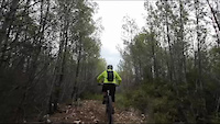
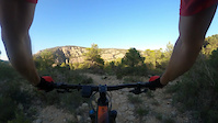
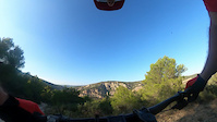
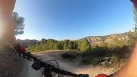
Photos of Valencia Mountain Bike
Videos of Valencia Mountain Bike
trail: Senda Campanillas
2:47 |
12 |
Nov 5, 2023
trail: Enlace
0:28 |
9 |
Oct 13, 2023
trail: Carcama Charco Negro 2.0
0:52 |
5 |
Oct 13, 2023
trail: Carcama Charco Negro 2.0
0:18 |
4 |
Oct 13, 2023
trail: Peñas de Mero
0:12 |
40 |
Nov 6, 2022
trail: Carcalín
0:37 |
20 |
Oct 2, 2022
trail: Corrales de Yátova
5:00 |
27 |
Jun 25, 2022

trail: Barranco
31:20 |
33 |
Feb 27, 2021
Current Trail Warnings
| status | trail | date | condition | user | info |
|---|---|---|---|---|---|
| Revolcaderos Casas Bajas-Territorio Hostil | Jun 5, 2026 @ 6:24pm (Europe/Madrid) Jun 5, 2026 | Dry | THCB | E-Bike senda salvaje, sin limpiar | |
| Revolcaderos Casas Bajas-Territorio Hostil | Jun 5, 2026 @ 6:24pm (Europe/Madrid) Jun 5, 2026 | Dry | THCB | E-Bike Senda salvaje, sin limpiar. | |
| Canelles Malacara-Buñol | Jun 3, 2026 @ 8:23am (Pacific/Midway) Jun 3, 2026 | Dry | juanx TFSPAIN | E-Bike mismo estado |
Recent Trail Reports
Activity Feed
| username | action | type | title | date |
|---|---|---|---|---|
| juanx | add | trail | activity #98016001 | Jun 28, 2026 @ 12:37pm 5 hours |
| CarlostbRkw8 | ridden | trail | activity #98002816 | Jun 28, 2026 @ 10:18am 8 hours |
| JuanEF | vote | trail | activity #97990695 and 2 more | Jun 28, 2026 @ 8:08am 10 hours |
| pegipo | add | report | activity #97978282 | Jun 28, 2026 @ 4:58am 13 hours |
| juanx | ridden | trail | activity #97972966 | Jun 28, 2026 @ 3:19am 15 hours |
Recent Comments
| username | type | title | comment | date |
|---|---|---|---|---|
| trail | Recuérdame que te meta un palo en los radios... | Jun 27, 2026 @ 9:38am 1 day | ||
| trail | Hola buenas , no se si sabes que tienes la... | Jun 27, 2026 @ 9:16am 1 day | ||
| trail | primera mitad dobletrack hasta el sembrado | Jun 27, 2026 @ 12:33am 2 days | ||
| trail | senda limpia con toboganes | Jun 14, 2026 @ 5:39am Jun 14, 2026 | ||
| trail | Un paso complicado por lo demas bien | Jun 13, 2026 @ 7:51am Jun 13, 2026 |
Local Badges
-

Señor del Gallo1 awarded -

Casinos 202411 awarded -

Bicuerca... a la saca!!!0 awarded -

Bicuerca !!!14 awarded -

Descent 10k Badge66 awarded -

Top 10 Trails0 awarded
Bike & Skill Parks
| name | type | city | rating |
|---|---|---|---|
| Moto Club ciutat d'Albaida motocross | skill park | Ontinyent | |
| Moto Club La Derrapada motocross | skill park | Higueruelas | |
| Pumptrack Viver | skill park | Sagunto | |
| Pumptrack Siete Aguas | skill park | Siete Aguas | |
| Pumptrack Requena | skill park | Requena |
Activity Type Stats
| activitytype | trails | distance | descent | descent distance | total vertical | rating | global rank | state rank | photos | reports | routes | ridelogs |
|---|---|---|---|---|---|---|---|---|---|---|---|---|
| Mountain Bike | 7,159 | 4,896 miles | 937,090 ft | 2,412 miles | 6,004 ft | 874 | 7,639 | 149 | 98,346 | |||
| E-Bike | 7,142 | 4,890 miles | 936,729 ft | 2,410 miles | 6,004 ft | 109 | 7,284 | 128 | 17,939 | |||
| Gravel Bike | 19 | 10 miles | 381 ft | 2 miles | 781 ft | 376 | 15 | 1,037 | ||||
| Adaptive Bike | 11 | 4 | 2 | |||||||||
| Horse | 1,089 | 619 miles | 107,897 ft | 304 miles | 4,774 ft | 733 | ||||||
| Hike | 7,195 | 4,930 miles | 948,248 ft | 2,428 miles | 6,004 ft | 57 | 7,599 | 213 | 3,236 | |||
| Trail Running | 7,202 | 4,928 miles | 947,549 ft | 2,426 miles | 6,004 ft | 1 | 7,604 | 17 | 3,621 | |||
| Dirtbike/Moto | 96 | 91 miles | 8,980 ft | 38 miles | 3,573 ft | 617 | 5 | 16 | ||||
| Observed Trials | 8 | 11 miles | 807 ft | 5 miles | 1,447 ft | 97 | ||||||
| ATV/ORV/OHV | 9 | 16 miles | 1,316 ft | 7 miles | 1,234 ft | 611 | 14 |
Frequently Asked Questions About Valencia
▼
What are the best places to ride in Valencia?
Valencia has 73 areas to explore for mountain biking. The top rated areas are:
▼
What are the highest rated mountain biking trails in Valencia?
The highest rated mountain biking trails in Valencia are:
- El Cartero (4.4/5)
- Tristán (4.4/5)
- Rogelio's-Mulatón (4.4/5)
- Peñas del Gordo Baja (4.3/5)
- Discordia (4.3/5)
▼
What is the best time of the year to ride in Valencia?
Based on ride log data, the most popular months to ride in Valencia are:
- May (451 activities)
- July (430 activities)
- December (426 activities)
▼
What is the longest trail in Valencia?
The longest trail in Valencia is Vía Verde Fluvial del Turia at 16.9 miles. View all trails sorted by distance.
Activities
Trails
Points of Interest
- Puntal de la Nevera Summit
- Fortificaciones Guerra Civil, Depósito. Sight
- Fortificaciones Guerra Civil Sight
- Charca y Cascada del Turche Viewpoint
- Telégrafo Sight
- Antiguas Salinas de Villargordo Sight
- Drop TTF
- Peñas Blancas Viewpoint
- Cumbre Summit
- Cumbre Summit
- El Talayón (5,246 ft)
- Cerro del Rabosero (3,786 ft)
- Pico de Juan Navarro (3,730 ft)
- By brenthillier
 NSMBA TRAILFORKS & contributors
 - Admins: mul0w, elyari, AMG, juanx, Angelreing, AMG, juanx, Fjavi, montonm
- #8855 - 13,901 views
- valencia activity log | embed map of Valencia mountain bike trails | valencia mountain biking points of interest polygons
Downloading of trail gps tracks in kml & gpx formats is enabled for Valencia.
You must login to download files.