close
-
Layers w
- Weather Layers
- Pro
- Pro
- Pro
- Pro
- Pro
- Pro
- More Layers
- Pro
- Pro
- Pro
- Pro
-
Upgrade to

3D
Trail Conditions
- Unknown
- Snow Groomed
- Snow Packed
- Snow Covered
- Snow Cover Partial
- Freeze/thaw Cycle
- Icy
- Prevalent Mud
- Wet
- Variable
- Ideal
- Dry
- Very Dry
Trail Flow (Ridden Direction)
Trailforks scans users ridelogs to determine the most popular direction each trail is ridden. A good flowing trail network will have most trails flowing in a single direction according to their intension.
The colour categories are based on what percentage of riders are riding a trail in its intended direction.
The colour categories are based on what percentage of riders are riding a trail in its intended direction.
- > 96%
- > 90%
- > 80%
- > 70%
- > 50%
- < 50%
- bi-directional trail
- no data
Trail Last Ridden
Trailforks scans ridelogs to determine the last time a trail was ridden.
- < 2 days
- < 1 week
- < 2 weeks
- < 1 month
- < 6 months
- > 6 months
Trail Ridden Direction
The intended direction a trail should be ridden.
- Downhill Only
- Downhill Primary
- Both Directions
- Uphill Primary
- Uphill Only
- One Direction
Contribute Details
Colors indicate trail is missing specified detail.
- Description
- Photos
- Description & Photos
- Videos
Trail Popularity ?
Trailforks scans ridelogs to determine which trails are ridden the most in the last 9 months.
Trails are compared with nearby trails in the same city region with a possible 25 colour shades.
Think of this as a heatmap, more rides = more kinetic energy = warmer colors.
- most popular
- popular
- less popular
- not popular
ATV/ORV/OHV Filter
Max Vehicle Width
inches
US Cell Coverage
Legend

Radar Time
Activity Recordings
Trailforks uses anonymized public activity data.
?
Activity Recordings
Trailforks uses anonymized public activity data.
?
Personal Heatmap
▶
Activity Types
all
/
none
▶
Options
2
Date range
month
–
Winter Trails
Warning
A routing network for winter maps does not exist. Selecting trails using the winter trails layer has been disabled.
Missing Trails
Most Popular
Least Popular
Trails are colored based on popularity. The more popular a trail is, the more red. Less popular trails trend towards green.
Jump Magnitude Heatmap
Heatmap of where riders jump on trails. Zoom in to see individual jumps, click circles to view jump details.
BC Backroad Status
![map legend]()
Service Road Atlas is a free to use, community-driven service for viewing and creating reports on the numerous back-country service roads around B.C. and Alberta.

Slope Aspect
Direction the slope faces
Trails Deemphasized
Trails are shown in grey.
Only show trails with no bike usage.
Suggested Layers
Based on selected activity type
Save the current map location and zoom level as your default home location whenever this page is loaded.
Save
No description for Vanderhoof has been added yet!
Login or register to submit one.
Activities Click to view
- Mountain Bike
33 trails
- Winter Fat Bike
0 trails
- Hike
39 trails
- Trail Running
39 trails
Region Details
- 6
- 9
- 12
- 6
Region Status
Open as of Aug 16, 2025Stats
- Avg Trail Rating
- Trails (view details)
- 33
- Trails Mountain Bike
- 34
- Trails E-Bike
- 1
- Trails Hike
- 39
- Trails Trail Running
- 39
- Total Distance
- 7 miles
- Total Descent
- 2,179 ft
- Total Vertical
- 235 ft
- Highest Trailhead
- 2,316 ft
- Reports
- 68
- Photos
- 18
- Ridden Counter
- 1,121
Sub Regions
-
Jump Park
-
Rip'n The North Bike Park
- 8
- 12
- 6
-
Riverside Park
- 1
-
Waterlily Lake
Popular Vanderhoof Mountain Biking Trails
• 75 ★ 4.0 • 1,401 ft • 0 ft • 65 •
Machine built with table tops, berms, board walks, drop and wood berm. TTF's have ride arounds.
• 65 ★ 0.0 • 1,726 ft • 0 ft • 53 •
A few features with ride arounds. Bottom of trail past is steeper than the top part.
• 100 ★ 0.0 • 3,547 ft • 11 ft • 49 •
Popular green difficulty singletrack. This mountain bike primary trail can be used both directions and has a easy overall physical rating with a 11 ft blue climb. On average it takes 7 minutes to complete this trail.
• 20 ★ 0.0 • 299 ft • 0 ft • 43 •
Less popular blue difficulty singletrack. This mountain bike primary trail can be used downhill primary. On average it takes 1 minutes to complete this trail.
• 80 ★ 0.0 • 1,483 ft • 0 ft • 42 •
Berms, Wood/dirt features with a ride around.
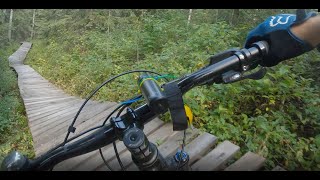
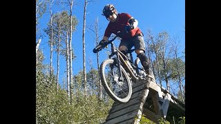
Photos of Vanderhoof Mountain Bike
Videos of Vanderhoof Mountain Bike
trail: Roughcut
0:22 |
391 |
Nov 12, 2021 , Vanderhoof

trail: Passive Aggressive
4:53 |
349 |
Nov 12, 2021 , Vanderhoof
trail: Hitting the Wall
4:53 |
205 |
Nov 12, 2021 , Vanderhoof
Recent Trail Reports
| status | trail | date | condition | info | user |
|---|---|---|---|---|---|
| Extended Play | Dec 26, 2025 @ 2:47pm (America/Vancouver) Dec 26, 2025 | Snow Packed | miamou74 | ||
| Delta Downhill | Aug 16, 2025 @ 7:31pm Aug 16, 2025 | Unknown | tyride | ||
| Waterworks | Aug 16, 2025 @ 3:08pm Aug 16, 2025 | Unknown | tyride | ||
| Charlie Brown | May 20, 2024 @ 10:25am May 20, 2024 | Dry | tyride | ||
| Hitting the Wall | Aug 29, 2023 @ 7:10am Aug 29, 2023 | Dry | Shafto | ||
| Tue's Tumbler | Jul 24, 2022 @ 11:27am Jul 24, 2022 | Ideal | bcsnipes | ||
| Rake and Ride | Aug 25, 2020 @ 3:30pm Aug 25, 2020 | Ideal | macbot2000 | ||
| Deadwood | Aug 25, 2020 @ 3:30pm Aug 25, 2020 | Variable | macbot2000 | ||
| Passive Aggressive | Aug 9, 2020 @ 10:24am Aug 9, 2020 | Ideal | tyride | ||
| Rae's Crawler | Aug 8, 2020 @ 4:29pm Aug 8, 2020 | Ideal | tyride |
Activity Feed
| username | action | type | title | date |
|---|---|---|---|---|
| Gremmen | wishlist | region | activity #95465647 | May 24, 2026 @ 9:53pm May 24, 2026 |
| CSM430 | wishlist | region | activity #93251691 | Apr 23, 2026 @ 5:29pm Apr 23, 2026 |
| tpierre | wishlist | region | activity #90864264 | Mar 19, 2026 @ 9:53am Mar 19, 2026 |
| ShamusUgXSkw | ridden | trail | activity #82168212 | Oct 11, 2025 @ 3:28pm Oct 11, 2025 |
| brendahoule | wishlist | region | activity #80486619 | Sep 16, 2025 @ 12:59pm Sep 16, 2025 |
Recent Comments
| username | type | title | comment | date |
|---|---|---|---|---|
| trail | Short but fun trail. It is like a roller coaster! | Nov 12, 2021 @ 7:17pm Nov 12, 2021 | ||
| trail | The gaps are gone | Aug 9, 2020 @ 10:23am Aug 9, 2020 |
Local Badges
-

10 Blue Trails12 awarded -

Epic Ride Climb 2k1 awarded -

Climbing 10k Badge2 awarded -

Climbing 100k Badge0 awarded -

Epic Ride Descent 2k0 awarded -

Descent 10k Badge2 awarded
Bike & Skill Parks
| name | type | city | rating |
|---|---|---|---|
| Rip'n The North Bike Park | skill park | Vanderhoof |
Activity Type Stats
| activitytype | trails | distance | descent | descent distance | total vertical | rating | global rank | state rank | photos | reports | routes | ridelogs |
|---|---|---|---|---|---|---|---|---|---|---|---|---|
| Mountain Bike | 33 | 7 miles | 2,178 ft | 5 miles | 236 ft | #4,954 | #108 | 18 | 56 | 1,341 | ||
| E-Bike | 1 | 2,943 ft | 207 ft | 2,877 ft | 207 ft | 42 | 11 | |||||
| Hike | 39 | 7 miles | 2,178 ft | 5 miles | 236 ft | #7,897 | #145 | 56 | 68 | |||
| Trail Running | 39 | 7 miles | 2,178 ft | 5 miles | 236 ft | #7,563 | #136 | 56 | 174 |
Frequently Asked Questions About Vanderhoof
▼
What are the best places to ride in Vanderhoof?
Vanderhoof has 5 areas to explore for mountain biking. The top rated areas are:
▼
What are the highest rated mountain biking trails in Vanderhoof?
The highest rated mountain biking trails in Vanderhoof are:
- Roughcut (4.1/5)
- Hitting the Wall (4/5)
- Corsa Cruiser (4/5)
- Pickle's Pass (4/5)
- Barlow Bender (0/5)
▼
What is the best time of the year to ride in Vanderhoof?
Based on ride log data, the most popular months to ride in Vanderhoof are:
- July (51 activities)
- August (14 activities)
- June (12 activities)
▼
Where can I park to ride in Vanderhoof?
There are 4 parking locations listed in Vanderhoof. The most popular parking spots are: View all parking and trailhead locations on the map to plan your visit.
Activities
Trails
- By brenthillier
 NSMBA TRAILFORKS & contributors
 - Admins: BCBR, TrailsBC, BCORMA, DSBC, wheelmaniac3, bcpunk, RTNBC, NBC, PGBRS, aleksa
- #3410 - 7,647 views
- vanderhoof activity log | embed map of Vanderhoof mountain bike trails | vanderhoof mountain biking points of interest
Downloading of trail gps tracks in kml & gpx formats is enabled for Vanderhoof.
You must login to download files.